It’s time for protected bike lanes on Sheridan Road in Rogers Park
By Craig Stern
If you look at Mayor Brandon Johnson’s old campaign website, you’ll see that he had an entire plank of his platform dedicated to building out a citywide network of connected, low-stress bikeways. “A safe bike lane is more than a stripe painted on the pavement,” he opined. “Chicago needs a dedicated set of streets with slow speeds and protected bike lanes to keep cyclists safe.”
It has now been more than two years since Johnson ascended to the mayor’s office. But one North Side neighborhood remains largely isolated from the protected bike lanes in other communities, and basically devoid of any its own PBLs: Rogers Park.
The community area’s boundaries are Ridge and Devon avenues, Lake Michigan, and Evanston. According to the Chicago Department of Transportation’s 2025 Chicago Bike Map, there are currently only two blocks of protected lanes in Rogers Park, on Pratt Avenue between Ravenswood and Pratt Boulevard. The rest of the 0.75-mile Pratt PBLs, apparently installed this year, are in the West Ridge, aka West Rogers Park, the community area to the west.
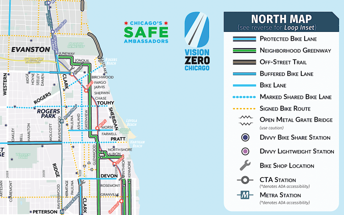
Rogers Park has a Neighborhood Greenway, mostly on Glenwood and Greenview avenues, but this basically just consists of normal residential side streets with extra paint thrown on them. It offers no direct access to most destinations of significance and provides no physical protection from drivers. And as far as north-south bike routes in the neighborhood go, that’s pretty much it.
To the south, the Edgewater neighborhood has more options, including protected lanes on Clark Street, and a greenway couplet on Kenmore (northbound) and Winthrop (southbound) avenues. But those facilities vanish at Devon Street, the border between the two communities.
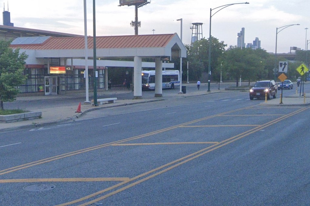
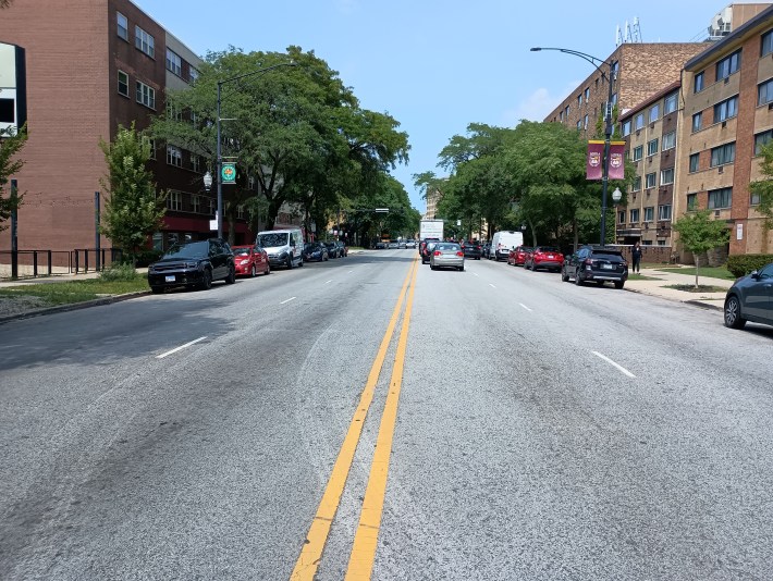
In addition to Rogers having limited options for low-stress, cross-neighborhood bike travel, it’s got a major barrier to north-south cycling, as well as accessing train stations, housing, retail, and the lakefront. That’s Sheridan Road, a four-lane “stroad” that serves as a traffic sewer connecting eight-lane DuSable Lake Shore Drive to the North Shore suburbs.
Streetsblog Chicago has previously discussed the safety and livability challenges posed by Sheridan, and proposed doing a four-to-three road diet to make room for protected bike lanes, and reduce speeding and serious crashes. I’d like to take another look at that subject, focusing on the portion in Rogers Park. Here are a few facts about Sheridan:
- The street started out in the 1880s as a way to extend Lake Shore Drive out to the suburbs. It was named Sheridan Road in 1889.
- In 1924, Sheridan was designated Illinois Route 42, officially recognizing it as a state highway.
- Although Illinois stopped calling Sheridan Route 42 back in 1972, it remains a highway in all but name.
- Sheridan is a constant source of road noise due to its high traffic volume and speed. Even indoors, half a block away from the road or more, cars can still heard at all hours of the day and throughout the night.
Sheridan Road is also a major source of air pollution, with some of the worst ozone pollution in the entire city. In 2023, Northwestern University researchers found that Lake Michigan traps ozone precursors such as nitrogen oxide and volatile organic compounds. High ozone levels are shown in yellow on the chart below.
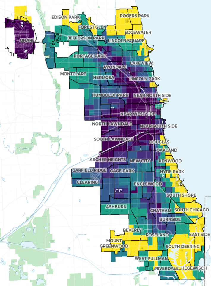
According to the Colorado Department of Public Health and Environment, gas-powered vehicles are a major source of these ozone precursors. So it’s not surprising that car-choked Rogers Park shows up solid yellow on that map. It’s especially frustrating when you consider that much of the smog is generated by suburbanites using the neighborhood as a cut-through route.
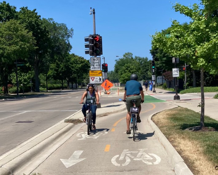
On the bright side, one could view Sheridan’s massive road width as a feature, not a defect, in that it provides plenty of room to install protected bike lanes. Granville Avenue, located two blocks south of Devon, is currently undergoing a Complete Streets makeover that will turn it into a 2.8 mile greenway between the North Shore Channel Trail and the Lakefront Trail.
So it would be a no-brainer to connect Rogers Park to Granville with protected lanes on Sheridan. They could start at the Evanston border and run south until Devon, where Sheridan jogs east. From there, the bike route would continue a quarter mile south on Broadway to Granville. Doing this would also make it easier to access Winthrop/Kenmore and the Lakefront Trail.
Again, doing a road diet on Sheridan would provide right-of-way for the bike lanes, which would be curbside. Car parking would be moved to the left of the bikeways, and if curb protection was added as well, that would create a safe, comfortable bikeway.
That would encourage bike and e-scooter users to ride in the street, improving safety for people, and having fewer mixed-traffic lanes would shorten pedestrian crossing distances. Drivers would also benefit, because eliminating the “stroad” layout would calm motorized traffic, with less speeding and fewer serious car crashes.
This will encourage Rogers Parkers to use bikes for short-to-medium-range trips instead of driving motor vehicles. Every time I go for a walk down Sheridan—which I do regularly—I see people biking on the sidewalks, evidently terrified of being run over by drivers on the four-lane road. Faced with breaking a city ordinance or the risk of being flattened into an impromptu road decal, many people will choose the former option. Sidewalk riding on Sheridan is a clear sign of the latent demand for safe bike infrastructure there.
Once biking feels safe, studies show that many more people will do it, thereby reducing the number of cars on the road. With fewer drivers using Sheridan at any given point in time, that will reduce travel times for those motorists who remain, as well as reducing the road noise and pollution those vehicles generate.
In addition, protected bike lanes will improve revenue for local businesses as Sheridan becomes more inviting to locals and less clogged by suburbanites blasting through with no intention to stop and contribute to the neighborhood economy. Study after study has found that adding protected lanes significantly boosts sales for local shops, restaurants, and other businesses.
Ironically, Evanston—the number one suburban beneficiary of Sheridan Road – has already built protected lanes on its own portion of the roadway next to Northwestern University. South of there, the north-south road is called Chicago Avenue, the equivalent of Clark Street in Chicago. There’s currently a plan to add PBLs on Chicago Avenue from Davis all the way south to Howard, the Rogers Park border as part of a forward-looking complete street project, with IDOT’s blessing and $3 million in state funding.
So the City of Evanston, with $138.7 million in annual revenue, is able to build protected bike lanes on Sheridan Road / Chicago Avenue. Surely the City of Chicago (with $17.3 billion in revenue, more than an order of magnitude more) can do the exact same thing on Sheridan south of Calvary Cemetery.
Rogers Park has suffered as a funnel for suburban car traffic for far too long. It’s time to get serious about making Rogers Park a safer, cleaner, more prosperous, and more pleasant place to live. It’s time for more protected bike lanes in the neighborhood, and what better place to add them than on the community’s most notorious main street?
Craig Stern is an attorney who lives in Rogers Park.

Do you appreciate Streetsblog Chicago’s paywall-free sustainable transportation reporting and advocacy? We officially ended our 2024-25 fund drive last month, but we still need another $44K to keep the (bike) lights on in 2026. We’d appreciate any leads on potential major donors or grants. And if you haven’t already, please consider making a tax-deductible donation to help us continue publishing next year. Thanks!
Streetsblog has migrated to a new comment system. New commenters can register directly in the comments section of any article. Returning commenters: your previous comments and display name have been preserved, but you'll need to reclaim your account by clicking "Forgot your password?" on the sign-in form, entering your email, and following the verification link to set a new password — this is required because passwords could not be carried over during the migration. For questions, contact tips@streetsblog.org.