Visiting new bikeways on the Near Southwest and Near South sides on Day Three of Bike Lane Week

Check out Day One: Mid-South Side here.
Check out Day Two: Far Southwest Side here.
Check out Day Four: Mid-North Side here.
Check out Day Five: Near Northwest Side, Far West Side, Near West Side, Near North Side here
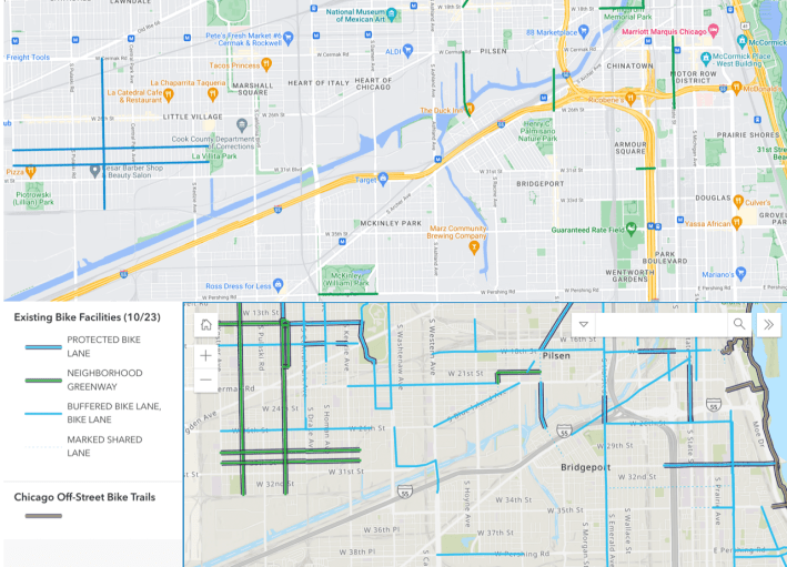
Streetsblog Chicago’s Bike Lane Week – in which I’m doing ‘L’ train + bicycle trips to explore 2023 Chicago Department of Transportation bikeway installations that I haven’t viewed in person before – keeps rolling along. See SBC’s map of this year’s completed and underway projects below.
While yesterday was cold and rainy, today was fairly nice (also cold, but I bundled up). I caught the Red Line with my bike from Uptown, transferred downtown to the Pink Line, and took that to the Pulaski station to cover new routes on the Near Southwest and Near South sides.
I covered a fairly broad swath of territory, from Little Village to the South Loop. So I’ll keep the bikeway descriptions concise, just pointing out a few interesting observations. Note that for some of these bikeways, I didn’t ride the entire route, but I think I got a pretty good sense of what shape they’re in.
Homan Avenue Neighborhood Greenway
This includes a northbound contraflow (“wrong-way”) bike lane on southbound-only stretches.
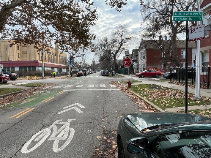
Neighborhood Greenways on 28th and 30th streets
28th is the westbound route and 30th is eastbound. (Oddly, there is no 29th here.) Their eastern terminus is the relatively new La Villita (“The Little Village”) Park, just east of Kedzie Avenue.
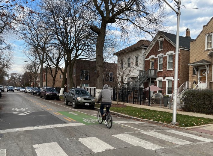
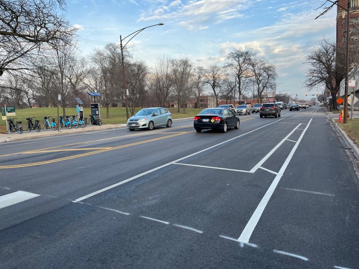
Pershing Road protected bike lanes
These lanes are partially finished, and only consist of paint right now. As a result, many drivers are currently parking in the curbside bike lanes, rather than the “floating” parking lanes. However, as we’ve seen on the new Clark Street PBL in Uptown/Lakeview, this behavior will likely change after concrete protection is installed.
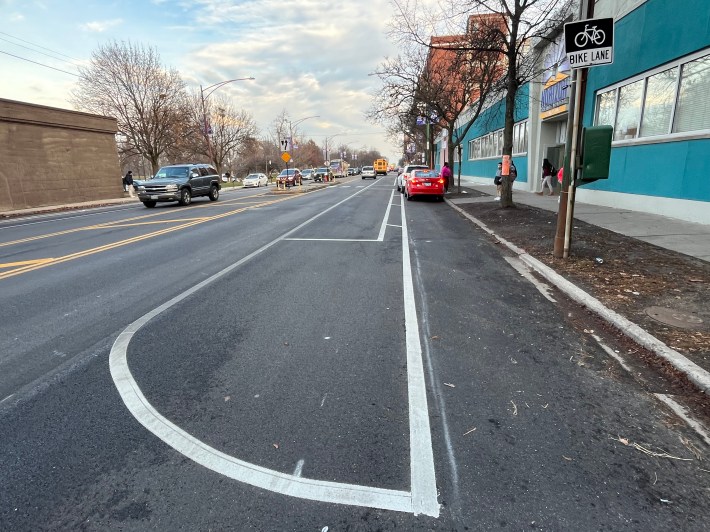
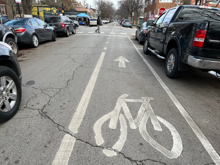
Protected bike lanes on Loomis Street
This is a popular bike route between Bridgeport and Pilsen that has been improved by the installation of concrete curbs. Take a virtual ride ride on the PBL in the video below.
However, as is the case in almost all Chicago curb-protected bike lanes, there are gaps in the protection. That’s sometimes caused by the desire to preserve curbside car parking, but in this case the installation may not be complete yet. There’s also no protection for bicycle riders from drivers on the metal Chicago River bridge grate here, although there is decking for the bike lane to reduce slip-and-fall hazards.
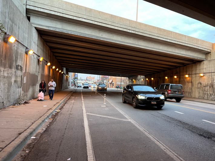
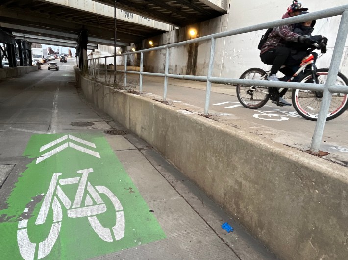
Halsted Street protected bike lanes
There’s not much to write home about here. It’s just a short stretch between the Stevenson Expressway (I-55) and the river that doesn’t offer much in the way of protection yet. There are just some flimsy plastic posts along the curbside lanes in the underpass below the highway, and near the bridge.
Oddly, as you approach the river from the south, there are bike symbols on both the roadway and the sidewalk, which results in scenes like this. Here’s the backstory of this set-up.
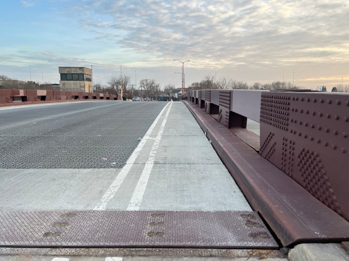
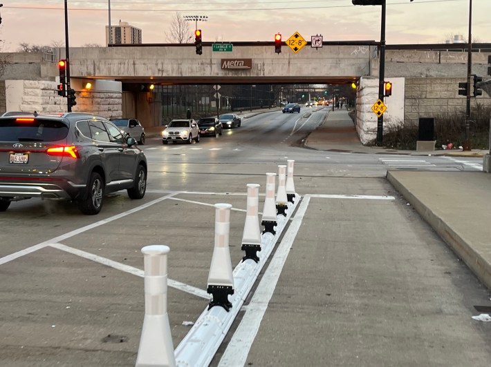
31st Street Bridge protected bike lanes
The plastic curbs with flexible posts on this stretch basically only cover the stretch of 31st that passes over the Dan Ryan Expressway. CDOT says plastic is the only option for PBLs on some Chicago bridges. But on the bright side, the curbs extend the existing concrete-protected lanes on 31st by another block or so.
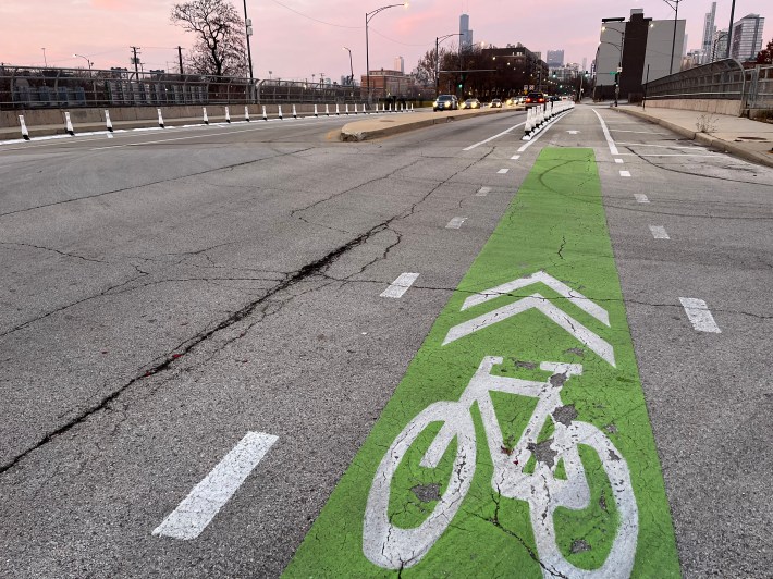
State Street concrete-protected bike lanes
From there I headed north on State Street to 26th Street, where I picked up a stretch of PBLs along State that has been upgraded with (somewhat spotty) concrete and plastic curb protection up to Reggie’s Chicago rock club at 21st Street.
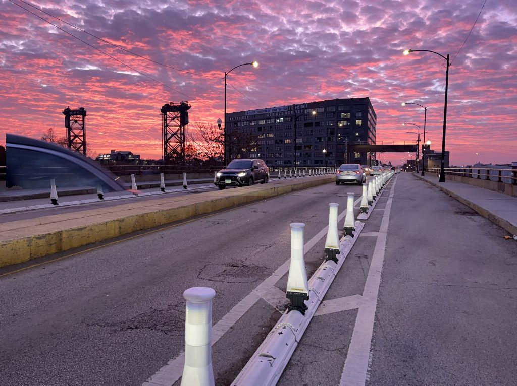
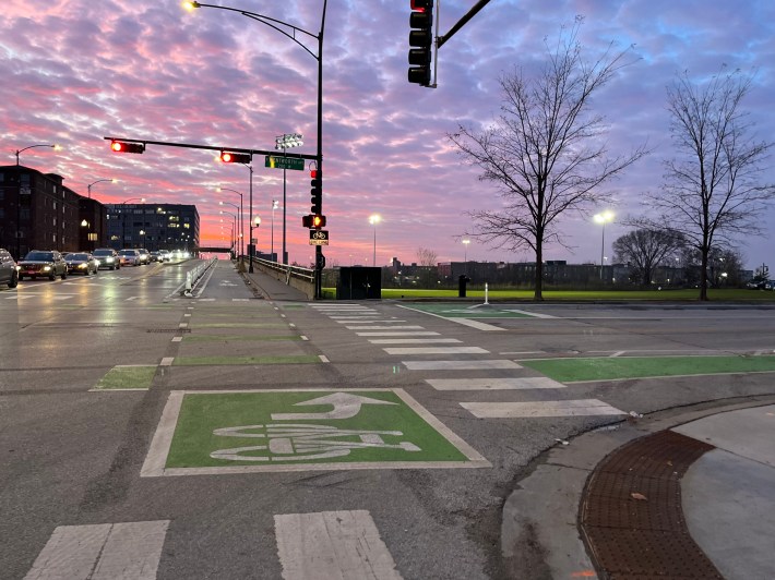
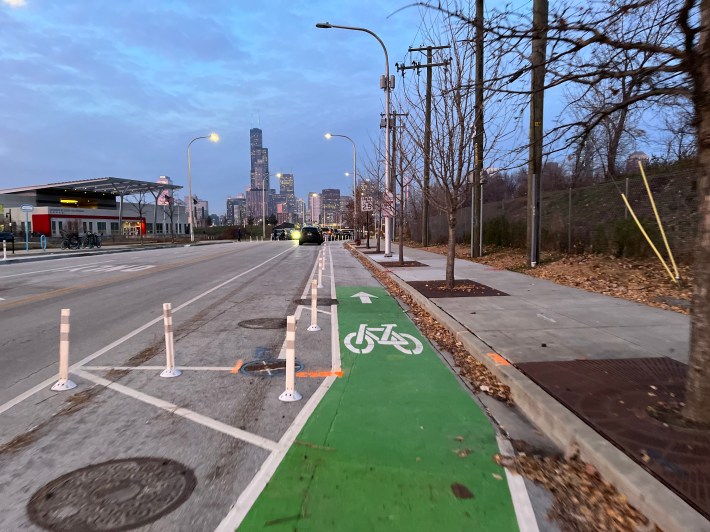
At 18th Street I headed west a few blocks to check out the plastic curb upgrade to the protected lanes on the bridge over the river. (See image at the top of this post.) But as I approached it, I was a little surprised to see that new paint and plastic posts were used to create curbside PBLs on Wentworth Avenue north of 18th.
But don’t get too excited. A raised bike lane has already been built on the Wells-Wentworth Connector, a new road located west of Clark Street linking the South Loop and Chinatown that’s part of The 78 megadevelopment. But there’s still fencing a couple blocks north of 18th to stop you from riding on it.
That’s despite former transportation commisioner Gia Biagi telling me in her exit interview in early August that the connector would “probably [open in] September.” But as you’ve probably realize by now, with apologies to Paul Masson Wines and Orson Welles, CDOT will cut the ribbon on no bikeway before its time.
Check out Day One: Mid-South Side here.
Check out Day Two: Far Southwest Side here.
Check out Day Four: Mid-North Side here.
Check out Day Five: Near Northwest Side, Far West Side, Near West Side, Near North Side here

Did you appreciate this post? Please consider making a tax-deductible donation.

Read More:
Streetsblog has migrated to a new comment system. New commenters can register directly in the comments section of any article. Returning commenters: your previous comments and display name have been preserved, but you'll need to reclaim your account by clicking "Forgot your password?" on the sign-in form, entering your email, and following the verification link to set a new password — this is required because passwords could not be carried over during the migration. For questions, contact tips@streetsblog.org.