CDOT: Cortland, Glenwood, Palmer, Leland will be “Shared streets for physical distancing”
Update 5/26/20, 5:30 PM: The Active Transportation Alliance, which initially indicated that it would not be advocating for open streets, but recently announced a change in strategy, provided the following statement in response to the news that Chicago will be piloting Shared Streets. “It’s exciting to hear the city is preparing to create more space for people to walk and bike safely during the pandemic. Swift action is needed to address the transportation needs of areas hit hardest by COVID-19 and prevent a dangerous spike in driving as travel increases. We continue to urge city officials to work with neighborhood leaders to develop plans that are community-informed and as effective as they can be. We look forward to continuing to weigh in and helping build a comprehensive and equitable plan for our streets.”
Update 5/27/20, 10:45 AM: Reader Kevin Zolkiewicz determined that all of the Glenwood/Greenview Greenway between Carmen and Howard will be a Shared Street. The piece and map have been updated accordingly.
More than two months after Streetsblog Chicago and other advocates began lobbying the city to temporarily open up streets for safe, socially-distanced transportation and recreation during the pandemic, something just about every other large, left-leaning U.S. city is already doing, it looks like it’s finally happening.
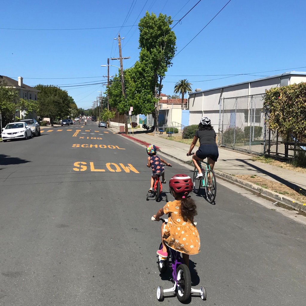
We published countless articles pushing for “open streets” walk/bike interventions, especially Oakland-style “Slow Streets, which involve prohibiting through traffic on side streets to allow pedestrian activity in the road (parking, deliveries, pickups and drop-offs allowed), including publishing a map of potential Slow Streets locations on May 13. In a tweet two days later, Mayor Lori Lightfoot indicated that there was some movement on that front.
People are itching to get outside. Businesses are looking at creative ways to serve customers. The key is how we do it. Stay tuned for some changes to our streets and sidewalks. Transportation is more than just cars. We’ll show how Chicago can be safer and easier to get around.
— Mayor Lightfoot #StayHomeSaveLives (@chicagosmayor) May 15, 2020
Around that time, 47th Ward alderman Matt Martin, whose district is largely comprised of Lincoln Square, told Streetsblog he had been in talks with the Chicago Department of Transportation, other aldermen, and residents about the possibility of doing open streets and Slow Streets in the ward. Martin then launched a community input map where residents could highlight streets in the ward where crowding has been an issue.
This weekend, eagle-eyed Streetsblog reader Kevin Zolkiewicz spotted several streets on CDOT’s ChiStreetWork website, the city of Chicago’s infrastructure map portal, that have permits issued to temporarily make them “a Shared Street for physical distancing” (CDOT’s words) during the pandemic, which appears to be the same thing as a Slow Street.
The streets that Kevin spotted that are slated for this treatment include:
- The Glenwood/Greenview Greenway from Carmen Avenue to Howard Street. This roughly 3.2-mile stretch is most of the Glenwood/Greenview Greenway connecting Uptown with Evanston. This route, like all neighborhood greenways (traffic-calmed pedestrian- and bike-priority routes, often with contraflow bike lanes) was on our potential Slow Streets map.
- Leland Avenue from Lincoln Avenue to Sheridan Road. This 1.7-mile segment segment lies partly within Alderman Martin’s ward and runs almost to the (closed) Lakefront. We suggested doing Leland east of Clark Street (a neighborhood greenway), since Leland is one-way eastbound between Lincoln and Clark. It’s not clear whether two-way bike traffic will be officially permitted on the one-way stretch.
- Palmer Street between Long Avenue and Kedzie Boulevard. This 2.8-mile stretch runs from Long, a good north-south biking street in Belmont Cragin, to Palmer Square park in Logan Square. The westernmost six blocks is one-way eastbound. Palmer wasn’t on our Slow Streets map, but it’s already a great low-stress biking street, so it’s a good choice for allowing on-street walking and running.
- Cortland Avenue from Ridgeway Avenue to Rockwell Avenue. This approximately 1.5-mile segment parallels the Bloomingdale Trail, aka The 606, which Lightfoot closed two months ago due to crowding concerns. Cortland is a block north of the trail, and this segment has two-way traffic. Our map suggested Wabansia Street, a block south, as a trail alternative, but Cortland is also a good choice. Note that there’s some overlap between the Cortland and Palmer routes, which are only three blocks away from each other, which will help ensure that crowding isn’t an issue.
You’ll notice that basically none of these routes are located on the South or West sides. That’s also the case with Chicago’s neighborhood greenways, which have basically all gone to North and Northwest side neighborhoods with relatively high levels of cycling where residents have advocated for more bike facilities.
However, it’s important to note that these four streets are only the ones that we’ve spotted on the ChiStreetWork page. A knowledgeable city official said that there are similar plans being developed on the South Side. Hopefully, unlike neighborhood greenways, these Shared Streets will be distributed equitably across the city, so that residents from all walks of life have an opportunity to benefit from safe routes for essential transportation, as well as fresh air and physical activity. That’s crucial for health during a time when Chicago’s most important car-free commuting corridors, The 606 and the Lakefront Trail, are closed.
Some mobility justice advocates have pointed out that in Black and Latino communities, many people do not feel safe going outside due to issues like gun violence, over-policing, and threats of immigration crackdowns, which means that open streets are effectively less open for some residents than others. Still, if most of Chicago’s African-American and Latino neighborhoods were passed over for Shared Streets, denying residents the opportunity to decide for themselves whether to use them or not, that would be another injustice. So we’re hoping that these routes will be equitably distributed.
CDOT spokesman Mike Claffey provided the following statement in response to questions about the Shared Streets permits:
As Chicago Department of Transportation Commissioner Gia Biagi has stressed, community engagement has been and will remain a critical component of CDOT’s process when creating new transportation policy. Over the past few weeks, CDOT has been engaging both the general public and key stakeholders to better understand transportation issues created by the COVID-19 pandemic and discuss potential solutions. As the city anticipates transitioning into a new phase of its re-opening plan sometime in June, CDOT is preparing plans to equitably re-allocate street space to residents, where feasible, for various uses beyond driving a car. CDOT will continue working with stakeholders in all of Chicago’s neighborhoods to implement effective and meaningful transportation initiatives that help increase access and mobility for all of Chicago’s residents, while keeping safety at the forefront.
In a recent interview on the city’s “Ask Dr. Arwady” Q & A program (read the full transcript at the bottom of this post), transportation commissioner Gia Biagi indicated that open streets initiatives will be prioritized in communities where residents are asking for them. “We want to take a really measured approach and say: Okay , if a neighborhood is raising their hand and experiencing some issues, we have lots of tools and we are happy to talk about how we can apply them.” CDOT is encouraging residents to share their experiences and ideas regarding pandemic-related transportation issues at the email covidmobility@cityofchicago.org.
If you live on one of these planned Shared Streets and this is the first you’ve heard of this program, rest assured that Slow Streets in other cities like Oakland, New York, San Francisco, Portland, and Seattle have been in effect for many weeks, and they seem to have a good safety track record — we’ve heard of zero serious conflicts between pedestrians, cyclists, and drivers. While the street openings generally involve zero additional policing (a deal-breaker for many residents in already-over-policed communities of color), signs and traffic cones are used to notify motorists of the through traffic ban and alert them to the presence of pedestrians in the road. The necessity of steering around these objects further encourages slower speeds.
Moreover, other than that minor adjustment, Slow Streets during Stay at Home present practically zero hassles for drivers. Currently main streets have light traffic since so many people are sheltering in place. Therefore, when motorists reroute crosstown trips from residential streets to arterials, there will be essentially zero impact on traffic congestion on the main streets. And, in addition to having a safe place to walk, run, skate, scoot, and bike right in front of their homes, local residents will benefit from a lot less traffic noise and emissions.
Looks like the ad-hoc #CarFreeHumboldPark event, sort of an accidental #SlowStreets intervention, has been a huge hit. All the fun of Chicago’s old Sunday Parkways events, but maybe $10K cheaper per mile (essentially free), without the zillions of cops. Photos: Michael Burton pic.twitter.com/ELV8KwBlUe
— Streetsblog Chicago (@streetsblogchi) May 23, 2020
We inadvertently got a taste of how awesome these Shared Streets will be last weekend, when Luis Muñoz Marín Drive, the ring road of Humboldt Park, was closed to car traffic and parking to prevent unsafe congregating during Memorial Day. While this wasn’t an intentional open streets program, police told Streetsblog it would be fine to walk and bike in the street, we got the word out about that, and families flocked to the park to get some exercise, with plenty of room for social distancing. While the drive was completely car-free (well almost, LOL), we can expect to see similarly adorable scenes on the upcoming Shared Streets.
Here are Commissioner Biagi’s full comments on open streets from the “Ask Dr. Arwady” show:
We are really closely examining what all these other cities are doing. We are taking these questions really seriously, and we want to ensure that whatever we end up doing is in keeping with staying at home and keeping safe. If you look at a city like Oakland that closed some 70 miles of residential streets, that sounds great. But the way we like to plan in Chicago is being really attuned to each individual neighborhood. It’s important for us to recognize that what we are seeing in terms of COVID, what we are seeing in terms of where people live and housing patterns and open space across the City, it’s all different. We want to take a really measured approach and say: Okay , if a neighborhood is raising their hand and experiencing some issues, we have lots of tools and we are happy to talk about how we can apply them.
But there’s a couple of important things to keep in mind: Whatever we do has to be meaningful; we are not doing things just to say we did something. It has to be that we are addressing a problem, and the problem has been identified through local knowledge and local knowhow, and whatever expertise we can bring.
The second thing is, we have to have the capacity. We do not have the capacity to stand in front of every cone that might be blocking a street to tell you not to go down it if you are in a car. So whatever we do, we cannot take away from the other obligations of City employees doing the work they are doing. Enforcement needs to be a construct of what communities can do together.
That leads to the third thing that is really important, which is a community-engaged process. One of things we’ve done is set up an email address because we do want to hear from Chicagoans about what they are seeing and what they would like to see happen. We care about the fact that one solution isn’t going to work everywhere. The email address is: covidmobility@cityofchicago.org .We want people to send us a couple of things: What you’re seeing. And the nearest intersection where you are seeing this occur. And some ideas you have and anything else you want to tell us about your experiences on streets and sidewalks. It’s our goal to listen really well, and then we’ll respond with tools and ideas as we go forward.