Eyes on the Street: The basically completed Granville Greenway has likely reduced car traffic, increased sustainable transportation use
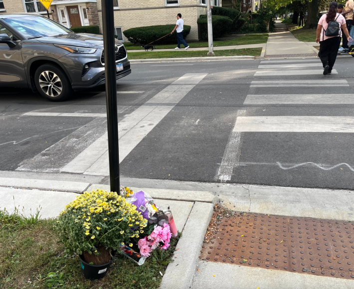
Yesterday, I visited the site where a northbound minivan driver fatally struck Juslene Akeza, 4, as she was crossing Talman Avenue (2630 W.) westbound on the north side of Granville Avenue (6200 W.) in West Ridge. That tragedy happened along the recently installed Granville Avenue Neighborhood Greenway. But as I noted in my writeup of the crash, the new east-west street design was basically irrelevant to the motorist’s failure to hit the brakes in time, the reason why police cited them for failure to reduce speed.
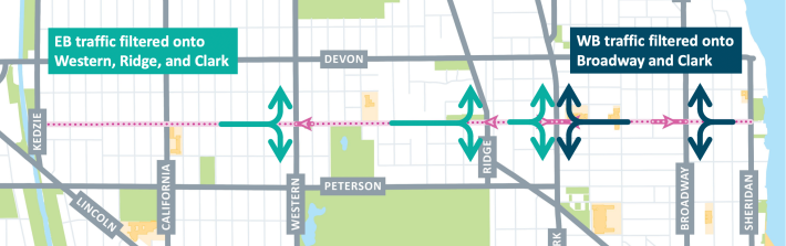
While I was in that part of town, I did my first examination of the bike-pedestrian-priority greenway, which appears to be largely completed. (I’m double-checking with the Chicago Department of Transportation that they don’t have anything else major planned for the corridor.) The route runs 2.8 miles between Kedzie Avenue (3200 W.) and Sheridan Road (1000 W.) in Edgewater.
Aside from a small retail district near the Red Line station just east of Broadway (1200 W.), Granville is a side street, with several schools and parks. But before CDOT installed the greenway, the corridor was treated like an arterial by drivers who used it as a “cut-through” route for long-distance trips, attempting to avoid congestion on nearby Devon (6400 N.) and Peterson (6000 N.) avenues.
Because of that, speeding and crashes were common on the largely residential road. In a recent five-year period, the corridor saw 664 crashes, with 162 people injured. Roughly 88 percent of the drivers who injured others don’t live in the community. And nearly half of recent collisions happened during school pickup and drop-off hours.
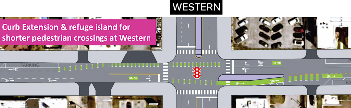
To address that problem, and make Granville safer for walking and biking, last year CDOT proposed converting some sections of the avenue to one-way for drivers. Contraflow lanes would legalize two-way travel for bike and e-scooter riders on those stretches. And speed humps and other types of traffic calming would be added.
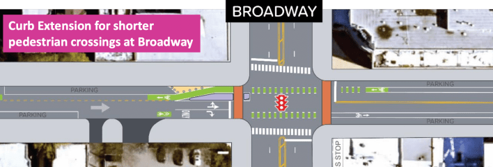
The proposal for the greenway. Image: CDOT
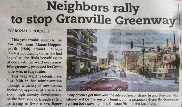
As you might expect, there was pushback to the proposal from motorists who didn’t want to lose one of their favorite “stealth” routes, or otherwise have to slightly modify their driving habits. A community meeting a year ago was contentious, and some community groups, and a neighborhood newspaper chain whose office happens to be just north of Granville, bitterly opposed the plan.
But the numbers suggested these naysayers were simply a noisy minority. According to CDOT, more than 200 people attended the department’s October 2024 community meeting, and of the 119 comments left expressing an opinion about the plan, 76 percent supported it.
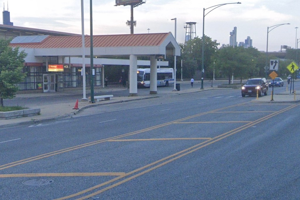
At any rate, from my ride on the corridor yesterday, it appears to be a successful project. Check out this handlebar POV video I shot riding east from California to the lake about a year ago at dusk, before the greenway was installed.
Now take a look at the clip I filmed yesterday, riding the same route, at around the same time of year, in similar weather, a few minutes before the evening rush, with the new greenway. There appears to be significantly less motor vehicle traffic, but more people riding bikes and e-scooters. And I didn’t notice any major aggravation from drivers, other than one motorist who honked at me (3:15 in the video) while they were trying to exit a parking lot. But that didn’t have anything to do with the greenway layout.
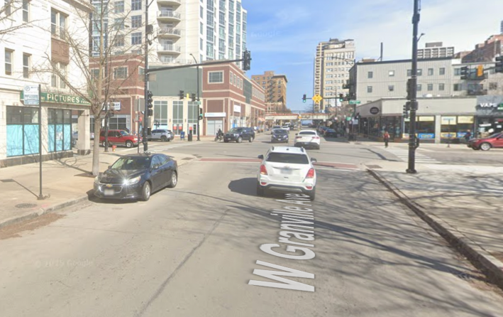
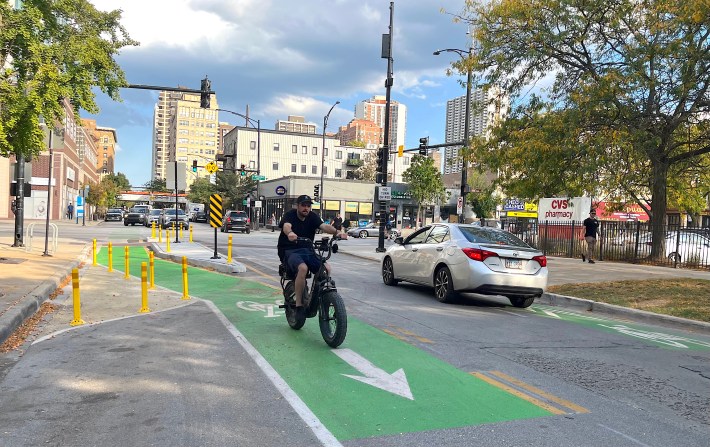
And to give you a better idea of how the corridor has changed, below is a gallery of some of the key street design changes, starting with the “before” Google Street View, followed by CDOT’s rendering of the redesign, and “after” images I took.
Surely there’s been plenty of grumbling from some of the more car-centric neighbors about this. But I’m confident that in the future, much-lower crash and injury number will confirm that decision-makers made the right call here.
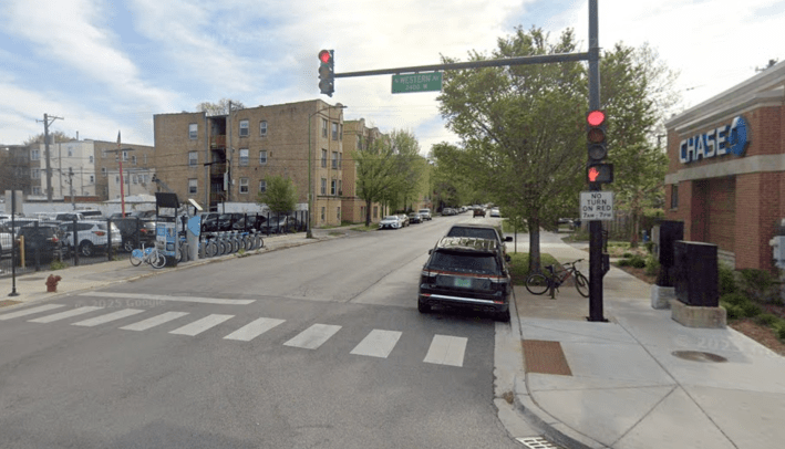
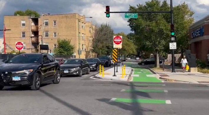
Granville and Western Avenue (2400 W.), looking east
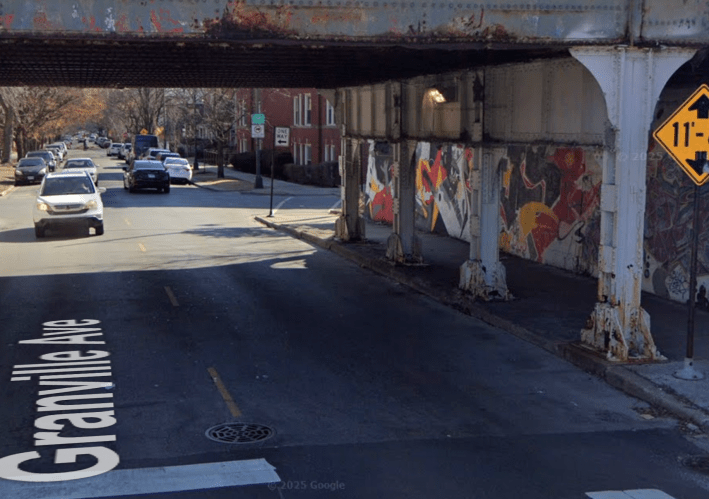
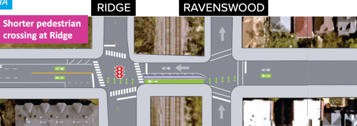
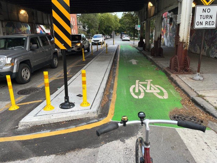
Granville and Ravenswood / Ridge Avenue (1800 W.), looking east under Metra’s Union Pacific North tracks
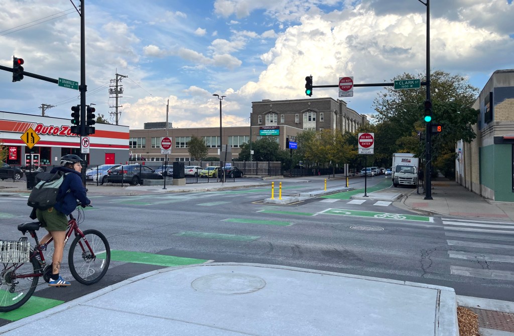
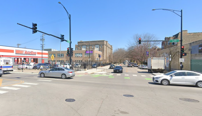
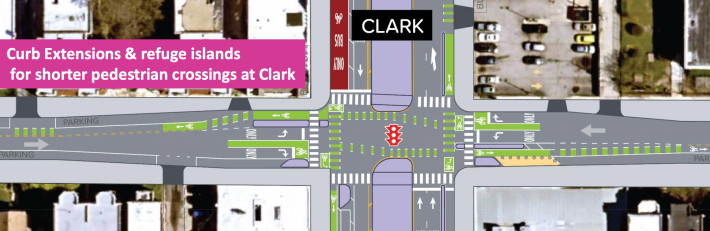
Granvile and Clark Street (1600 W.), looking east
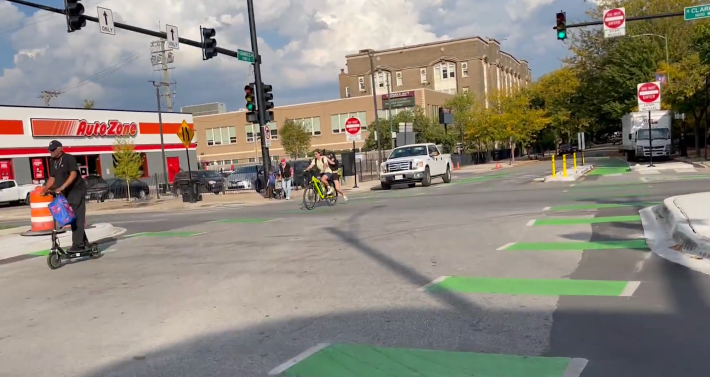
Granville and Broadway (1200 W.), looking east

Do you appreciate Streetsblog Chicago’s paywall-free sustainable transportation reporting and advocacy? We officially ended our 2024-25 fund drive in July, but we still need another $42.5K+ to keep the (bike) lights on in 2026. We’d appreciate any leads on potential major donors or grants. And if you haven’t already this year, please consider making a tax-deductible donation to help us continue publishing next year. Thank you!

Read More:
Streetsblog has migrated to a new comment system. New commenters can register directly in the comments section of any article. Returning commenters: your previous comments and display name have been preserved, but you'll need to reclaim your account by clicking "Forgot your password?" on the sign-in form, entering your email, and following the verification link to set a new password — this is required because passwords could not be carried over during the migration. For questions, contact tips@streetsblog.org.