City cuts ribbon on Clark Street upgrades in Rogers Park, including converting Arthur Avenue to a pedestrian plaza
Yesterday, City officials celebrated the completion of a major streetscape revamp on and around Clark Street between Devon (6400 N.) and Arthur (6500 N.) avenues, with a ribbon cutting.
The Clark Street Streetscape Project, completed by the Chicago Department of Transportation, modified a stretch of Ashland Avenue, put in more pedestrian plazas, and widened sidewalks. It also added bike racks, benches, garbage cans, and public art.
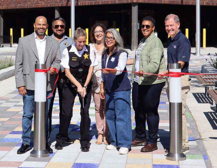
This initiative has been in the works since 2018, with most of the construction taking place over the past two years. The improvements span parts of the 40th, 48th, and 49th wards, and all three alderpersons currently representing those districts were on hand to mark the occasion at the newly minted plaza in front of the 24th District police station. The officials said the improvements have made the area safer, and have provided more places to relax and gather.
The upgrades
The project originated as part of the much broader Vision Clark Street Corridor master plan, which was completed in 2017. As its name implies, the document mapped out improvements for the entire Rogers Park portion of the Clark Street corridor. Sandi Price, executive director of the Rogers Park Business Alliance chamber of commerce, said stakeholders are still looking for funding for the remaining sections of Clark in the neighborhood.
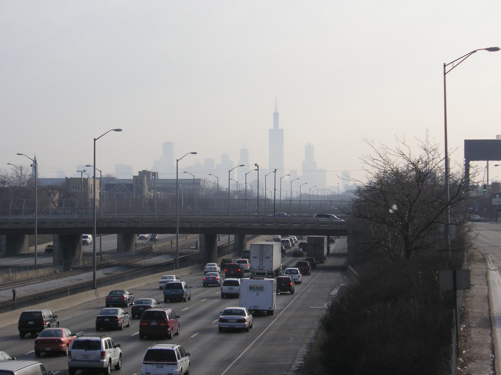
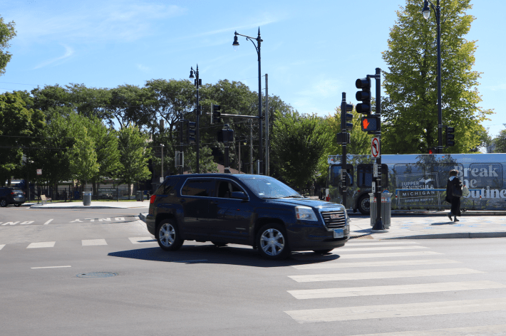
As City officials noted during the ribbon-cutting, the corridor is something of a transportation hub. CTA bus routes 36 Broadway and 151 Sheridan terminate at a turnaround on the east side of Clark, south of Arthur. Riders can transfer to the 22 Clark and 155 Devon via nearby stops.
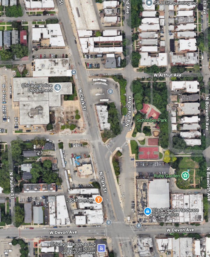
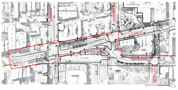
One major issue with the previous street layout was that buses entered the turnaround through the segment of Ashland north of Devon, where Ashland splits off of Clark. (Ashland and Clark are essentially the same road on the mile or so between this intersection and Victoria Street [5800 N.], at the north end of Andersonville, where Ashland and Clark split again.)
Ashland north of Devon previously veered off at an awkward angle, which was especially tricky for longer, articulated buses. The old layout also created a blind spot for southbound drivers on Ashland making a hairpin right turn, northwest-bound, onto Clark. Look at the aerial image above to see what I’m talking about.
After the streetscape makeover, Ashland north of Devon is now a longer, smoother curve. And now there’s a large pedestrian island between Ashland and a new road segment specifically intended for drivers heading south on Ashland and turning onto Clark. That road meets Clark at a 90-degree angle, so there’s less of a blind spot.
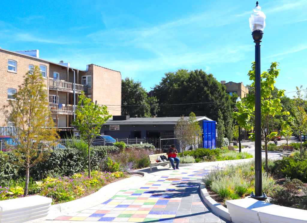
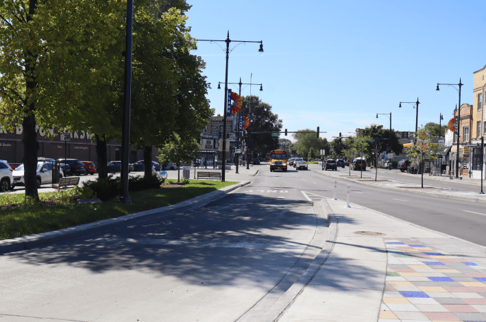
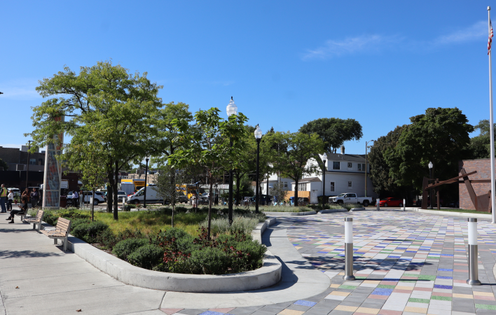
Another notable change is that what used to be a one-lane, one-way westbound section of Arthur between Clark and Ashland has been transformed into a pedestrian plaza, complete with a winding path, benches and public art. See the photo of it at the top of this post.
Meanwhile, the plaza in front of the police station, across the street from the turnaround, was spruced up with more grass, trees and benches.
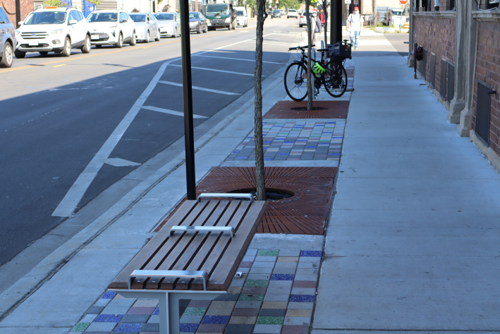
Other improvements were less obvious, but still notable. Both sides of Clark Street got new trees, benches, “inverted U” bike parking racks, light poles, and garbage cans. Contractors added colorful sidewalk tiles and community identifier banners throughout the corridor. As someone who has had to navigate this stretch of Clark after dark many times, I can attest that walking there now feels a bit safer.
On the other hand, the bench design includes raised metal bars that added to their cost, but serve little purpose than to discourage unhoused people from sleeping on them.
The ceremony
The project was a collaboration between CDOT, the chamber, and the Illinois Department of Transportation, since a small stretch of state-jurisdiction right-of-way was affected on Ashland. As the current alderpersons noted during the ribbon-cutting, the project began when former alders Patrick O’Connor (40th), Harry Osterman (48th) and Joe Moore (49th) represented the wards. So the new alders described their roles as taking the batons from their predecessors, and making sure the project got the necessary permits and other support.
The Rogers Park Business Alliance’s Price said that she is impressed with the results of the collaboration. “We added a lot of green space,” she said. “The community loves, and hopefully we’ll do events at, the police plaza.”
CDOT Commissioner Tom Carney described the project as “transformative” and emphasized that the final design was based on community input. “We continuously heard what a challenge [the Clark/Ashland] intersection presented, and the lack of public space,” he said. “It’s a prime example of what we can do when we design a space for people, one that is good for businesses and residents.” Carney gave special praise to the three alders, describing them as champions of infrastructure that benefits the public.
Ald. Vasquez described the project area as “a location where neighbors can come together,” adding, “It just really has a vibrancy you don’t see often.”
Ald. Manaa-Hoppenworth said that improvements like this “save lives and bring people together.”
Ald. Hadden said she was particularly struck by the use of color in the tiles, street art and signage. “[A public space] can be functional and it can be beautiful,” she said. “It’s wonderful to see this vision come to fruition.”
24th District Commander Alison Christian, who was promoted to that title about a month ago, said that people usually come to the police station distressed and may leave just as distressed. “I truly believe that this [new plaza in front of the station] will help when they walk out.” she said. “Hopefully, this is what they will remember.”

Did you appreciate this post? Please consider making a tax-deductible donation, to help keep Streetsblog Chicago’s sustainable transportation news and advocacy articles paywall-free.

Streetsblog has migrated to a new comment system. New commenters can register directly in the comments section of any article. Returning commenters: your previous comments and display name have been preserved, but you'll need to reclaim your account by clicking "Forgot your password?" on the sign-in form, entering your email, and following the verification link to set a new password — this is required because passwords could not be carried over during the migration. For questions, contact tips@streetsblog.org.