The Chicagoland sustainable transportation scene in nutshell: My presentation to University of Michigan students
Watch a video of the speech here.
Check out SBC’s previous article about the interactive map here.
Last week, students from the University of Michigan’s Department of Urban and Regional Planning took a transportation-themed trip to Chicago. These folks are in a new degree program called Urban Technology, and they spent their time in the Windy City checking out issues and opportunities related to sustainable transportation.
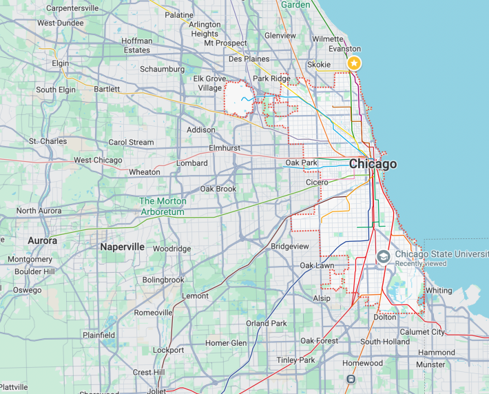
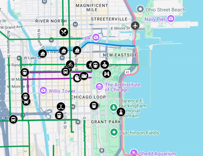
Teaching Professor Phil D’Anieri asked if Streetsblog Chicago could recommend some locations for the students to explore, so I put together an interactive map of walk/bike/transit hotspots in or near the Loop, basically the city’s central business district.
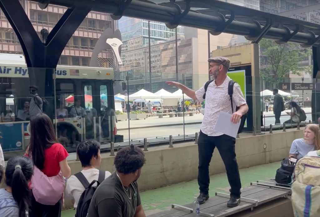
On Thursday, June 12, I gave a speech, intended as an introduction to our city’s livable streets scene, before the student did walking tours based on the map.
Here’s a transcript of my presentation, edited for clarity and brevity.
Welcome to Chicago. If you’ve never visited before, it may seem a bit overwhelming. It’s the largest city in the Midwest. But I can tell you that after living here for a long time, it starts feeling kind of like a small town, in a good way.
Chicago overview
One of the great things about living in Chicago, besides the food and beaches, is that it’s not hard to live here without a car. We have an extensive transit system that includes CTA ‘L’ trains and a grid of CTA buses, and we also have a commuter rail system called Metra that can take you just about anywhere in the suburbs. And we even have a train that goes directly to Indiana called the South Shore Line, which will take you as far as South Bend, and places like the Indiana Dunes.
So if you want to live car-free, this is really one of the best places in the country to do that. It’s got one of the most extensive transit systems behind New York City. And this is a much more affordable place to live. Rents are about a third of what they are in New York. We have a lot of the same things people like about New York, but they’re a lot more affordable and accessible here.
The transit fiscal cliff
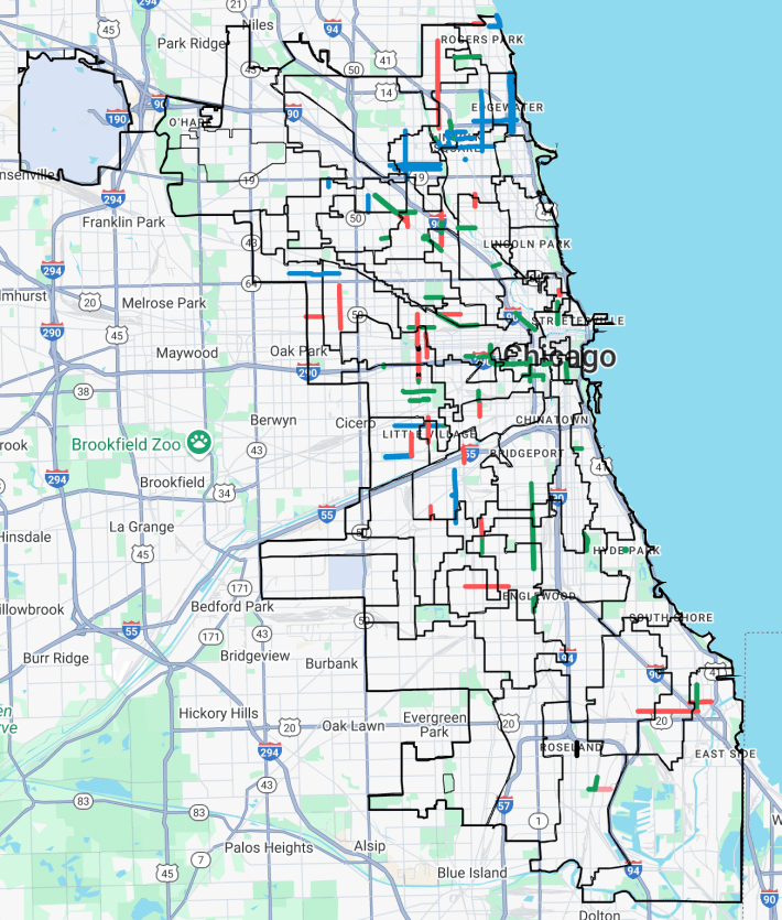
One thing I should tell you is that we are, transit-wise, in sort of a moment of crisis in Chicagoland. That’s what we call the region, Chicago and its suburbs. We are approaching something called the transit fiscal cliff. Because of COVID-19, and less ridership after the pandemic, and federal COVID stimulus funds running out, it’s predicted that in 2026 we will have a $771 million total deficit for our three local transit systems, the CTA, Metra and Pace, the suburban bus system.
At the end of May, there was a crisis at the statehouse down in Springfield, Illinois, where legislators were trying to pass a transit funding and reform bill in order to fill that budget gap. But it didn’t happen. Some people weren’t happy with what was proposed. So now we’re in danger of having a 40 percent cut in service for our three transit systems and 3,000 transit workers being laid off. It’s really important for them to solve this problem over the summer, or the three agencies are going to have to have to start planning for having $771 million less revenue next year, which means we might have less bus service than Kansas City or Madison, Wisconsin.
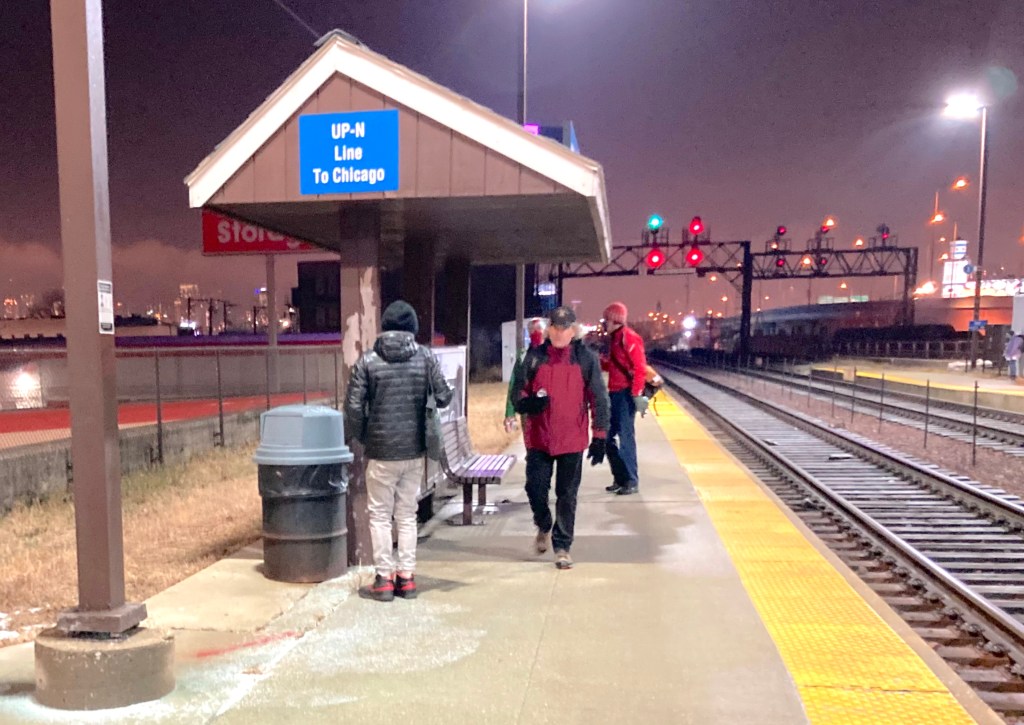
The Chicagoland rail system
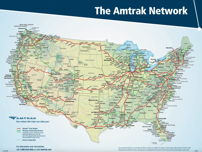
All right, so the map I created is sort of a choose your own adventure thing, or I think Phil has a couple of routes in mind as well, but I emphasized several forms of transportation here. You folks might want to check out our extensive rail system. We have five train stations that serve Metra and/or the South Shore Line and/or Amtrak. Union Station is our biggest station, and that’s over there, across the river.
Chicago is a rail hub. And that’s another thing that makes it a great place to live without a car. If you want to go to most of the other major cities in the United States, you can just take Amtrak there instead of flying or driving. It might take you a while, but it will be an interesting ride. For example, you can get to New Orleans by train going directly south down the country, and that takes about 20 hours, and you sleep on the train. So I recommend that trip.
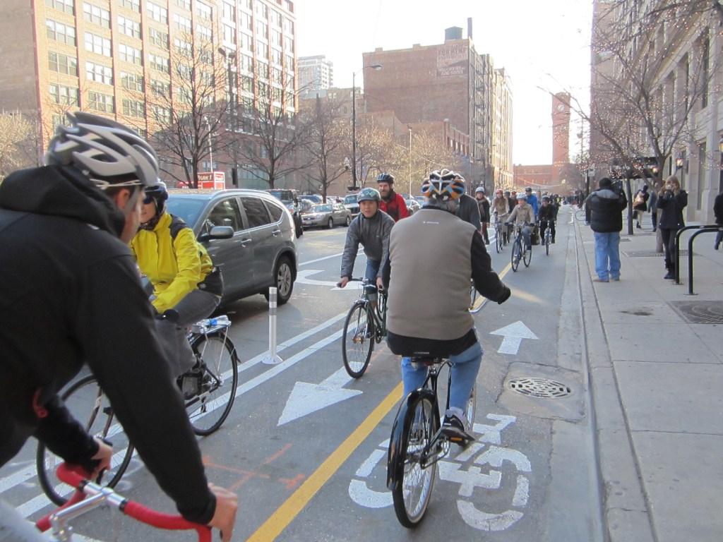
Loop Link bus rapid transit “lite” corridor
This [speech location] is actually a really good place for us to hang out, because we see the nexus of a few different transportation modes here. So this big shelter here is a Loop Link bus rapid transit “lite” station. If you folks are familiar with bus rapid transit, that’s something that exists in a lot of cities around the world. It’s big in Latin America and Asia, and New York has some good express buses nowadays.
But ideally a bus rapid transit system has prepaid boarding, which means you pay your fare before you get on the bus, so you don’t have to wait in line to pay. It has level boarding, so you don’t have to climb stairs to get on the bus. That’s pretty much what this platform is. It takes you up to about bus level. It should have dedicated lanes for the buses, which this has, in theory. You can see this bus is going down the red lane.
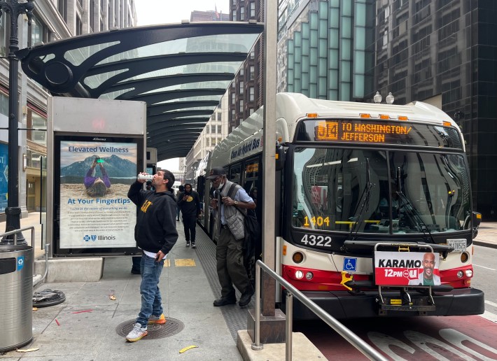
The problem is, the bus lanes in Chicago are not enforced very well, which means it’s not uncommon for private vehicle drivers to use the lanes to drive or park in them. The city is trying to address that. But as things stand in Illinois right now, it’s illegal to use cameras to enforce rules against driving in the bus lanes, or bike lanes. So hopefully we’ll pass some legislation in Springfield that would address that.
So I call this “BRT lite,” because we don’t have prepaid boarding, and we don’t have very good enforcement.
But one thing that’s cool about our Loop Link system is these island bus stations. The bus stops are away from the sidewalk, and you’ll notice there’s a ramp that wheelchair users can take up to the platform. Definitely, the wave of the future is making all transit facilities accessible for people with disabilities.
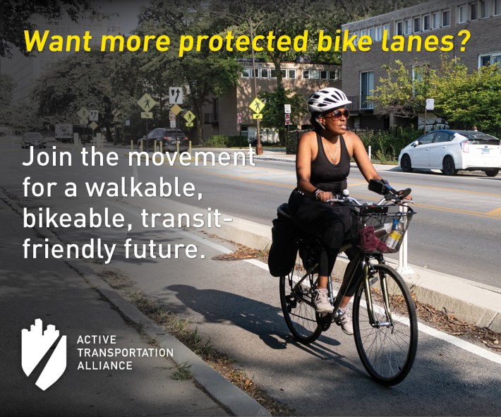
Protected bike lanes
So this island bus stop doubles as protection for this bike lane. A protected bike lane is designed with either concrete protection, those flexible plastic posts [points to some west on Washington] – which aren’t that useful if a driver wants to drive into the lane, since they can just driver over them – and/or parked cars.
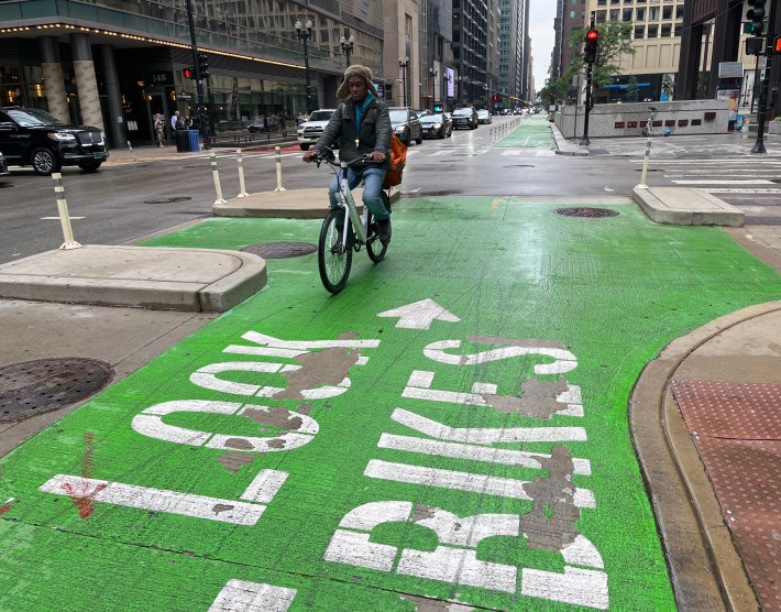
So we’ve got a fair amount of those in the loop nowadays. Recently, the Chicago Department of Transportation improved a lot of the bikeways by adding curb protection. Washington is a good route for getting eastbound across the Loop.
Overview of the Loop
As I said on the map, the Loop is Chicago’s central business district, basically. It’s a peninsula. The Chicago River goes west from Lake Michigan, and then there’s the North Branch that goes Northwest, and the South Branch goes southwest and connects with the Sanitary and Ship Canal. And that eventually leads to the Mississippi River.
So one of the first things on the map list is Madison and State. Madison is the westbound Loop Link route. That corridor does not a have a bike lane on it. The westbound protected lane route is Randolph Street. [Points north towards it.]
By the way, that’s the Thompson Center over there, which is being turned into Google headquarters. That’s why it’s all the glass is removed right now. Let me just point out a few more things while we’re here.
[Points to the west.] So that’s our City Hall and the Cook County Building. This is the Cook County side, and then City Hall is on the other side. That’s where a lot of the decisions about transportation get made here. So I attend a lot of meetings by the City Council.
The ward system, and how it can be a barrier to sustainable transportation
We have 50 alderpeople in the 50 wards of Chicago. The population of our city is about 2.7 million. It’s the third largest city in the United States. And we have 50 alders. They’re sort of like a mini-mayor for one out of 50 sectors of the city. So each of them has about 50,000 constituents, and they make all the decisions about sustainable transportation.
That’s one of the issues we have in Chicago. We don’t have the world’s greatest bicycle network or dedicated bus lane network, because each street passes through several wards, and you have to have all the alders onboard with a policy, or else it won’t get approved. For example, if you want to do a long bike lane, it helps a lot if the ward is pretty long. We have what’s called gerrymandering here. The city is divided up into lots of jigsaw puzzle pieces, and that was done to make sure everybody gets fair representation the City Council. The problem is, you have a lot of weird decisions to make about about where a straight line can go.
Discussion of a few hotspots on the Streetsblog map
All right, so here we also have the 1967 Picasso sculpture. It’s untitled, but a lot of people think it looks like a baboon or a woman. This is where our Critical
Mass bicycle parade gathers on the last Friday of every month, and it also hosts lots of other special events.
One thing you might want to check out is over at State and Madison streets. That’s the “ground zero” of our city now. Addresses are “North” north of Madison and “South” south of Madison. And they are “West” west of State and “East” east of State. Not much of that city is it. Not much of our city is east of State Street, but we do have an East Side neighborhood.
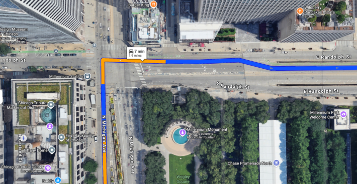
Another thing you might look at while you’re here, is what I call “Chicago’s Dumbest Intersection,” Michigan Avenue and Randolph Street. It’s a very dangerous intersection. Somebody was fatally struck on a Divvy bike-share bicycle there a couple weeks ago. Michigan is our main shopping street. Randolph is a bike route you can take to Lake Michigan and the Lakefront trail.
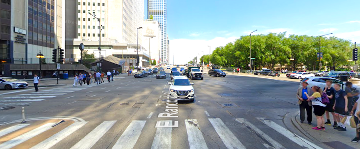
The problem with that intersection is Michigan Avenue is about ten lanes wide there, and it’s the intersection of a north-south street and an east-west street, but there’s no south crosswalk. So if you’re going between the Chicago Cultural Center, where a lot of special events happen, and Millennium Park, which is our big arts and performance space nowadays, you’re supposed to cross three streets to get from the cultural center to the park. That’s because there’s no direct crosswalk between the two. The City wanted to make it easy for drivers to come off DuSable Lake Shore Drive or Upper Randolph, head west on Randolph, and then turn south on Michigan Avenue, without having to yield to pedestrians.
Conclusion
Alright, I think you folks will be able to figure most of this stuff out from the previous Streetsblog article. But I’ll just close by saying I hope you folks enjoy checking out sustainable transportation here. Chicago really is one of the world’s great capitals as a Petri dish for figuring out sustainable transportation
issues. I don’t think we’re the greatest livable streets city in the world, but we’re pretty good by U.S. standards.
If you decide to go into the urban planning or transportation planning fields, I think you could really do worse than to settle down here. So get to know the city while you’re in town, and I would definitely encourage you to consider taking a job here after you get out of school.
Watch a video of the speech here.
Check out SBC’s previous article about the interactive map here.

Did you appreciate this post? Streetsblog Chicago is currently fundraising to help cover our 2025-26 budget. If you appreciate our reporting and advocacy on local sustainable transportation issues, please consider making a tax-deductible donation here. Thank you!

Read More:
Streetsblog has migrated to a new comment system. New commenters can register directly in the comments section of any article. Returning commenters: your previous comments and display name have been preserved, but you'll need to reclaim your account by clicking "Forgot your password?" on the sign-in form, entering your email, and following the verification link to set a new password — this is required because passwords could not be carried over during the migration. For questions, contact tips@streetsblog.org.