The CTA reveals the final plans for the path and public space under the new Red and Purple tracks. Will it have safe street crossings?
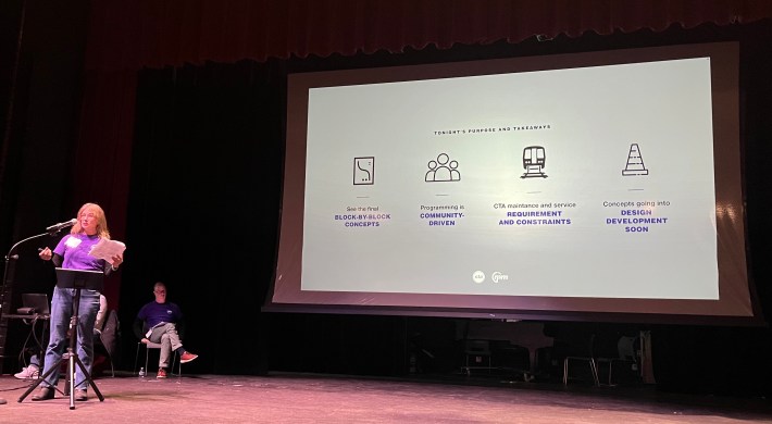
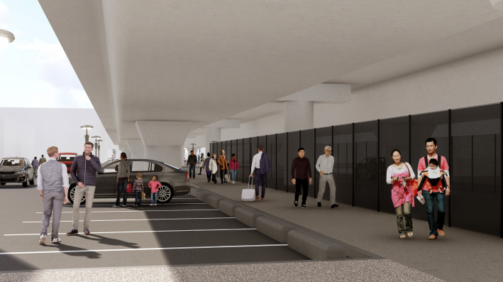
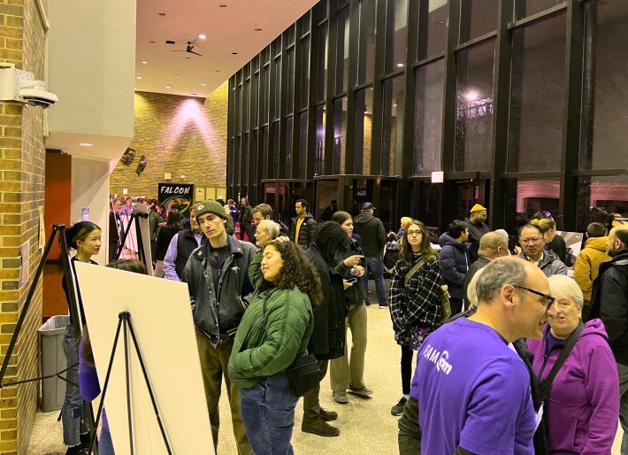
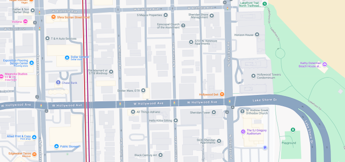
This week, the CTA released the final design concepts for a pedestrian path and other new amenities on a 1.3-mile segment under Red and Purple tracks, between the Lawrence and Bryn Mawr stations in Uptown and Edgewater. At the second of two community meeting this week, held last night at Truman College, 1945 W. Wilson, attendees seemed generally satisfied with the design.
However, questions remain about whether the mid-block street crossings for the trail will be safe, or whether the amount of space under the tracks that will be reserved for parking cars is actually warranted. And, as is to be expected with this sort of initiative, not everyone was thrilled with the aesthetics that were chosen for the route.
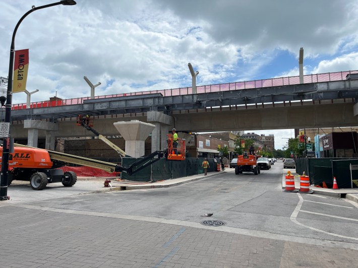
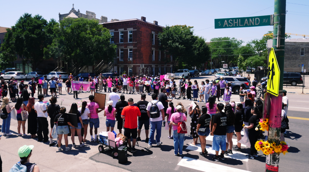
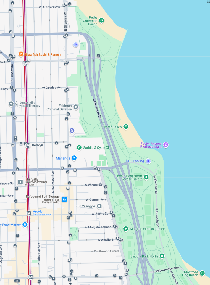
The path and public space effort is part of the $2.1 billion first phase of the Red and Purple Modernization program, which is in its home stretch. For over a year, the transit agency has been seeking feedback from citizens and merchants about how best to use land under the ‘L’ tracks that was opened up by the removal of a 100-year-old embankment barrier. That wall, which spanned the ten-block distance between Lawrence and Ardmore avenues, was taken out as part of RPM, which includes track replacement and rebuilding four stations to make them wheelchair accessible. The new train stops are slated to open this summer, with an announcement this spring about the exact date.
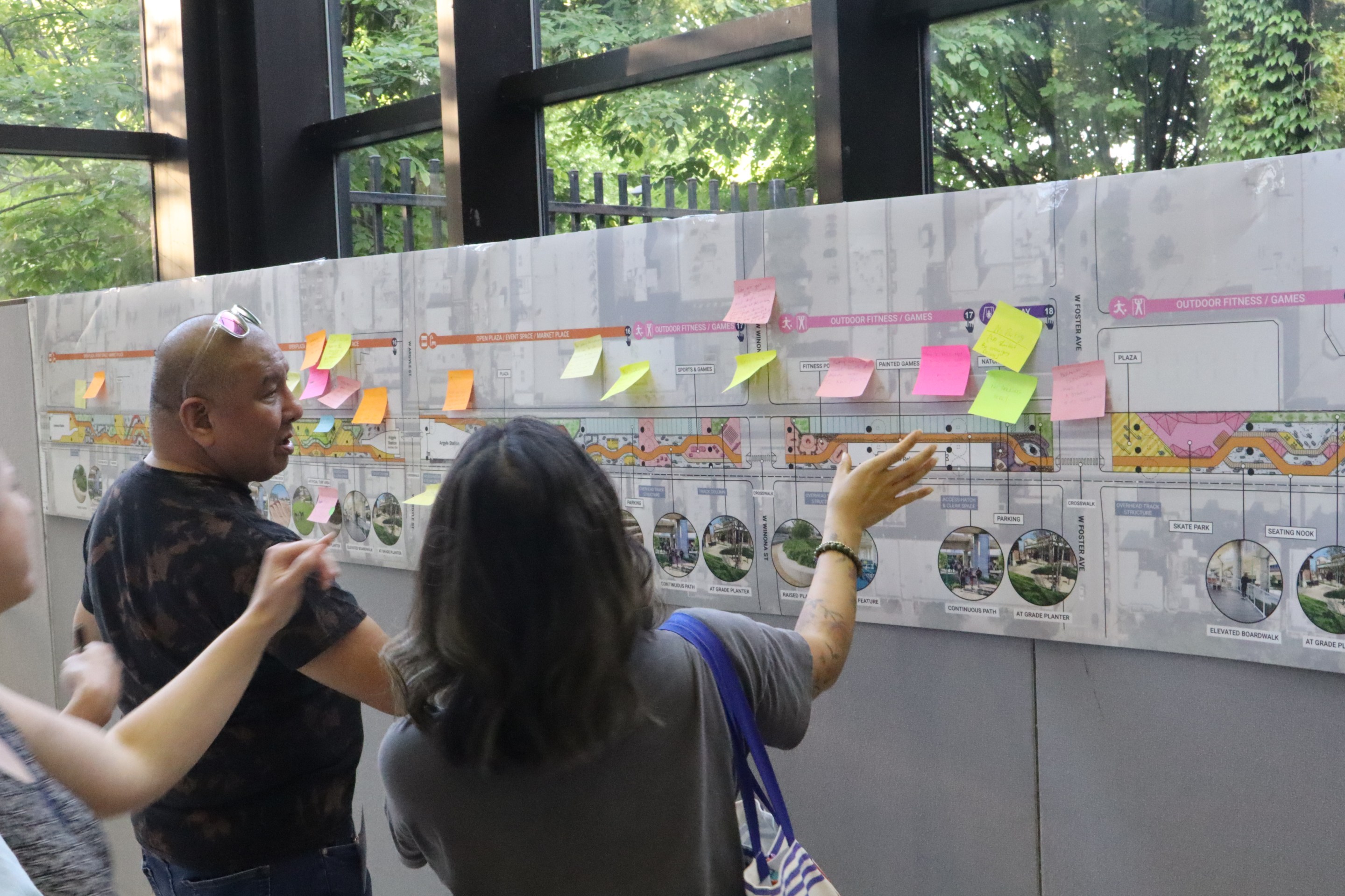
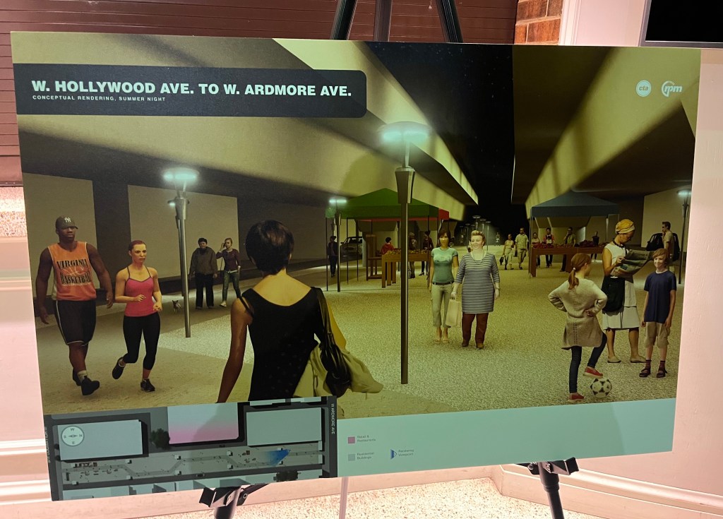
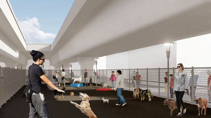
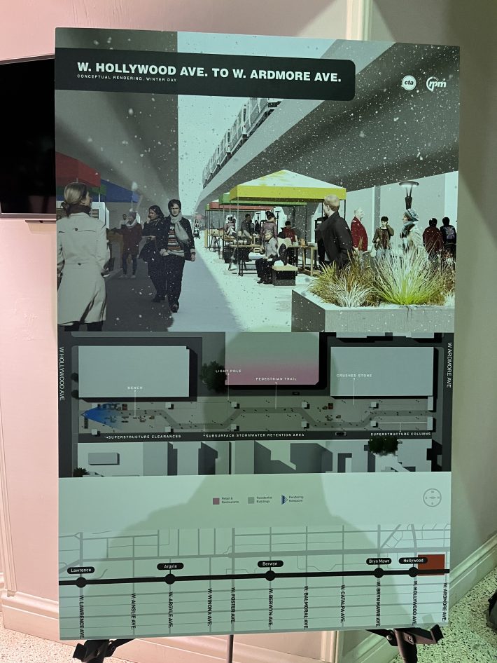
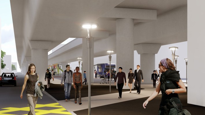
The local landscape architecture, urban design and architecture firm Site Design Group helped lead the planning process for the under-the-tracks public spaces. The CTA held several community meetings to collect input last year, with robust attendance. In addition to the new walkway, the final plan includes plazas that can be used for community events; playgrounds; dog runs; benches; and a fitness area. Work on building the the path and facilities is projected to start next year and wrap up in 2027.
CTA spokesperson Tammy Chase introduced last night’s meeting, stating that the design goal for the space under the ‘L’ was to keep they layout relatively open-ended. “We kept hearing a refrain from many of you that… you wanted a space that was open and flexible, that wasn’t too programmed, that didn’t have a real narrow, ‘Oh it can only be used for this thing’ [focus], because the community could change in five to ten years and what people want can change,” she said. “So we took that to heart, and the layouts that you’ll see tonight do reflect that.”
Probably the most controversial part of the the public space project was how many car spots to include under the tracks. “If I had to rank the topics that we heard the most about, parking was one that people felt very strongly about, for and against,” Chase said after her presentation. “Residents didn’t necessarily want parking behind their homes, especially if they don’t know who’s parking because it’s public parking. On the other hand, businesses said, ‘Gosh, we’re running a business in a really urban, dense environment, we need parking, and so we compromised.”
According to Chase, the parking spots were focused near Argyle street and its “Asia on Argyle” shopping district. “When they do get a big crush of shoppers, they want to make sure they’ve got enough parking,” she said.
While there are plenty of metered parking spaces near the Argyle strip on Broadway and Sheridan Road, Chase said no parking counts were conducted before making decisions about how many spaces to include under the tracks. “We’re not qualified to judge how much parking there is,” she said. “We were just trying to be responsive to the community under our ‘L’, saying, ‘Yeah, we can provide some additional parking.'”
Chase said the spaces would be public parking possibly through SpotHero or rented through the CTA. The land is owned by the transit agency, which is independent from the City of Chicago. Therefore, the parking revenue will not be used to compensate the City’s parking concessionaire for lost income when metered spots are converted to other uses, such as curbside protected bike lanes.
The path will not be particularly bicycle-friendly, since it will wind around different features and will have many street crossings without stoplights or stop signs. That shouldn’t be a major issue to bike riders, since the tracks are just west of Neighborhood Greenway routes on Winthrop (southbound) and Kenmore (northbound) avenues, and not far from the Lakefront Trail. Chase said the curving route under the ‘L’ wasn’t an intentional effort to slow down people on bikes. “We were trying to make a space that feels comfortable and inviting, and not just a straight path.” The path with be paved with crushed limestone sections for jogging on either side, a similar layout as the LFT.
As attendees checked out the display boards in the lobby, Maiko Lehman, a computer programmer who lives near Foster Avenue and Sheridan, said she is pleased overall with the final design. “I’m happy that there’s not a ton of parking,” she said. “I walk this area all the time because I have relatives and friends who live at the north end of it, so I’m always walking on Kenmore and Winthrop, so it will be nice to have an alternative walking path under there.”
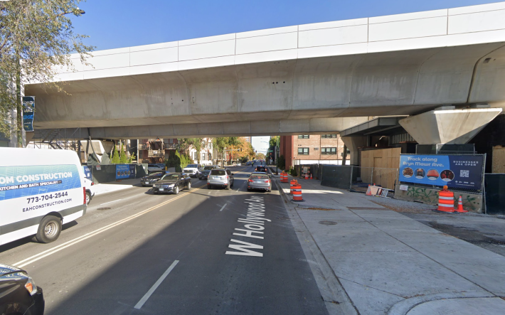
Lehman said the one thing she wished had turned out differently in the design that was released is a lack of raised crosswalks for the mid-block streets crossings. That’s particularly an issue for crossing Hollywood Avenue, a four-lane road that connects with DuSable Lake Shore Drive. “I really hate crossing Hollywood,” she said. “It’s a highway onramp in the middle of a neighborhood. I think it’s a travesty. but it is what it is.”
While path users will be expected to detour to stoplight intersections at Broadway to the west or Winthrop to the east, it’s likely that many will simply cross mid-block, exposed to heavy and/or high-speed traffic. “It’s people coming on and off DLSD who’ve sort of still got the road rage going, and they’re in a hurry,” Lehman said. She added that drivers at the stoplights on the way to and from the highway often “block the box,” by stopping within an intersection during a red light, making it difficult for pedestrians to cross in a crosswalk, even though they have the walk signal.
One other critique Lehman had is that the new stations will take up nearly the entire right-of-way under the tracks, so people on foot will be directed to detour around them by walking in the alleyway. The pavement will be painted with a pattern in an effort to make this obvious to pedestrians and drivers.
Chase said the Hollywood crossing issue is still needs to be resolved, because the streets is controlled by the Illinois Department of Transportation. Historically, that agency has opposed traffic safety measures that would require drivers to slow down, although that position seems to be evolving. She said a mid-block crosswalk is still under consideration at Hollywood, and local Ald. Leni Manaa-Hoppenworth (48th) will be involved in the decision as well. Chase added that she’s unsure if any of the other street crossings of streets under Chicago Department of Transportation jurisdiction would have raised crosswalks to improve safety, but said she’d look into it.
As for the aesthetics of the final design, Ellen Duong, who owns the plant store Qideas Plant Shop, 1134 W. Argyle, just west of the station, said they were a little different than what she expected. “It was more colorful in the original designs, and they asked us all to pick colors and whatnot, and I’m not seeing a lot of inclusion of colors, and I’m really disappointed in that. There isn’t much greenery either.” Much of the space under the tracks doesn’t get a lot of sun exposure, and who will maintain plants in the space, and how, is yet to be determined.
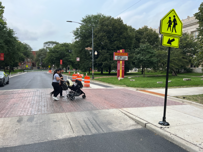
These various concerns and reservations aside, I got the sense that most of the attendees are looking forward to the new walking trail and public space. Here’s hoping that the authorities do the right thing by providing safe and convenient street crossings.
Read today’s CTA news release about the program here.
View the final renderings for the project here.

Did you appreciate this post? Streetsblog Chicago is currently fundraising to help cover our 2025-26 budget. If you appreciate our reporting and advocacy on local sustainable transportation issues, please consider making a tax-deductible donation here. Thank you!

Read More:
Streetsblog has migrated to a new comment system. New commenters can register directly in the comments section of any article. Returning commenters: your previous comments and display name have been preserved, but you'll need to reclaim your account by clicking "Forgot your password?" on the sign-in form, entering your email, and following the verification link to set a new password — this is required because passwords could not be carried over during the migration. For questions, contact tips@streetsblog.org.