Berwyn! Take a virtual bike ride from the channel to the lake, mostly on Berwyn Avenue, thanks to new contraflow lanes east of Clark Street
Earlier this week I razzed Block Club Chicago a bit for its article giving airtime to merchants’ claims that wider sidewalks and protected bike lanes on Lincoln Avenue in Lincoln Square “could put existing shops out of business.” I wasn’t trying to be unkind, but rather to set the story straight about the overall benefits of PBLs, so that initiatives like this don’t get bogged down or diluted by needless controversy. That way we can efficiently work towards creating a citywide network of connected, protected lanes for people riding bikes, scooters, and other sustainable transportation devices, reducing crashes, emissions, and congestion.
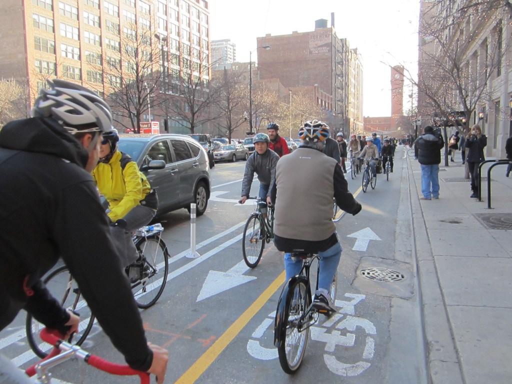
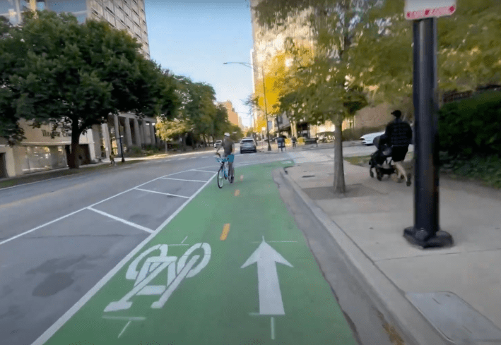
But, as I wrote, nowadays Block Club is generally doing a fine job at the Chicago sustainable transportation reporting game. Case in point was writer Madison Savedra’s recent piece on the new stretch of the Berwyn Avenue Neighborhood Greenway (5300 N.) between Clark Street (about 1530 W.) and Lake Michigan. I recently noticed a new eastbound contraflow bike lane on Berwyn east of Clark in Andersonville, but before that article came out, I hadn’t made the connection that that bakery-fresh bikeway is part of a lower-stress route a mile east to the lakefront.
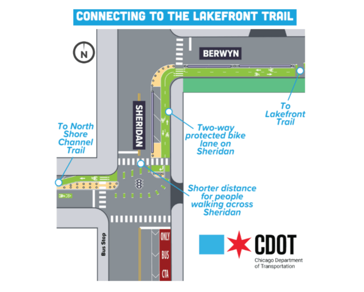
It was previously impossible to bike the entire mile along this stretch of Berwyn in either direction. That was because the avenue switches between one-way westbound west of Broadway (1200 W.), and one-way eastbound east of Winthrop Avenue (1100 W.) The new contraflow sections solve that problem.
Berwyn already had a eastbound contraflow bike lane much of the way east from the North Shore Channel (and its car-free trail) to Clark. But it’s still not legal and safe to bike completely on Berwyn between the channel and the lake. That’s because the eastbound bike lane currently ends at Hoyne Avenue (2100 W.) Moreover, there’s no stoplight at Ashland Avenue (1600 W.) to enable safely crossing the high-speed, five-lane road, so doing so is a sketchy proposition.
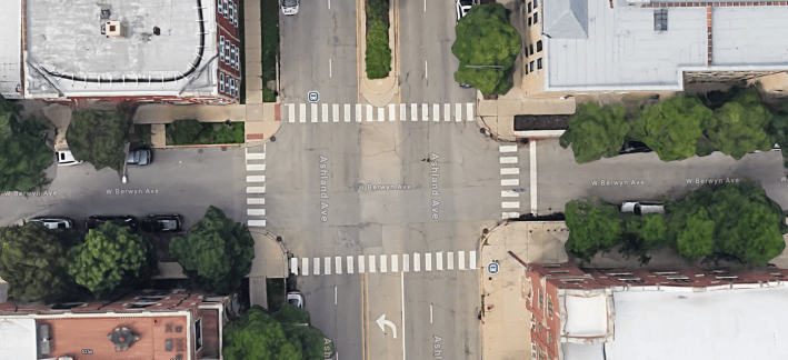
But Block Club reported that help is on the way. According to the 48th Ward office, next year CDOT will stripe the last half mile of eastbound contraflow on Berwyn between Hoyne and Clark, and install a new stoplight at Berwyn/Ashland.
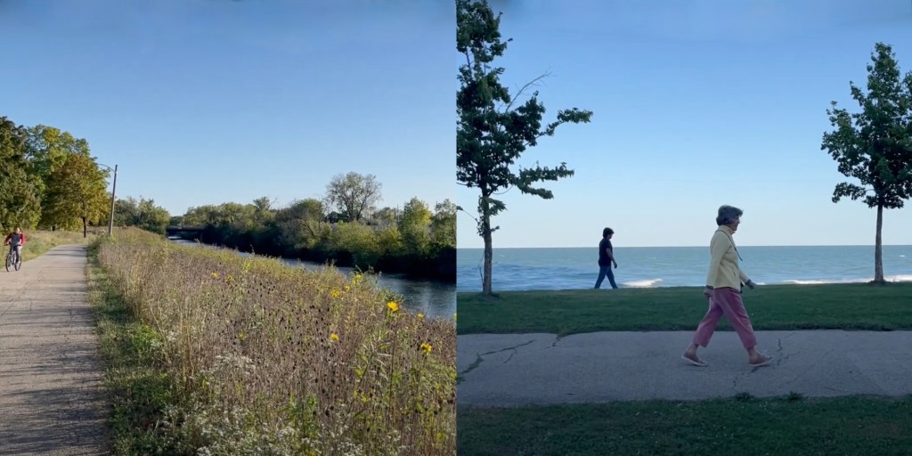
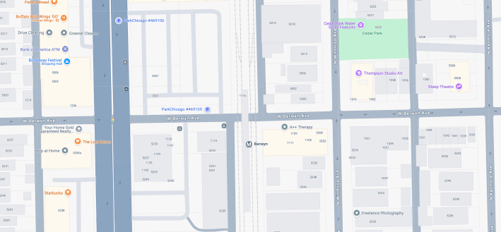
But until you can pedal on Berwyn all the way between the canal and the lake, in the meantime, the new contraflow section east of Clark still enables a nifty new alternative route, roughly three miles long. It works both eastbound and westbound, with a safer, signalized crossing of Ashland. In a nutshell, detouring between Berwyn and Balmoral Avenue (5400 N.) a block north, at Hoyne and Clark, is the key. You can also shortcut a bit by taking Bowmanville Avenue, a southwest-northwest street on south side of Rosehill Cemetery, between Berwyn and Balmoral.
In case that last paragraph was confusing, above is a map of a route between the canal and the lake that currently works in both directions, illustrating what the heck I was talking about. I’ve included some recommended stops along the way.
I’m pretty chatty in this video, discussing the street design situation and many points of interests along the way, and I think it’s a pretty scenic route. So you might find it somewhat informative, interesting, or amusing to watch the entire half-hour video, perhaps while sipping your favorite beverage.
And here’s a short video of the first section of the westbound trip, to give you a sense of how that’s done. Feel free to let me know what you think of the new route in the comments section.
Read the Block Club Chicago article here.

Did you appreciate this post? Please consider making a tax-deductible donation, to help keep Streetsblog Chicago’s sustainable transportation news and advocacy articles paywall-free.

Read More:
Streetsblog has migrated to a new comment system. New commenters can register directly in the comments section of any article. Returning commenters: your previous comments and display name have been preserved, but you'll need to reclaim your account by clicking "Forgot your password?" on the sign-in form, entering your email, and following the verification link to set a new password — this is required because passwords could not be carried over during the migration. For questions, contact tips@streetsblog.org.