BRT TBD: The Better Streets for Buses Plan lays out case and framework for bus improvements, details vague
I took a quick look at the “Better Streets for Buses Plan” when it first came out earlier this month in this Streetsblog Chicago post. I recently invited contributor Sharon Hoyer, one of our site’s transportation plan analysis blackbelts, to take a closer look. – John Greenfield, editor
Last week, the Chicago Department of Transportation and the CTA released a plan for improving bus service across the city. For many advocates, the Better Streets for Buses plan is a long-awaited commitment to make public transportation in Chicago faster, more convenient, and more equitable by cost-effective means. While the plan lists the benefits of better bus service and ways to achieve it, exactly what improvements will be made where remain vague.
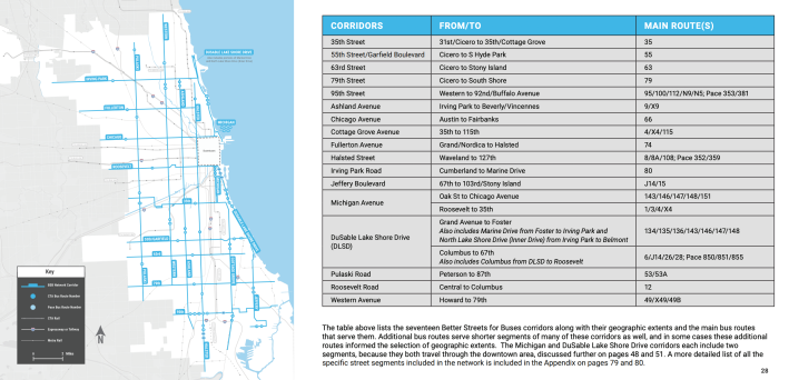
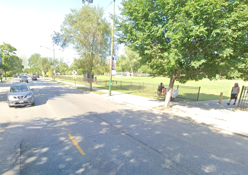
What the plan does clearly define is a grid of 17 bus corridors that will be prioritized for infrastructure improvements. Dubbed the Better Streets for Buses Network, the routes were selected in part through evaluation of economic and mobility hardship in neighborhoods citywide, and a public input process that included an interactive map where users could pin areas and routes to prioritize. The resulting network covers 185 miles of roadway and includes the most heavily used bus routes, many of which are often plagued by car traffic congestion, service gaps and infuriating “bus bunching”—when two or more buses arrive together after a long wait.
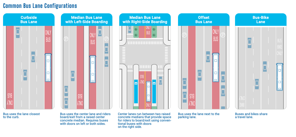
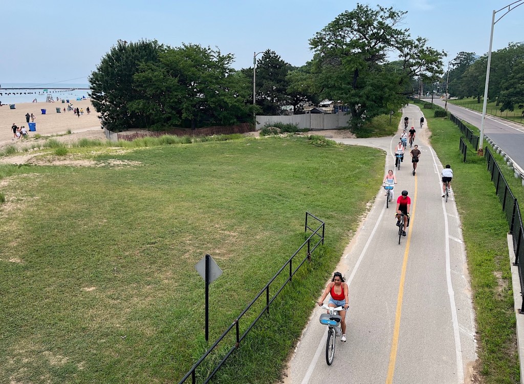
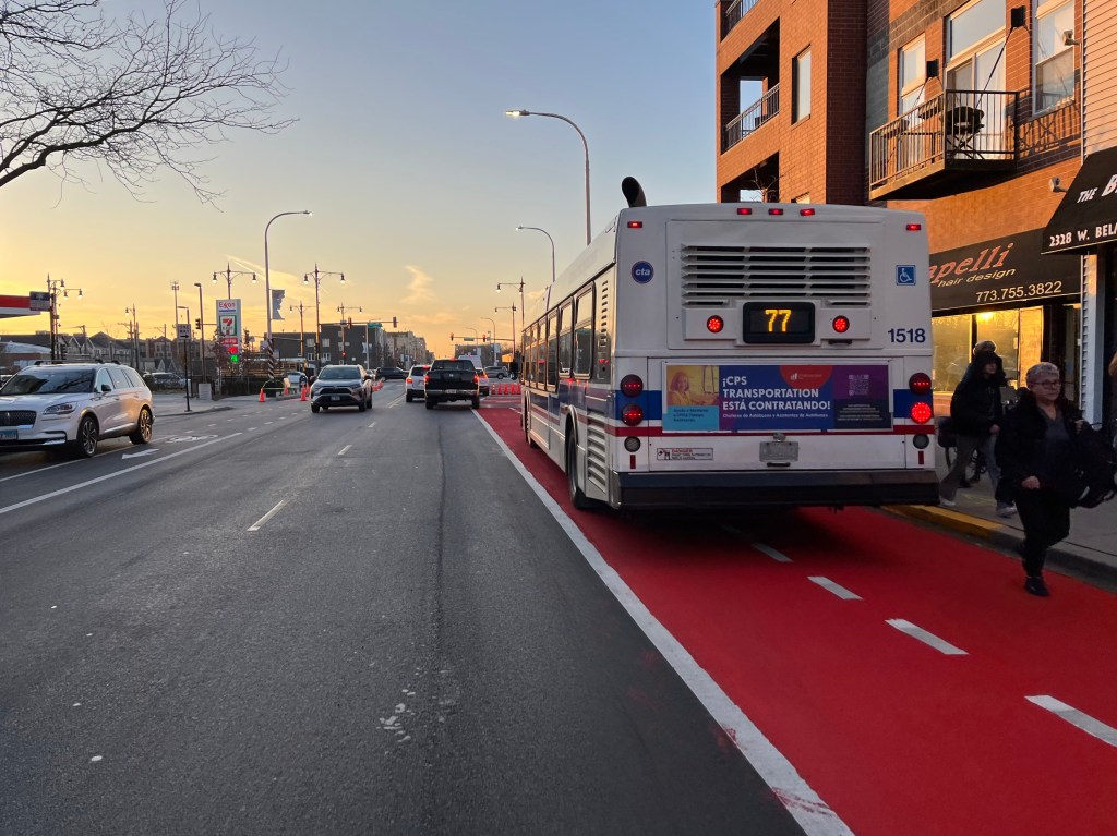
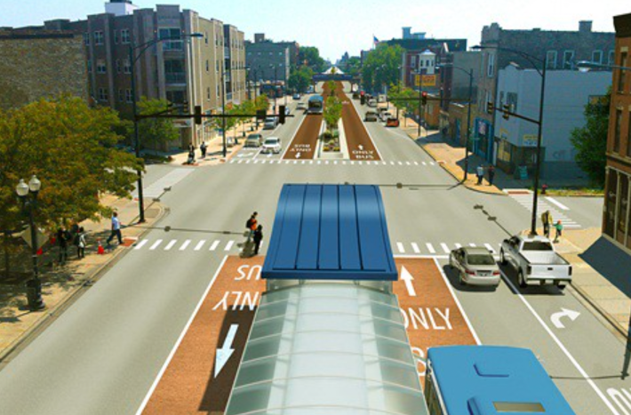
Alongside the network, the Better Streets for Buses plan includes a toolbox of street treatments that improve bus service, categorized into three buckets: bus stop treatments, bus friendly streets and bus friendly intersections. Dedicated bus lanes, bus boarding islands and pedestrian bumpouts, transit signal priority for buses, queue jump lanes and signals, as well as sidewalk improvements, better lighting, seating and shelters at bus stops, and bike parking are on the list, among others. What treatments will be used depends on the conditions of the street, specific needs of the route and other factors.
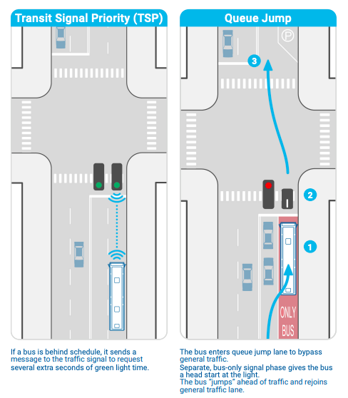
Transit signal priority and bus queues. Image: CDOT
The plan briefly addresses Bus Rapid Transit, a more comprehensive set of improvements that allow buses to travel near the speed of trains. Taken together, several of the treatments in the toolbox—including longer dedicated bus lanes and pre-paid boarding—could add up to some version of BRT—a cause for which transit advocates have joined voices ever more loudly. While acknowledging the benefits and high demand for BRT and some interest in pursuing it, the plan is decidedly vague. It states, “CDOT and CTA intend to develop and advance BRT projects on one or more of the Better Streets for Buses corridors; however, additional discussion and conversation is needed with communities to determine the best corridors and best designs to advance.”
A few specific projects already underway are named in the plan, including transit signal priority for buses on Ashland from Cermak to Irving Park; the South Halsted corridor which connects the Pace Harvey Transportation Center, the 79th and 95th Street Red Line Stations; and the 79th Street corridor—the most heavily used bus route in the city. The plan also celebrates recent improvements like the express Jeffrey Jump, the Loop Link system, Transit Signal Priority for approaching buses on Ashland and Western; and Bus Priority Zones on Chicago Avenue, Western Avenue and 79th Street.
Many of the 43 pages of the Better Streets for Buses plan, and a two-minute promo video, are dedicated to making the case for speedy bus service on key routes—an argument that need not be made to any rider of public transportation and one that would seem obvious to most Chicagoans, 96 percent of whom live within a half-mile of a bus stop. However, the plan may be intended as an advocacy tool, summed up in a call to action near the end of the document:
“Not all Chicagoans use the bus and many are unaware of its benefits and potential to contribute even more to the region’s transit system,” it states. “Because tradeoffs with other street uses are sometimes needed in order to implement bus priority street treatments, it is important that people who may not think much about the bus in their day-to-day lives hear from people they trust about reasons to support these changes.”
CDOT and CTA have secured a Cook County Invest in Cook grant to begin research and design on three Better Streets for Buses corridors. Chicagoans are invited to provide input on design and implementation plans as they develop by signing up for the Better Streets for Buses email list, and participating in the Chicago Mobility Collaborative, a public forum dedicated to active and sustainable transit modes.
Read more about the Better Streets for Buses plan here.

Did you appreciate this post? Please consider making a tax-deductible donation.

Streetsblog has migrated to a new comment system. New commenters can register directly in the comments section of any article. Returning commenters: your previous comments and display name have been preserved, but you'll need to reclaim your account by clicking "Forgot your password?" on the sign-in form, entering your email, and following the verification link to set a new password — this is required because passwords could not be carried over during the migration. For questions, contact tips@streetsblog.org.