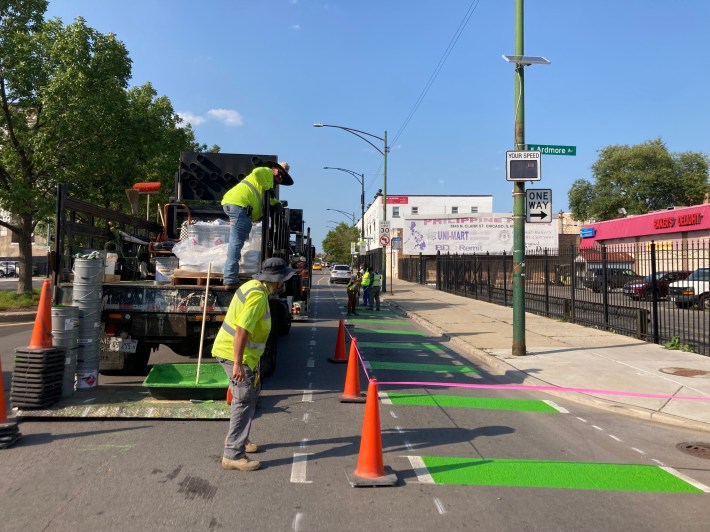
In late July Edgewater alderman Harry Osterman (48th) announce that the Chicago Department of Transportation would be installing protected bike lanes on the high-speed, four-lane stretch of Clark Street between Hollywood Avenue (5700 N.) in Andersonville and Devon Street (6400 N), the border of Rogers Park. Work began on the project in late August, and since then a number of folks have taken to Twitter to share that drivers were still parking in the half-finished bikeways, creating a confusing and hazardous situation for bike riders.
Looks like the new Clark street bike lane is off to a great start 🙄 pic.twitter.com/WtClFhAsR7
— Jean Cochrane (@jean_cochrane) September 8, 2021
When we shared the above tweet with CDOT spokesperson Mike Claffey, he asked local cyclists to be patient as the department deals with construction delays due to pandemic-related supply chain issues. "We understand the concerns that are being expressed," he said. "This is a fairly long stretch that we are working on and we ask folks to bear with us while we get the new lanes installed. Every one in the [construction] industry is facing supply chain issues, as we are facing with some of the construction materials needed to complete this project." He added that CDOT doesn't have a hard completion date at this point, but promised that the department is doing its best to get the work done as quickly as possible.
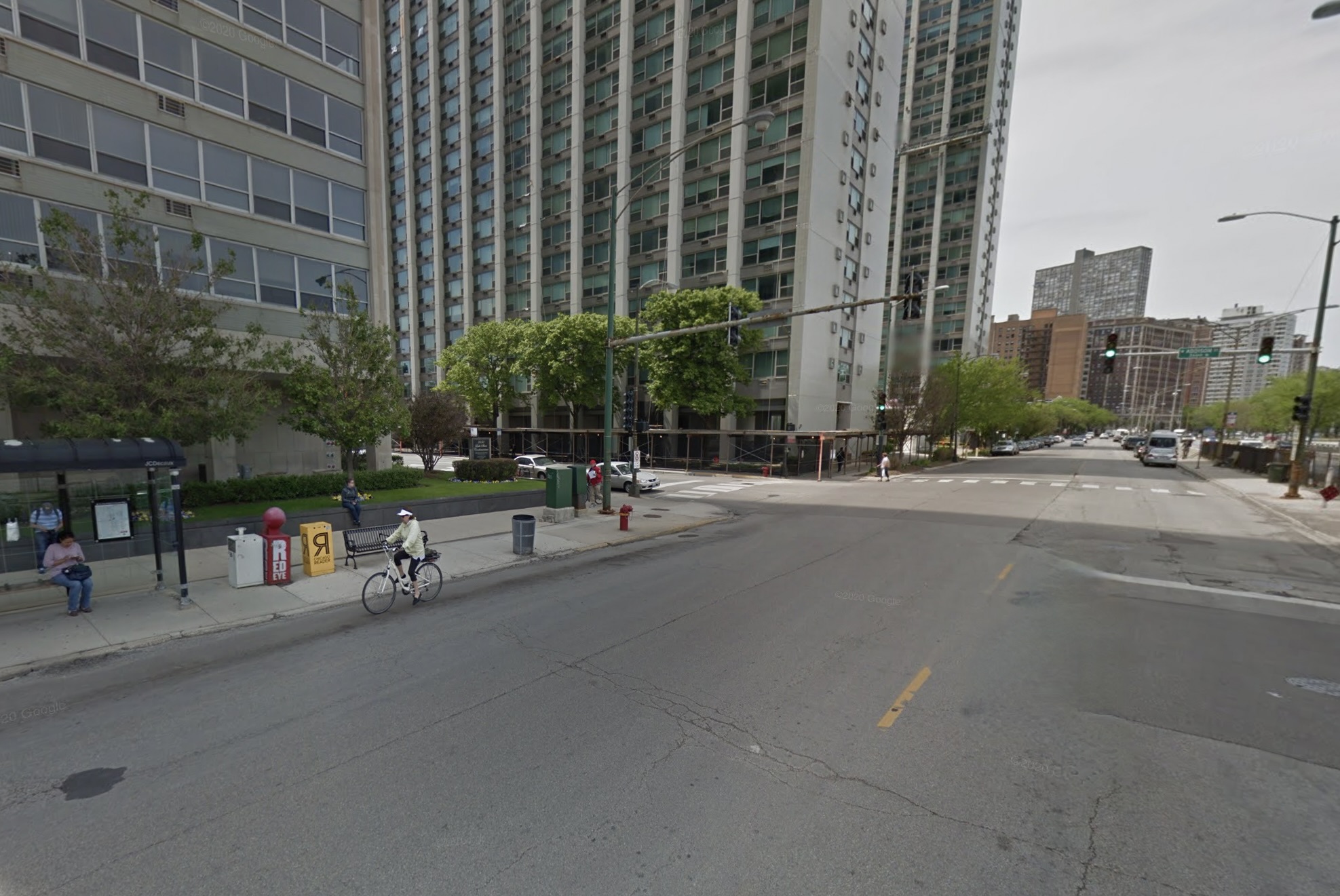
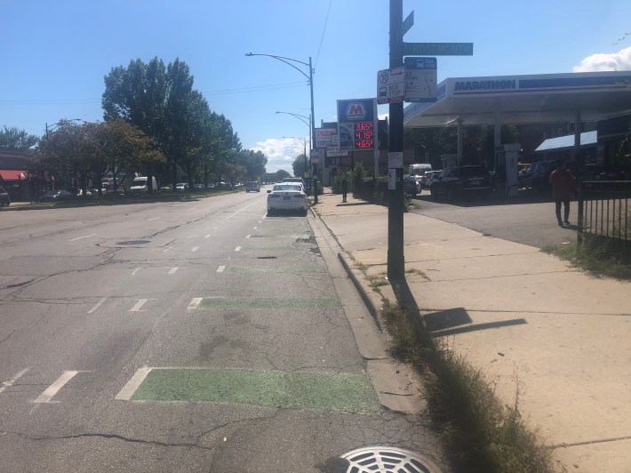
I recently checked out the partially completed project to get a sense of how these bike lanes will work in practice. I started out at Devon and Clark and was immediately disappointed that once again CDOT throws cyclists to the wolves by not designing a protected intersection. As northbound cyclists approach Devon, they’re forced to share space with vehicular traffic, since there's a mixing zone where right-turning drivers cross the bike route.
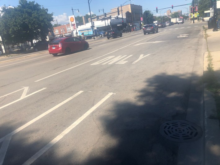
I understand the challenges of creating a protected intersection here given the amount of buses that use the intersection, but I still believe there’s room to make the intersection safer for northbound cyclists. I found this interesting National Association of City Transportation Officials (NACTO) article on designing a transit street with bike lanes . I'd love to see more bus prioritization along the Clark corridor. Considering the fact that this intersection is a transfer point for the #155 Devon, #151 Sheridan, #36 Broadway, and #22 Clark routes, bus prioritization makes sense.
Southbound cyclists don’t fare much better. The paint for the bike lanes doesn’t begin immediately at the intersection. There's a useless sharrow (bike-and-chevron marking) a few feet away from an non-protected bike lane, which is located to the left of the parking lane.
I shared my concerns on Twitter about this intersection and tagged 40th Ward alderman Andre Vasquez. He responded that he's looking into getting actual protection for the bike lane and that there's been "confusion" with the design of the bike lane.
Something tells me this will be a common site in the "protected" bike lanes @ChicagoDOT is building on Clark St. 6300 N block. @Andrefor40th Any way we can get some real protection? pic.twitter.com/onJa3EWoDl
— Courtney Cobbs (she/her) (@FullLaneFemme) September 9, 2021
Indeed, one of the main problems with the bike lanes on this corridor is that there's no consistency of design. While it's good that CDOT is stripping most of the on-street parking from this segment of Clark to make room for the bikeways (there are plenty of parking lots on this car-centric stretch), in some locations curbside parking was preserved. And in many of the locations where the on-street parking remains, the bike lane exists as a non-protected bikeways to left of parked cars, usually with wide striped buffers, which suggests there was plenty of space to instead create a curbside parking-protected bike lanes.
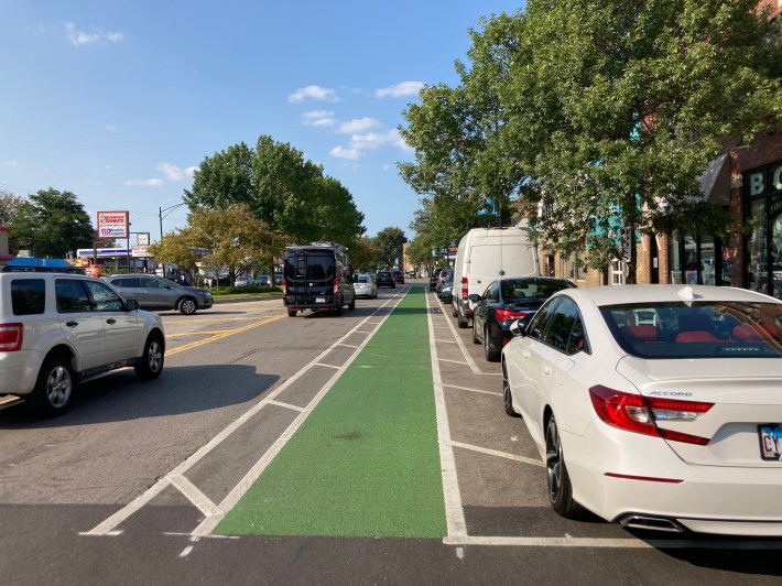
As it is, the bikeway is constantly switching from curbside parking-protected (green on the map below), to curbside (yet-to-be-installed) plastic bollard-protected (yellow), to non-protected on the left side of the parking lane (red.) That means bike riders will often have to slalom between the curb lane and the left side of the parking lane. It's a confusing layout for cyclists alike.
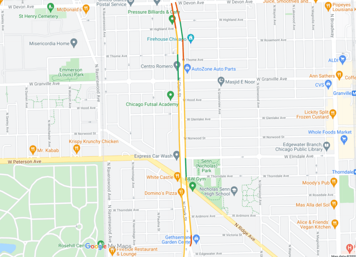
Most of the bike lane mileage on the corridor will be curbside, bollard-protected, although presumably there won't be bollards at bus stops, or other locations where drivers will need to cross the bike lane.
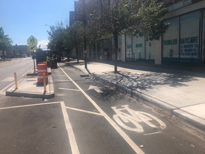
At Clark and Thome Avenue there's a pedestrian island that doubles as protection for the southbound bike lanes. I wish CDOT was using concrete or metal bollards for protection along the entire corridor. Hopefully the flexible plastic bollards will eventually be replaced by concrete curbs, as has been the case with several other Chicago protected lanes.
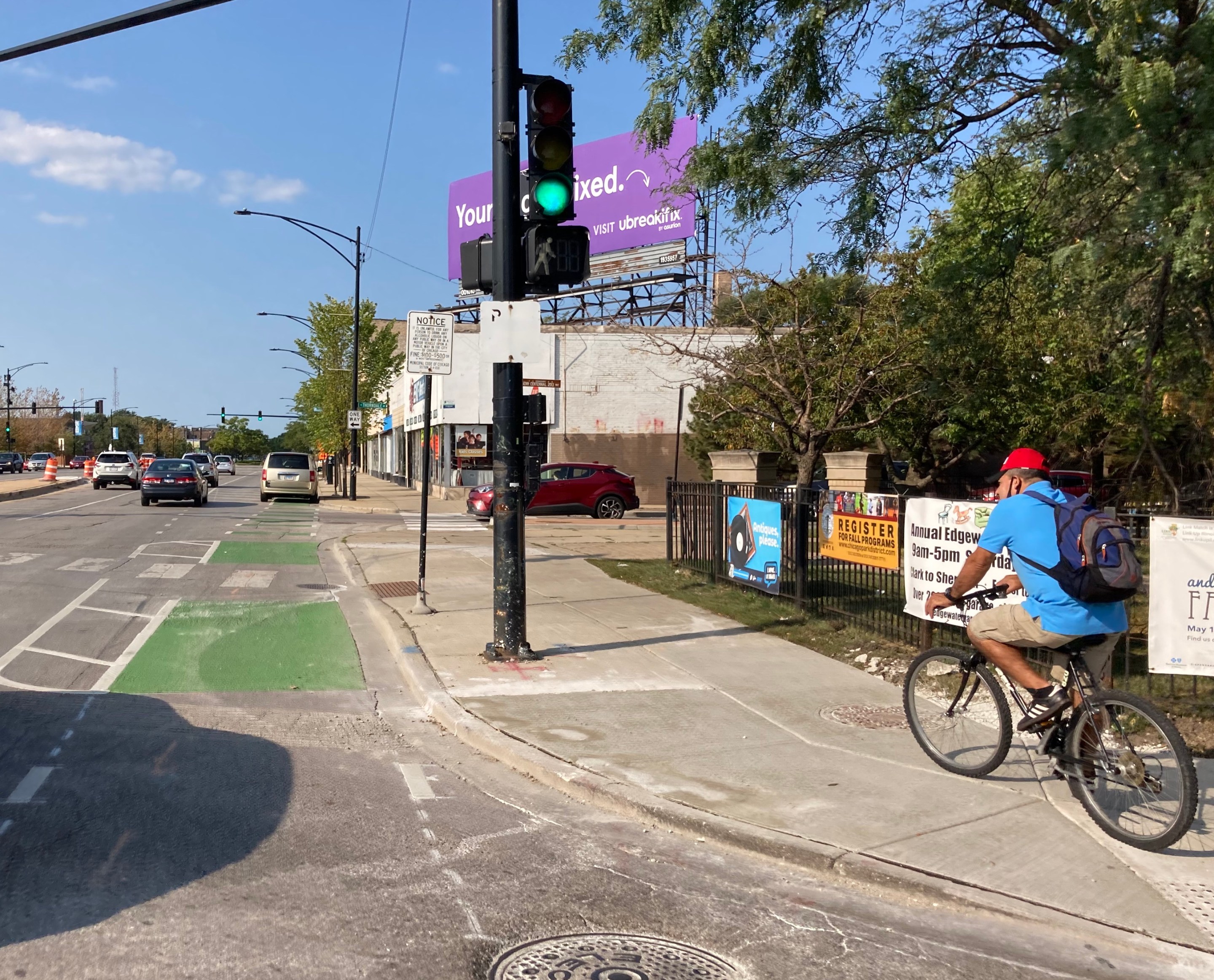
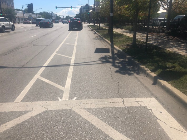
For part of my ride south, I took the sidewalk since drivers were parked in the curb lane, the space that will become a bollard-protected bike lane at some point. As I approached Clark and Elmdale / Peterson avenue, I noticed a few drivers cutting into the non-protected bike lane to turn right at the light.
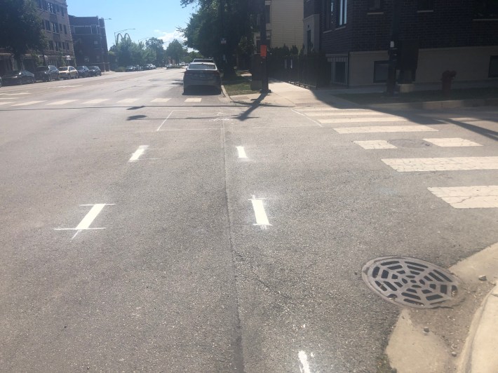
Once I crossed the Ridge/Hollywood intersection, the curbside bike lane was completely full of cars. I rode in the narrow striped buffer next to the parked cars until I reached Hollywood and Ashland, where the bike lane ends.
Next I turned around and headed north on Clark. I started out as Clark/Hollywood but didn't see any markings to indicate future bike lanes. I went back to Hollywood/Ashland and didn't see any northbound bike lane markings there either. I took Ashland north to Rosehill Drive, where non-protected northbound bike lanes appeared on Clark next to Gethsemane Garden Center. In the photo below you can see the bike lane slalom between non-protected to curbside bollard-protected, but drivers are currently parking in the curbside bike lane.
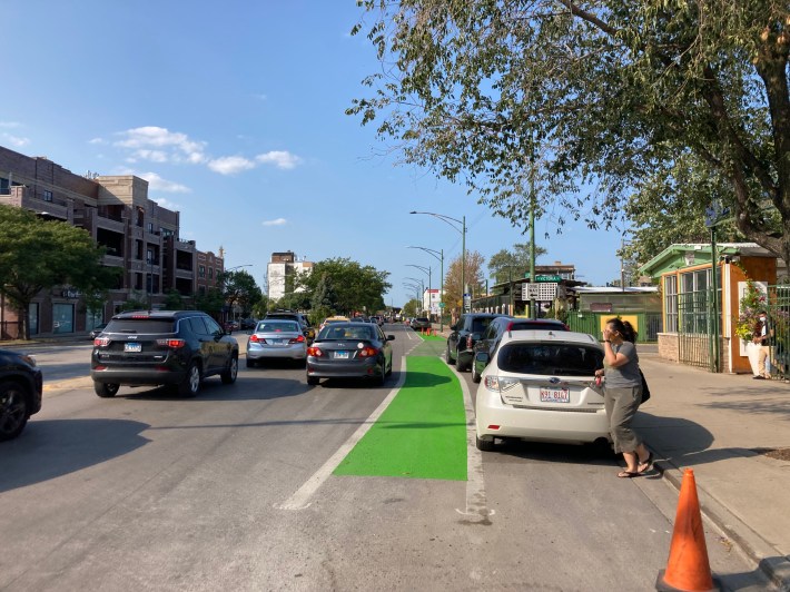
The post-protected curbside lane continue, minus a short stretch of parking-protection between Thorndale and Elmdale, until about Thome, where the lanes revert to non-protected bikeways.
At Granville there's a road diet, with one of the two northbound mixed-traffic lanes is converted to make room for the bikeway. I came across a post in an Andersonville Facebook discussion group in which drivers were complaining about a lack of notice that the number of travel lanes would be reduced. When I went out Wednesday afternoon to snap a few photos, I walked in the bike lane and a few drivers came precariously close to running me over. Assuming plastic posts are going to be installed here, it likely won't take long for a driver to knock them over. More robust protection is needed along with signs warning drivers that the easternmost driving lane will end.
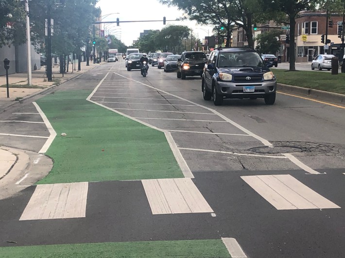
At Rosemont there's a block of parking protection to Highland, followed a final block on non-protected lane until Devon.
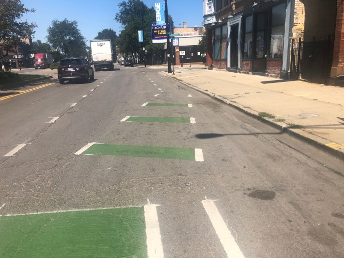
While these markings are an improvement from previous conditions, I still believe there's more that can be done to create a safer cycling environment. We should be using durable hard barriers to surround bike lanes and giving motorists plenty of warning before a lane reduction. I expect even with the plastic posts drivers will park in the bike lanes with impunity just like they do across Chicago. It's too bad we didn't raise our design standards to prevent such dangerous and illegal acts.
