Could a network of Slow Streets circuits speed pandemic recovery?
Back in May, inspired by Oakland, California’s Slow Streets program, a network of streets where through traffic is banned to enable safe, socially-distanced transportation and recreation during the pandemic, I put together a map suggesting a possible Slow Streets network in Chicago. My proposal, intended as a conversation-starter, covered the area bounded by 95th, Cicero, Devon, and the lake, the same zone I had studied while creating the original Mellow Chicago Bike Map. (I expanded the mellow map citywide this spring.)
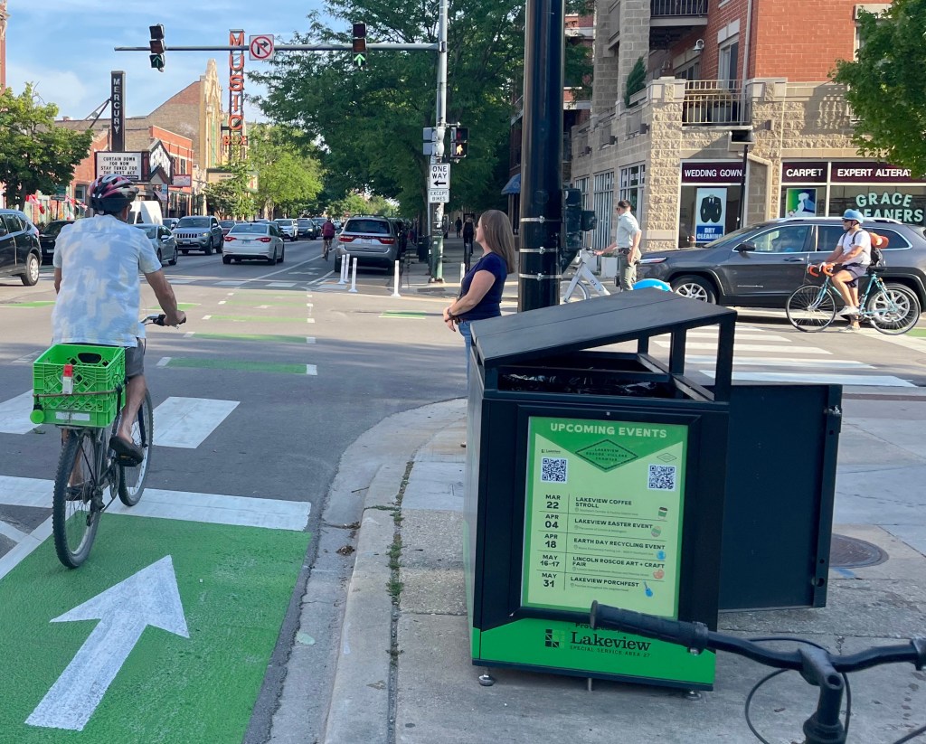
On May 29, after lots of lobbying by Streetsblog Chicago, the Chicago Department of Transportation debuted the city’s first Slow Street (the department called it a “Shared Street”) on Leland Avenue. That street was a good choice that wasn’t on my map. There was some overlap between my proposal and the dozen or so streets where CDOT proposed or implemented Slow Streets including the Roscoe / School couplet (proposed), Glenwood (proposed), and Wabansia (implemented.) I don’t know whether department staffers were influenced by the Streetsblog map, or if it was just a case of great minds thinking alike.
CDOT’s program, which ended in late November, was fairly popular, especially in neighborhoods with high rates of biking like Lincoln Square and Wicker Park. So I expect we’ll see it return in some form next year, hopefully as a connected network of safe, traffic-calmed streets for walking, jogging, skating, scooting, and biking.
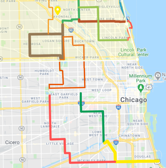
Since there’s more than one way to skin a cat, Streetsblog reader Nate Hutcheson recently took a crack at brainstorming such a system himself, with Slow Streets designed as a community and economic development strategy for pandemic recovery. So far his map covers the parts of the city where he’s most familiar with local destinations like retail districts, but he would like to eventually expand the plan citywide.
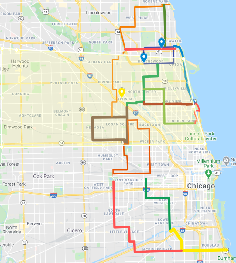
“This spring and summer, local businesses will still be struggling and people will be craving fun and safe things to do outside,” he said. “So let’s give people an easy way to do that.” He said the project started as a strategy to help bring more people on board with the notion that creating a more bike- and pedestrian-friendly city is good for local business.
“The circuits would provide the framework for people to enjoy a route that could bring them back to their starting point and give them places to stop to explore on foot,” Hutcheson explained. “I thought if we could get businesses, especially breweries, on board then it would be something that chambers of commerce could champion as a pandemic recovery strategy, rather than pitting pro-car people against pro-bike/walk people.”
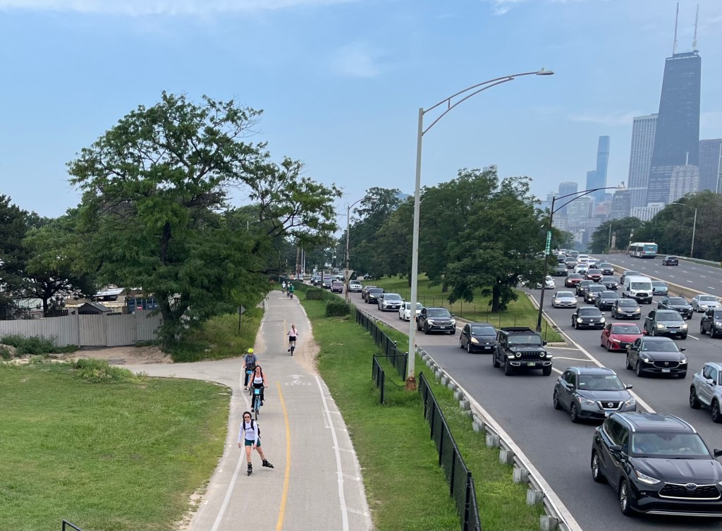
Hutcheson is also an advocate for the (not new) idea of completely removing Lake Shore Drive, and his map is designed to popularize the notion that taking the eight-lane highway off the shoreline “will bring more joy and business to Chicago than keeping it would.” The yellow area on the map is the “bus-shed” that he argues would enable many more people to enjoy the lakefront if the bus lines ran all the way to the lakefront instead of stopping at or west of the drive. The North Side bus shed is shown, since the city and state are currently in the process of redesigning the north half of the drive for reconstruction.
Hutcheson added that he also wants to incorporate affordable housing policy that could help mitigate any Bloomingdale Trail-style housing displacement impacts that might be associated with a useful new bike network. He’s already started floating the idea of the Slow Street system with his alderman, 40th Ward rep Andre Vasquez, and a local chamber of commerce.
What do you think — does Hutcheson’s concept have any promise as a strategy to create a more walkable, bikeable city and speed pandemic recovery? If nothing else, his map would look cool on a T-shirt.

Read More:
Streetsblog has migrated to a new comment system. New commenters can register directly in the comments section of any article. Returning commenters: your previous comments and display name have been preserved, but you'll need to reclaim your account by clicking "Forgot your password?" on the sign-in form, entering your email, and following the verification link to set a new password — this is required because passwords could not be carried over during the migration. For questions, contact tips@streetsblog.org.