Map: Here are the latest Chicago Slow Streets and Cafe Streets
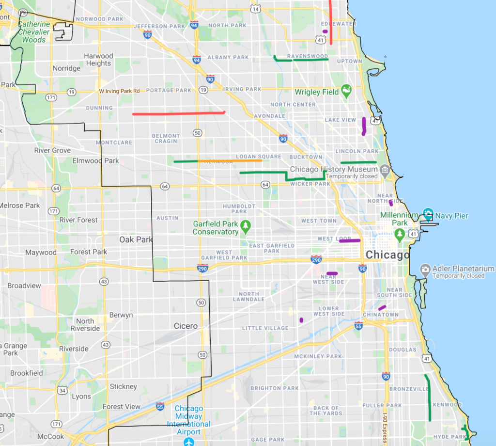
While Chicago is way behind many peer cities when it comes to opening streets for socially-distanced walking, biking, and dining during the pandemic, we’ve been gradually adding new Slow Streets (the city calls them “Shared Streets”) and Cafe Streets. We’ve compiled the locations of proposed (red), approved (orange), and installed (green) Slow Streets, as well as implemented Cafe Streets (purple) into the map below, which will be updated as new streets come into play.
Here are the Slow Streets, in various states of progress:
- Dorchester Street / Kenwood Avenue loop in Woodlawn: installed
- South Shore Drive between 53rd and 56th Street: installed
- Drexel Avenue between Pershing Avenue and 51st Street: installed
- Bloomingale alternative route on Cortland Street, Rockwell Street, Wabansia Avenue, and Marshfield Avenue: installed
- Palmer Street: installed between Long and Cicero avenues; approved between Cicero and Kedzie Boulevard
- Dickens Avenue between Racine Avenue and Clark Street: installed
- Roscoe Street between Narragansett and Milwaukee avenue: proposed
- Leland Avenue between Virginia Avenue and Clark Street, with a gap between Lincoln and Western avenues: installed
- Glenwood and Greenview avenue greenway route: proposed, back-burnered
Here are the current Cafe Streets
- Andersonville (Ward 40): Balmoral Street on both sides of Clark Street (every day)
- Chinatown (Ward 25): Archer Avenue from Wentworth Avenue to Princeton Avenue (every day)
- Edison Park (Ward 41): Oliphant Avenue from Northwest Highway to the first alley (weekends)
- West Loop: (Ward 27): Randolph Street from the Kennedy Expressway to Elizabeth Street (weekends)
- Lakeview (Ward 44): Broadway from Belmont Avenue to Diversey Parkway (weekends)
- Lincoln Park (Ward 43): Lincoln from Fullerton to Wrightwood (weekends)
- Lower West Side (Ward 25): Oakley Street from 24th Street to 24th Place (weekends)
- Rush & Division (Ward 2): Rush Street from Oak to Cedar Streets
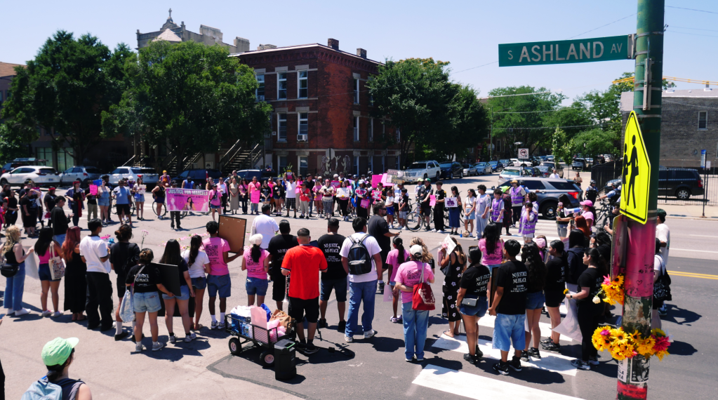
- Little Italy (Ward 28): Taylor Street from Loomis Street to Ashland Avenue (weekends)
Note that some of these Cafe Streets aren’t open every weekend, depending on what merchants said they wanted. For example, the buzzing Broadway corridor, arguably the most successful Cafe Street, won’t be pedestrianized again until July 24.
Originally city proposed pedestrianizing parts of 75th Street in Chatham and 26th Street in Little Village. However, the 75th plan was reduced to sidewalk seating, and the 26th plan was cancelled altogether after some merchants and other community leaders expressed concerns about the impact on motorists and sales. As a result, no predominantly Black- or Latino-owned restaurant strips currently are getting a Cafe Street treatment.
In general, the current map of Slow Streets and Cafe Streets is lopsided, with few or no pedestrianized roadways on the West and Southwest sides. Hopefully the city will take action to address this, so all Chicagoans can reap the safety, health, and economic benefits of car-free streets,

Read More:
Streetsblog has migrated to a new comment system. New commenters can register directly in the comments section of any article. Returning commenters: your previous comments and display name have been preserved, but you'll need to reclaim your account by clicking "Forgot your password?" on the sign-in form, entering your email, and following the verification link to set a new password — this is required because passwords could not be carried over during the migration. For questions, contact tips@streetsblog.org.