An expensive new interchange expansion that the Illinois Department of Transportation is pushing for downtown threatens to dump more traffic on Chicago streets, but the project still needs approval from the Chicago Metropolitan Agency for Planning to move forward. While IDOT is simultaneously proposing some improvements for biking and walking in the area, all of those could be implemented without the new highway components. The deadline for public comments to CMAP about the project is Monday.
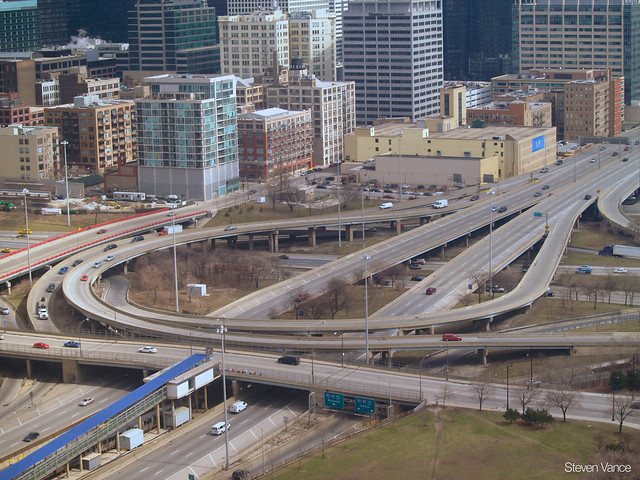
IDOT is planning to build new car lanes and three new flyovers at the Circle Interchange, the downtown spaghetti bowl confluence of the Dan Ryan, Kennedy, and Eisenhower Expressways (I-90/94, I-290). IDOT justifies this $410 million project by saying it will improve traffic congestion, reduce crashes at this location, speed up travel time, and make it easier for truckers to drive through the interchange.
But an analysis from the Chicago Metropolitan Agency for Planning concluded that none of these changes are guaranteed and warned that the project will lead to more car trips, more carbon emissions, and fewer transit trips [PDF]. CMAP's Tom Garritano said "the project was not identified as a priority in the planning process that led to the development of GOTO2040," the agency's regional plan, in 2010. Since the project isn't listed in GOTO2040, it can't move forward unless CMAP approves it.
According to CMAP's analysis, the interchange expansion is projected to convert 1,000 trips from transit to driving and increase carbon dioxide emissions by 39,000 metric tons each year. While the Circle Interchange, according to the Federal Highway Administration, is the nation's "most heavily congested freight bottleneck," this expensive effort to make room for traffic isn't going to fix congestion. CMAP predicts that drivers in the region will save 1.2 seconds per trip if the project is built.
Active Transportation Alliance Executive Director Ron Burke suggested that the interchange project is a poor way to achieve transportation goals. "If you really want to address congestion in a long-term sustainable way, we need to give people alternatives to driving, especially driving alone," he said. "We're concerned about this emphasis on highway expansion at a time when the experience in Chicagoland and other areas shows us that it is, at best, a short-term solution to roadway congestion. In general it perpetuates land use and travel patterns that make us auto dependent creating a negative feedback loop. It's not a sustainable way to address congestion."
Brandon Gobel, who hauls bricks for a trucking company based in Pilsen, thinks that the Circle Interchange is difficult for truckers to drive through but is highly skeptical that the changes will have any effect on congestion. "What improvements to transit service are being made for people who could skip the Circle Interchange and prevent the area from returning to the same congestion levels?" he said. "Since this area is so important for cargo, non-truckers could be tolled."
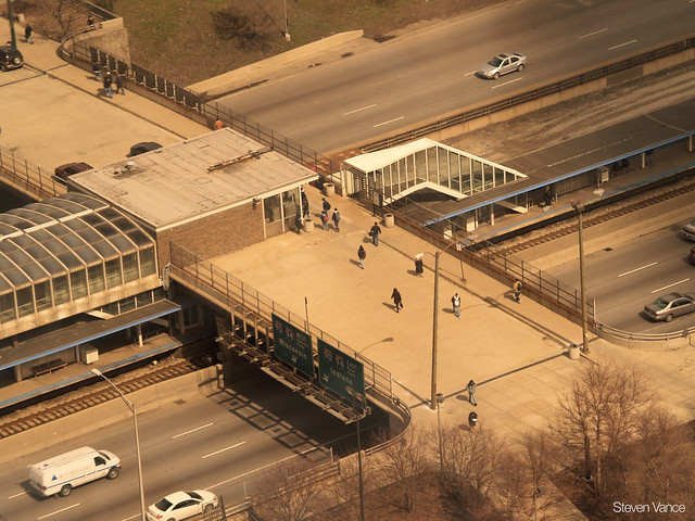
IDOT is attaching some bike and pedestrian improvements to the interchange project, but all of them could be implemented independently of the interchange. "The main takeaway is that in every drawing there are some improvements for bicyclists and pedestrians," said Paul Lippens, a transportation planner at Active Trans. "They're making a good faith effort to implement the complete streets policy, which I think is encouraging."
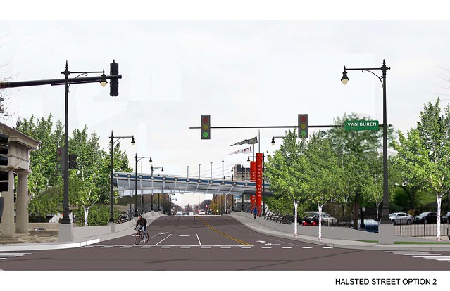
The bike proposals include buffered bike lanes on one block each of Harrison Street and Jackson Boulevard, between Halsted and Canal Streets, and a bike lane on southbound Halsted Street between Van Buren and Harrison Streets where there's currently only a northbound bike lane. The Halsted bike lanes would be in the center of the street, with automobile traffic on both sides of the bike lane.
To fit the new flyover from northbound Dan Ryan onto westbound Eisenhower under Peoria Street, the Peoria Street bridge will have to be reconstructed. This very lightly-trafficked street is "an opportunity to go above and beyond," Lippens said, adding that "this is really a gateway for all modes to enter the UIC Campus. It can even be a gateway from the highway into the Loop." The University of Illinois at Chicago's campus master plan calls for this area to become a "signature gateway" to the campus.
UIC said they were unable to share details of their plans, and IDOT hasn't responded to request for comment. (Disclosure: Architect Ryan Lakes and I worked on a proposal for a pedestrian street here that we introduced at a UIC Urban Innovation Symposium last week.)
The CMAP Board and CMAP's Metropolitan Planning Organization Policy Committee will consider IDOT's request to include this project in the GOTO2040 plan at their March 13 and 14 meetings, respectively. The public comment period ends Monday, February 18. To comment on the interchange project, write to: CMAP, ATTN Plan and TIP amendments, 233 S. Wacker Dr., Suite 800, Chicago, IL, 60606; via email or phone 312-454-0400.


