South Branch riverfront proposal aims to connect parks, expand green space, and improve transportation, recreation

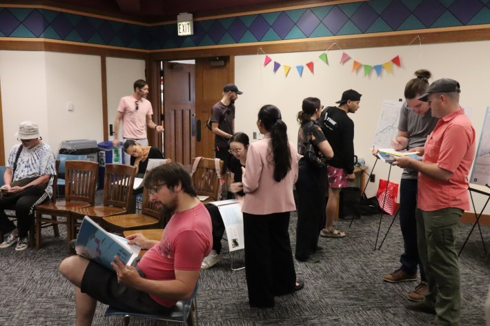
Last week the McKinley Park Development Council gave an overview of its new riverfront redesign proposal, The South Branch Connectivity Project: Framework Plan, to residents at the neighborhood’s local library. Over the past year, upwards of 600 neighbors have provided feedback for this plan to link the riverside parks, create more green space, and to provide more transportation and recreation options along the waterway. The purpose of the meeting was to give a preview of how a continuous riverwalk might look, and what it would take to achieve that vision.
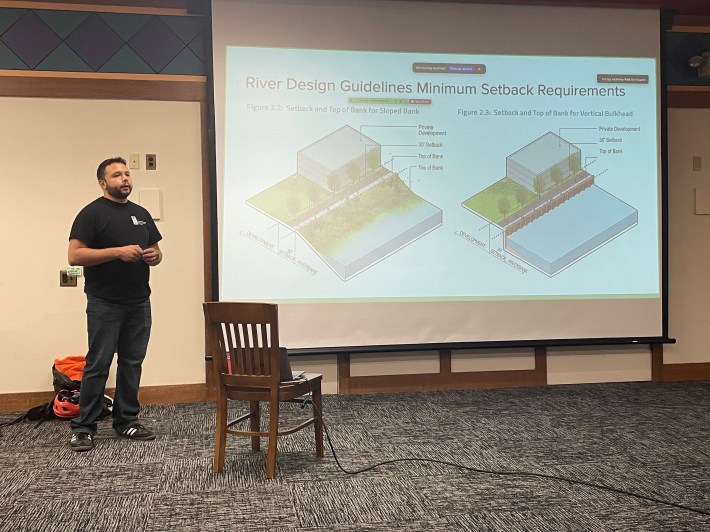
“In 2019 the City updated the Chicago River Design Guidelines,” explained Eladio Montenegro, project manager with the McKinley Park Development Council, at the start of the presentation. “And those require that anyone who buys land along the river, and develops it, has to create a public walking path. So it’s very specific. You have to do a 30-foot setback from the edge of the river, create a ten-foot trail with gravel on the side, specific plants and trees, specific seedings, specific lighting, and that kind of stuff has to happen. And so that’ll take care of some big chunks of our project.”
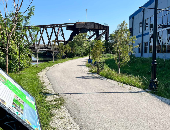
The impetus for the plan stems from decades of pollution from industrial land use and physical barriers like the Stevenson Expressway. Once the development council determined the initial project goals, it turned its attention to five months of community engagement. This included written surveys; pop-up events in multiple areas, and a group discussion led by the University of Illinois Chicago’s College of Urban Planning and Public Affairs at the Eleanor Boathouse, 2828 S. Eleanor St. That facility is located at the confluence of the South Branch of the Chicago River and Bubbly Creek, just east of Ashland Avenue (1600 W.)
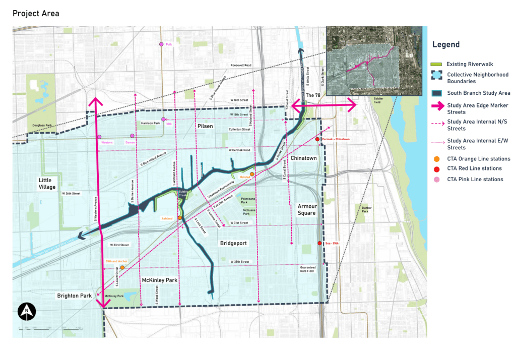
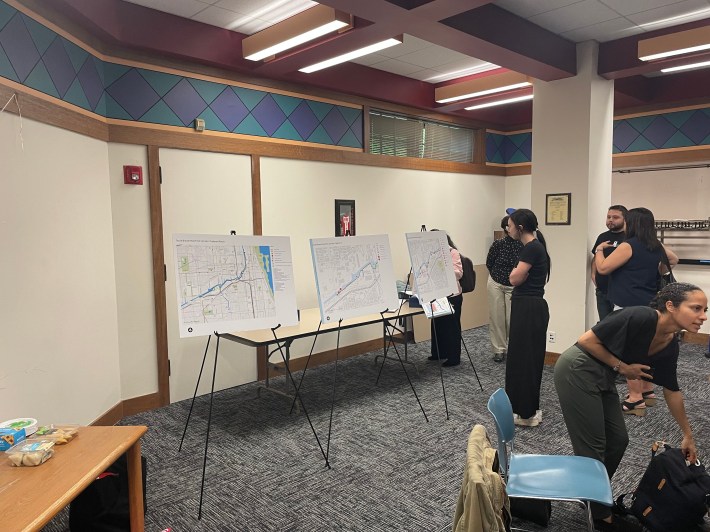
After that, the development council designed a riverfront trail on the south side of the waterway that would connect Western Avenue (2400 W.) to Ping Tom Memorial Park, just east of Canal Street (500 W.). The council divided the South Branch study area into three different segments, all of which have their own unique “characteristics, opportunities, and challenges”.
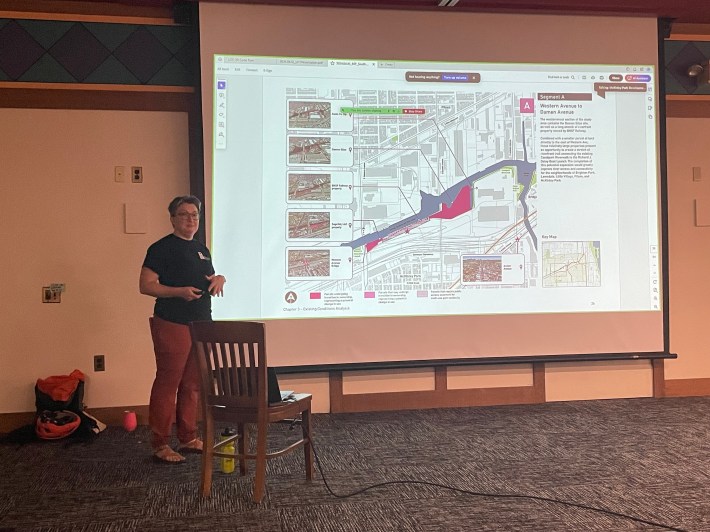
Segment A is Western to Damen (2000 W.) avenues, where there’s the potential to build a riverfront trail between the existing Canalport Riverwalk, west of Ashland, to the Richard J. Daley Boat Launch, just west of Western.
Segment B is Damen to Halsted Street (800 W.), where it would be possible to fill in gaps between properties and better connect the Bridgeport, McKinley Park, and Pilsen communities.
Segment C is Halsted to Ping Tom Memorial Park, where it would be possible to connect the Armour Square/Chinatown and Bridgeport communities to the planned The 78 megadevelopment.
Beyond creating the trail, the plan seeks to make the area inviting to use. For instance, inspired by South Branch’s natural and industrial past, there would be a combination of industrial and organic design elements blended together, such as railings, fencing, lightning, signage, hardscape, and site furnishings. The design would also incorporate historical landmarks and public art.
This big project would have several stages of implementation measures. The development corporation set five goals for near-term implementation measures. The first is to provide a continuous multi-use trail along the river. The second is improving the mobility, safety, and accessibility of people on foot and bikes. The third is to connect Armour Square/Chinatown, Bridgeport, Brighton Park, Little Village, McKinley Park, and Pilsen to the river and the city. The fourth is creating a cohesive and welcoming sense of place along the South Branch. And the fifth is to improve the public space along the river.
“It’s incredibly exciting to see how far along things have come,” said local State Rep. Theresa Mah (D-24th) after the meeting. “The idea to create a connection along the riverfront so that cyclists can avoid the dangers of Archer Avenue and have a way to get to the Loop is fantastic and important. I truly appreciate the work that the development council has invested in this effort.”
“Their work coordinating this plan and moving it forward is key, and it is only because of their hard work and the community’s engagement that this is able to happen,” added Mah. “The fact that they have come this far, having gotten a grant, conducted community meetings and charrettes, engaging an architecture firm, completing a plan, and working with various entities to discuss the project means that this is more than a pipe dream at this point. This project is well on its way! I am grateful to MPDC for the dedication and seriousness with which they’ve approached this plan. I applaud their efforts, and I am committed to helping them as much as I can.”
“The bridge over bubbly Creek is going to have the biggest impact, because it’s literally a bridge between neighborhoods, and will have a huge impact on access to the Ashland ‘L’ station, which is the busiest station on the Orange Line,” said Kate Eakin, president of the McKinley Park Development Council. “So we also hope that besides making it easier for pedestrians and cyclists, it’ll also increase CTA ridership. So I think there’s a lot of different impacts that can come out of that single piece of infrastructure.”
“I had been to a previous meeting two months ago and it was pretty much similar,” said an attendee named Andreas, who declined to give his last name. “Except this time, I really saw the input that we provided at the previous meeting being presented. It felt like they listened to it.”

Did you appreciate this post? Please consider making a tax-deductible donation.

Streetsblog has migrated to a new comment system. New commenters can register directly in the comments section of any article. Returning commenters: your previous comments and display name have been preserved, but you'll need to reclaim your account by clicking "Forgot your password?" on the sign-in form, entering your email, and following the verification link to set a new password — this is required because passwords could not be carried over during the migration. For questions, contact tips@streetsblog.org.