Which Metra corridor would become more bike-friendly and greener under a new plan? Ravenswood!
Chicago’s Ravenswood Avenue (1800 W.), already an iconic corridor for Metra’s Union Pacific line trains, bicycling, and community green space, is slated to get even better.
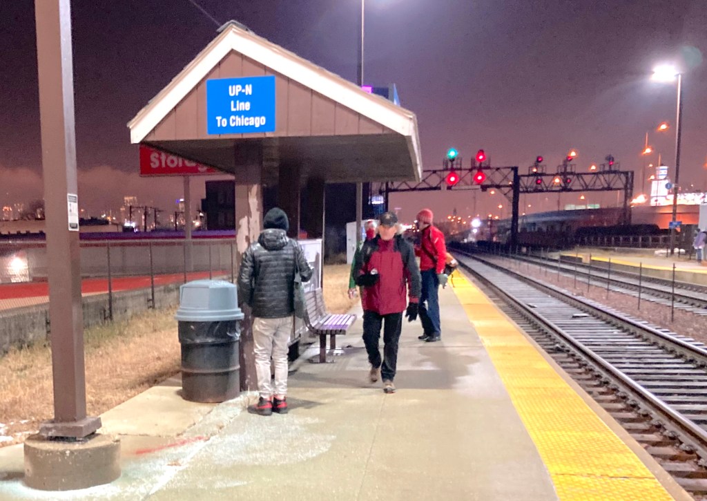
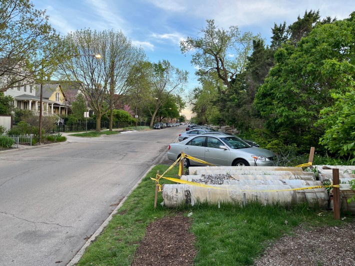
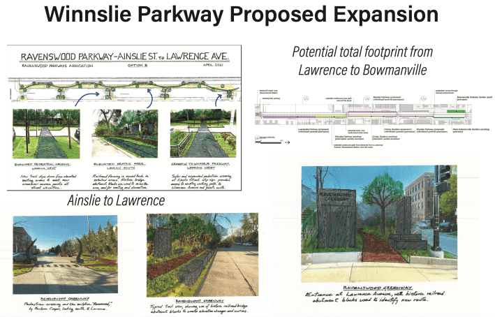
This week the 40th and 47th Wards spread the word about plans for the new Ravenwood Greenway bike route, and the expansion of the existing Winnslie Parkway walking trail and garden along the commuter rail embankment. (“Winnslie” is a portmanteau of Winnemac [5030 N.] and Ainslie [4900 N.] avenues, the space’s current boundaries.) Improvements to the avenue will cover the 1.5 mile stretch from Lawrence (4800 N.) to Peterson (6000 N.) avenues, between the newly rehabbed Ravenswood UP-N station and the under-construction Peterson/Ridge stop.
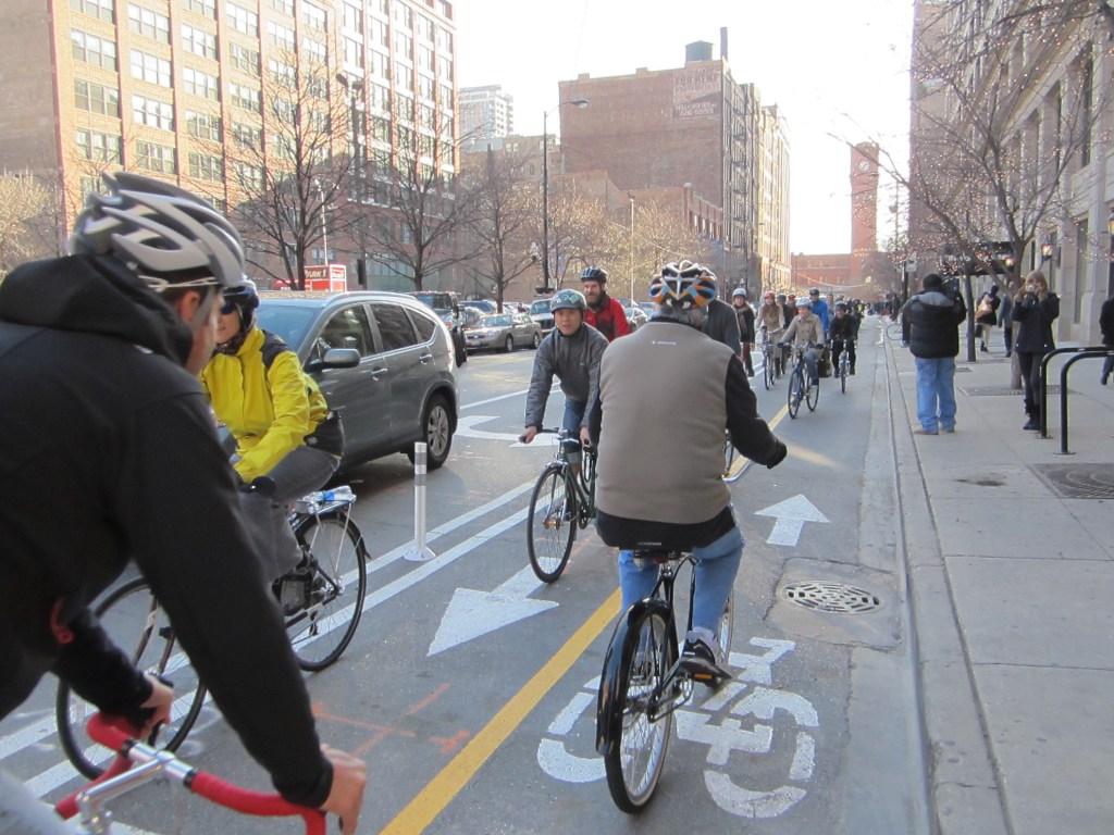
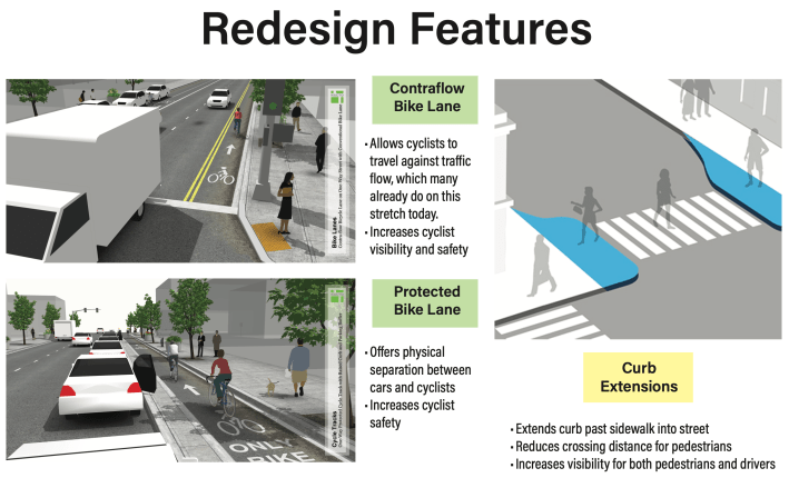
“This project is based around the planned resurfacing of the east leg of Ravenswood from Wilson to Peterson,” 47th Ward Chief of Staff Joshua Mark told Streetsblog. He said in his district, represented by sustainable transportation-friendly Ald. Matt Martin, “We are adding a contraflow bike lane to connect to the Leland Greenway.”
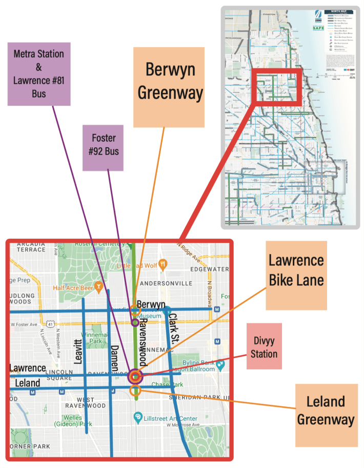
That is, the new southbound bikeway on an otherwise-one-way-northbound segment of Ravenswood south of Winnemac, will meet up with the long-awaited two-way side-street bike route on Leland Avenue (4700 N.)
The section of the southbound bike lane on Ravenswood between Winnemac and Ainslie avenues will be curbside with concrete protection. Installing that part of the new bikeway will involve converting existing car parking spaces on the west side of the street.
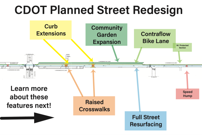
Mark said City parking counts found those spaces were getting relatively little use – more on that in a bit. So, in addition to shielding cyclists from reckless drivers, one reason for the concrete protection is to help keep motorists from parking in the bike lane.
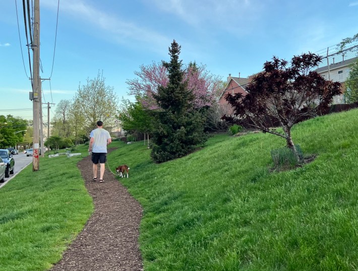
“We are also going to be extending the existing Winnslie Parkway community garden along the tracks from Ainslie down to Lawrence by converting diagonal parking [on the west side of Ravenswood] to parallel parking to create space,” Mark added. “All of this comes with several raised crosswalks and speed humps for traffic calming.”
Winnemac is the borderline here between the 47th Ward and the 40th Ward, represented by Ald. Andre Vasquez, who also has a generally strong record on sustainable transportation issues. His Director of Communications and Development Alison Murphy said there will be speed humps and other traffic calming measures, like sidewalk bumpouts to shorten crossing distances, between Winnemac and Peterson.
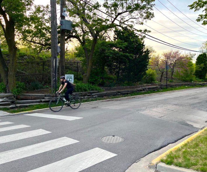
“We’re also looking forward to having a calmer and smoother neighborhood bikeway that connects with the Peterson/Ridge Metra station, which is scheduled to open May 20th,” Murphy added. “We’re working with CDOT on a plan to improve bike and pedestrian safety around the station, which Ravenswood Ave will be a crucial part of. We look forward to sharing more details about that in the coming months.”
Erica Schroeder, spokesperson for the Chicago Department of Transportation, which will do the upgrades, provided a couple more details. She said the repaving will happen between Wilson (4600 N.) and Foster (5200 N.) avenues, and from Bryn Mawr (5600 N.) and Thorndale (5900 N.) avenues. “Ravenswood between Foster and Bryn Mawr will not be resurfaced, but will still be part of the overall project and will include speed humps and pedestrian curb extensions.”
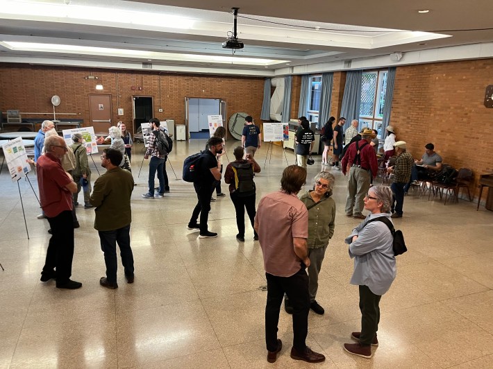
Needless to say, both green-thumbs and sustainable transportation fans voiced enthusiasm for the plan at a well-attended open house Wednesday at the nearby Thorek Retirement Community, 4950 N. Ashland Ave. (1600 W.)
Obviously Mark Weber, president of Friends of Winnslie Parkway, was one of the supporters. “It’s going to be quite a bit of expansion of the green space from Ainslie down to Lawrence,” he said. “We should have enough space for a trail and some trees, native plants, storm water retention, all kinds of good things that you can do with green space.”
Nathan Roberts, a software developer who lives nearby attended the open house, is also a fan of the plan. “As someone who doesn’t drive and likes having more safe walking and cycling infrastructure, as well as just nicer places to walk in, I got excited about the plan, so I wanted to show my support.”
On the other hand, some of the more car-oriented neighbors in attendance were wary of the plans to convert 49 car spots to make room for the bikeway and green space. It was the 47th Ward’s Josh Mark’s job to explain why this wouldn’t cause a parking crunch.
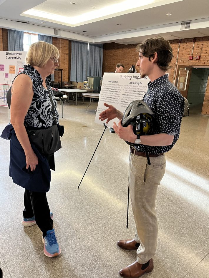
“We’re talking about Ravenswood east of the tracks, from Winnemac to Lawrence,” Mark told neighbors. “We [collected] some pretty extensive parking utilization data to understand the impacts, and how that parking is used. I used to live a block or two away, so I could attest visually to the fact that that parking is often underutilized, but we wanted the hard data.”
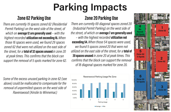
“The impact on the parking is going to be of two types,” Mark said to attendees. “From Ainslie to Winnemac we are going to be [converting to the southbound protected bike lane] all of the parking on the west… Anyone who lives in the area can tell you that cyclists are always biking south on Ravenswood here [despite it being one-way northbound]. Because Ravenswood doesn’t exist on the west side of the tracks here, we want to make [southbound riding] safe.” Again, the other type of change to parking will be converting existing diagonal spots between Ainslie and and Lawrence to parallel parking.
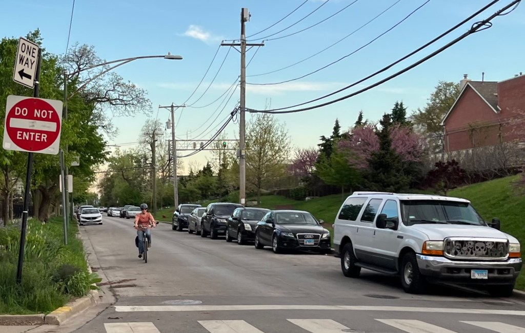
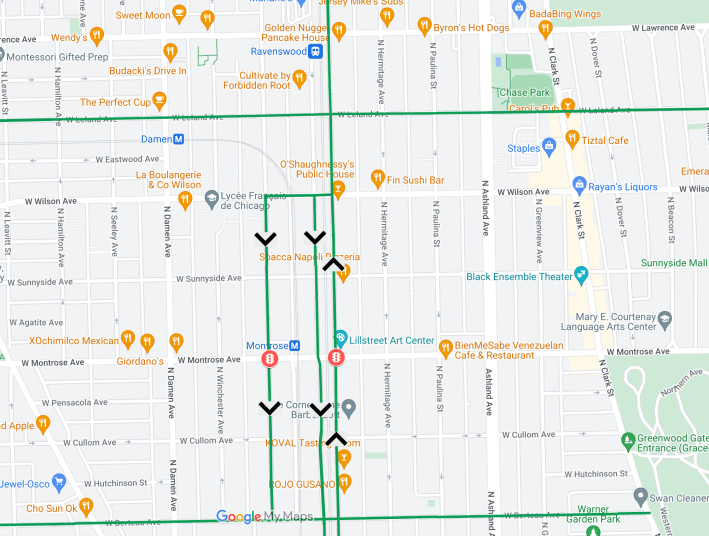
Ravenswood is one-way northbound between Lawrence and Winnemac.
Pink (Winnemac to Ainslie): Conversion of parallel parking spaces on the west side of Ravenswood to a concrete-protected southbound contraflow bike lane.
Green (Ainslie to Lawrence): Conversion of angled parking spaces on the west side of Lawrence, south of the existing Winnslie Parkway, to parallel spaces to make room for extending the green space south, and adding a southbound non-protected bike lane.
When some of the residents expressed concerns that there wouldn’t be enough parking left on Ravenswood, Mark replied that the data indicates the number of spots left over will be more than what’s currently used, even at peak times. “What this boils down to is, how we allocate our space within our public realm… it’s always a tradeoff. So if we were to choose to have spaces that go un-utilized, that’s a choice over what we’re otherwise able to bring to neighborhood, which is safe biking facilities, and more green space.”
Clearly, swapping empty asphalt for a bike lane and more lush greenery is a no-brainer. Who Ravens-wouldn’t?
Update 5/6/24, 1:00 PM: Josh Mark provided the following update on how bike travel south of Lawrence would function under the new plan.
“The contraflow bike lane on Ravenswood will continue south of Leland – specifically until the Leland Greenway. Ravenswood (east leg) is two-way between Leland and Wilson, so you can keep going until there.”
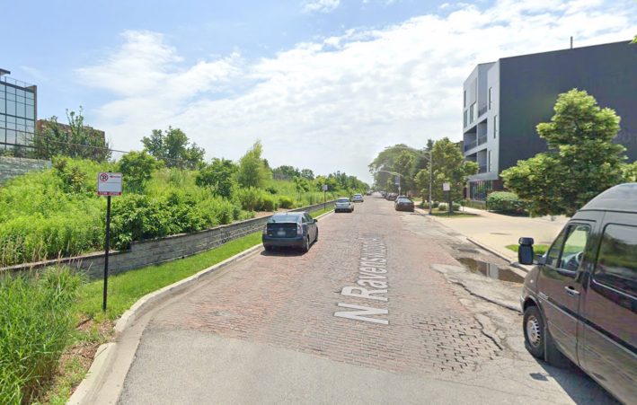
“You can then head west on Wilson to the west leg of Ravenswood (the one with the pavers – but we are actually having that one resurfaced since the pavers are in poor shape, especially for biking.) Or you can ride a little further west to Wolcott Avenue [1830 W.], which brings you south, with a traffic light at Montrose Avenue [4400 N.], to the Berteau Neighborhood Greenway [4200 N.]”

Did you appreciate this post? Please consider making a tax-deductible donation to help Streetsblog Chicago keep publishing through 2025. Thank you.

Read More:
Streetsblog has migrated to a new comment system. New commenters can register directly in the comments section of any article. Returning commenters: your previous comments and display name have been preserved, but you'll need to reclaim your account by clicking "Forgot your password?" on the sign-in form, entering your email, and following the verification link to set a new password — this is required because passwords could not be carried over during the migration. For questions, contact tips@streetsblog.org.