Take a virtual ride on the new Leavitt Street Greenway
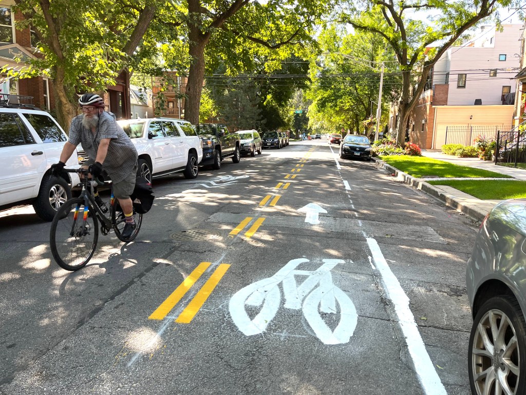

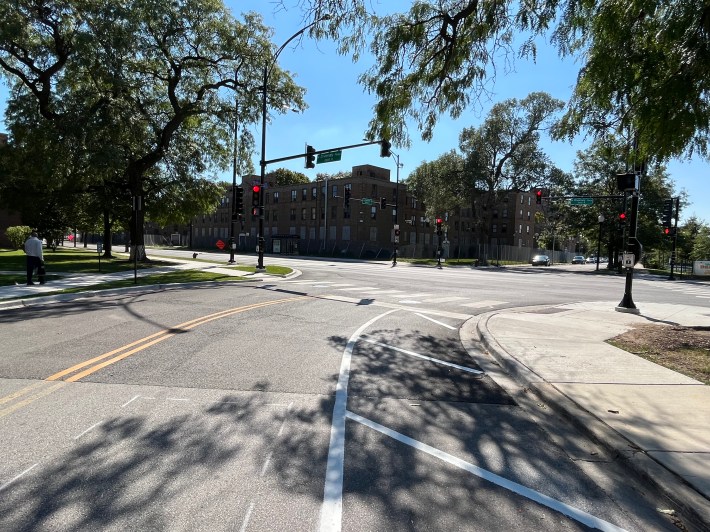
As I’ve discussed at length before, Leavitt Street (2200 W.) was an excellent choice by the Chicago Department of Transportation for a two-way Neighborhood Greenway side street street bike route. North of the north branch of the Chicago River, it was already a relatively chill northbound alternative to the bike lanes on hectic Damen Avenue (2000 W.) Leavitt has stoplights or four-way stop signs at every major street crossings.
Riding about half of the current southbound contraflow lane on Leavitt, starting at Montrose this morning.
But it didn’t work as a direct, legal southbound route due to one-way northbound stretches. The greenway plan included contraflow (“wrong-way”) bike lanes to allow for two-way travel. There were also going to be bike-friendly sinusoidal, speed humps to calm traffic. Unlike regular speed humps you can pedal over them comfortably without lifting your backside off the saddle.
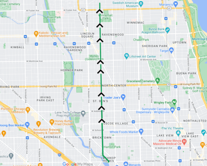
The project, which was supposed to start a few weeks after early July, got postponed a bit by contractor delays. But a 47th Ward staffer (the project is also supported by the 32nd and the 40th) told me yesterday that lane striping work was underway on the two-mile stretch between Diversey Parkway (2800 N.) and Montrose Avenue (4400 N.)
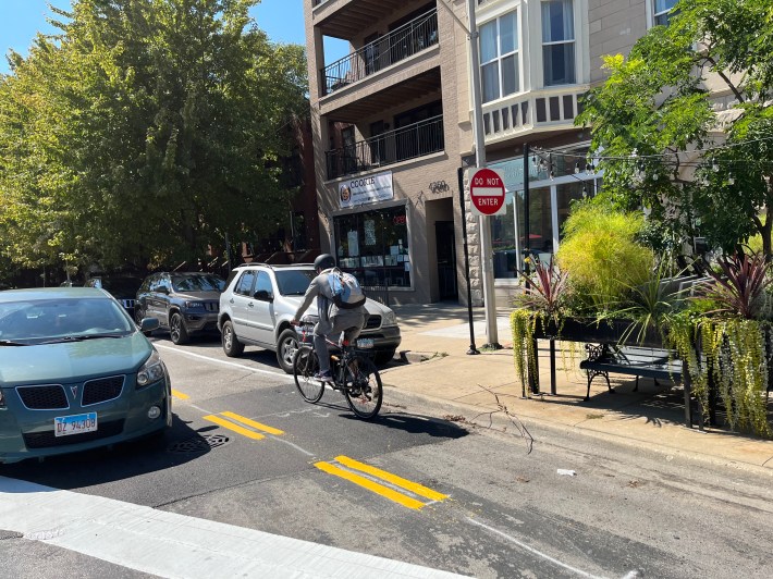
That part is pretty much finished, except for the addition of green pain to highlight the bikeway, and adding “Bikes Excepted” to the existing “Do Not Enter” signs for southbound vehicles. The last mile or so to Berwyn Avenue (5300 N.) will be done in the near future, the staffer said.
They also told me another stretch of the Leavitt Greenway between Milwaukee Avenue / The Bloomingdale Trail (1800 N.) and Lyndale Avenue (2230 N.) in Bucktown, in the 32nd Ward, is also currently under construction.
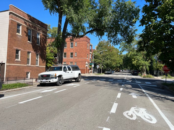
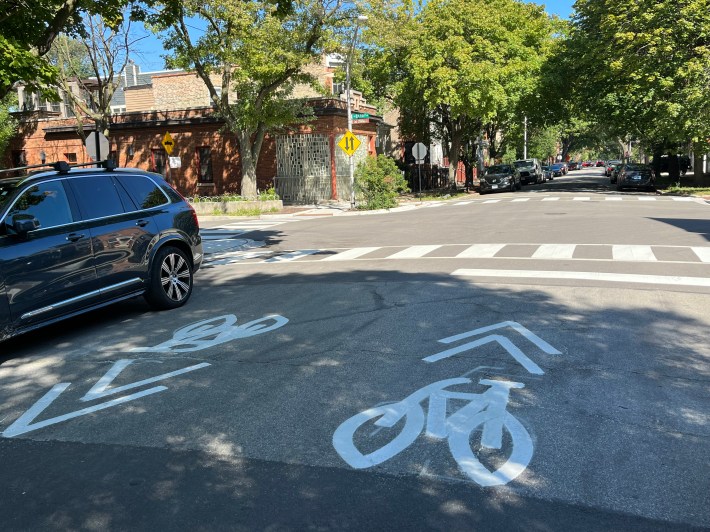
As you can see from the video above, which covers roughly the first half the current southbound, north-of-the-river, segment of the greenway, riding it is a fairly smooth experience, speed humps included. The layout varies a bit, there’s the one-way sections of Leavitt with contraflow lanes, and the two-way portions with shared-lane marking (“sharrows”) in each directions. But there’s also a stretch between Roscoe (3400 N.) and Melrose avenues (3230 N.) with dashed bike lanes, which drivers are technically allowed to cross if necessary, with a single shared travel lane between them.
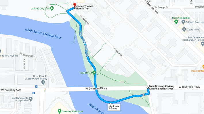
Not shown in the video: If you aren’t in a rush, I recommend starting a trip north on Leavitt from Diversey by picking up a short-but-scenic stretch of the Jimmy Thomas Nature Trail, a causeway/riverfront path, from the south side of the parkway. From there you can ride under the Diversey Bridge and north a block or so to the end of the trail, where you can pick up the Leavitt Greenway just south of Oakdale Avenue (2930 N.)

I think Leavitt is now a very nice southbound route as well. But it’s actually not the most exciting bikeway project in this part of town. On Belmont Avenue (3200 N.), just a few blocks west of Leavit, there’s a new concrete-protected main street bikeway that Streetsblog contributor Sharon Hoyer called a “game-changer” in late August. It runs between the protected bike lanes on Rockwell Avenue (2600 W.) and the Belmont Blue Line station at Kimball Avenue (3400 W.) That route has gotten even better since Sharon wrote about it, so we’ll share some of the new highlights in the near future.

Did you appreciate this post? Please consider making a tax-deductible donation.

Read More:
Streetsblog has migrated to a new comment system. New commenters can register directly in the comments section of any article. Returning commenters: your previous comments and display name have been preserved, but you'll need to reclaim your account by clicking "Forgot your password?" on the sign-in form, entering your email, and following the verification link to set a new password — this is required because passwords could not be carried over during the migration. For questions, contact tips@streetsblog.org.