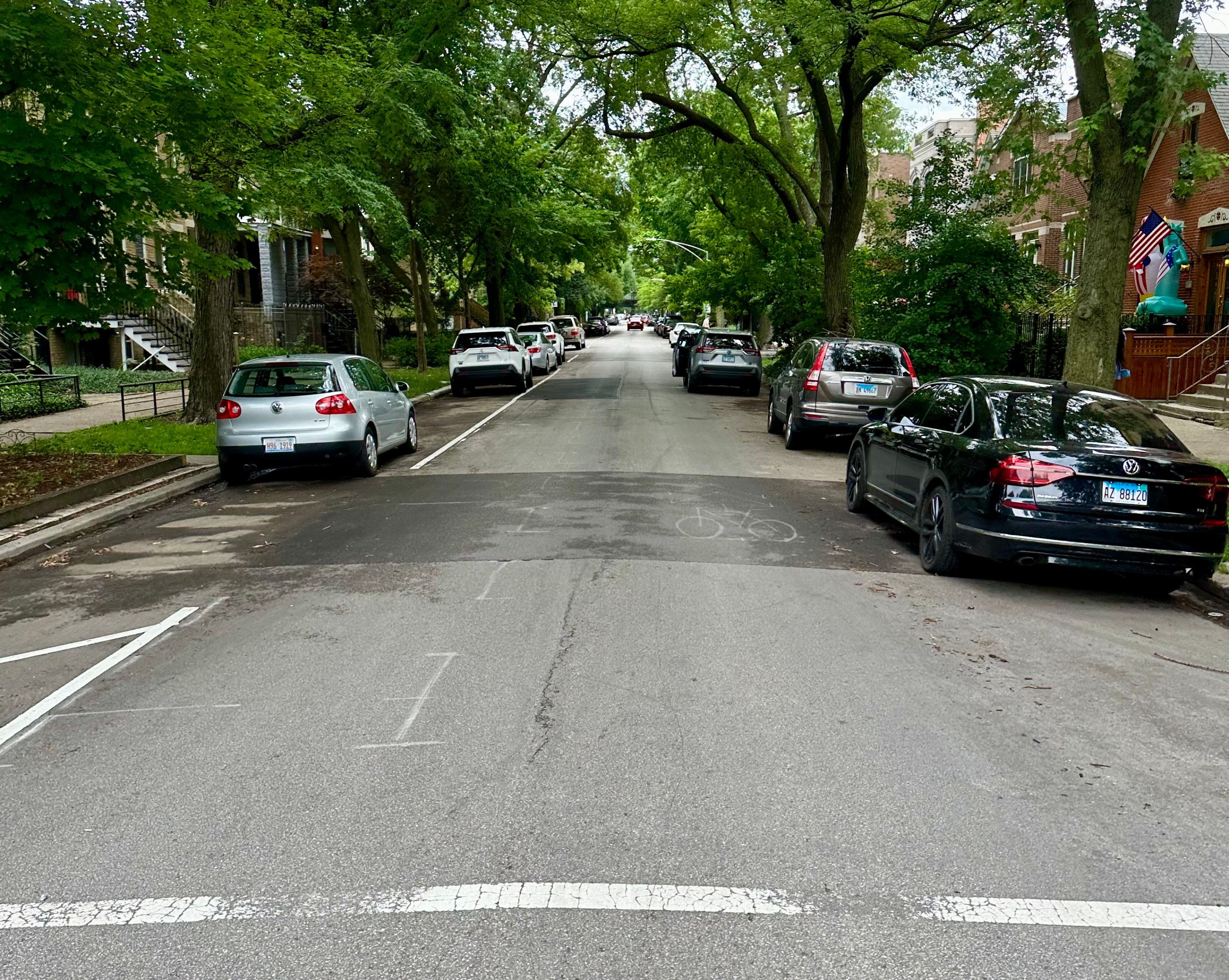
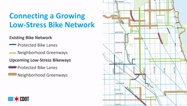
On Monday evening, Chicago Department of Transportation staff and representatives from the 32nd, 40th, and 47th ward offices presented details for the planned Leavitt Street Neighborhood Greenway project to a virtual audience of roughly 90 people. The project will represent an earnest push towards creating additional “low stress” corridors and improve safety for bicyclists, pedestrians, and drivers, Brad Huff, manager of the Complete Streets program at CDOT told the audience.
The greenway will be implemented along the 3.3 mile stretch of Leavitt Street from Diversey Parkway to Rosehill Cemetery, connecting the North Center, Lincoln Square, and Bowmanville neighborhoods. Huff noted that there would be no change made to on-street parking along the route.
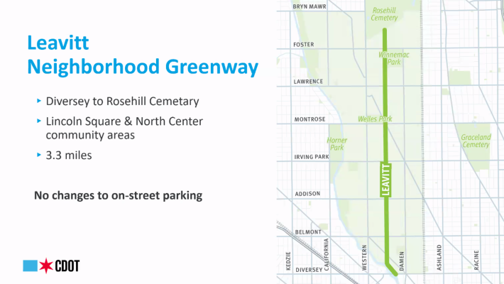
Leavitt was chosen for numerous reasons, Huff indicated, but a top reason was because it is a natural bypass for bicyclists to avoid busy Damen Avenue to the east and Western Avenue to the west. There are also eight schools and four parks along the route, and the number of families and young children moving to the area is growing.
Lower stress, greater safety
One variable that significantly affects the possibility of injury or death in a collision between a bicyclist and vehicle driver is speed, Huff said during his presentation. There’s an 80 percent risk of injury or death for a pedestrian who is impacted by a vehicle, he elaborated, however, that risk drops to 10 percent at 20 miles per hour.
“People walking and biking make up just 3 percent of all automobile crashes in the neighborhood, but yet they make up 42 percent of fatal and serious injury crashes.” Huff said to the group. “We know that as the speed of cars goes up, so does the risk of death and serious injury. And this is really especially true as the cars on our streets get bigger and heavier.”
The United States currently does not have pedestrian-vehicle crash safety standards, but there is a moment to change that now.
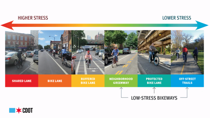
And with the Leavitt Greenway plan, the safety of all road users is a major consideration, he added. This means reducing the speed limit to 20 miles per hour, installing curb extensions, high-visibility crosswalks, and speed humps. Additionally, there will be signage for the new speed limit, route destinations, and indicating two-way biking is allowed.
The idea is to also make the commuting experience much more enjoyable — and "low stress" — for cyclists, Huff added. That will give bicyclists an alternative route to busier streets where people are driving much faster and the risk of injury or death is also much higher. And lower stress corridors are likely to help less experienced riders, as well as children, gain more confidence in riding in Chicago.
“Something like a regular bike lane on a busy street like Damen is going to be comfortable only for a certain number of folks,” Huff said. “It's not going to be comfortable for children, for families, or for others who may be reluctant to get around by bike or a different option.”
It's also possible that cycling on Damen is not comfortable for anyone, given that the majority of its bike lane infrastructure is in the door zone.
Two lanes and project timeline
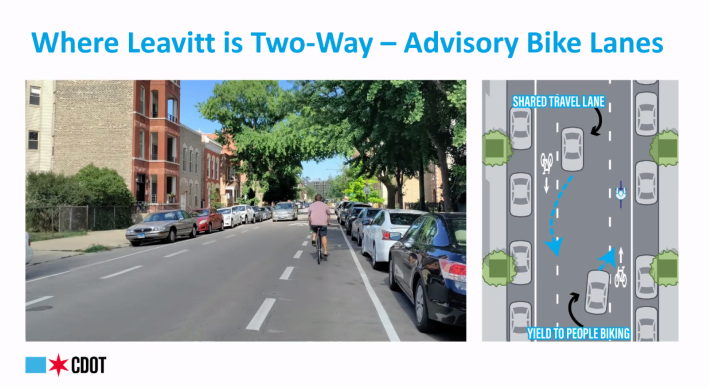
While Leavitt is a one-way street through much of the 3.3 mile stretch that will become the greenway, the project will feature two-way bike lanes on sections of the street that are two-way. Vehicles will share a travel lane in the center of the road, which will be flanked by separate “advisory” bike lanes going in each direction.
“The idea is that people biking have a dedicated lane to ride in on the sides of the street,” Huff explained. “When two motorists are coming to cross one another, they are permitted to cross into this bike space only after yielding to people on bikes and then once they pass each other they can return to that center lane.”
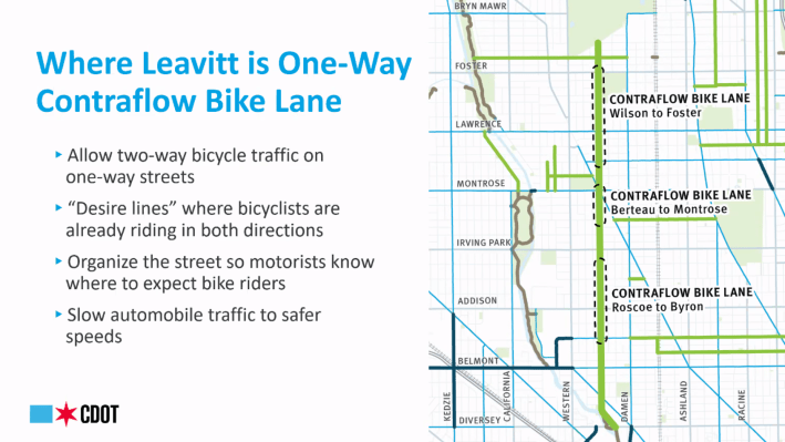
For the one-way stretches of Leavitt, CDOT will install contraflow bike lanes, which allow bicyclists to more safely ride in the opposite direction of vehicle traffic. Huff said that cyclists are already using Leavitt this way, and the greenway project will only formalize it and help indicate to motorists that bicyclists are permitted to use these routes in both directions.
“The idea is really just making everyone much more predictable so everyone knows what to expect and where to expect people,” he said.
In terms of timeline, some of the early aspects of the project, such as resurfacing and bike lane marking, are already underway. Speed humps will be installed after patching and repairing the street is completed. And then by the end of the summer or autumn, the curb extensions along the route will be installed. However, a final timeline and an estimated time for the completion of the project is still to be determined.
