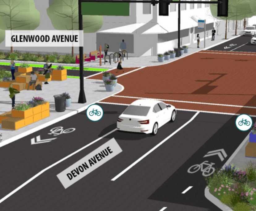
The Edgewater Chamber of Commerce, Rogers Park Business Alliance, and Loyola University Chicago have released the Elevate Devon Corridor Plan, “a strategic plan for the vibrant avenue in Rogers Park and Edgewater.” The plan focuses on the one-mile stretch of Devon Avenue between Sheridan Road and Ravenswood Avenue, bordering the neighborhoods of Rogers Park and Edgewater. I reviewed the document and spoke to Sandi Price, the executive director of the Rogers Park Business Alliance, to see what the plan might mean for residents and visitors, especially those who travel by foot, bike, and transit.
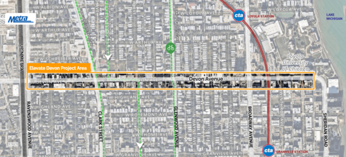
The project sponsors were interested in figuring out a way to blur the boundaries between Rogers Park, Edgewater, and Loyola University, and had been meeting as a group for years prior to the conception of the new plan. The goal was to blend the adjacent neighborhoods into a more cohesive community, says Price. In order to realize their vision, they knew they needed funding and therefore a plan.
The contracted consultant team Teska Associates, Inc. began the project in December 2021, and conducted the standard existing conditions study, market study, stakeholder interviews, steering committee meetings, and public engagement events. Public engagement was mostly virtual (online polling, workshops, and open house) with three days of in-person pop-ups at Loyola and along Devon Avenue. The team reports that the online map feature gathered the most community input.
The final plan presents six main themes for the corridor: Safety First; Celebrate Color; Align with Nature; Orient, Light, and Invite; and Reinforce Identity. These themes translate to four framework plans for different sections of the corridor, five strategies for further development of the corridor, and an action plan to guide short-term and long-term implantation. Let’s take a look at the framework plans and implementation plan, the meatiest of the content in the document.
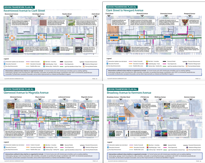
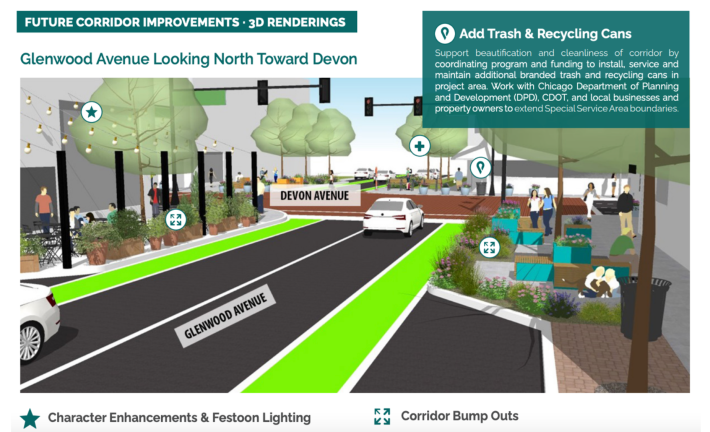
The framework plan recommends, essentially, placemaking improvements and road diet strategies along Devon Avenue: corner sidewalk bump-outs, street furniture, decorative signage, a wayfinding kiosk, decorative pavers, murals, decorative lighting, bus stop enhancements, bike amenities, bike lane extensions. It calls for 49 improved crosswalks (“Creative Crosswalks” and “Decorative Crosswalks”), three new pedestrian islands at especially wide crossings, 22 bike rack and amenities stations, seven wayfinding stations (new signage or kiosk), and ten key “Intersection Updates.” These intersections have been revamped to include corner bump-outs, shortened and decorative crosswalks, and added streetscape amenities like seating, lighting, artwork, and landscaping.
Currently, the Devon Avenue streetscapes allocate six feet as sidewalk, 3.5 feet for street trees, 1.5 feet for curb and lampposts, seven feet for on-street parking, five for a bike lane, and ten feet for a vehicle travel lane on each side. Adding curb bump outs at these intersections would eliminate the parking lane and give those seven feet back to the pedestrian. six-foot sidewalks and 3.5-foot tree planters make for a pretty measly pedestrian realm, and giving back seven feet for increased landscaping, walking space, resting space, artwork, or bike lane protection would greatly improve the experience of walking down Devon. Bike lanes (although not currently buffered or protected) already exist on Devon Avenue, but the plan proposes extending the bicycle network in the surrounding area.
A problem, though, and this is a problem inherent to many urban planning studies and plan documents, is that the Elevate Devon Corridor Plan project sponsors and partners are not in control of the land that the plan proposes to change. Streetscape improvements are carried out in the streetscape – sidewalks, bike lanes, street trees, planters, street furniture, crosswalks, curbs, parking, vehicle travel lanes – which is (in this case, and in almost every case) the public, city-owned and controlled right of way. Almost all of the proposed streetscape and placemaking improvements would require Chicago Department odf Transportation approval, further study and design, and funding. The plan addresses this in the implementation section, providing an implementation matrix of next steps, those responsible for each next step, and estimated cost of each item.
And, helpfully, CDOT has already seen the plan. The team wanted them to go through it before publication to ensure that all the proposed streetscape elements are feasible. Price reports that CDOT was amenable to the proposed changes, but no timeline for required further studies (traffic study, engineering review, etc.) or implementation has been established yet. The project sponsor team is meeting later this week to begin working out a timeline and next steps. Low-cost initiatives are likely the first elements that will be actualized, says Price.
The Elevate Devon Corridor Plan, if implemented, will improve pedestrian and cyclist safety and experience of Devon Avenue and likely bring more business to the area. The proposed changes and upgrades would reduce the ROW space dedicated to cars and give more space to people, expanding the public realm to be more engaging, safe, and representative of what the community wants this corridor to be.
