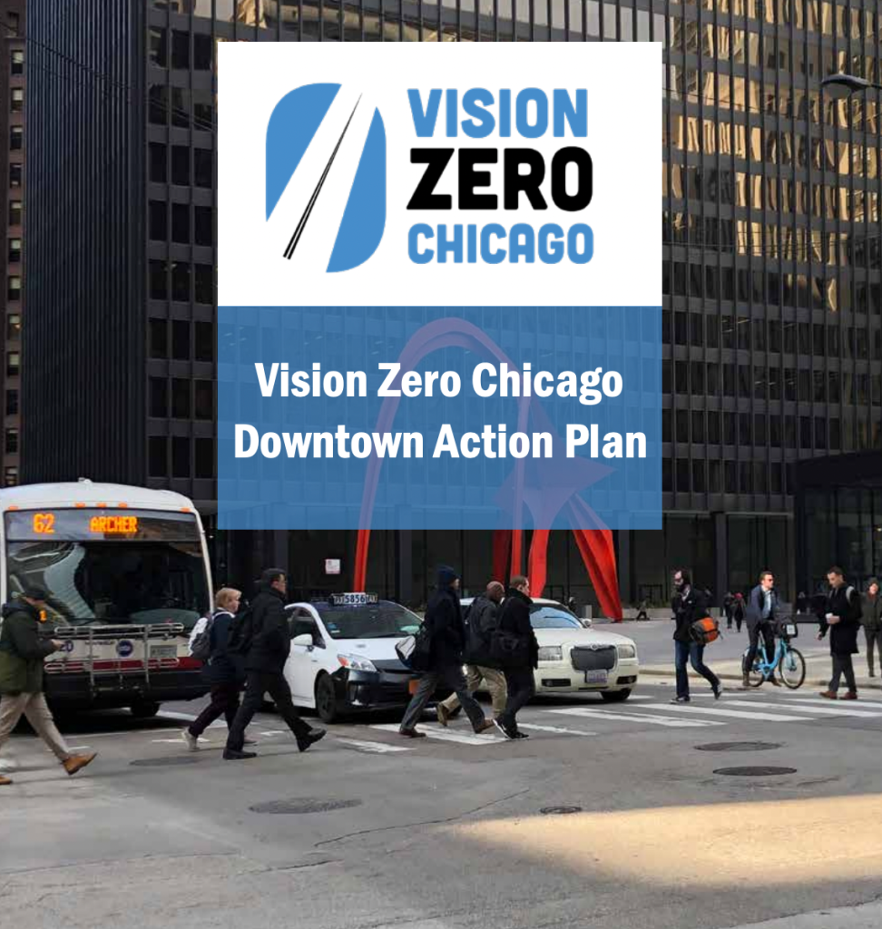
Downtown VZ plan calls for signal changes, intersection upgrades, 20 mph speed limit
Vision Zero is a global movement to eliminate serious and fatal traffic crashes by taking a systemic approach to road safety. Cities and states pledge to implement Vision Zero in their approach to traffic safety. The goal is to change how entities such as states and cities design, use, and view streets so that all users are safe.
The Vision Zero Chicago crash prevention plan, was released in 2017. The document identified downtown Chicago, defined as the Loop and Near North Side community areas, as one of eight High Crash Areas within the city, with the rest being in low-income communities of color on the South and West Sides. In late 2021 the city of Chicago released its Vision Zero Chicago Downtown Action Plan.
Downtown Chicago is an economic and transportation hub for the city and region. It’s also a hot spot for traffic crashes. The downtown High Crash Area experiences the highest overall number of severe crashes citywide in the city. In addition to its designation as a HCA, the downtown area contains 15 of the city’s 43 High Crash Corridors.
In order to create recommendations to improve downtown traffic safety, the Vision Zero team made a full assessment of existing conditions. Between 2012 and 2016, the Central Business District (a somewhat different zone than the downtown VZ High Crash Area – see map above) experienced serious injury and fatal crashes at nearly double the citywide crash rate, 742 crashes per 100,000 residents in the CBD, compared 398 of these crashes per 100,000 residents citywide. Each week in the CBD three people are seriously injured or killed in traffic crashes. Nearly every week one of these victims is a person walking.
Serious crashes in the Central Business District impacted travelers of all modes, with people in vehicles making up the the majority of total serious and fatal injury cases. However crashes within the CBD disproportionately involved people walking and biking, as is also the case citywide. Of all serious crashes in the CBD, 39 percent involve vulnerable road users. Of all traffic fatalities in the CBD, 55 percent of the victims were people walking or biking. The most common cause of crashes in the CBD, representing 43 percent of serious crashes, is a failure by a motorist to yield the right of way. For these crashes, 67 percent of victims are people walking or biking, with over three-fourths occurring at intersections. Within the CBD, speeding is a cause of 20 percent of serious crashes. Vulnerable road users are the victim in over 25 percent of speeding crashes. While the CBD can feel perpetually gridlocked for much of the day, at times and locations with less traffic congestion, motorists often drive at a dangerous speeds.
The new report’s recommendations to eliminate serious and fatal crashes fall into two categories: priority recommendations and supporting recommendations. Priority recommendations maximize benefits across the CBD and can be replicated at multiple locations. These recommendations are said to provide the foundation for Vision Zero in downtown according to the action plan.
Supporting recommendations either require longer term phasing or are discrete in impact. However, they have been identified by the task force as essential to achieving Vision Zero downtown. Here are a few of the recommendations from the action plan.
Corridor-wide rapid delivery interventions on State Street
Given that State Street is a high crash corridor between Kinzie Street and Chicago Avenue, the plan argues that rapid delivery interventions can produce high-impact results within a short time period. Some recommendations include leading pedestrian intervals (stoplight signal phasing that turns on the walk signal before drivers get a green to give pedestrians a head-start) and lagging left turns (signal phasing in which the left-turn arrow is given to motorists after vehicles traveling straight have passed through the intersection) at all five State Street high crash intersections where they are currently lacking. Pedestrian countdown timers are also recommended for the four State Street high crash intersections that lack them.
The plan also calls for getting rid of existing rush-hour parking restrictions on some blocks to allow for safety improvements such as sidewalk bump-outs. Rush-hour parking bans theoretically create extra travel lanes during peak hours, but the plan notes that since the restrictions aren’t consistently enforced, they lead to motorists weaving in and out of the lanes to get around parked cars. On various Downtown streets with bus routes, the removal of rush hour parking controls could also enable improvements to bus service.
The Vision Zero team checked in with the CTA on corridor-wide recommendations to ensure bus operations would not be adversely impacted by the treatments.
Rapid-delivery intersection treatments
The plan calls for quick-and-cheap physical changes intersections with high crash rates, high pedestrian volumes, and/or intersection layouts and crash history that indicate that near-term changes to the intersection design would improve safety. The rapid delivery toolkit includes paint-and-post bump-outs and pedestrian islands; “hardened centerlines and rubber median bumps” (using flexible posts and a rubber curb to encourage drivers to slow down when making left turns and discourage them from cutting the corner), and crosswalk striping changes.
The downside of using cheap, flimsy materials for bump-outs and pedestrian islands rather than concrete is that they’re often quickly demolished by motorists. A Streetsblog reader noted, “The flex-posts for the mid-block bump-out on Randolph linking City Hall and the Thompson Center have already been destroyed by drivers (or potentially plows). I saw them flattened last week and now they are missing I’ve seen cars parked in the space already. If we can’t maintain safety infra at the foot of City Hall, what hope is there for the rest of Chicago?”
Bike network expansion
The plan includes a supported recommendation to continue the expansion of the protected bike lane network using the Chicago Streets for Cycling Plan as a guide. The document calls for prioritizing bike routes that are useful for cycling to workplaces, retail, cultural institutions, and transit stations. A map of the planned 2021-22 bikeway expansion released by the Chicago Department of Transportation last September indicates that new protected bike lanes will be installed on Halsted Street (Fulton Street to Grand Avenue), Kinzie Street (Wells Street to State Street), Wells Street (Harrison Street to 18th Street, as part of the Wells-Wentworth Connector project in The 78 megadevelopment), and Taylor Street (Canal Street to Morgan Street.)
Lowering the downtown speed limit to 20 mph
Despite downtown intersections having more people walking than driving during rush hours, and even during non-peak travel hours, the default speed limit on the majority of downtown streets is the same as the citywide default, 30 mph. Speed studies have found that people are driving fast throughout the day despite the perception that downtown is too congested to allow for high speeds. This speeding puts all road users at risk and does not help people get to their destinations any faster, given the short block lengths and ubiquity of traffic signals downtown. Often drivers are simply speeding to the next red light.
The goal lowering the speed limit to 20 is to reduce the speed of drivers who behave recklessly, endangering the lives of others. This recommendation makes sense given that speed is a top cause of crashes downtown. Speed is listed as a contributing cause in close to 20 percent of downtown crashes. Speed is also said to play a role in other types of crashes, including failure to yield collisions, as high speeds narrow a driver’s field of vision and increase the distance needed to stop.
In order to reduce the downtown speed limit, a variety of steps are needed. One of those steps is stakeholder coordination. CDOT and other city agencies, elected officials, and Vision Zero task force members such as the Active Transportation Alliance, the Magnificent Mile Association, the Chicago Loop Alliance, and Friends of Downtown, will need to coordinate closely around each step in the legislative process to build public support. There will also need to be coordination with Illinois Department of Transportation given that 16 percent of road miles in downtown fall under IDOT jurisdiction, including 61 percent of the road miles designated as High Crash Corridors.
There are even more recommendations worth checking out in the Vision Zero Chicago Downtown Action Plan. As with all transportation plans, many of these recommendations will require funding and political will. It remains to be seen if the city can eliminate severe and fatal traffic crashes by 2026, the timeframe set by the Vision Zero action plan in 2017. Given that Chicago traffic fatalities have spiked during the COVID-19 pandemic, that’s a tall order.

Streetsblog has migrated to a new comment system. New commenters can register directly in the comments section of any article. Returning commenters: your previous comments and display name have been preserved, but you'll need to reclaim your account by clicking "Forgot your password?" on the sign-in form, entering your email, and following the verification link to set a new password — this is required because passwords could not be carried over during the migration. For questions, contact tips@streetsblog.org.