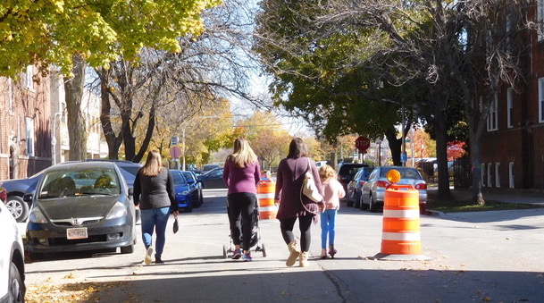
Now that the weather is generally getting colder in Chicago (although you wouldn't know if from today's 70-degree high), one might that the city's program to create traffic-calmed Slow Streets for socially-distanced transportation and recreation during COVID-19 would be winding down. (The Chicago Department of Transportation calls these corridors, where through traffic is banned, "Shared Streets.") Indeed, partly due to grumbling from drivers, CDOT has already dismantled the wildly popular Dickens Avenue Slow Street, and part of the Bloomingdale Trail alternative route on Cortland Street.
But surprisingly the department just rolled out a new T-shaped Slow Street route in the Irving Park neighborhood on Grace Street between California and Kedzie avenues, and Richmond Avenue from Addison Avenue to Grace, 0.75 total miles.
An October 20 Facebook post from 33rd Ward alderman Rossana Rodriguez sought feedback on the project. "Many neighbors proposed bringing [Slow Streets] to the ward during the Idea Collection stage of our Participatory Budgeting Process," the post stated. "We reached out to CDOT and below is the area they proposed for the initiative. We are asking neighbors, especially those who live in the area, to give us their feedback." There were about 20 Facebook comments on the issue varied in opinion, but most of the commenters were skeptical about whether the project would be successful.
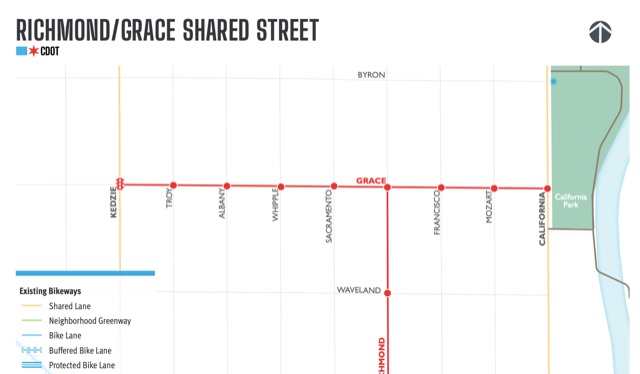
Veronica Tirado-Mercado, the ward's director of neighborhood services, said the Slow Street route is a pilot program running from November 2 to November 30, depending on the weather. (Once snowplowing season starts, CDOT will be taking down all of the Slow Streets barricades and traffic barrels.)
Tirado-Mercado expects that CDOT will create another survey to gauge residents' use and acceptance of the Slow Streets. Ward residents will get a heads-up about the upcoming request for feedback via canvassing, the ward newsletter, and social media.
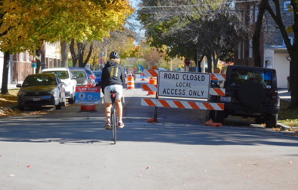
Yesterday, I walked the Slow Street on Grace from Kedzie to California, the western boundary of California Park, where you can pick up the 312 RiverRun, a north-south trail network. Work is currently underway to complete an underbridge below Irving Park Road that will connect California Park to Horner Park to the north. Once that's completed, you'll be able to travel three miles along the river between Belmont and Montrose avenues without crossing any streets.
On my walk I encountered Louis Beaudion, who lives nearby on Francisco Avenue. He told me he was unclear on why the barricades and barrels had appeared. However, he said he rides his bike to Horner Park many times a week, so the Slow Street will come in handy for him.
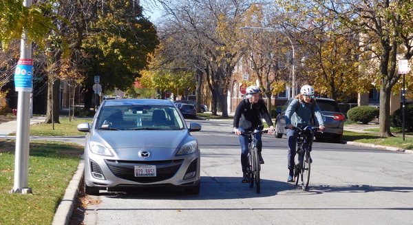
Near California Park I met Ernesto Villa, who was walking his dog. "I walk my dog around here all the time, and I just noticed the barricades today," he said. He's not a fan. "I don't like them because [drivers] don't know what to do. This street is already narrow, and it makes it difficult to pass through."
But it's likely many residents and families will find the new Slow Street route to be a nice place to walk, push a stroller, jog, skate, scoot, and bike, as has been the case on many other such corridors. Said CDOT spokesman Mike Claffey, "Despite how late it is in the season... we hope to keep it in place through the month of November."
Follow Imelda March on Twitter at @hcram1.
