Zoom Interview: The backstory of the Mellow Chicago Bike Map
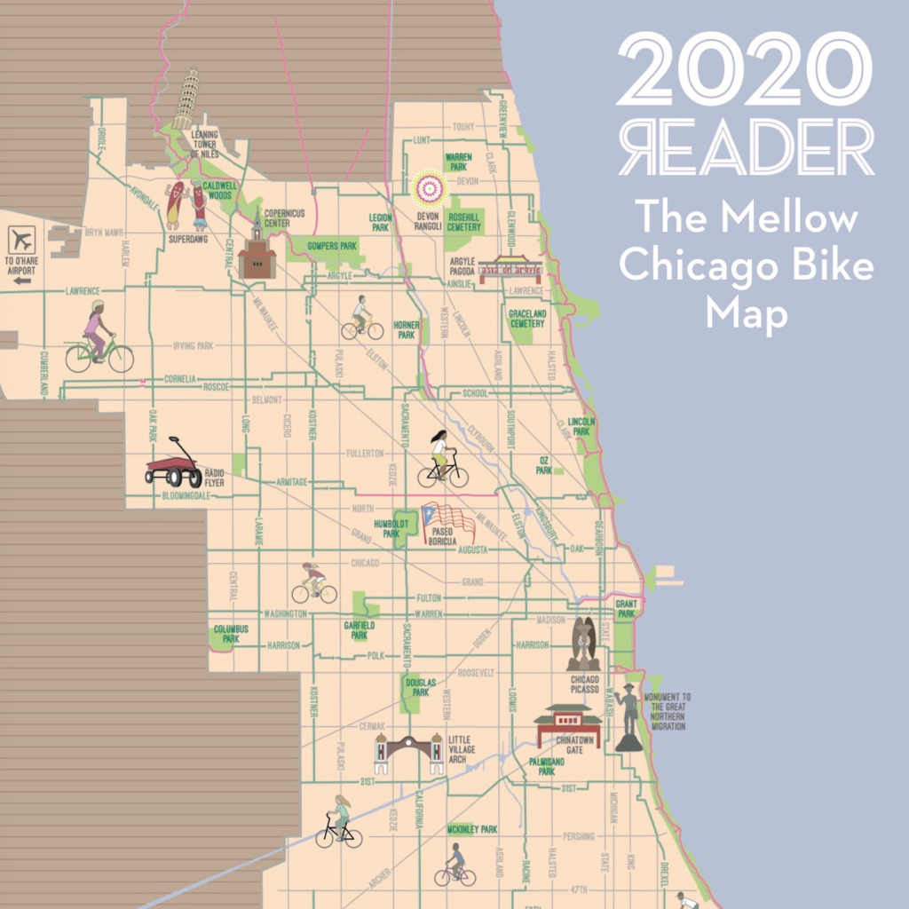
If you didn’t get a copy of the new Simplified, Citywide Mellow Chicago Bike Map when it was published in the Chicago Reader free newspaper earlier this summer, never fear. You can get a deluxe, glossy poster version of my map of chill cycling routes, beautifully illustrated by local artist Joe Mills, sent to your home when you make a $15 donation to the Reader, which recently relaunched as a nonprofit. Another $5 gets you the equally cool Chicago Indie Bookstore Map. You can also view a much more detailed version of the SCMCBM in Google Map format, handy for smartphone navigation.
Recently DePaul University professor Sarah Brown invited me do an Zoom interview about the origins of the bike map, and the Chicago transportation scene in general, to share with students in a new class she’s teaching this this fall called “Explore Chicago at your Own Speed.” All incoming freshmen are required to take a “Discover/Explore” Chicago course that introduces them to the city and engages them around a specific theme. For Brown’s class, she’s inviting students to think about how they might explore Chicago using some form of physical movement: walking, running, biking, rollerblading, etc. Part of the course will focus on streets, sidewalks, and trails, and that’s where she plans to introduce students to biking in the city.
The conversion evolved into a freewheeling discussion of Chicago transportation, with a few history lessons thrown in. Here are some of the topics we covered.
- 0:00: Intro and discussion of the Mellow Chicago Bike Map
- 5:40: Divvy bikes and e-scooters
- 7:40: Road and safety recommendations
- 12:45: Reallocating space from cars to walking, transit, and biking
- 15:00: Chicago’s role as a transportation hub, and the awful parking meter deal
- 25:10: More local history and conclusion
I hope the convo will encourage new DePaul students to explore our city via the many different car-free travel modes available, which, in my humble opinion, is one of the best things about living in Chicago.

Read More:
Streetsblog has migrated to a new comment system. New commenters can register directly in the comments section of any article. Returning commenters: your previous comments and display name have been preserved, but you'll need to reclaim your account by clicking "Forgot your password?" on the sign-in form, entering your email, and following the verification link to set a new password — this is required because passwords could not be carried over during the migration. For questions, contact tips@streetsblog.org.