Eyes on the Street: City installs Bloomingdale Trail alternative Slow Streets route
The Slow Street corridor that will substitute for the closed Bloomingdale Trail, aka The 606, seems to be nicely taking shape with today’s installation by Chicago Department of Transportation crews. According to a map released by CDOT, from Lawndale Avenue (3700 West), the route will head east on Cortland Street (1900 North), south on Rockwell Street (2600 West), east on Wabansia Avenue (1700 North), north on Marshfield Avenue (1630 West) and then east on Cortland, in the Logan Square and West town community areas. It’s a total distance of about three miles.
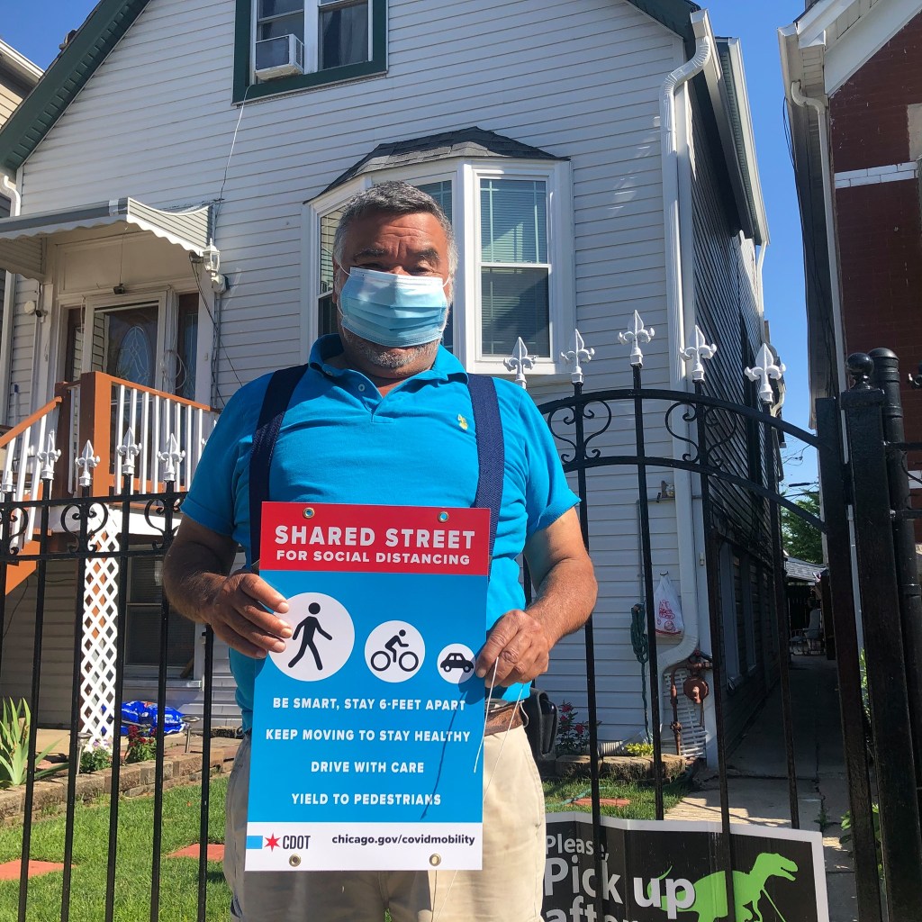
This morning CDOT chief Gia Biagi and 1st Ward alderman Daniel LaSpata stopped by to check out the installation work, as crew members installed barricades at each signalized intersection with signs marked “Road Closed; Local Traffic Only” and traffic barrels with placards stating “Shared Street for Social Distancing” with tips on safe use.
At Cortland and Rockwell, a sign has a right-turn arrow to direct Slow Street users south on Rockwell, but as of this morning there was no left turn sign at Rockwell and Wabansia. Of course, wayfinding arrows will be needed in the other direction as well.
Unlike the Slow Street on Leland Avenue in Ravenswood in the 47th Ward, where a community input map was launched before installation, or the Palmer Street proposal in the 35th Ward, where a bilingual neighborhood outreach effort is underway, we haven’t heard of any community input work that was done in regards to the Bloomingdale alternative. LaSpata’s office didn’t immediately respond to a question about that.
We’ve already heard via Twitter from someone who said they live on Cortland and were surprised by the project. “I support this, but as someone that lives on Cortland, I wish we got a heads up. I found out only when I went outside today and found barricades.”
So it won’t be a shock if there’s a bit of pushback from residents, particularly motorist who are annoyed at having to change their driving habits. But if you’re upset that you can’t drive fast on residential roadways or use them as cut-through alternatives to main streets, you’re doing it wrong anyway.
Besides, if the popularity of Leland is any indication, Logan and West Town residents will ultimately be so stoked about this new transportation and recreation corridor, especially at a time when The 606 is closed, that they won’t mind having to drive a little more responsibly.

Read More:
Streetsblog has migrated to a new comment system. New commenters can register directly in the comments section of any article. Returning commenters: your previous comments and display name have been preserved, but you'll need to reclaim your account by clicking "Forgot your password?" on the sign-in form, entering your email, and following the verification link to set a new password — this is required because passwords could not be carried over during the migration. For questions, contact tips@streetsblog.org.