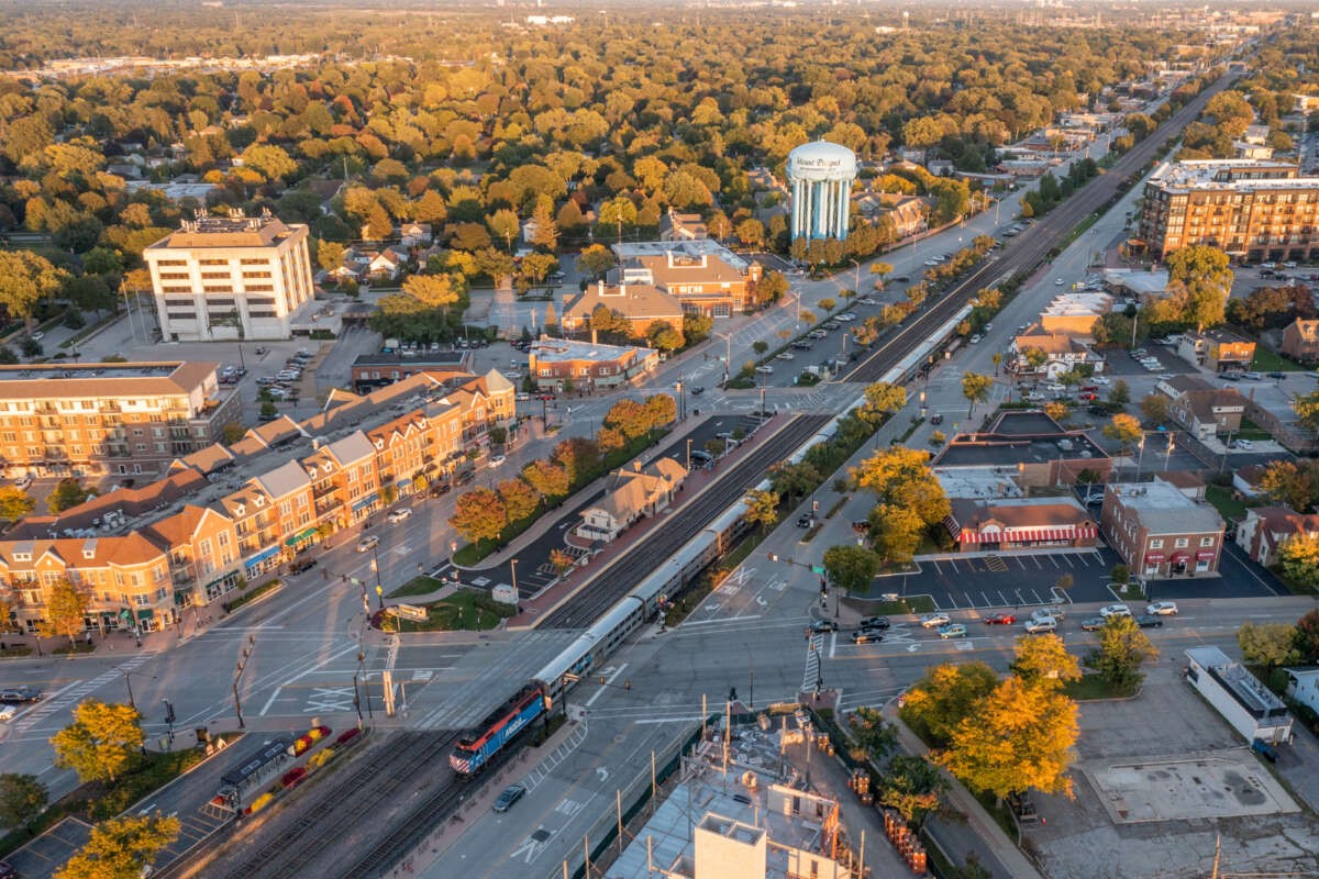
Many Chicago cyclists appreciate Wilson Avenue as a commuting route because it's a secondary street that runs uninterrupted for several miles between Albany Park and the lakefront, in a city where good east-west bike routes are relatively rare. Wilson also provides you with a fairly safe crossing of the Chicago river via a two-lane span with a solid bridge deck as opposed to a slippery open grate.
Still, I'm not a huge fan of Wilson. While it's a residential street west of Western Avenue, it can still feel a little hectic -- especially during rush hours -- because it's a popular cut-through route for motorists trying to avoid traffic jams on Montrose and Lawrence. So I usually avoid it when I can by taking routes highlighted on the Mellow Chicago Bike Map, which I released this summer via the Chicago Reader. (The map currently covers the area bounded by 95th, Cicero, Devon, and the lake, but it will be expanded to include the entire city later this fall.)
I read this morning in Block Club Chicago that the Wilson bridge will be closed to street traffic through October for repainting. One sidewalk will be remain open for pedestrians at all times, and if you want to continue using Wilson as a bike route, you can walk your bike on the bridge sidewalk if you like.
But since the bridge is getting a facelift, not take the opportunity to try out some low-stress east-west alternatives to Wilson that I devised especially for Streetsblog Chicago readers? (They don't yet appear on the Mellow Map in their entirety.) Both itineraries run between Pulaski and the Lakefront Trail, and they include stoplights or four-way stop signs at all major street crossings. Here's the link to an interactive Google Map of these routes.
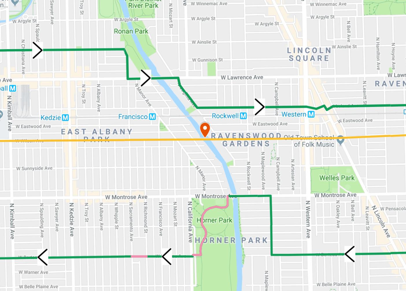
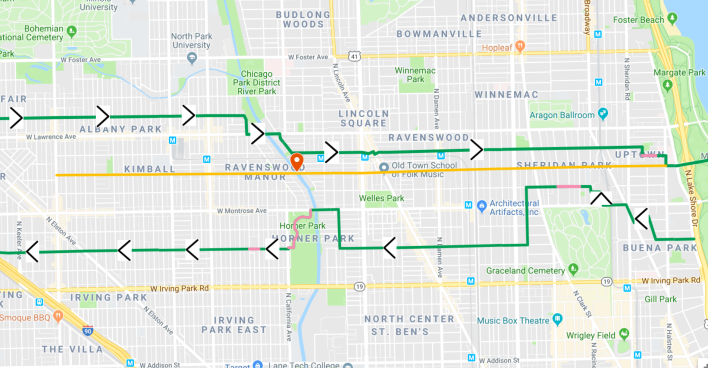
Eastbound, you take Ainslie until Sacramento and then head south to cross the river on Lawrence, then south on Virginia to Leland. From there you continue east to Clark, where the Leland Greenway begins and signs and pavement markings usher you to the shoreline path, including a stretch on the controversial Wilson sidewalk bike lanes under Lake Shore Drive.
The westbound route is more convoluted due to the dearth of uninterrupted westbound streets near Wilson with safe major street crossings, and the presence of Graceland Cemetery and Horner Park. So you won't hurt my feelings if you stay on Wilson instead, but if you have the time and inclination to navigate this undulating itinerary, I think you'll find it's a fun, low-stress route.
From the Lakefront Trail's Buena underpass, head west a couple of blocks and then zig-zag northeast via Hazel, Cullom, Broadway, Montrose, and Clifton to Sunnyside. Continue west across the Sunnyside pedestrian mall and onward to Greenview, where you drop south to the Berteau Greenway. Roll west to Campbell, north to Montrose, and then southwest through paths in Horner Park to Berteau. From there you can continue west for a couple more miles of very tranquil pedaling.
Take these routes for a spin if you have a chance, and let me know what you think in the comments.
![]()
Did you appreciate this post? Consider making a donation through our PublicGood site.