Property developer Zack Cupkovic said he didn't really discover Goose Island until four years ago, even though he grew up in the nearby Lakeview neighborhood. The man-made island was created in 1857, when the North Branch canal was completed on the east side of the land mass, separating it from the mainland. When you drive across the island on Division Street, Cupkovic said, "it barely seems like you're going over an island."
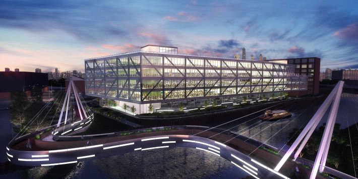
He works for R2 Companies, which published a land use and transportation vision for the island's next decade, dubbed the Goose Island 2025 Plan. They propose adding more workplaces, as well as new transportation infrastructure that will make it easier for the new employees to get to work without driving.
While Cupkovic said Goose Island is in an ideal location, near 'L' lines and downtown, he feels the site hasn't yet reached its full potential for commercial activity and transportation access. The only direct transit transit access is via the CTA's #8 Halsted, #70 Division, and limited service #132 bus route.
The 2009 opening of the Cherry Street pedestrian and bike bridge on the north side of Goose island made it easier to walk there from the Red Line's North/Clybourn station. But, due to the lack of a bridge, there's no way to directly access the island from the nearby Chicago Blue Line stop.
Last year, R2 hired local design firm PORT Urbanism to draft the plan to increase transportation access for the thousands of new workers Cupkovic says the island can support.
Their plan proposes two new car-free bridges. The first one would be located at the former footings of a bridge that formerly existed at the southwest side of the Goose Island, back when Ogden Avenue crossed the island. That bridge, and the rest of Ogden north of the Chicago River, were removed completely by 1993. The new bridge would create the missing link to the Chicago Blue Line stop.
Currently, a walking trip from the station to 909 W Bliss St., where R2 wants to rehabilitate an industrial building for commercial space, is three-quarters of a mile, and the new bridge would cut that to less than half a mile. Cupkovic's company already owns the building, but there are only about three people working there on a daily basis -- he says the company can bring in 600 workers. In another building they plan to build, Cupkovic said they could fit 1,000 workers.
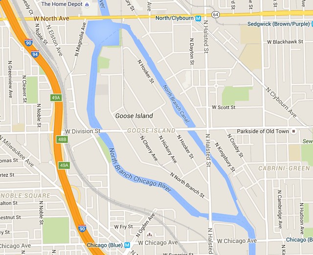
A second car-free bridge on the east side of the island would connect with Evergreen Avenue, located two blocks north of Division. This would shorten the walking distance to the North/Clybourn station, as well as the SoNo ("South of North") development and the city's largest Whole Foods Market, whose food court is already a popular lunch spot for Goose Island workers.
R2 is already in talks with the Chicago Department of Transportation about getting these bridges built. Cupkovic says they want to get private financing for the Ogden bike/ped bridge. "The city's been supportive," he says.
Speaking of financing, most of the island is in a tax increment financing district. Cupkovic thinks that the TIF money should be used only for infrastructure, because Goose Island is already an attractive-enough area for business investment without the need for city-subsidized incentives.
R2 is also proposing two new bridges for motor vehicles, as well as pedestrians and cyclists, at Weed Street on the northeast side of Goose Island, and Blackhawk Avenue, on the northwest side. Cupkovic said that these bridges would create connections for workers to access residential and retail on the mainland. Of course, they'd also encourage more driving.
The Goose Island 2025 Plan also calls for the creation of a new "River West" stop for Metra's UP-North and UP-Northwest lines near the future Ogden bridge. And while there's already a water taxi stop at the north end of the island, which takes workers to and from downtown, the plan proposes adding two more water taxi routes.
One less enlightened element of R2's plan is their proposal to demolish the car-free Cherry Avenue bridge and build a new car-friendly bridge. That should be a non-starter, because the because the bridge, originally completed in 1902 for rail use, is an official landmark. Andrew Moddrell at PORT said that "It wasn't part of the plan to modify the existing bike/ped bridge, it’s a beautiful bridge. Rather, we proposed a new auto bridge to the east that would connect to the dead-end street just north of the Whole foods parking lot."
R2 and Port Urbanism will create a more intricate plan this year. In the interim, the developer wants to collaborate with other Goose Island property owners to add new landscaping, signs, and lighting to highlight the island and its development potential, Cupkovic said.
![]()
Did you appreciate this post? Streetsblog Chicago is currently funded until April 2016. Consider making a donation through our PublicGood site to help ensure we can continue to publish next year.

