More Before-and-After GIF Goodness: Bike Lanes, a Ped Scramble, and BRT

Inspired by a post from Streetsblog USA’s Angie Schmitt, I recently tried my hand at using a new-ish feature of Google Streetview to illustrate how Chicago street transformations have improved traffic safety and made neighborhoods more livable. Google now lets you access archived Street View images, so it’s easy to see how our roadways have changed for the better.
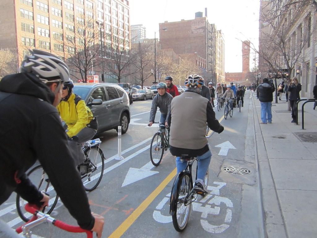
Streetsblog Chicago readers said they enjoyed the last round of before-and-after GIF animations, so here’s a fresh batch, this time using some original photos, rather than just Street Views. Above is a view of the new curb-protected bike lanes on Clybourn Avenue in the Old Town neighborhood, which involved repurposing one of the parking lanes. It’s become an instant hit with cyclists.
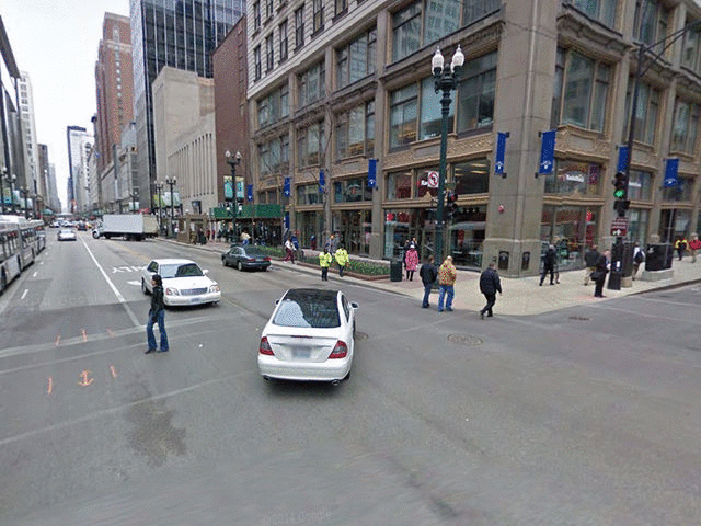
Below is the city’s first (and only) pedestrian scramble intersection at Jackson Boulevard and State Street in the Loop. In addition to east-west and north-south crossing phases, the scramble phase allows walkers to cross in all directions, including diagonally.
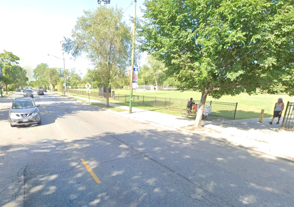
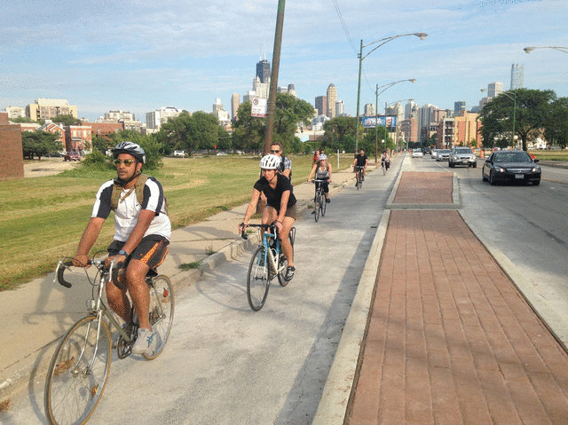
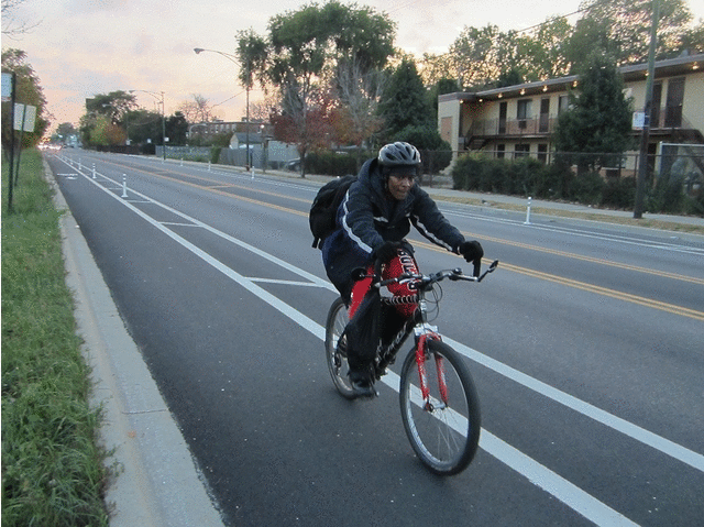
These bike lanes on Vincennes Avenue in the Longwood Manor community show how some paint and flexible poles can transform an overly wide speedway into a calmer, more bikeable street quickly and cheaply. It would be great if the buffers are replaced with concrete curbs in the future.
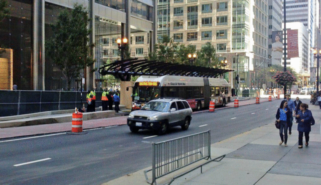
The Loop Link bus rapid transit project is under construction on Madison and Washington streets downtown. This corridor, connecting West Loop train stations with Michigan Avenue, will include dedicated lanes, limited stops, and queue jumps, plus near-level and (eventually) pre-paid boarding. The Washington corridor will include a protected bike lane; the old bike lane on Madison (shown) will be replaced with a PBL on Randolph Street, 2 blocks north.
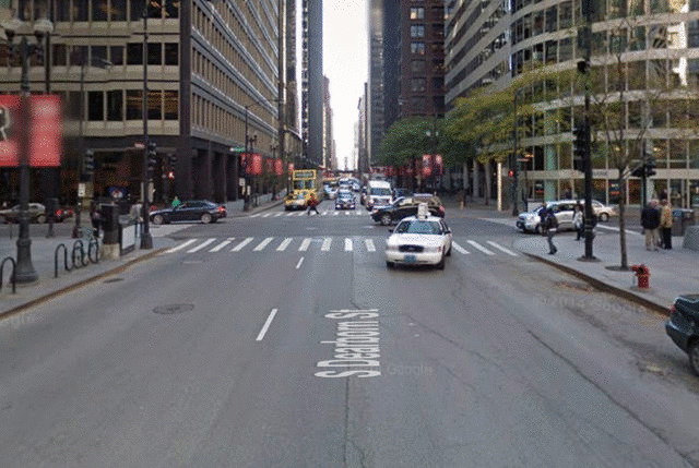
The creation of the Dearborn Street two-way protected lane involved the conversion of one of the three travel lanes on this overly wide thoroughfare. Bicycle traffic on the street has more than doubled since the lanes went in and, thanks to dedicated bike signals, stoplight compliance increased by 81 percent.
This post is made possible by a grant from the Illinois Bicycle Lawyers at Keating Law Offices, P.C., a Chicago, Illinois law firm committed to representing pedestrians and cyclists. The content is Streetsblog Chicago’s own, and Keating Law Offices neither endorses the content nor exercises any editorial control.

Read More:
Streetsblog has migrated to a new comment system. New commenters can register directly in the comments section of any article. Returning commenters: your previous comments and display name have been preserved, but you'll need to reclaim your account by clicking "Forgot your password?" on the sign-in form, entering your email, and following the verification link to set a new password — this is required because passwords could not be carried over during the migration. For questions, contact tips@streetsblog.org.