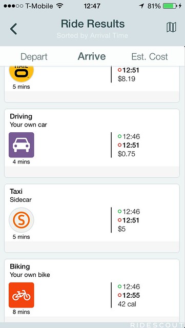
The number of transportation choices available to Chicagoans continues to grow, particularly as shared options like car-sharing and Divvy bikes become ever more popular. Yet these options can turn the simple act of planning a trip across town into a complicated exercise that requires weighing multiple factors, like cost, convenience, time, and ever-changing availability. RideScout, a new app that was recently updated to include Chicago, presents numerous transportation choices all within a single smartphone screen. After factoring in your origin, destination, and the time of day, RideScout compares choices like walking, bicycling, Divvy bike-sharing, Metra, CTA trains and buses, taxis, Zipcar, and SideCar shared rides.
Transit industry specialists have long sought to create such a "multi-modal trip planner," or MMTP. The familiar Google Maps – both on the web and on smartphones – is probably the largest provider of trip directions, but its interface makes it difficult to compare trips across different modes. OpenPlans, parent of Streetsblog, has developed OpenTripPlanner, which is used by Portland's TriMet agency. Our own Regional Transportation Authority developed Trip Planner (launched as "GoRoo") in 2010, which gave directions to 3.4 million users in 2013, even without a smartphone app.
RideScout aims to make it easier to quickly understand all of the available choices for getting around town. CEO Joseph Kopser calls it an app that "optimizes cities" by making the necessary travel calculations for its users.
RideScout is the only MMTP app that includes Zipcar as an option, for users within walking distance of an available car. Right now, that walking distance is set at 1/3 of a mile, but in the future they'll let users choose how far they want to walk. Additionally, he said that the app will soon look to see if there's a bus or train to take you to a Zipcar – a feature that might be especially useful in bad weather, or if the nearest Zipcar has already been checked out.
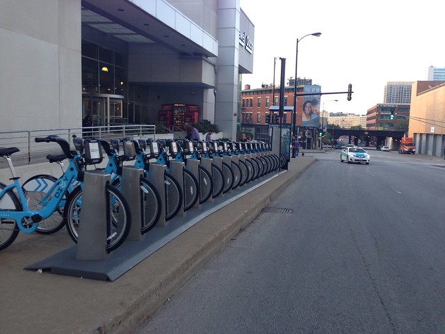
One recent RideScout improvement based on user feedback was adding "dock block prevention" for Divvy riders. "We give you an update along the way," Kopser explained, "and the app will ding at you" if your destination Divvy station fills up while you're en route. "At the next stop sign, you can look at the alert, and get new directions" to a nearby station that still has docks or bikes available.

RideScout, like other multi-modal transportation planners, still relies on imperfect algorithms to figure out trip options. Elizabeth Edwards emailed Streetsblog recently about what RideScout and Google Maps had suggested for her trip. Edwards used to spend a "white-knuckled hour" driving twice a week from Rogers Park to Hyde Park via Lake Shore Drive, saying, "there HAD to be a way to make the commute by transit and have it be... less stressful and [more] cost effective."
Edwards looked up Metra timetables and "figured out that I could take UP-N from Rogers Park to Ogilvie, and then Metra Electric from Millennium to 55th-56th-57th." She signed up for Divvy to easily make the short trip across downtown, between the Ogilvie and Millennium stations. However, "No trip planners that I consulted would ever suggest this route (or the reverse)," Edwards wrote, citing Google Maps in particular. Edwards suspects that Google Maps, which isn't flexible enough to consider Divvy, can't find a good route "to cover the mile between stations in under 20 minutes." She hasn't checked RideScout during the times she needed to get from Rogers Park to Hyde Park, but added that she has "yet to see Metra displayed as an option, in the couple of times I've checked RideScout for rides."
Yet an app can only do so much to completely optimize the city's many transportation options. Chicago's transportation providers, like transit agencies and Divvy, need to do their part as well. They need to better communicate information to current and potential riders, beyond feeding data to apps like RideScout.
Transportation providers also need to provide physical links and cues to facilitate the growing number of multimodal connections being made. CTA subway stations could include signs showing passengers which exit leads to a Divvy station. (Sean Wiedel, the Chicago Department of Transportation's Divvy program manager, said he would bring this up with CTA at their next meeting.) Plenty of people who currently wait in long taxi queues outside downtown Metra stations might be better served taking CTA, but aren't currently directed to.
The RTA recently allocated $5 million to market CTA, Metra, and Pace services to new riders, twice as much as it had previously allocated for signage informing passengers of connections between services. Which expenditure is more important?
Even the most optimized app, or the many new private services, like Blackline or Lyft, can only improve the travel experience for a select few riders. The public agencies who run our transit and manage our streets have to do their part, too, to facilitate multi-modal connections all the way across town.


