Logan Square Reimagined presentation and tour discussed the factors and thinking behind the street makeover


The large traffic circle in the Logan Square neighborhood, where Milwaukee Avenue, Kedzie Avenue and Logan Boulevard / Wrightwood Avenue meet, underwent a massive transformation last fall. After decades of planning, the Chicago Department of Transportation completed a major revision of the confusing, high-speed corridor, pedestrianizing the portion of Milwaukee Avenue that sliced through the circle and uniting the green spaces that house the Centennial Monument, aka the “Magic Eagle” pillar, and Comfort Station arts space. Kedzie Avenue has been relocated northeast of the Logan Square Blue Line CTA Station, creating a pedestrian plaza between the station and neighboring businesses to the east. Off-street bike paths, curb bump outs, pedestrian refuge islands and new signaled crossings were added. Travel lanes for driver are reduced, and vehicles now travel both clockwise and counterclockwise around the circle, completely changing how people on four wheels, two wheels and on foot flow through the complex hub.
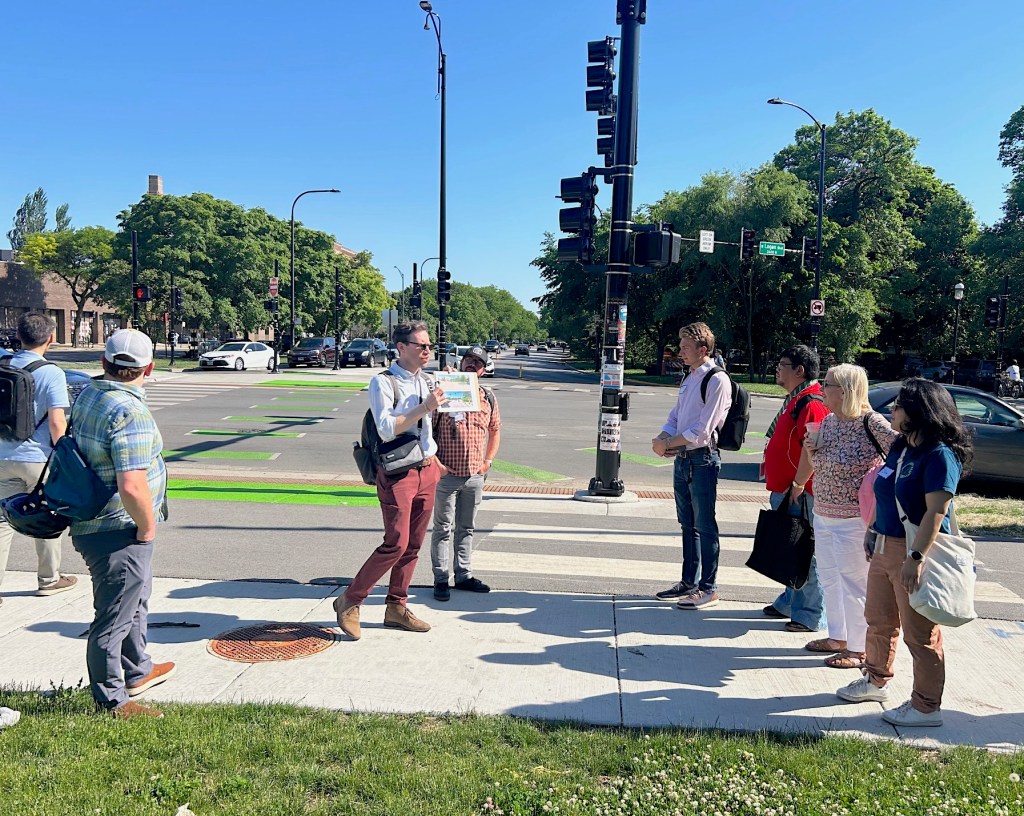
Last Wednesday, representatives from the Chicago Department of Transportation and Jacobs, the engineering consulting firm on the project, led a walk-through of the redesign as a lead up to the Transport Chicago conference on June 12. About two dozen attendees gathered at Reno, a restaurant located on Kedzie just north of the monument, for the tour. CDOT engineer Dave Miller, who oversaw the project, Jacobs engineer Craig Jakobsen, and landscape architect Nilay Mistry gave a short presentation on the history the area and the evolution of the redesign.
Miller explained that Logan Square is the fifth in a series of streetscape projects along Milwaukee Avenue and the “crown jewel” in terms of vision and scope. He thanked the business owners around the circle for their patience through a construction period that stretched across two years.

Jakobsen then provided a brief history of the area. In 1929, the Blue Line ran at street level to the Logan Square station, which was terminus of the line. The surrounding concrete lot was envisioned as a bus station. In 1970, the Blue Line was relocated underground and extension of the train line toward O’Hare began. Plans to close Milwaukee Avenue through the circle and reroute Kedzie to create a plaza date back to a proposed project celebrating the Illinois Bicentennial, initiated in 2011.
Jakobsen said the original plan was to keep the one-way flow of cars. But a traffic study found two-way travel would alleviate the snarl of congestion on the west side of the circle where it connects with Wrightwood, and better match travel patterns for drivers heading north on Kedzie.

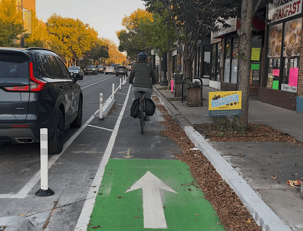
A two-way shared bike and pedestrian path was added around the perimeter of the island. New dedicated off-street bike paths demarked with bright green paint run next to the sidewalk on the north side of Logan Boulevard, continuing north on Milwaukee and on both sides of the relocated stretch of Kedzie. Jakobsen said the service drive on Kedzie south of the circle was considered a bike facility by the planers. The service drives on northbound Kedzie and eastbound Logan now end in a cul de sac, quieting traffic in these areas and simplifying the intersections.
One of the most striking images in the presentation was a color-coded map illustrating the amount of non-roadway area was gained around the square. It is an almost unheard-of reallocation of space away from cars and to people and hopefully one of many.
Mistry then spoke about the design process for La Placita, the new people space created by relocating Kedzie north of the monument. To celebrate the longtime Logan Square Latine community, the plaza’s design was inspired by public spaces from several countries in Latin America, as seen in weaving pattern motifs in the paving stones and benches designed to eventually be spaces for mosaics by local artists. The courtyard more than doubled the available space for outdoor restaurant seating and created a space for artisans to pop up markets as an extension of the very busy Sunday farmers market, now housed on the pedestrianized section of Milwaukee Avenue.

The presentation concluded with enticing renderings of a new canopy to be built over the CTA station, which will completely cover the waiting area for buses. This project is bundled with a future gazebo that will cover the stage in La Placita, providing much needed shade. The timeline on these projects has not yet been announced.

On the walking tour Miller and Jakobsen noted major improvements in pedestrian infrastructure including new refuge islands on the north and west sides of the circle, more prescriptive turn arrow traffic signals, and Audible Pedestrian Signal buttons at crossings for people with visual impairment.
Streetsblog contributor Lisa Phillips noted that people biking northbound on Kedzie and continuing east on Logan must now make four crossings to use dedicated bike facilities on their route – a zigzag that takes more time than simply sharing the lane with motorized traffic. The lack of off-street bike path or dedicated bike lane on the west side of the circle, between Milwaukee Avenue and Kedzie south of the monument, creates ambiguity about the path people on two wheels should take. I saw many folks on scooters and bikes divert to the sidewalk to cross Wrightwood and continue onto the Kedzie service drive. I observed a few briefly diverting to the traffic lane to do so.
I asked Miller what the intended path for bikes and scooters is at this section of the circle. He replied that constraints, including public commitments for the project to be parking neutral – neither adding nor taking away parking spaces – dictated that design focus on optimizing the most used bike route of Milwaukee Avenue.
One such optimization was the addition of bike signals on the north side of the circle, one of the few outside downtown. People on bikes can still cut through the circle on concrete pavers stamped to resemble wood planks – a nod to the route’s history as Old Plank Road – or ride on the off-street path on the north side of the street.

Jakobsen said the project has decreased vehicle volume and calmed motorized traffic. Overhead cameras have been stationed at key points to collect counts of vehicles and bikes for further analysis.
Mistry then guided the group through La Placita, noting that the lack of trees at the south end of the plaza was due to mandatory CTA setbacks and underground utilities. Existing planters were widened to create a little more green space. Mistry said the plaza does not have a Special Service Area to fund planting maintenance. CDOT is responsible for the beds, which is why they chose to use limited, low-maintenance plantings.
Temporary jersey barriers at the north end of La Placita have been brightly painted by local artists. Mistry said the design team is considering how permanent protective barriers could similarly reflect the community.

The tour concluded at the CTA station, where Mistry described how the larger canopy will better shelter people waiting for buses. The mosaic pavers in La Placita will also appear in the renovated train station and new wayfinding signs will be installed.
The group then headed back to Reno for a happy hour, passing a fully occupied set of bike racks on the way.

On November 12, SBC launched our 2026 fund drive to raise $50K through ad sales and donations. That will complete this year’s budget, at a time when it’s tough to find grant money. Big thanks to all the readers who have chipped in so far to help keep this site rolling to the end of 2026! Currently, we’re at $33,461 with $16,539 to go, ideally by the end of May.
If you value our livable streets reporting and advocacy, please consider making a tax-deductible gift here. If you can afford a contribution of $100 or more, think of that as a subscription. That will help keep the site paywall-free for people on tighter budgets, as well as decision-makers. Thanks for your support!

Streetsblog has migrated to a new comment system. New commenters can register directly in the comments section of any article. Returning commenters: your previous comments and display name have been preserved, but you'll need to reclaim your account by clicking "Forgot your password?" on the sign-in form, entering your email, and following the verification link to set a new password — this is required because passwords could not be carried over during the migration. For questions, contact tips@streetsblog.org.