Why would the safe streets plan for Francisco between Lawrence and Ainslie be eliminated?

Update 12/2/23, 8:45 AM: On Friday December 1, Ald. Vasquez’s spokesperson Alison Murphy emailed 40th Ward constituents to say there will be a community meeting about the Francisco Avenue plan on Tuesday, December 12th, 5:30 p.m., at Lawrence Hall [4833 N. Francisco]. “Representatives from CDOT will give a presentation on the design and respond to the questions and suggestions brought forward by the community over the past few weeks,” Murphy wrote. “After the presentation, we will have a Q&A session, which our office will facilitate… If you have any questions or concerns in advance of this meeting, feel free to reach out to me.”
Carl Beien is an organizer with Chicago, Bike Grid Now!, which advocates for a citywide network of bike-priority residential streets, and holds Bike Jam rides to call attention to the campaign.
A critical planned safe streets improvement in Lincoln Square is at risk of being cancelled by Ald. Andre Vasquez (40th) who is usually a reliable advocate for safe streets and sustainable transportation. The planned improvement that’s at risk is a change to the direction of Francisco Avenue (2830 W.) between Lawrence (4800 N.) and Ainslie (4900 N.) avenues from one-way southbound to one-way northbound. Much like the backlash against similar initiatives, opponents are begging the alder to scuttle the project.
Some reasons for Ald. Vasquez’ decision about Francisco are understandable. He’s received complaints from constituents about the Chicago Department of Transportation’s current streetscape project on Lawrence between Western Avenue (2400 W.) and the North Branch of the Chicago River (2900 W.)
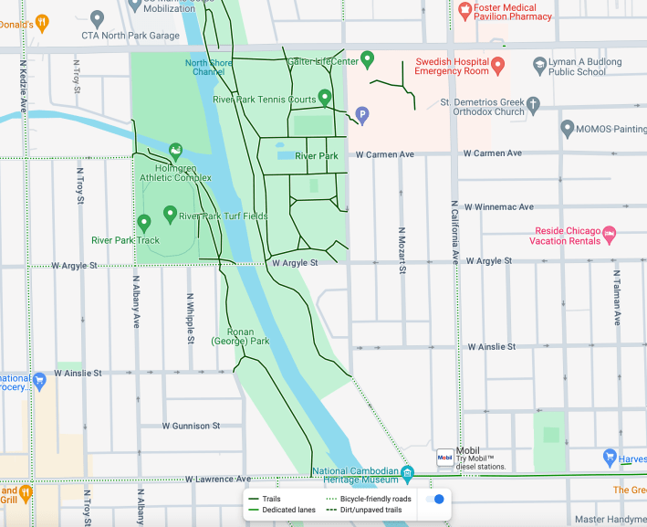
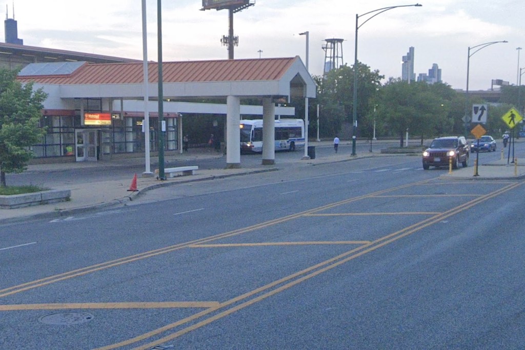
That project, which broke ground last December, includes a short stretch of contraflow bike lane on Francisco that will make it a little easier to get to and from the North Shore Channel Trail, which runs along the river and channel. (The two waterways split a couple blocks north of Lawrence.)
The Lawrence streetscape with be a huge improvement when it finished, but the project isn’t scheduled to end until spring 2024, and the avenue is still in rough shape nearly a year after the groundbreaking. The time between tearing up sidewalks and pouring concrete seems inordinately long, inconveniencing everyone.
And road closures have sometimes required redirecting traffic down alleys and the wrong way on side streets, at times with no signage at all. This has led to lots of Facebook complaints about the project tagging Ald. Vasquez
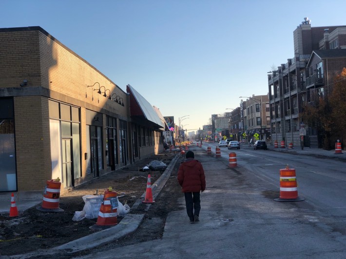
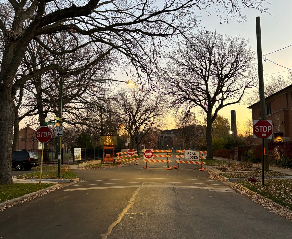
Another reason why some of Vasquez’s constituents are up in arms about permanently changing the direction of the 4800 block of North Francisco from southbound to northbound is that CDOT was sloppy about rolling out a pilot of the redesign. The department placed barricades with “Do Not Enter” and “Road Closed” signs at Ainslie/Francisco (see the photo at the top of this article) with no messaging to neighbors and no other enforcement strategy.
Unsurprisingly, drivers have been simply going around the barriers, perhaps because they look like insincere “road closed due to construction” signs. That contributes to the Lawrence streetscape operational problems.
But other arguments against the permanent redirection of Francisco are unsubstantiated, such as claims this project will hurt pedestrians. On the contrary, this project would resolve longstanding safety issues, and the street redesign would be in line with global best practices.
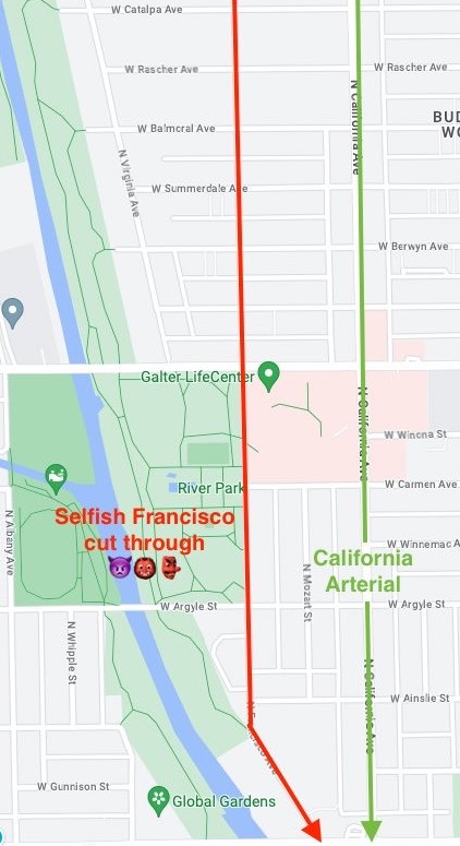
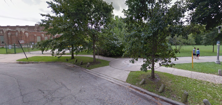
Users of the North Shore Channel Trail are likely familiar with Francisco north of Lawrence since it is an access point to the south end of the trail. However, this stretch of Francisco is particularly dangerous for people on foot and bikes because it is part of a common neighborhood cut-through route for drivers.
To illustrate the extent of the problem, I recently observed a nearby intersection, and saw 51 motorists pass in the 15 minutes between 4:45 and 5 p.m. on a weekday. Not only is this an inappropriately high traffic volume for a neighborhood street but, predictably, not a single driver even came to a complete stop at the stop sign.
The the redesign of the 4800 block of North Francisco is an inspiringly comprehensive solution to prevent dangerous and inconsiderate driving. The plan reinforces both the nascent Bike Grid and the advocacy group Better Streets Chicago’s recently announced campaign for “Community Blocks.” Inspired by Barcelona’s successful Superblocks program, Community Blocks would dramatically reduce neighborhood cut-through traffic.
If the Francisco change was made permanent, drivers would no longer be able to speed all the way to Lawrence. Doing so would reduce traffic volumes and calm traffic. It would also make other popular nearby cut-through side-street routes less appealing to drivers trying to avoid using main streets, like they’re supposed to. Along with endangering vulnerable road users, cut-through traffic makes residential streets less peaceful and pleasant to live on.
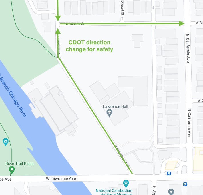
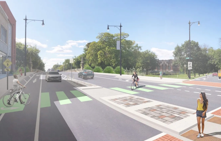
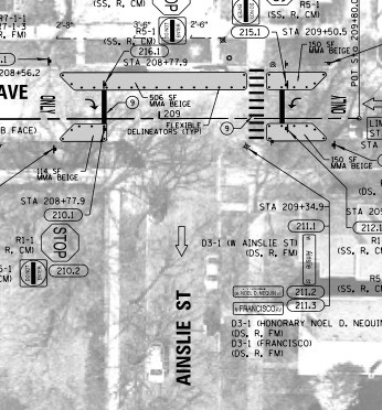
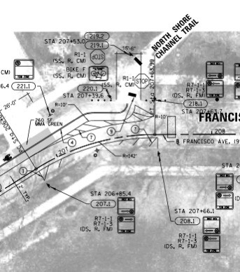
Implementing the Francisco change, however, is difficult in part because drivers often pay so little attention to the road that they may now collide with oncoming traffic. In order to reduce the risk posed by distracted or otherwise reckless driving, CDOT has proposed several street design changes.These include expansive curb bump-outs at the intersection of Ainslie and Francisco; adding reflective signage on those bump-outs; the bidirectional bike lane along Francisco; and a pedestrian refuge island on Lawrence.
While regular Streetsblog readers may learn of these proposals and feel that CDOT is finally embracing world class safe streets infrastructure, some neighbors confusingly claim the direction change will put pedestrians at risk. While Ald. Vasquez has recently stated that he shares their concerns about pedestrian safety, it is difficult to understand exactly how pedestrians would be put at risk by all of these safety improvements.
The only clear risk to anyone is if drivers fail to notice the headlights of oncoming cars at Francisco and Ainslie. So it is mystifying that Ald. Vasquez has described this risk to constituents as a “pedestrian” problem that could warrant cancelling of the direction change. This is especially confusing because many cities have solved this problem with prominent, concrete modal filters, such as large, decorative planters in the intersection.
Ald. Vasquez has asked CDOT to redo its due diligence in order to convince him that this redesign is safe, and he has promised to hold a community meeting to discuss CDOT findings. Encouragingly, after many calls from people who support redirecting Francisco, Ald Vasquez has already shown that he may be amenable to keeping, and even expanding, the safety improvements on Francisco, even as far north as at Foster (5200 N.)
Overall, this is a story of an alderperson trying to do his best for a wide array of constituents, and a dedicated effort by safe streets advocates to change Chicago for the better. However, the work is not yet done. There is one outstanding and sincere concern related to space for school buses at Lawrence Hall, 4833 N. Francisco, a home for at-risk youth. However, Ald. Vasquez must not be allowed to conflate Lawrence Hall’s needs with the baseless claims that the permanent direction change would pose a risk to pedestrians.
For these reasons, Streetsblog readers, nearby residents, and users of River Park and the North Shore Channel Trail are encouraged to continue lobbying Ald. Vasquez to move forward with the direction change on Francisco. They should also consider attending any upcoming community meetings to similarly voice their support.

Did you appreciate this post? Please consider making a tax-deductible donation.

Streetsblog has migrated to a new comment system. New commenters can register directly in the comments section of any article. Returning commenters: your previous comments and display name have been preserved, but you'll need to reclaim your account by clicking "Forgot your password?" on the sign-in form, entering your email, and following the verification link to set a new password — this is required because passwords could not be carried over during the migration. For questions, contact tips@streetsblog.org.