County, CDOT hosted bike ride to look at the strengths and weaknesses of SE Side bike infrastructure
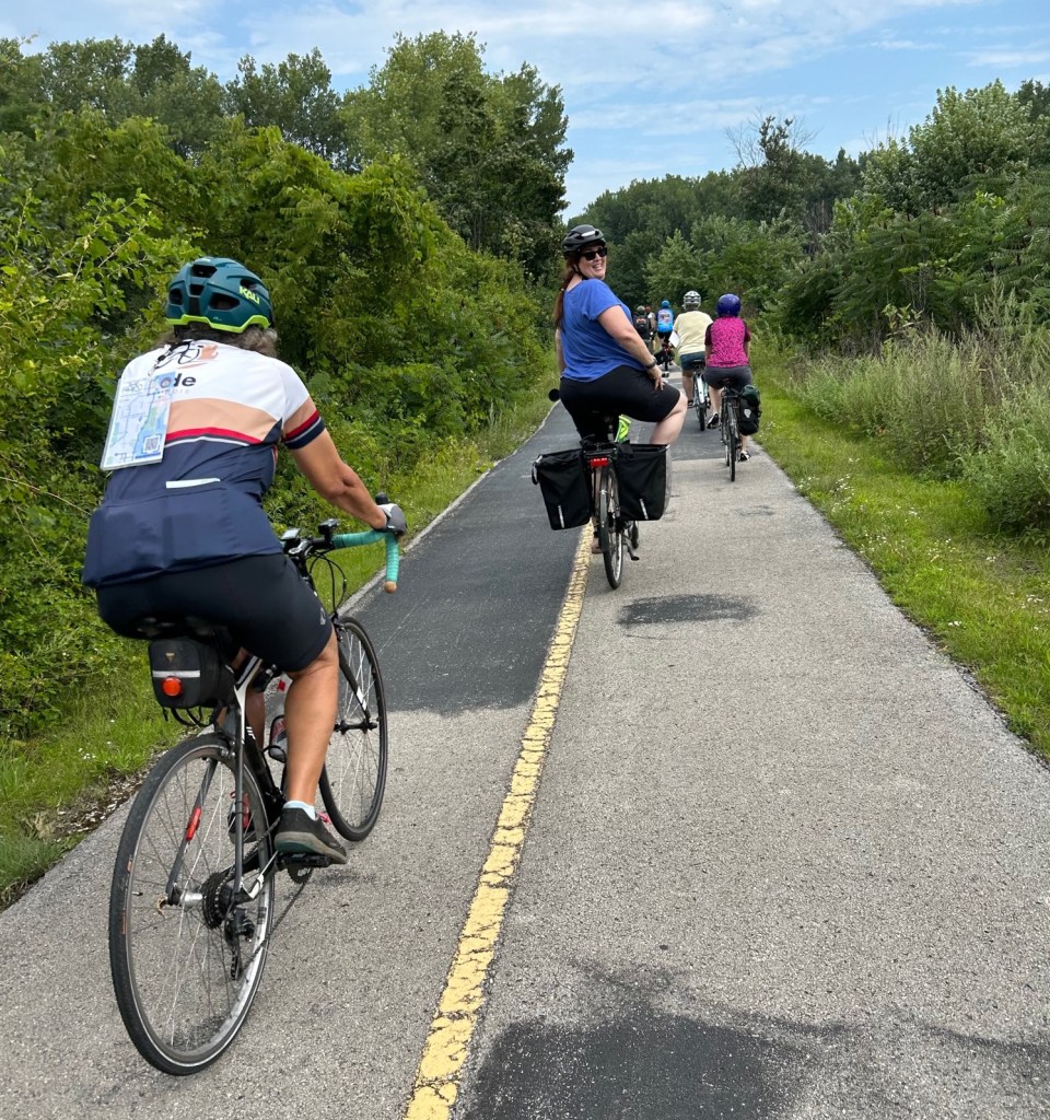

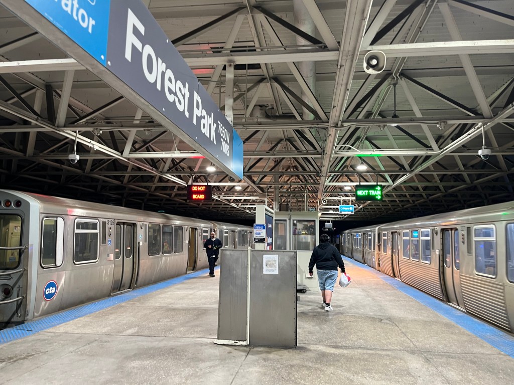
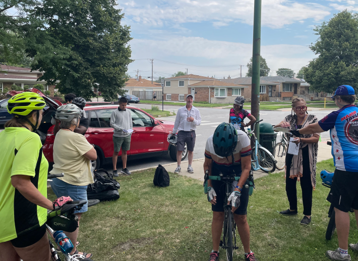
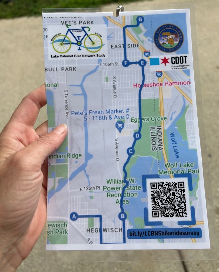
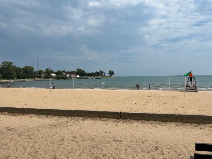
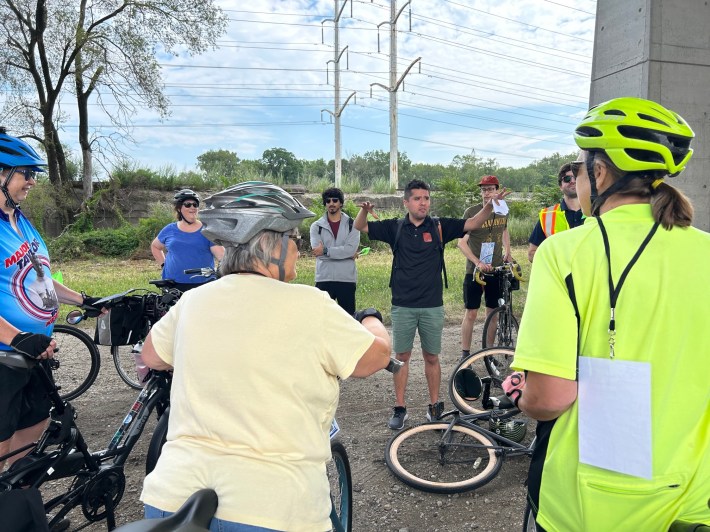
Last Saturday, as part of the Lake Calumet Bike Network Study, the Cook County Department of Transportation and Highways (DoTH) and the Chicago Department of Transportation hosted a bike tour through Chicago’s Southeast Side to get feedback from riders about how to make cycling safer. Participants gathered at the Henry Booth House community center, 2725 E. 130th St. in Hegewisch, and rode to Calumet Park Beach, 9801 S. Avenue G. After that, the riders had the option of either going off on their own or following one of the tour leaders back towards the starting point in Hegewisch.
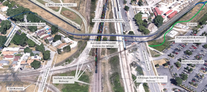
“The basic idea is, around Lake Calumet there are a number of new facilities and a number of planned facilities which will happen – The Burnham Greenway [Multi-Modal Connector] will probably get completed around 2027-ish,” said Benet Haller, transit manager at DoTH said at the event. “Connecting 111th street to a trail across Lake Calumet. How do we take residential streets that are relatively low stress, sidepaths, trails and connect it all together into a complete, low-stress network?”
“We want to see how we can connect to adjacent communities to the south, like Calumet City, Dolton, Burnham and Riverdale, Haller added. “Today, we’re testing one route where there are sections that are good and sections that are not so good. We want to look at the entire 34-square-mile study area and see how it becomes a complete and useful network.”
“We’ve tried to do our outreach for the bike plan in a variety of ways,” Haller said. “And clearly, if you’re gonna talk about a bike plan, it’s very helpful to actually bike… One of the things that this illustrates, is that there aren’t all that many places we could do a long bike ride safely right now.” He said biking through the area highlights gaps in the bike network, and the need to continually upgrade paths to keep them in good working shape.
Alan Oviedo from the communication firm Rudd Resources led the seven-mile ride. Loaner bikes were available, and free bike lights and whistles were offered to riders. Oviedo said the starting point at the Henry Booth House was to “signify local points of interest. We see businesses, libraries nearby. We’ll get a feel of riding through the neighborhoods, through the forest preserve and get a sense of what would be beneficial to work on for bikers and pedestrians.”
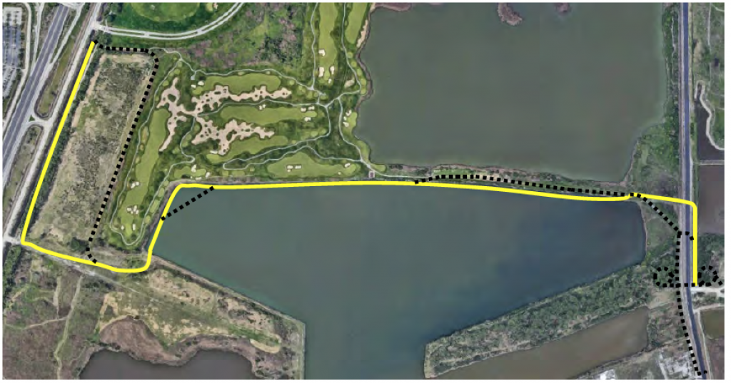
The ride took side street routes with well-worn shared-lane markings to the beautiful Burnham Greenway, which runs along Wolf Lake, before heading north on the trail to the East Side community.
One of the participants was Blue Island resident and bike advocate Jane Blew Healy, who works at St. Francis de Sales High School, 10155 S Ewing Ave., which the ride passed by. She said she takes her students and environmental club on the Calumet Park pedestrian paths.
Healy said the Burnham Greenway at its northern segment in Beniac (John “Beans”) Greenway Park, 3925 E 104th St., “is getting really rough and irregular. It really needs some improvement.” She also said that when the trail ends at the complex intersection of 100th Street, Ewing Avenue, and Indianapolis Boulevard west of Calumet Park, “it’s friggin’ terrifying on foot and bike.”
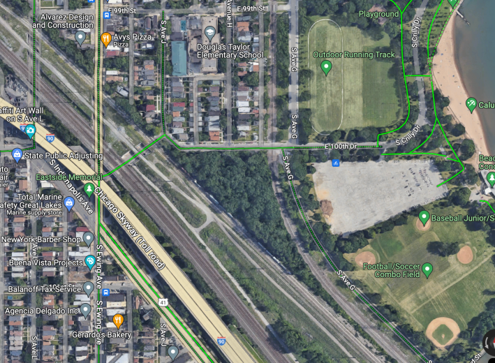
“It’s always difficult when trails merge into sidewalks and under bridges,” said rider Thomas Canty. “That was a challenging area… where Ewing and Indianapolis kind of merged. That’s a really busy intersection. So trails there will have to be marked and made safe for bikers.”
Oviedo said the study is looking at creating low-stress side street routes and protected bike lanes on larger roads to connect greenways and new trails, as well as to create connections to the south suburbs.
One attendee said she would like to see the Major Taylor Trail, located on the Far Southwest Side, connect with Altgeld Gardens and Wolf Lake. Several expressed the need for bike-pedestrian facilities on highway-like 130th Street in the Riverdale community area, which includes the Altgeld Gardens housing project.
There will be another bike tour to check out Southeast Side bike facilities for the study on Saturday, September 23, at 10 am, starting at Chicago State University, 95th Street and King Drive.
Take the Lake Calumet Bike Network Study survey here.

Did you appreciate this post? Please consider making a tax-deductible donation.

Streetsblog has migrated to a new comment system. New commenters can register directly in the comments section of any article. Returning commenters: your previous comments and display name have been preserved, but you'll need to reclaim your account by clicking "Forgot your password?" on the sign-in form, entering your email, and following the verification link to set a new password — this is required because passwords could not be carried over during the migration. For questions, contact tips@streetsblog.org.