Traffic calming around Chicago schools and parks
This post also runs on Steven Vance’s personal blog Steven Can Plan.
Reducing the number and speed of drivers near schools and parks is a proven way to reduce the number of traffic crashes involving children, part of the practice known as “traffic calming.” In Chicago a key way to do that has been to “cul-de-sac” (which I’m using as a verb) a street to prevent drivers from using the street as a cross-town “cut through” route and discourage speeding.
My study of this subject was inspired by the above tweet, where the person is accurate when they say turning a crosswalk into plaza with u-turns for drivers on either side “works with any street.” Indeed: Full access to the school or park and to every property on the block is maintained, but people driving are not able to pass through the plazas while people on foot and bike can (another practice called “modal filtering.”)
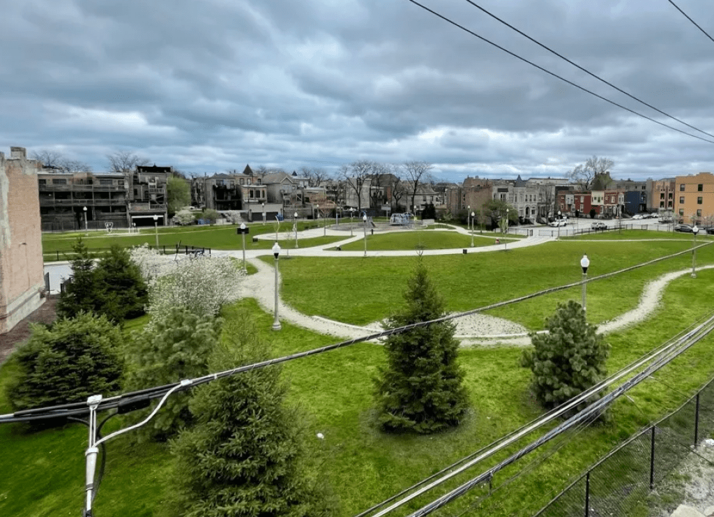
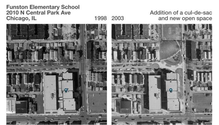
My favorite example in Chicago is Hadiya Pendleton Park, at 4345 S. Calumet Ave. in the Grand Boulevard community. This project created two mid-block cul-de-sacs and a park in the middle of a block, using vacant city-owned land on both sides. Creating new open space is a common corresponding outcome of the cul-de-sac application. That’s what happened at Funston Elementary School, 2010 N. Central Park Ave. in Logan Square, as you can see in the before-and-after photos aerial below.
On Twitter I asked for additional examples of places where the city has created traffic calming near schools and parks using cul-de-sacs. I got suggestions from Roland, Emily (who mentioned Funston), Matt, Steven, and this person:
Using OpenStreetMap, Overpass Query Language, and Overpass Turbo, one can find all of the schools and parks that are within a specified distance of a cul-de-sac. It turns out there are 153 schools and parks in Chicago that are within 150 feet of a cul-de-sac. (This only considers schools, parks, and cul-de-sacs, tagged as “turning circles,” currently mapped in OSM, and I have not verified each of the 153 instances.)
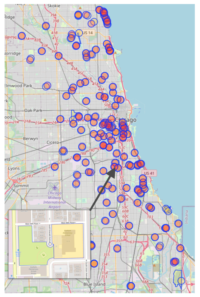
The map and data analyzed in this post was based on information added to OpenStreetMap, the Wikipedia of maps. If a cul-de-sac, park, or school is missing it can be easily added – please email Steven at svance[at]streetsblog[dot]org to let him know.

Did you appreciate this post? Please consider making a tax-deductible donation.

Read More:
Streetsblog has migrated to a new comment system. New commenters can register directly in the comments section of any article. Returning commenters: your previous comments and display name have been preserved, but you'll need to reclaim your account by clicking "Forgot your password?" on the sign-in form, entering your email, and following the verification link to set a new password — this is required because passwords could not be carried over during the migration. For questions, contact tips@streetsblog.org.