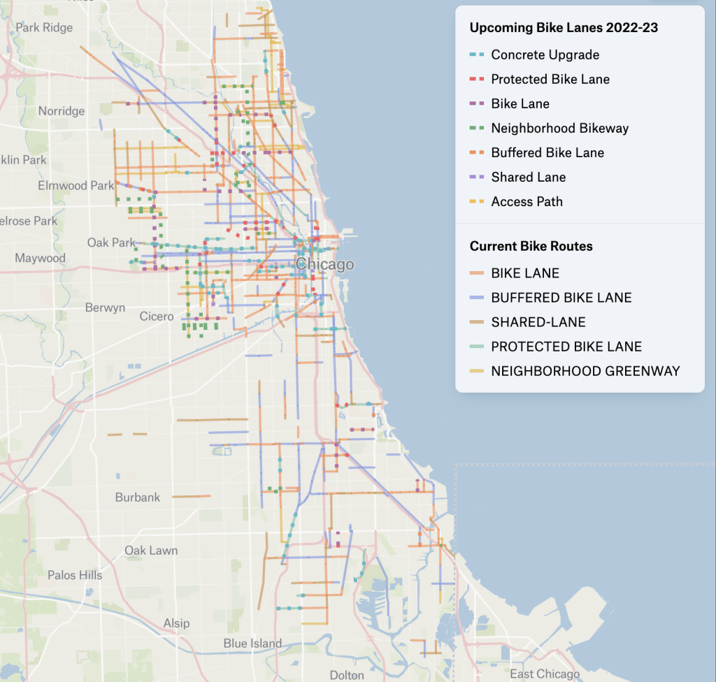
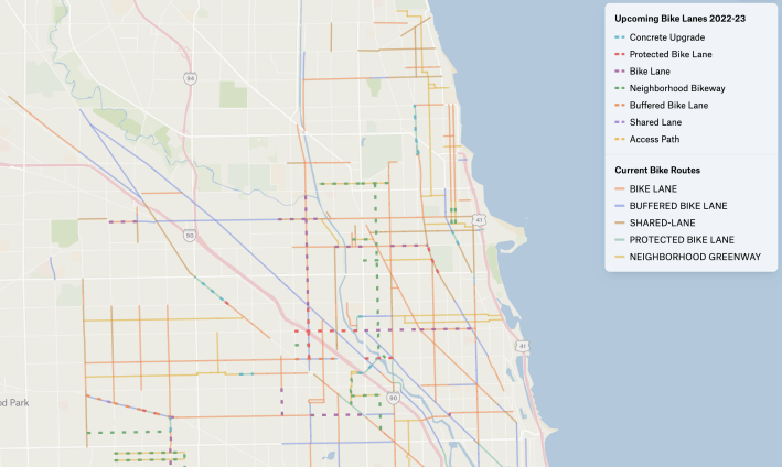
Check out the colorful Chicago Current and Upcoming Bike Lanes map
Here at Streetsblog Chicago we like to inform our readers about other efficient and/or cool ways to keep up with local urban planning efforts.
Just last night I heard from Sean MacMullan, a volunteer for Ald. Carlos Ramirez-Rosa’s (35th) participatory budgeting process who does civic tech volunteering through the group Chi Hack Night. As part of a project looking at new infrastructure across the city, MacMullan has geocoded upcoming Chicago Department of Transportation bike network data and created the nifty Chicago Current and Upcoming Bike Lanes map shown above.
You can go to the map’s Felt.com page for a larger interactive version of the document.
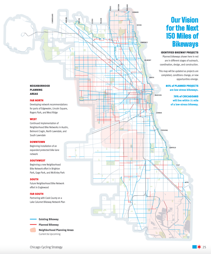
Granted, you can view a very similar CDOT map, Our Vision for the Next 150 Miles of Bikeways, in the city’s recently published Chicago Cycling Strategy report. But this CDOT document only shows which bikeways are existent (blue) and which are planned (red.) However, you can dig deeper into the report to get more info about what kind of bikeways have been installed or are planned where.
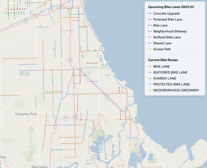
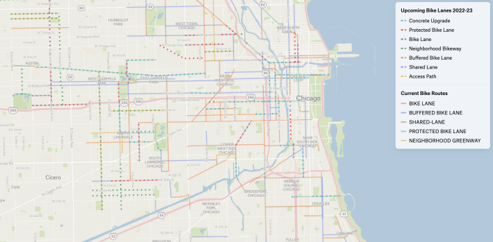
Meanwhile, the CCUBL map lets you easily see, via a more complex color code, where there are currently, or plans for, diverse types of bikeway improvements. These include concrete upgrades, protected bike lanes, (non-protected) bike lanes, Neighborhood Bikeways (bike-friendly residential streets), buffered bike lanes, shared bike lanes (aka “sharrows”), or an access pass.
One issue that both maps highlight is that current bikeway access, and/or definite plans for improvement, are currently meager in many parts of town, or even non-existent. (Looking at you, Mount Greenwood neighborhood on the Far Southwest Side.) But on the bright side, the CDOT map does designate Neighborhood Planning Areas in pink on the Far North, West, Southwest, South, and Far South Sides, plus downtown, where things are in the process of getting better, generally due greater opportunities for community input on bikeway planning.
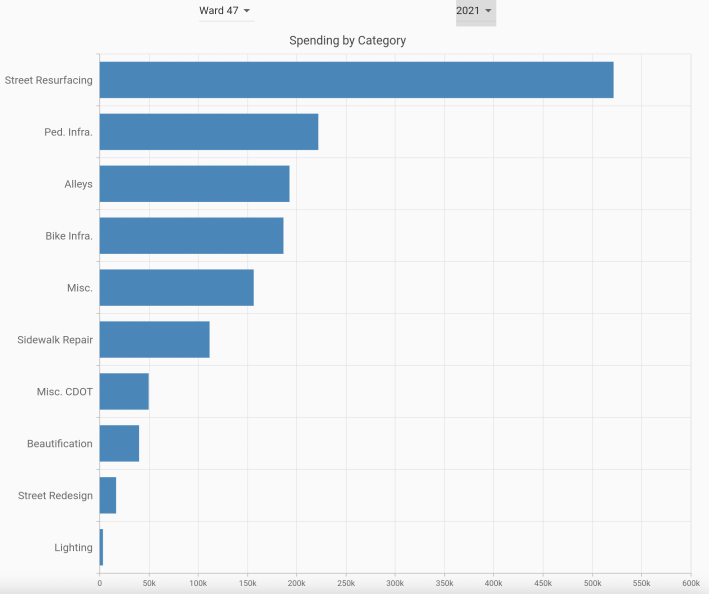
If you want to see more of MacMullan’s urban planning-related work, check out his recent collaboration with Hack Night colleagues, charts that show infrastructure spending data for all 50 wards from 2019-2022. MacMullan geocoded the data, Sajid Ali implemented the project code management system, Harry Brisson made the prototype website, and Jonathan Ortega made the latest visualization. This info is also available as a Felt.com map.
MacMullan asked Streetsblog to add this call for action for our Readers. “If you would like to get involved with the project, you can attend Chi Hack Night and join the Ward Wise breakout group,” he said. “We meet weekly on Tuesday nights.”
“If you want more bike lanes in your neighborhood, reach out to your local ward office and make your voice heard!” MacMullan concluded. “Next year’s cycle of aldermanic menu spending is about to begin. Bike lanes are one of the project types your alderperson can fund.”

Read More:
Streetsblog has migrated to a new comment system. New commenters can register directly in the comments section of any article. Returning commenters: your previous comments and display name have been preserved, but you'll need to reclaim your account by clicking "Forgot your password?" on the sign-in form, entering your email, and following the verification link to set a new password — this is required because passwords could not be carried over during the migration. For questions, contact tips@streetsblog.org.