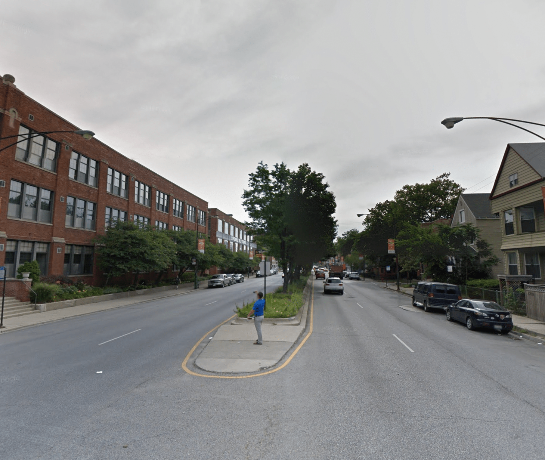
It was a terrible irony that retired CPA and 47th Ward volunteer Peter Paquette, 75, was fatally struck by a distracted driver last June while trying to cross the street at Irving Park Road (4000 N.) and Hoyne Avenue (2100 W.) in Chicago's North Center neighborhood. It's one of several intersections on the five-lane state-jurisdiction road where his friend local alderperson Matt Martin previously proposed installing pedestrian islands, only to have them vetoed by the Illinois Department of Transportation on the grounds that they would inconvenience drivers. Moreover, Paquette was killed immediately after an early voting rally at O'Donovan's tavern at Irving Park/Hoyne, attended by dozens of city and state politicians, including Governor J.B. Pritzker himself.
But hopefully it will be some comfort to the Paquette family to know that his story helped finally persuade IDOT to drop its opposition to pedestrian safety infrastructure on large roads throughout the city, which will help keep countless other seniors, children, and Chicagoans in general safer. In the wake of Peter's death, Martin and a few state legislators lobbied IDOT and the Chicago Department of Transportation to negotiate an agreement, announced Tuesday, that gives city officials much more latitude to make safety upgrades to intersections with state roads.
On Thursday the alder announced that, thanks to the state lifting its restrictions, the ward and CDOT are immediately moving forward with installing pedestrian islands, curb extensions, new crosswalks, and/or Rectangular Rapid Flashing Beacons at six intersections along Irving Park in the ward, including the one where Paquette was struck. The latter treatment, similar to a HAWK beacon, includes a push button that pedestrians can use to activate flashing lights on either side of a crosswalk, alerting drivers to the presence of people in the crossing. RRFPs are virtually nonexistent in the city of Chicago. All of these intersection improvements are slated for completion this year.
Irving Park Road pedestrian upgrades: red circles = existing stoplights; orange circles = new RRFB beacons; purple circles = new curb extensions; green circles = new pedestrian islands; black circles = new crosswalks.
47th Ward director of development and infrastructure Josh Mark walked Streetsblog through the plans for each of the six junctions, including three brand-new crosswalks. "Getting IDOT to agree to three new crosswalks on a road they treat like a highway is huge," he said.
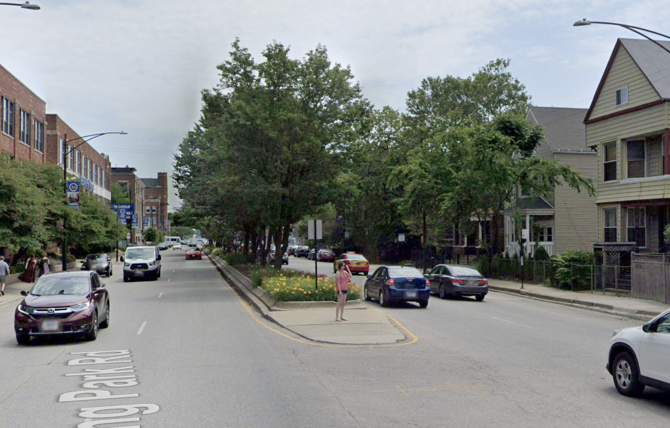
Irving Park/Hoyne (2100 W.)
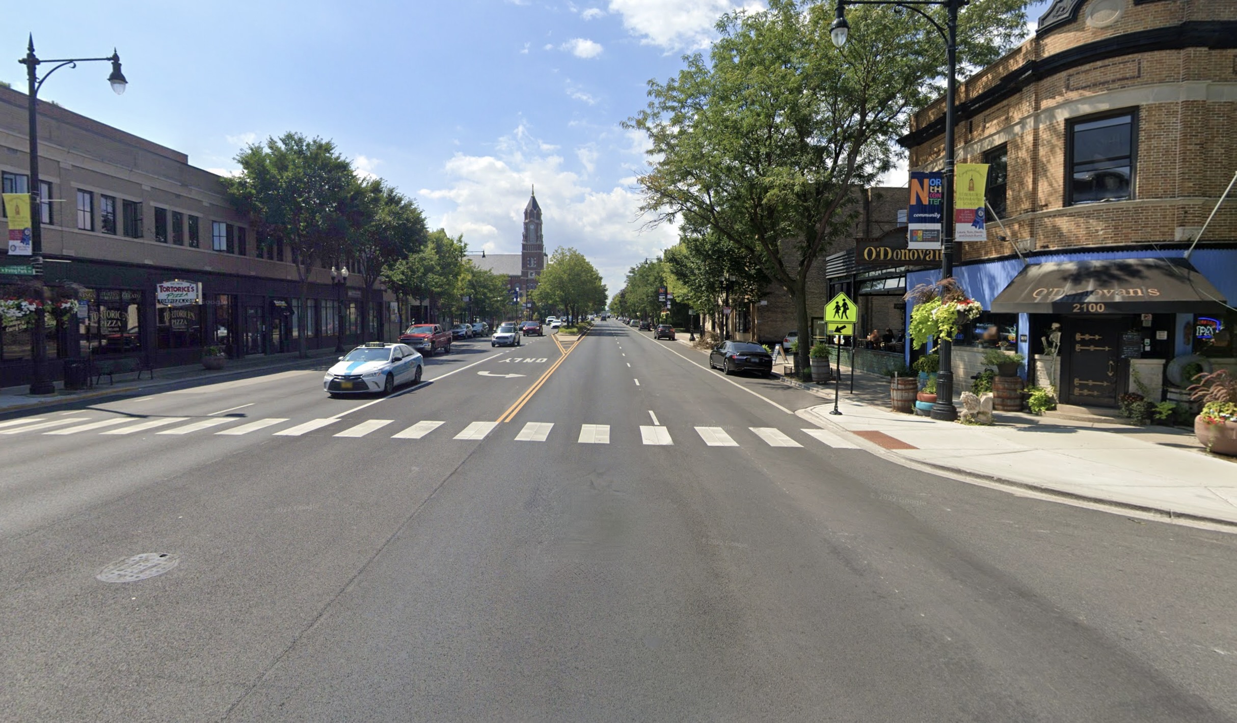
Two years ago curb extensions were built at this intersection, where an eastbound driver later struck Paquette, as part of a street repaving project. But, again, IDOT vetoed the proposed pedestrian island that might have saved the senior's life by allowing him to safely wait in the middle of the street for a break in eastbound traffic. That was due to the presence of an eastbound left turn lane onto Hoyne, a quiet residential street.
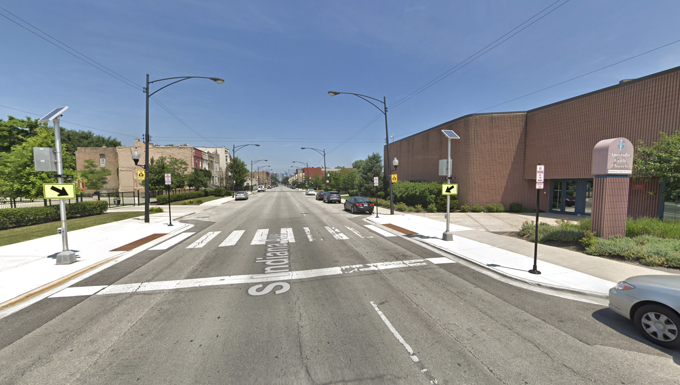
Left turns from eastbound Irving Park will be banned, and that turn pocket will be replaced by a pedestrian island for the west crosswalk, where Paquette was walking when the motorist hit him. Rectangular Rapid Flashing Beacons will also be installed. Mark said his understanding is that the only other location with RRFB in Chicago is at the mid-block crossing between Apostolic Faith Church, 3823 S. Indiana Ave. in the Douglas neighborhood, and its parking lot.
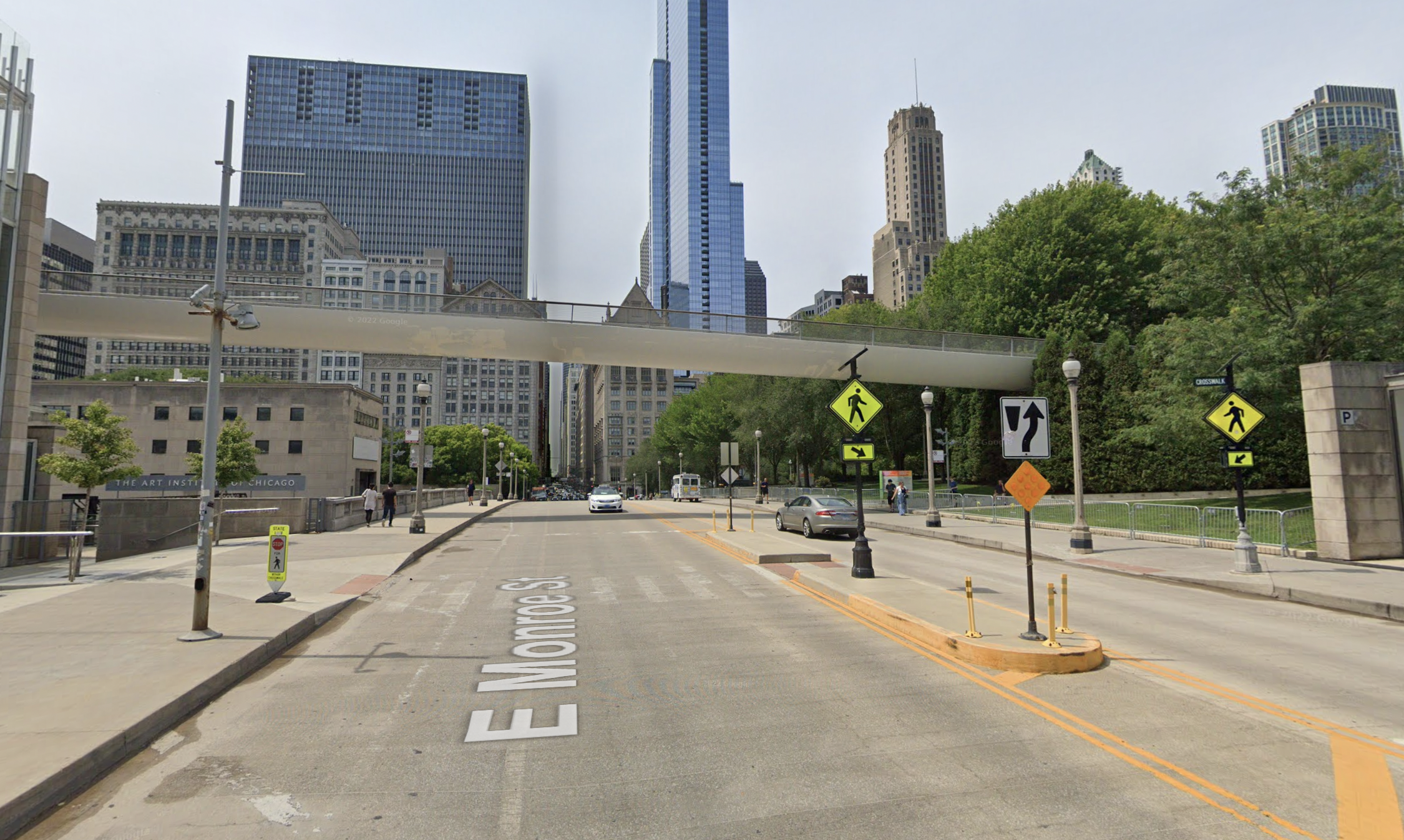
After publication of this piece, Streetsblog's Steven Vance reminded me that there are also RRFB at the midblock crosswalk on Monroe Street east of Michigan Avenue, between the Art Institute of Chicago and Millennium Park, under the pedestrian bridge, although we're not sure whether the beacons are still functioning.
Steven noted that the crosswalk and beacons were added after then-Chicago Tribune architecture critic Blair Kamin wrote, "Many pedestrians, as I observed Monday, cut across heavily trafficked Monroe, jogging, if necessary, to outrace approaching cars. This is an accident waiting to happen. The city either needs to approve the midblock crosswalk the museum wants or require the Art Institute to post signs directing pedestrians to the nearest street corners."
It's important to note that the beacons are not equivalent to a stoplight. Drivers are not required to stop when they see the flashing lights unless a pedestrian is in the crosswalk, as they would be mandated to do by Illinois law for people in any crosswalk that does not have RRFBs.
So while the beacons will help raise driver awareness of crosswalks, vulnerable road users should still be wary of the fact that, despite the state law, motorists often fail to stop for people in crosswalks, especially on multilane state roads like Irving Park where speeding is common. Even the flashing lights won't guarantee that all drivers will behave responsibly.
Tragically, that issue was laid bare in June 2016, when a negligent driver fatally struck Joni Beaudry, 55, on her bike at an RRFB crosswalk in Mount Prospect. According to witnesses, after leaving a bike path in a park, the cyclist activated the beacons on four-lane Central Road before crossing southbound towards Weller Lane. After three eastbound motorists stopped for her, she likely assumed it was safe to ride across Central.
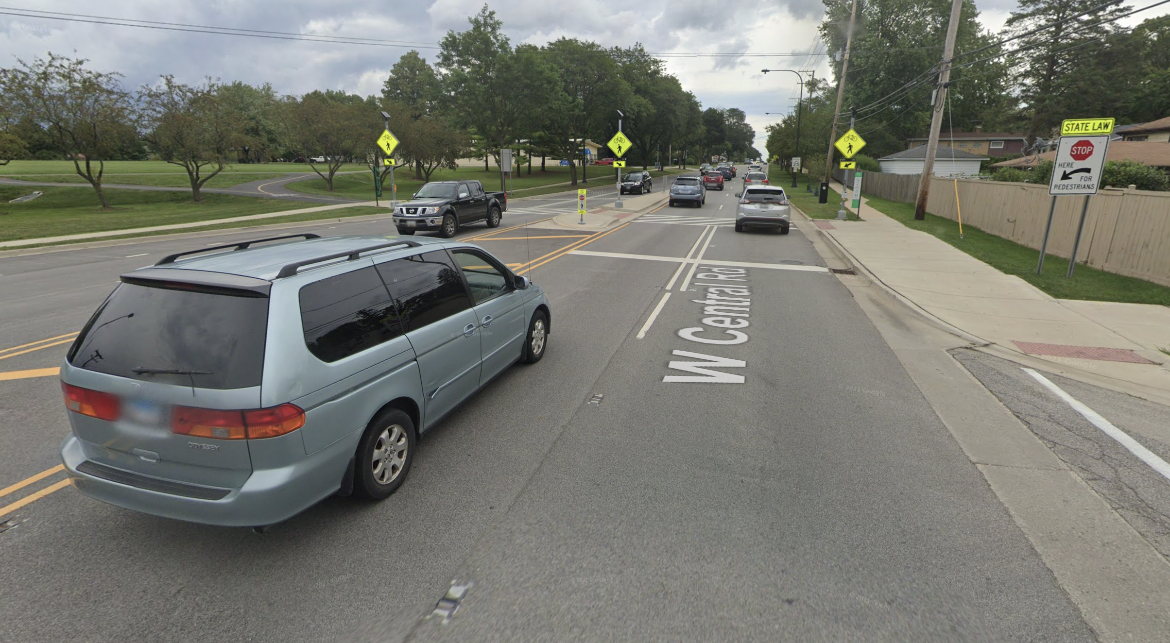
That's when an eastbound SUV driver hit her. That motorist admitted she was speeding and wasn't wearing her required corrective lenses, but claimed she didn't see the flashing lights or Beaudry before the bike rider was in front of her vehicle. Infuriatingly, Mount Prospect police and Mount Prospect officials initially stated that the victim was partly at fault for her own death. They argued, in effect, that even though Beaudry was already in the crosswalk, she should have double-checked that no drivers were about to break the law before she proceeded across the eastbound lanes.
If there had been a pedestrian-activated stoplight at this intersection instead of an RRFB, it's far less likely that the SUV driver would have disobeyed it. Moreover, it would be more obvious to all that the motorist was completely at fault for the crash.
Besides Hoyne, the Irving Park Plan also calls for installing flashing beacon crosswalks at Maplewood (2530 W.), Claremont (2330 W.), Hemitage (1730 W.) avenues. More on those intersections, along with the other two that are getting pedestrian islands but not RRFB, in a bit.
On the stretch of Irving Park within the 47th Ward, there are currently stoplights at Rockwell (2600 W.), Western (2400 W.), Oakley (2300 W.), Leavitt (2200 W.), Damen (2000 W.), Ravenswood (1800 W.), Ashland (1600 W.), and Southport (1400 W.) avenues, as well as Clark Street (1330 W.) and a midblock crosswalk at the Ravenswood Brown Line station (1830 W.) See the map embedded above for an overview of these locations.
Asked whether it would make more sense to install new pedestrian-activated stoplights instead of RRFBs, Mark said he doubts IDOT, or even CDOT, would sign off on increasing the stoplight density on Irving Park. He said he's confident that people on foot will watch out for lawbreaking motorists when crossing in the beacon crosswalks. At any rate, he argued, it's safer to have RRFBs at intersections where people are already walking than not to have them.
Assuming that's true, it will still be crucial to install plenty of signage at the Irving Park RRFB intersections to remind drivers that they must stop for people in the crosswalks. As of 2019, there were large signs at the Mount Prospect intersection stating "State Law: Stop Here For Pedestrians," which may have been added after the driver killed Beaudry. It would also be a good idea for CDOT and the Chicago Police Department to stage some crosswalk enforcement events at these intersections to further raise motorist awareness of the state crosswalk law.
Irving Park/Bell (2230 W.)
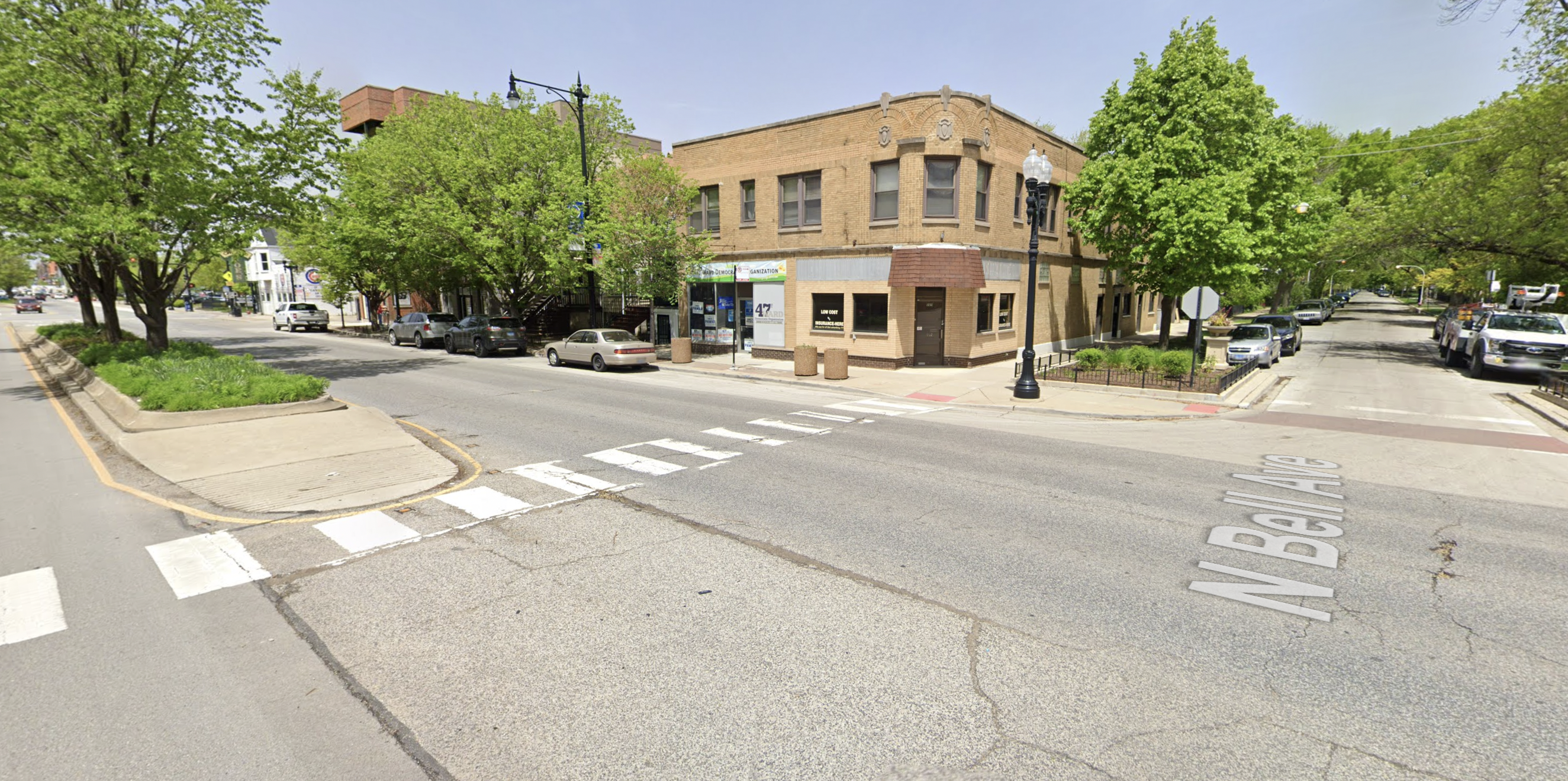
Mark said this intersection, located next to St. Benedict church and school, represents the "most egregious" example of IDOT vetoing a pedestrian island for no good reason. Currently there's no eastbound left turn pocket here, and there's a planted media west of the intersection, but there's no proper pedestrian island. Instead, the east end of the median has a sloping "mountable curb" with rumble strips.
That's because the intersection is designed so that a trucker driving a 60-foot semi south on Bell can make a westbound right turn onto Irving Park. Mark explained that doing this move would require the driver to "oversteer," counterintuitively turning the cab to the left and driving over the low median, so that the cab is extended a bit past the median into the westbound lanes. Watch this video at 2:10 for an explanation of how this move works.
But Mark noted that semi drivers rarely if ever use this stretch of Bell because it's a quiet one-way southbound side street that dead-ends half a mile north at Welles Park. "It never made sense." Last fall Martin introduced an ordinance to ban trucks from all the side streets at the intersections that are getting new pedestrian islands, which was passed by the City Council. That paved the way for all these junctions, including Bell, to get pedestrian islands with concrete protection on both sides of the relevant crosswalk.
Irving Park/Greenview (1500 W.)
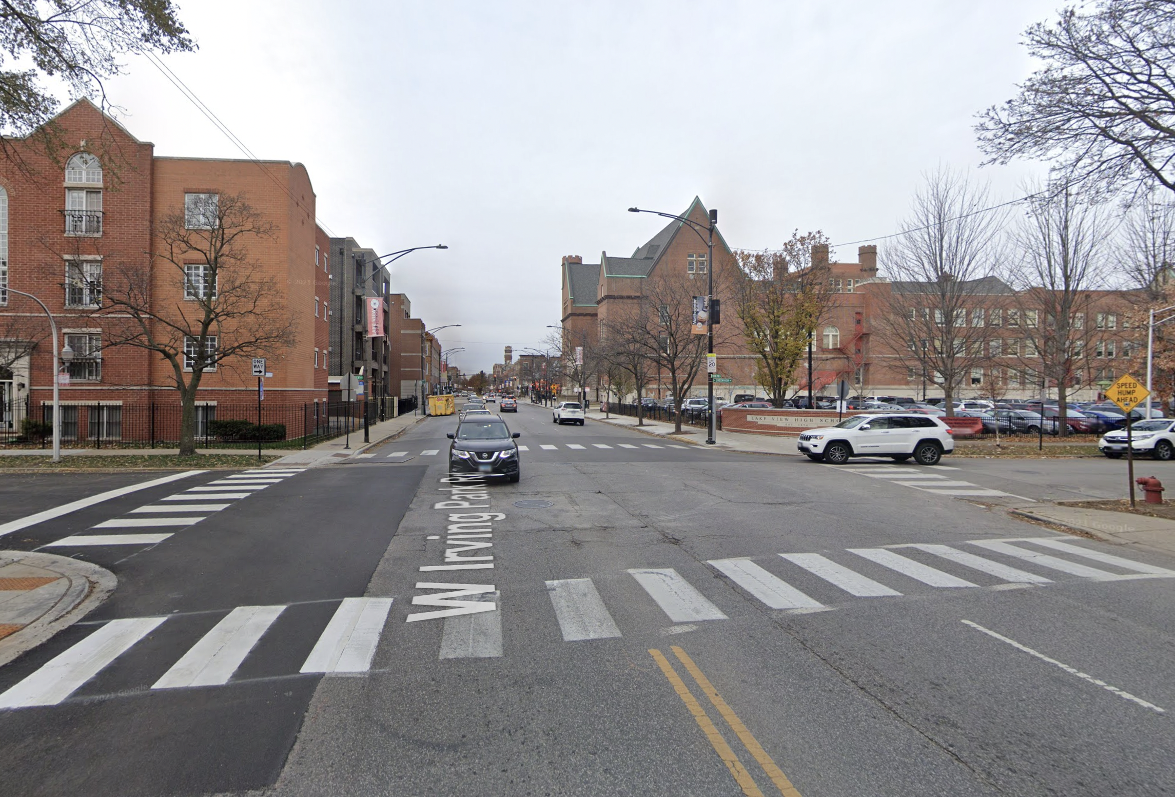
East of Ashland, Irving Park narrows to two lanes, but high traffic volumes and speeding are still issues, making this unsignalized intersection, located just east of Lake View High School, a tricky one to cross. This junction will be getting a curb extension. In addition, 47th Ward residents recently voted in a participatory budgeting election to fund speed feedback signs here to alert drivers when they're breaking the law.
Irving Park/Maplewood (2530 W.)
The remaining three intersections Mark discussed will be getting brand-new crosswalks, which, again, is notable on a five-lane IDOT road. Maplewood (2530 W.) is one of three Irving Park intersections that border Revere Park, which the ward staffer said sees 300,000 children a year, so safe crossings are crucial.
Rockwell (2600 W.) has a stoplight, but on the afternoon of December 27, 2022, a hit-and-run SUV driver critically injured army veteran Tom Kownacki on the sidewalk there. There's a bus stop and bench at the northeast corner of that intersection. Campbell (2500 W.) has colored, stamped, brick-like crosswalks, but no pedestrian island or curb extensions.
In addition to a new striped crosswalk, which will pass through a gap in two planter medians, Maplewood will get curb extensions on both sides of the street, and RRFBs.
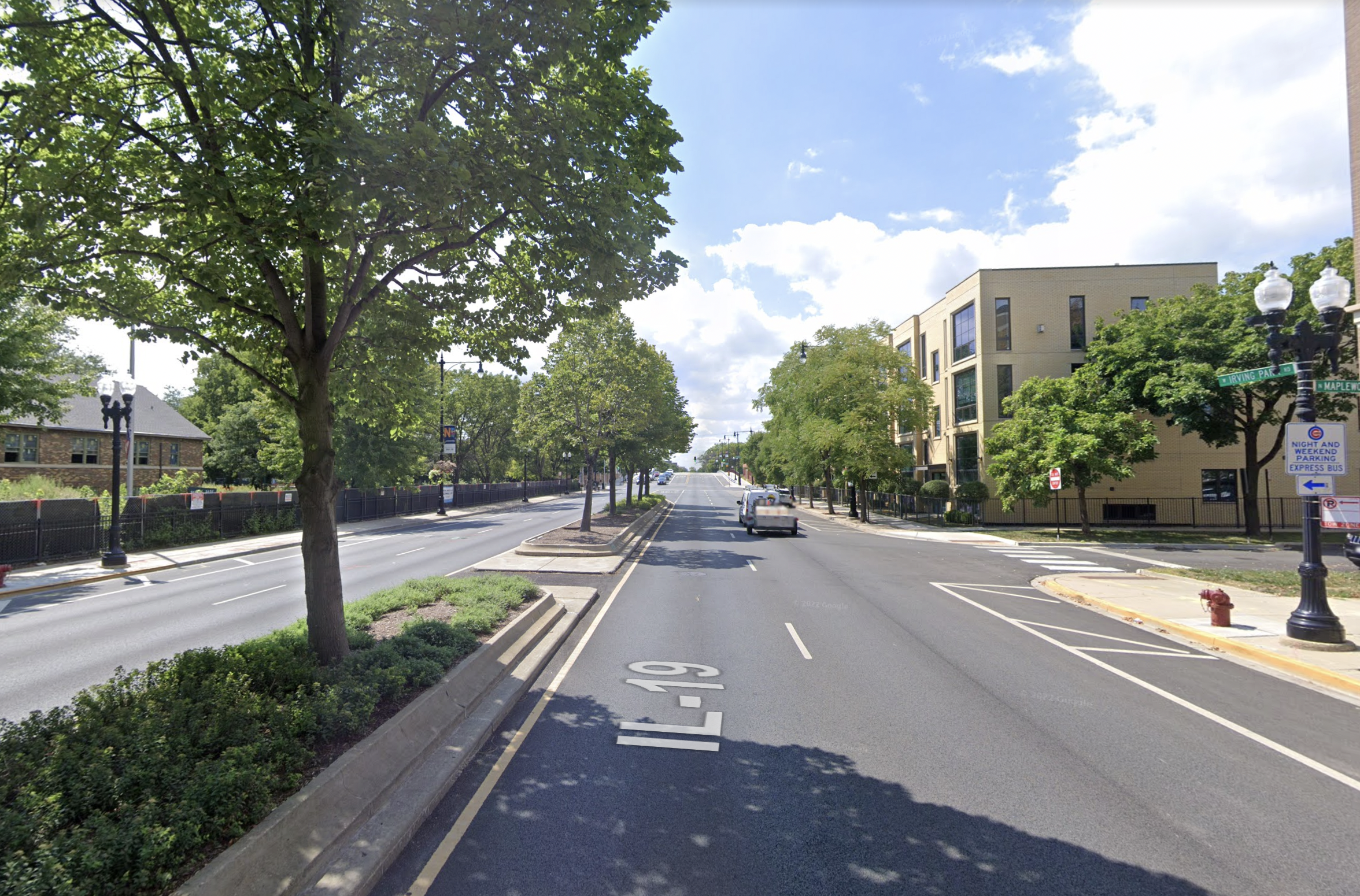
Irving Park/Claremont (2330 W.)
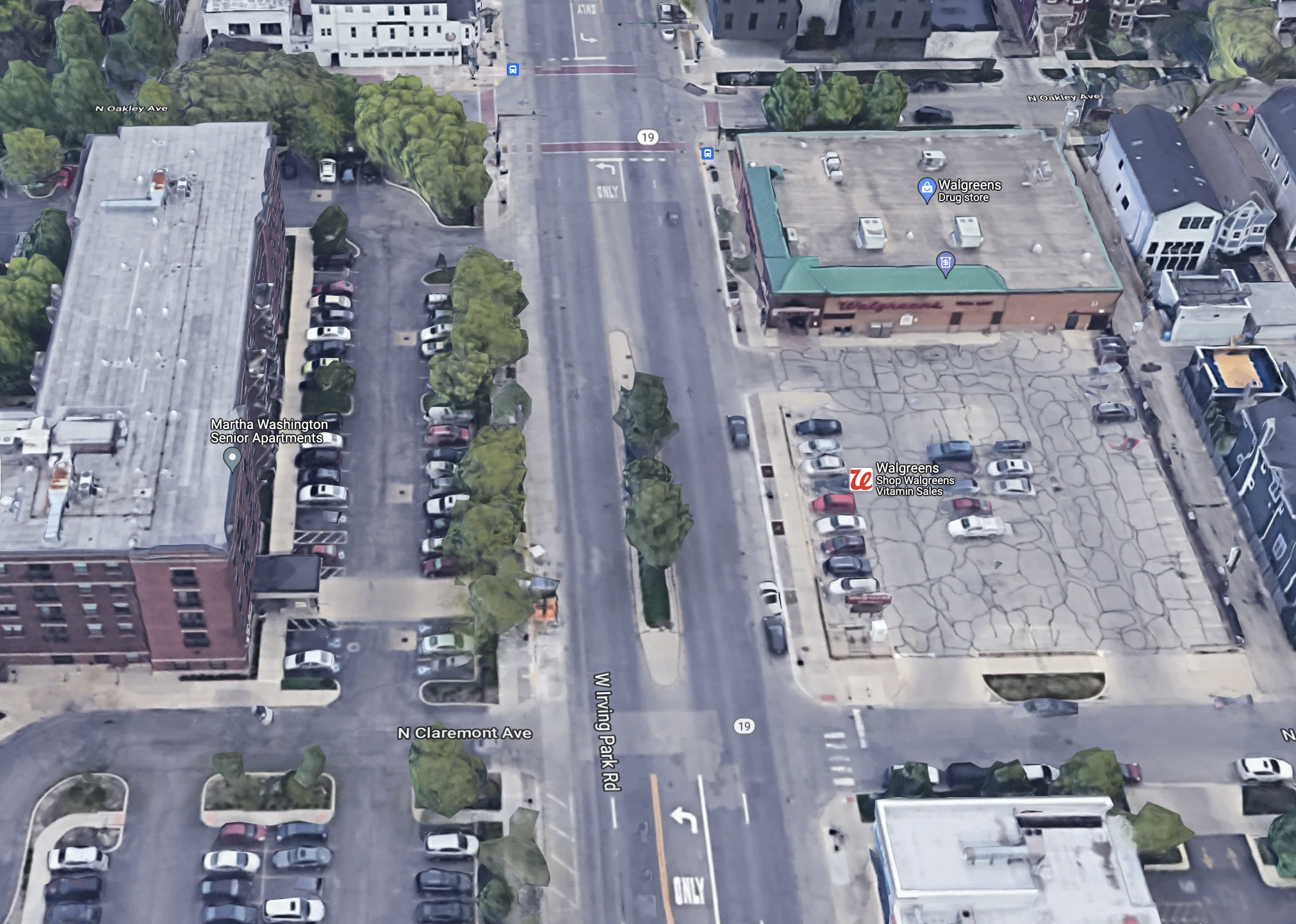
There are multiple senior housing buildings on the north side of Irving Park here, and a Walgreens on the south side, located between Claremont and Oakley (2300 W.) Mark said it's common for elderly people, especially those with mobility issues, to cross Irving Park road at the unsignalized Claremont intersection, rather than traveling a longer distance east to Oakley, which has stoplights, and then back west to the drug store's front door. But Claremont doesn't even have marked crosswalks.
"I can't think of anything scarier than a an 85-year-old person trying to cross a five-lane road with no protection," Mark said. Claremont will get the new striped crosswalk, curb extensions, and pedestrian-activated flashing beacons.
Irving Park and Hermitage (1730 W.)
Mark said the quarter-mile stretch between Ravenswood (1800 W.) and Ashland (1600 W.) is the longest segment of Irving Park in the ward with no crosswalks, so a new striped crossing at Hermitage will address that. This junction will also be getting curb extensions and RRFB.
"We've been working on making Irving Park safer since the first day Matt took office," Mark concluded. "It's too late for Peter [Paquette], who we knew and loved. But this project reflects our priorities: Protecting kids and seniors, and improving pedestrian access throughout."

If you appreciate Streetsblog Chicago's livable streets coverage, please consider making a tax-deductible donation to help us raise $50K by 1/31 to fund our next year of reporting. Thank you.