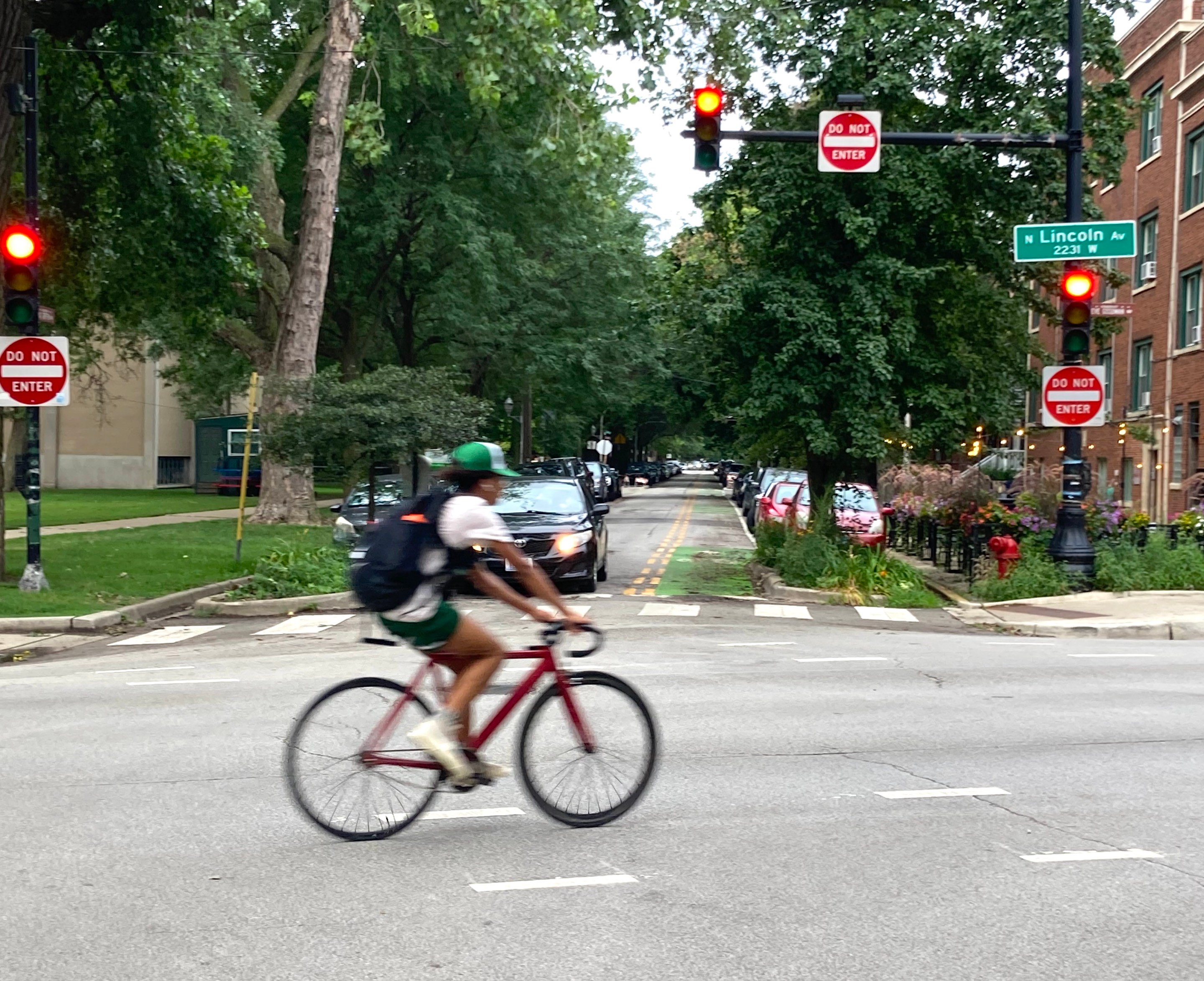
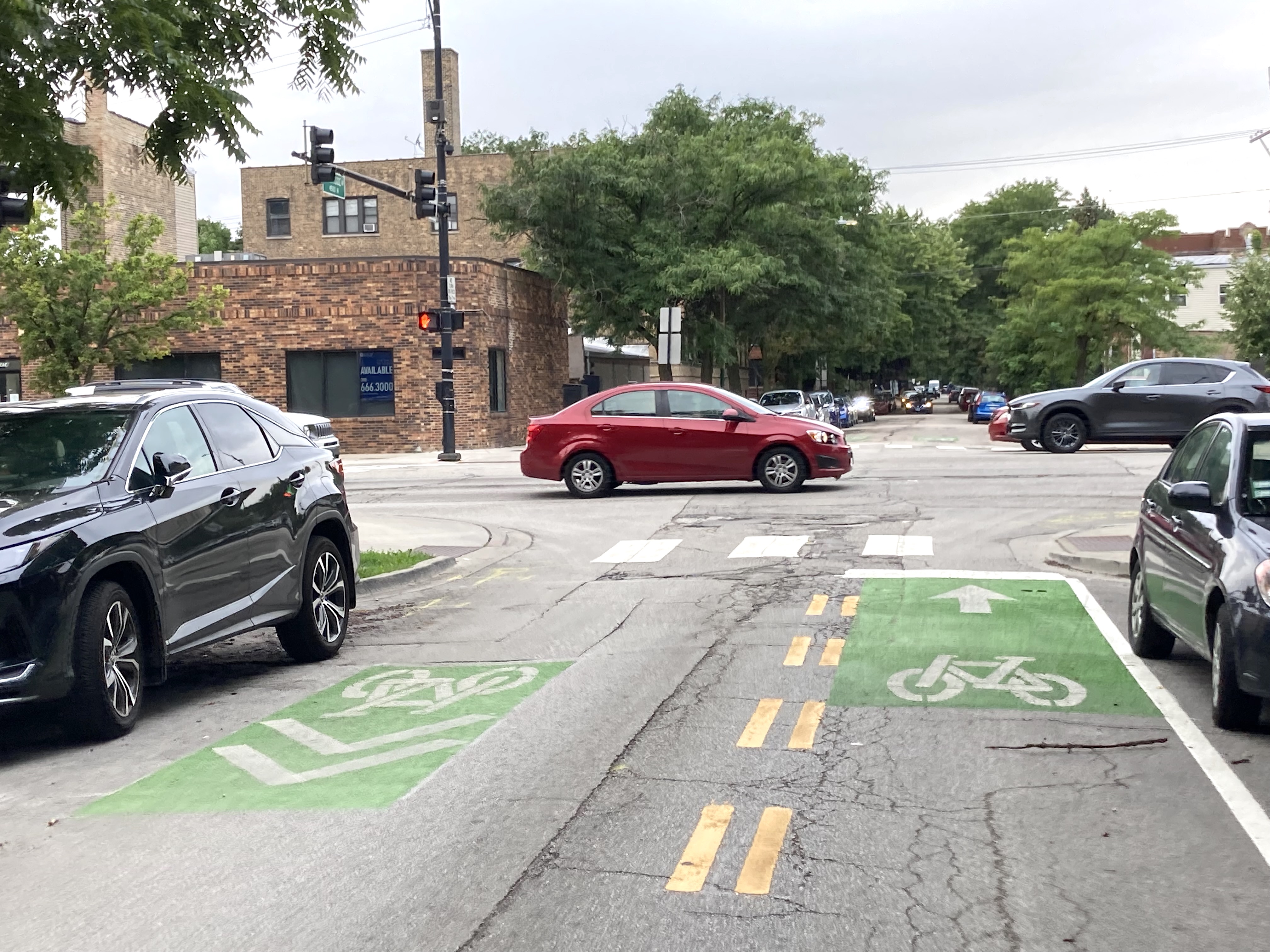
It's a simple project, but one that I've been looking forward to for a long time. The Chicago Department of Transportation, in cooperation with bike-friendly alder Matt Martin (47th), recently striped a contraflow ("wrong-way") bike lane on the short stretch of Sunnyside Avenue (4500 N.) between Western (2400 W.) and Lincoln (2230 W.) avenues in Lincoln Square, next to Welles Park.
According to Martin's director of development and infrastructure Josh Mark, the contraflow lane was proposed by CDOT and the 47th Ward's Youth Council and got 1,000 votes in the ward's participatory budgeting election. The idea was to connect with bikeway treatments on Rockwell (2600 W.) and Campbell (2500 W.) avenues the council had previously gotten installed, part of the ward's efforts to create a cohesive bike network. See more upcoming projects in the district at the bottom of this post.
The contraflow lane is only about a block and a half long. But by allowing people on bikes to legally ride west on the short one-way eastbound segment of Sunnyside next to the park, the lane opens up a new way to bike west from Ashland Avenue (1600 W.) to the 312 RiverRun trail system in Horner Park, which runs a mile and a half between Montrose (4400 N.) and Belmont (3200 N.) avenues.
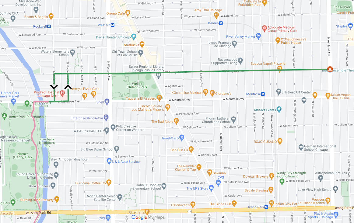
The route could be further improved by adding a short stretch of two-way curb-protected or raised bike lane on the south side of Montrose east of the RiverRun. This would provide a safer connection between the trail and Rockwell Avenue, the southbound street you take when you're heading west on Sunnyside, and Maplewood (2530 W.), the northbound street you take to bike east on Sunnyside.
Sunnyside was already a good route east from the RiverRun, thanks to the existing stoplight at Sunnyside/Western, which makes it safe to cross the five-lane arterial.
In conjunction with the new contraflow lane, CDOT is also installing curb extensions on Sunnyside in front of the Welles Park fieldhouse and swimming pool, which makes it safer to cross Sunnyside at that location.
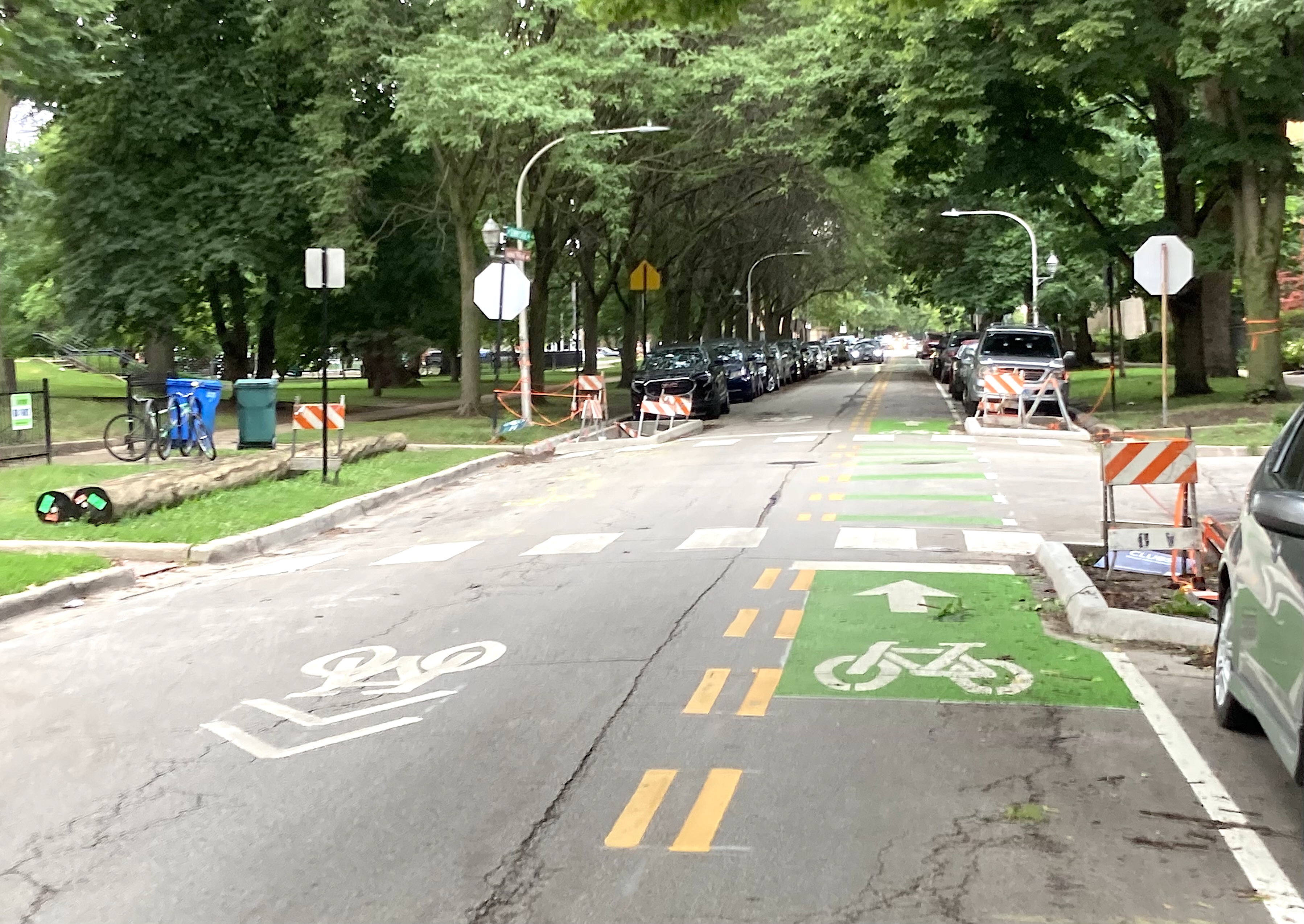
The transportation department will also add a dedicated bike stoplight for westbound bike riders at Western. As it stands, those riders can simply obey the pedestrian signal.
The main issue with this route is the lack of stoplights at Sunnyside's intersection with Ashland, another five-lane arterial. Crossing there is risky for people walking and biking, so I generally avoid taking Sunnyside east to my home in Uptown except during low-traffic times. Martin has expressed interest in making that intersection safer by adding traffic signals and/or pedestrian islands.
Crews striped the new contraflow bike lane on Sunnyside, which now connects Sulzer Library, Welles Park, and Waters Elementary School.
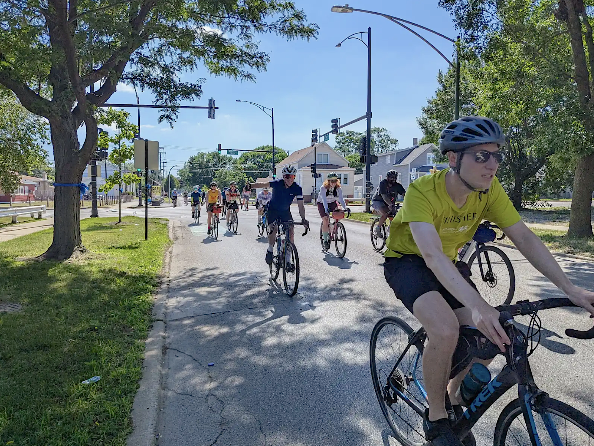
Come try it out at our community bike ride next week!
📆 August 12th kick-off at 7 PM📍 Welles Park🔗 https://t.co/zLqd2DQbqF pic.twitter.com/N8FhGcJazl
— Alderman Matt Martin (@AldMattMartin) August 2, 2022
Sunnyside is just one of a few new and planned bike routes in the 47th Ward. CDOT recently striped dashed bike lanes on Montrose between Clark Street (1430 W.) and Damen Avenue (2000 W.) A new bike-priority Neighborhood Greenway treatment is slated for construction later this year on Leland Avenue (4700 W.) between Clark and Western. And concrete-protected bike lanes are planned for Clark Street between Irving Park Road (4000 N.), and could be extended north to Foster Avenue (5200 N.)