New Maplewood / Campbell bikeways are a youth-driven participatory budgeting project
The experiences of pre-voting-age residents are an overlooked resource when it comes to creating safe conditions for walking and biking. After all, if we want to build “eight-to-eighty” facilities suitable for everyone from young children to seniors, we need to find out what eight-year-olds and other kids need from the built environment.
“Children often have very valid views from an urbanist perspective, because they don’t necessarily drive,” said Josh Mark, director of development and infrastructure for 47th Ward alderman Matt Martin. The district includes parts of Lincoln Square, Ravenswood, North Center, and Lakeview. Martin recently approved a traffic-calmed “Slow Street” route on School and Henderson in Lakeview in response to a letter-writing campaign from local second-graders who said they needed a safe space to recreate during COVID-19.
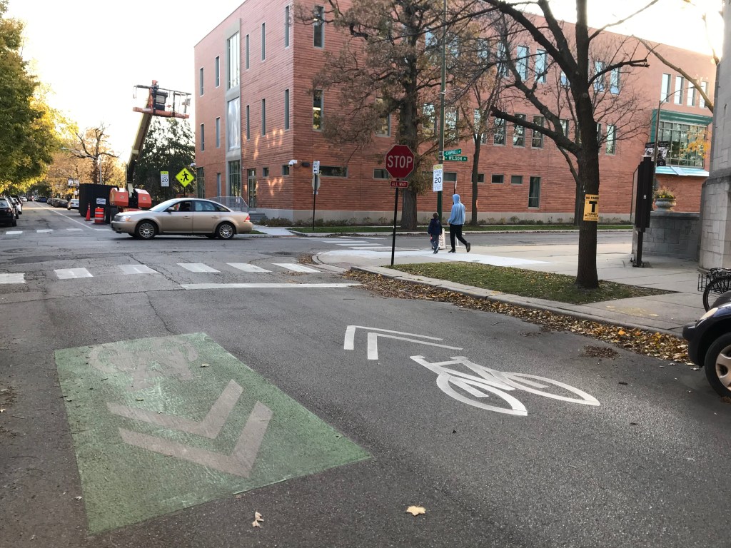
And local youth helped spearhead plans for short stretches of new bikeway markings on Maplewood (2530 West) and Campbell (2500 West) avenues between Montrose (4400 North) and Leland (4700 North) avenues. The bikeways, which run past Waters Elementary, 4540 N. Campbell, was as part of the ward’s first-ever participatory budgeting election earlier this year.
While some aldermen allow constituents to vote on how all of the district’s annual $1.3 million in discretionary “menu” funds for infrastructure improvements should be spent, Martin took a different approach. He allocated $150,000 to it, and let the 47th Ward Youth Council, including students ages 12-18, propose projects, which community members then voted for.
The bikeway markings were among the winning proposals. The markings include non-protected painted bike lanes on sections where there was sufficient road width, plus shared-lane markings, aka “sharrows” (bike-and-chevron symbols), some of them superimposed on green rectangles for extra visibility.
“Biking is an excellent mode of transportation — it’s environmentally friendly in addition to being a popular form of exercise,” said Simone Garber, a student at Jones College Prep who’s a member of the youth council. “The newly installed bike lanes near Waters Elementary will increase the safety of students commuting to and from school, as well as increase foot traffic and invite people to take in the ambiance surrounding the area. I’m very proud of the youth council for pushing this initiative forward.”
There’s currently a Slow Street treatment on Leland, and next year the Chicago Department of Transportation will install a permanent, traffic-calmed “neighborhood greenway” route on the avenue, with a contraflow bike-lane to legalize two-way cycling. So one purpose for the new markings will be to help Waters students get to and from the school from the upcoming greenway, which will likely cross the Chicago River via Wilson Avenue. A new annex recently opened at Waters so, once the pandemic is over, the school will be busier than ever.
Mark said the new markings are intended as a conversation starter to work with CDOT on some sort of bike improvements to Montrose, which connects to the in-development 312 RiverRun north-south trail corridor. “Montrose is complicated, though, because it’s a busy two-lane street with a tight layout.”
CDOT estimated the cost of the Maplewood / Campbell project at $40,000, but it didn’t wind up costing that much. So, as a lagniappe, Martin used the surplus cash to add green paint and dashed lines to the six-way Ravenswood Avenue / Addison Street / Lincoln Avenue intersection. The markings help alert drivers to the presence of cyclists, and direct bike riders safely across the junction.

Read More:
Streetsblog has migrated to a new comment system. New commenters can register directly in the comments section of any article. Returning commenters: your previous comments and display name have been preserved, but you'll need to reclaim your account by clicking "Forgot your password?" on the sign-in form, entering your email, and following the verification link to set a new password — this is required because passwords could not be carried over during the migration. For questions, contact tips@streetsblog.org.