100th Street Calumet River Project would create new recreational trail on Southeast Side
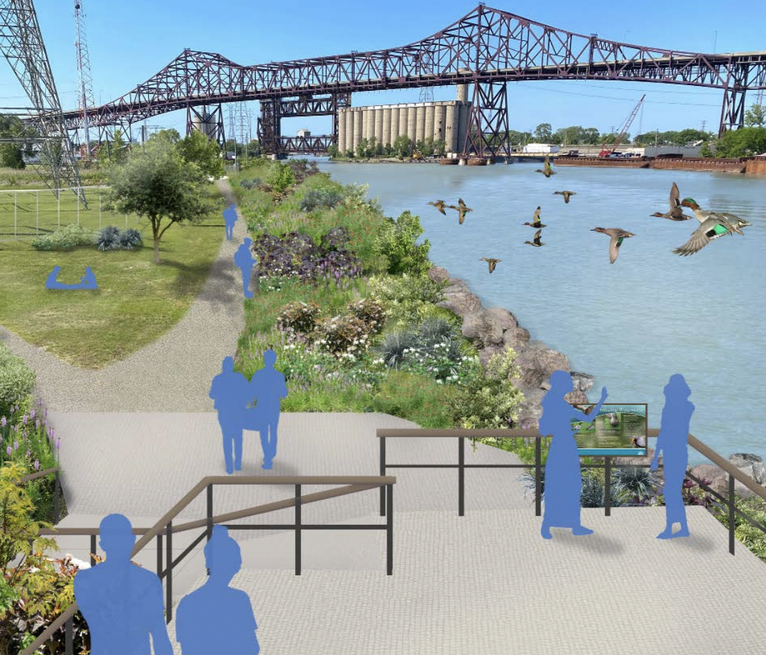
Image: Great Cities institute
Para leer este artículo en español, haga clic aquí.
The 100th Street Calumet River Project was suggested by community members during the 2016 South Chicago Commercial Avenue Revitalization planning process of 2016. It is in the initial stages of development. Residents identified the site as an opportunity for restoration of the natural riverbank habitat, a trail, and a public viewing area for river activity. If completed, the site would become a part of the greater network of transportation and recreation infrastructure on the Southeast Side. Currently the project team, headed by Great Cities Institute at the University of Illinois at Chicago, is conducting outreach to develop a community stewardship and governance plan for the site.
I discussed the 100th Street initiative with Jack Rocha, a Community Development Planner at GCI, and Alex Perez, Advocacy Manager at the Active Transportation Alliance, which assists with community engagement and transportation analysis of the project area. The interview has been lightly edited for clarity.
Ruth Rosas: Can you explain what the 100th Street Calumet River Project is?
Jack Rocha: The project comes out of organizing work that GCI started with the Commercial Avenue Plan that was completed and published in 2016. Along with that, the project comes out of the organizing work that the Metropolitan Planning Council has regarding rivers. Both organizations heard similar things as far as what kind of activation people want to see along the river. The Calumet River is an industrial zone so there is no legal public access along the river. The project would include activation of the Calumet River as well as connecting the site by a trail.
RR: So, who are the current owners of this area and how will the change of a non-public space into a public space happen?
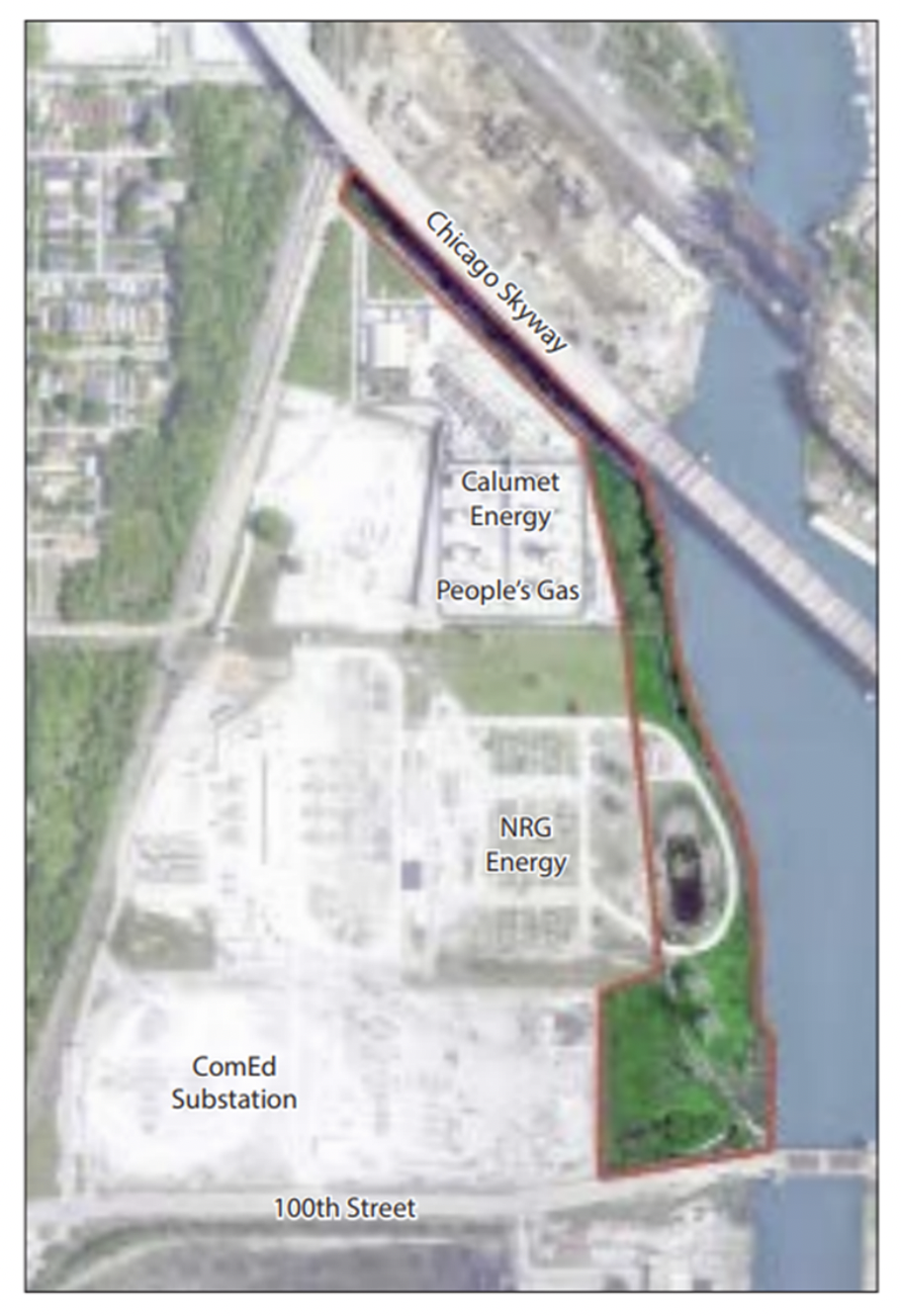
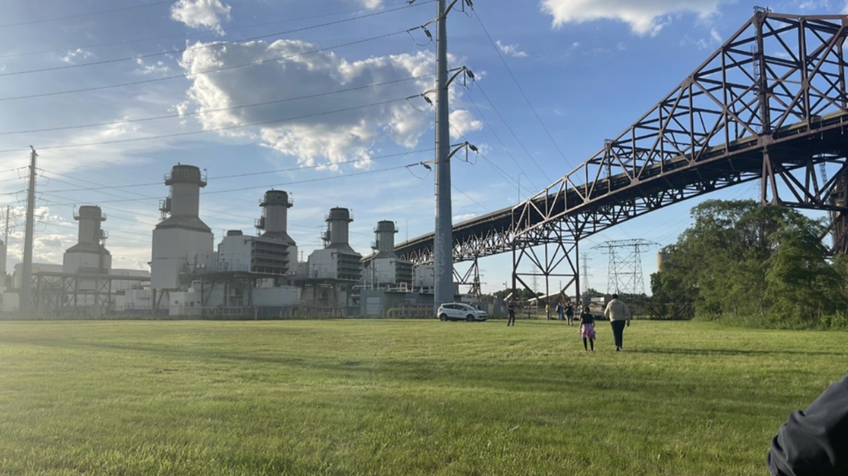
JR: The area for the project is bordered to the east by the Calumet River, by a rail viaduct to the west, the Chicago Skyway to the north, and by 100th Street to the south. The area that makes up the site is owned by local utility companies. Historically, the north half of the site is owned by People’s Gas and the south half of the site is owned by ComEd. Throughout the years, the site has been occupied by other smaller utility companies. However, for the north side of the site, we’ll be working with People’s Gas and its parent company, WEC Energy Group.
The process to get this to be public land is for companies to grant an easement to the city of Chicago. However, the owner of the site would be NeighborSpace which has its own land bank. It would get help from the community to bring the project to full implementation and management.
RR: Who are the communities that would be part of this project?
JR: The site is on the edge of different communities but is also separated from communities by the river and the rail line. Communities that would be impacted are South Deering, East Side, South Chicago, and Calumet Heights.
RR: What role is ATA playing in this project?
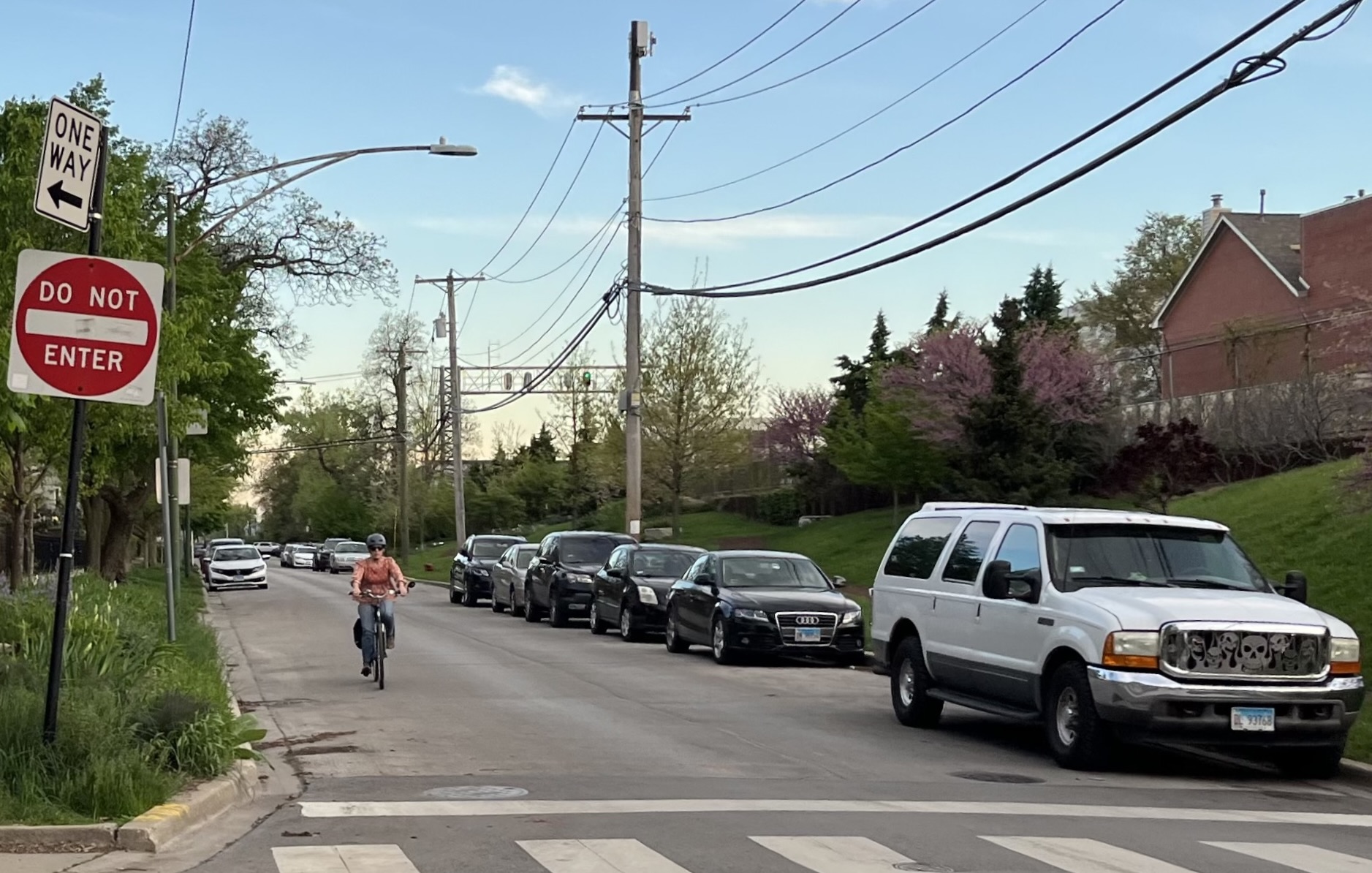
Alex Perez: There was community engagement happening before COVID and we had to switch from in-person engagement to online engagement. We did a study on the existing conditions of the site. We did a crash analysis map, looking at serious crashes. Fatal car crashes in the study area predominantly occur on busier streets like 100th Street We also conducted a truck count as 100th Street is a major truck route.
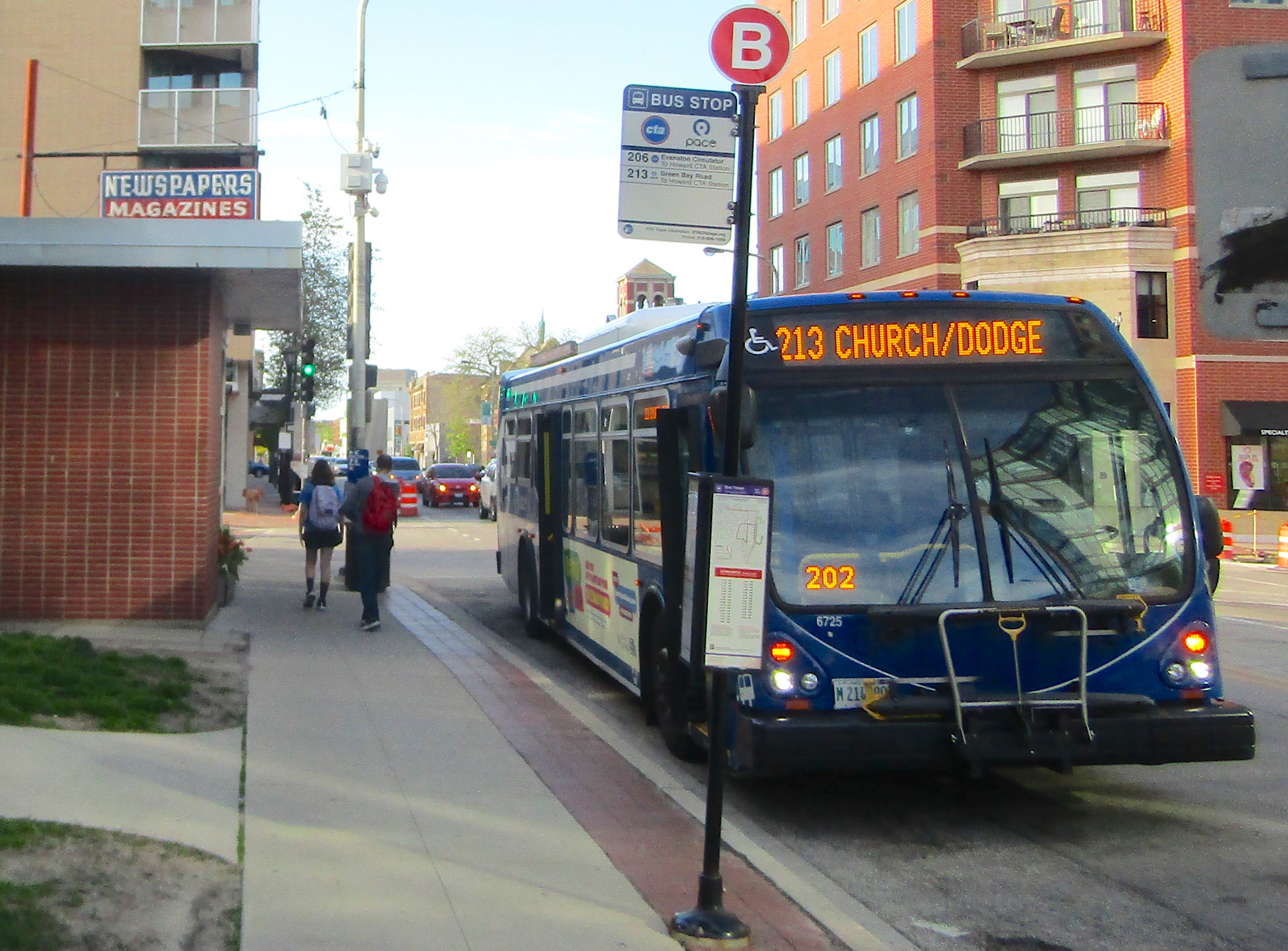
We also heard from the community that there were a lot of [truckers] passing through the area, so we wanted to get those counts as well as traffic volume. This will help us understand access points at 96th Street and 100th Street. We are prioritizing improvements on 100th Street as a southern entrance point, not just for cyclists but for pedestrians as well. There is a bus stop on 100th St.
However, from our crash data analysis, we know serious car crashes are happening on 100th. 96th Street may be used as a smaller street entrance. It is more bikeable and pedestrian-friendly. Moving forward, ATA will take more of an active role in community outreach. For example, I will cohost a leg of the Big Marsh Bike Convergence. The Convergence is an annual event that Big Marsh Park uses to get the word out to surrounding communities about the park.
RR: Who are the other partners working on this project?
JR: ATA, Neighbor Space, Calumet Collaborative, and the National Park Service. The NPS has a program called River Trails Community Assistance that helps river activation projects as well as other kind of trail projects. And the 10th Ward Office has been a huge supporter of the project as well.
RR: What infrastructure improvements are planned for the site and surrounding streets?
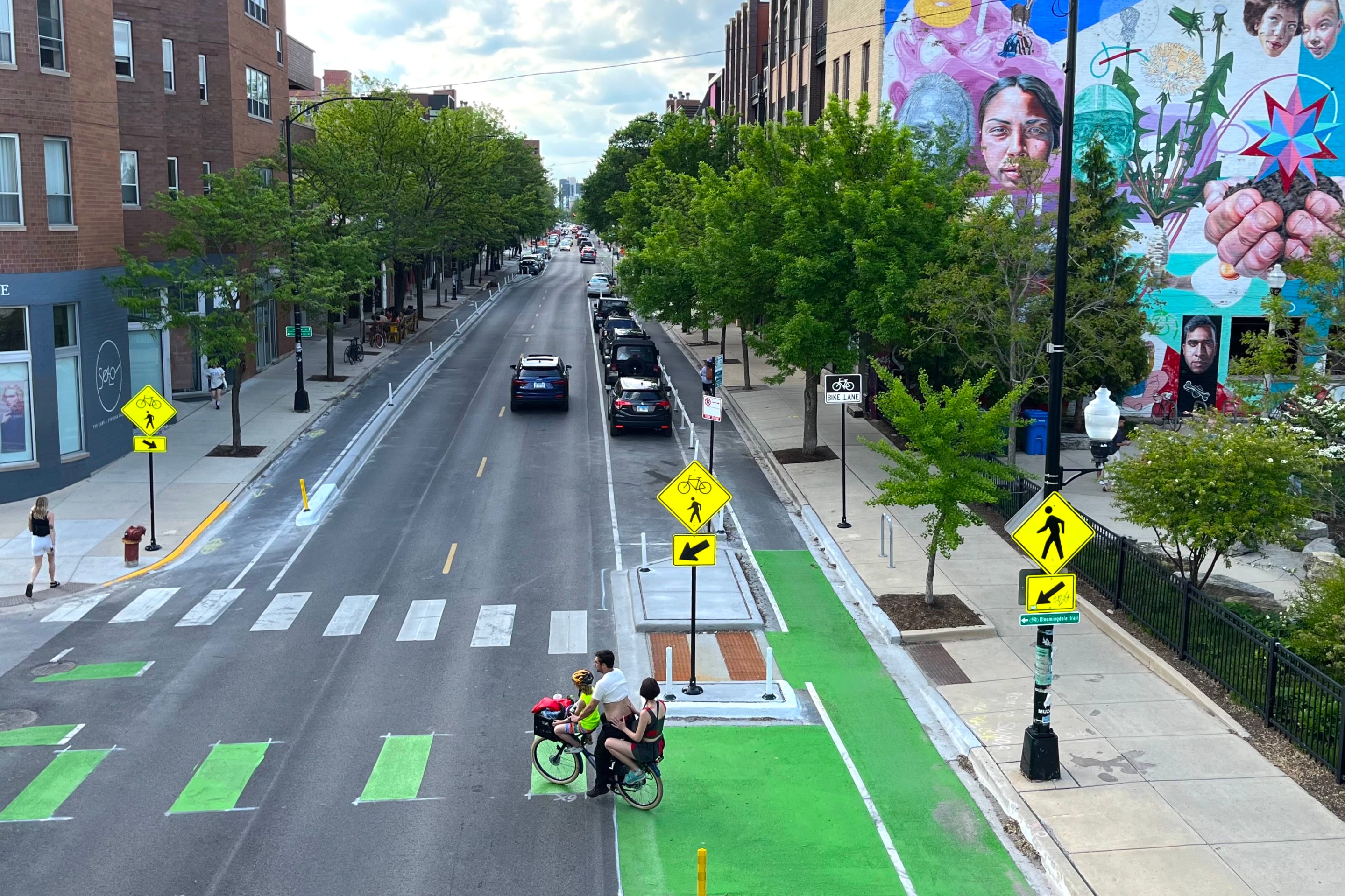
AP: The infrastructure improvements will focus on opening entrances to the site because the site is closed off from the street right now. There’s also a bike lane on 100th Street but it’s not protected. So upgrading the bikeway with physical protection might be a recommendation. The bridge also had improvements recently. That was one improvement we wanted to see done. The 10th h Ward has been very active and collaborative with identifying ways to improve access to the site and for future projects. The goal of the project is for 100th St to become a main connector from the site to the communities. The southern entrance point, which would be on 100th Street, would connect to the Burnham Greenway and to the Lakefront Trail.
RR: Were there any environmental findings in the site assessment?
JR: The Phase 1 Environmental Site Assessment was completed. It is a surface level survey of the conditions of the site. There was nothing they found that stated there’s any potential for heavy contaminants that would prohibit a trail or even a park from being built. But the main recommendation for Phase 2 of the Environmental Site Assessment is soil testing.
RR: In terms of truck traffic, are there plans to mitigate the amount of traffic going through the area?
AP: We are planning future conversations with the 10th Ward about possible improvements to make it safer, possibly slowing down traffic and improvements on visibility.
JR: That is something that the 10th Ward Office has been talking about, how do we deal with the truck traffic there. There are other projects in their ward, not near this site, but they are working to ease the impact that trucks have on communities.
One thing I’d like to mention about why we are trying to talk about a trail that leads to 100th St. The Southeast Side is segmented by the Calumet River and the East Side community is an island. The only way to get from Indiana and the East Side community to the rest of Chicago is to cross one of these bridges that connects them to the city. All those bridges, 95th Street, 100th Street 106th Street, and Torrance Avenue are also truck routes. This area is on the scale of Lincoln Park in terms of size, so of course, activating the site by connecting to the Lakefront Trail and Burnham Greenway is important.
RR: How has the community responded to the suggestions of activating the Calumet River on 100th Street and making it accessible?
JR: Our initial feedback, reflected on the 2016 Commercial Avenue Plan, has been positive. We are fielding all potential interests from the community, from a bike trail, to a hiking trail, to a boat launch, to a park on the southern end. There are concerns about safety. Sharing a space with an existing utility company, we have to assess the hazards.
AP: I’ll add that from the initial responses from the community, they wanted a recreation space in the area. They have been trying to fight for more accessible open spaces in the community.
JR: People would like more off-street biking so they can get to different areas safer and not have to deal with truck traffic. Our overall goal with organizing behind the 100th Street River Project is to improve bike and pedestrian infrastructure to the surrounding area. Regardless if this site moves forward or not, we are hoping to bring better bike and pedestrian amenities to the communities.
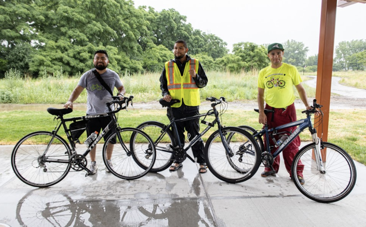
Outreach for the next phase of the River Project is underway. The team from GCI and ATA hosted their first open house and community site visit Thursday, June 9 with 30 people in attendance. The second community event at the 100th Street River site will be on Saturday, September 10th from 3-6pm. Outreach will continue through spring and early summer. To stay up to date, please visit the GCI website or if you have any questions, please contact Jack Rocha at jrocha3[at]uic[dot]edu.
Stay in touch
Sign up for our free newsletter
More from Streetsblog Chicago
Since COVID, Pace ridership has fared better on major corridors and in north, northwest suburbs than in south, west ‘burbs
The suburban bus system's top five busiest routes largely maintained their ridership rankings.


Due to incredible support from readers like you, we’ve surpassed our 2023-24 fundraising goal
Once again, the generosity of walk/bike/transit boosters is fueling our reporting and advocacy.
Which Metra corridor would become more bike-friendly and greener under a new plan? Ravenswood!
Thanks to plans to convert little-used parking spaces, the avenue is slated to get a new bike lane, and the Winnslie Parkway path and garden will be extended south.