A report from abroad: Barcelona transforms transportation—What it means for Chicago
For personal reasons, I call two towns home. During the fall and spring college semesters I live and work in Chicago, while I spend most of my summer in Barcelona, Catalunya (Spain). I have been making this commute since 2001 but have lived in Chicago since 1992. Being a Dutch native, bikes and trains were part of my upbringing.
When I moved to Chicago I reluctantly had to accept that, when short on money and time, owning a car turned out to be the only way to meet my transportation needs for work and study. Luckily, a new job in 2003 made car-free living possible, and out went the car. Aside from noticing monthly savings, I got to know Chicago much better, crisscrossing the neighborhoods on foot, by bike, and public transportation for commuting, shopping, and leisure. It also made me aware of the many obstacles facing a car-free life. I got to know Barcelona in a similar way—by foot, bus, train, and by bike.
For this report I took many photos and described where I took them and the streetscape or transportation changes visible in them.
Barcelona and Chicago share many traits. Both claim a strong industrial past, are important trading centers, dotted with famous universities, have made a mark on the world of architecture, and support great centers of art, medicine, and science. Situated at almost the same latitude, both border on large bodies of water, and both form the nucleus of a large, spread-out metropolitan area surrounded by suburbs.
Ignoring Barcelona’s medieval city center, much of Barcelona is built in a grid pattern like Chicago’s. A big difference is that most of Barcelona’s blocks are rectangular with the corners cut off (chamfered).
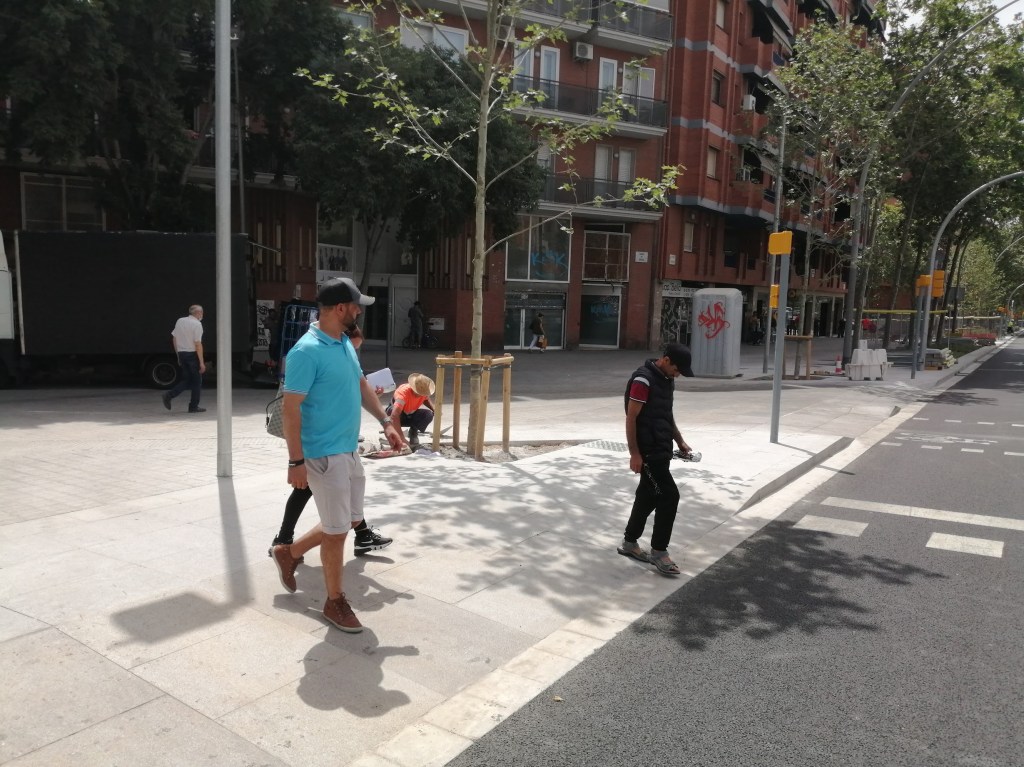
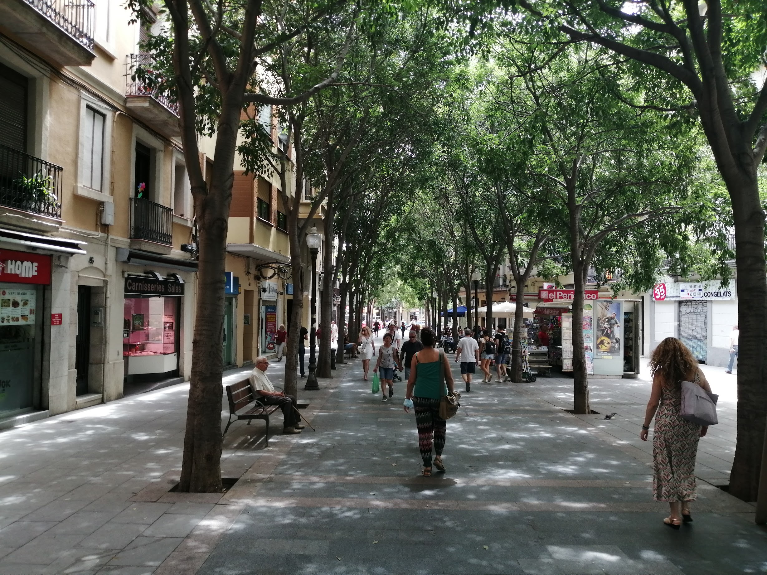
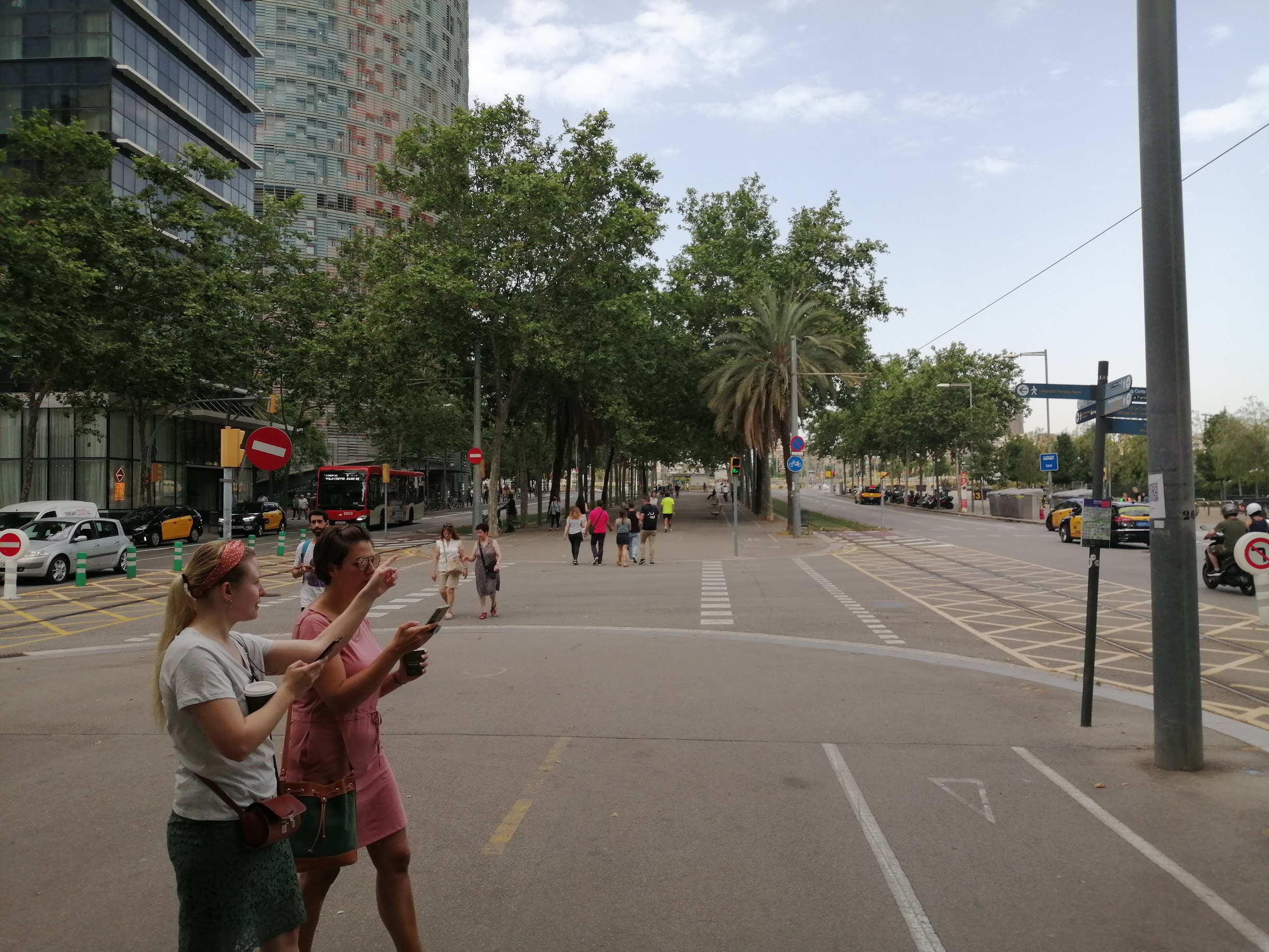
There are also contrasts. Barcelona is more densely constructed – like Chicago’s Edgewater and Bucktown neighborhoods – and is way more walkable than Chicago. Supermarkets, fruit and veggie stores, bakeries or cafes are never more than a block away—there are no food deserts. Barcelona has a more predictable weather pattern, gets very hot in the summer but sees no snow in the winter, is surrounded by a 1,500 feet tall mountain range. And while most of the city is flat, about 20% of the city is built on moderate to steep inclines.
Barcelona’s districts function similarly to Chicago’s wards, but Barcelona’s mayor has considerably more authority over transit policy and projects. Neither the Catalan state government (Catalunya is an autonomous region of Spain), nor the district mayors can influence transit development the way Chicago alderpersons and IDOT do in Chicago.
From the 1950s until the early 2000s Barcelona followed a familiar car-centric approach to transportation, accelerated by readying the city for the purpose of the 1992 Olympics when a few large projects were created to maximize traffic flow within the city—the ring at the Plaça de les Glories being the most notorious. Most vehicle arteries were made unidirectional, creating six-lane stroads that even contemporary Chicago wouldn’t dream of. With few exceptions, drivers had free reign, traffic volume rose, resulting in a crash-prone, noisy traffic-choked urban environment that, because of its reliance on diesel fueled vehicles and two-stroke “gas-oil” burning motorcycles, elevated air pollution to alarming levels.
While some steps had already been taken to reverse the negative effects of its car-dependency, the international “Fórum Universal de las Culturas” held in Barcelona in 2004 can be considered an important step in which the city showed resolve to calm and diversify its urban transportation as part of a wider plan “support for peace, sustainable development, human rights, and respect for diversity”. Many of the measures then proposed and which are now being implemented have already led to noticeable results. These same measures might work in a similar fashion in Chicago.
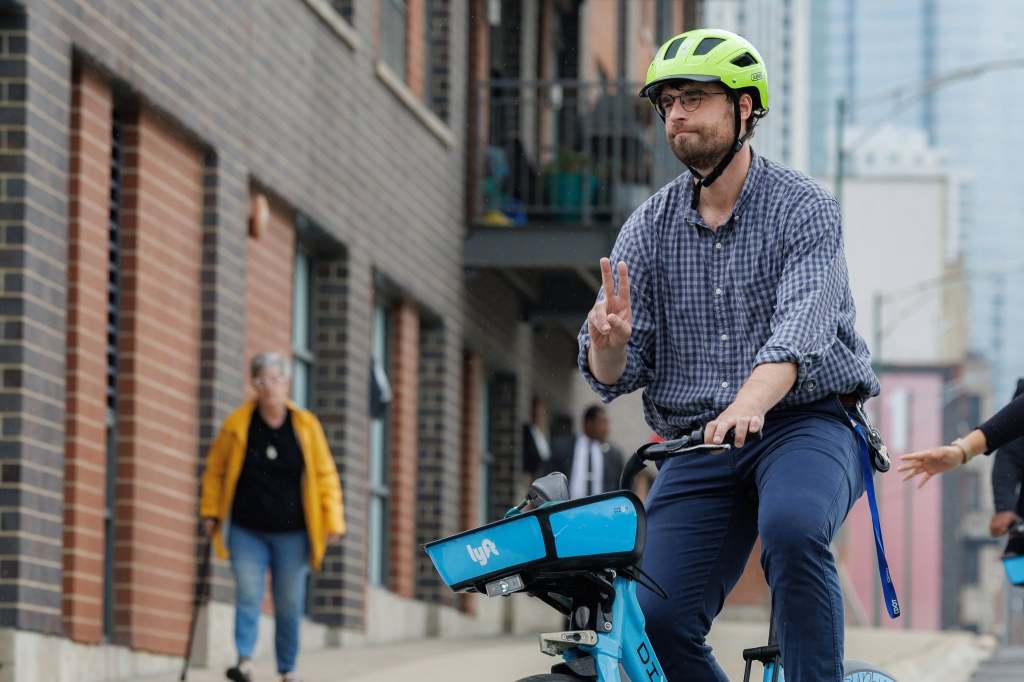
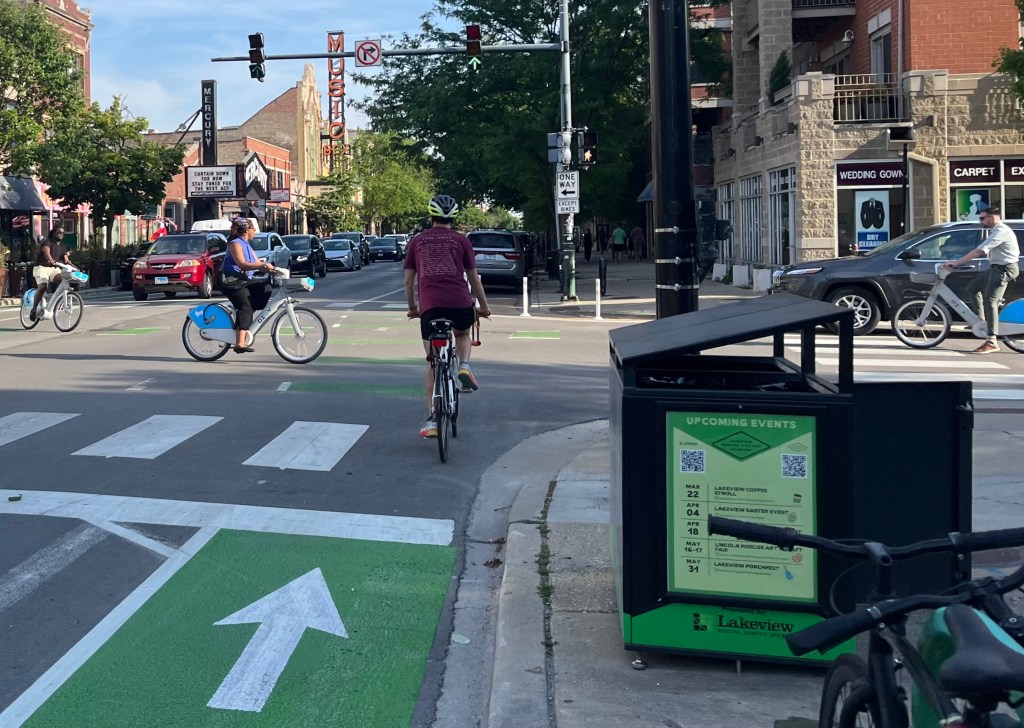
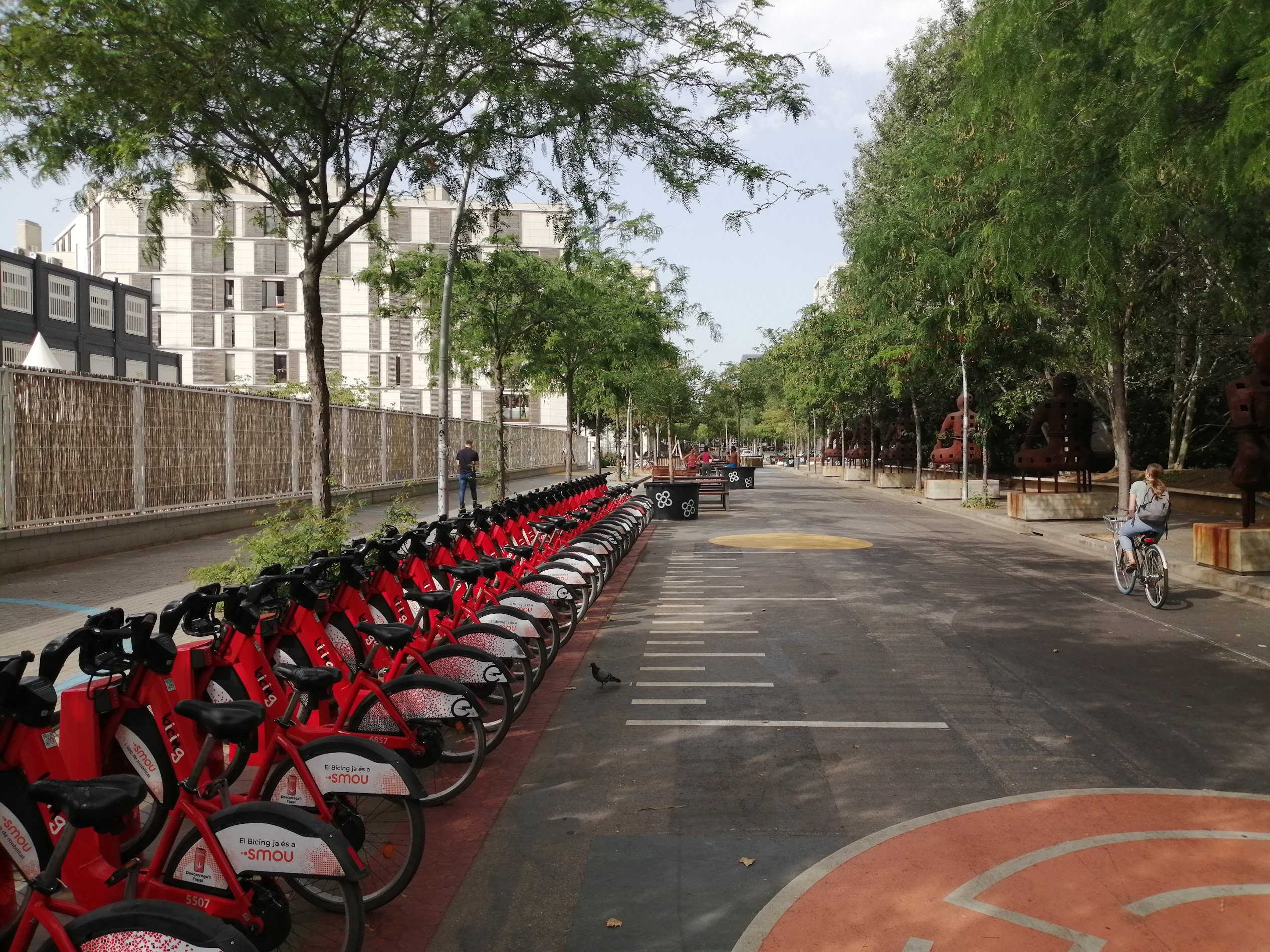
Bicing, Barcelona’s version of Divvy bike share, was introduced in 2004 and immediately took off beyond expectations. Yet the absence of bike paths initially created such bike anarchy that the construction of an integral network became a necessity. Like Chicago this initially resulted in paint on the road, and often in poorly chosen places, the most hilarious being the bike paths that ended at the entries of the subway.
Luckily, Barcelona learned quickly and now redesigns streets, so they always have a bike lane marked by paint and physically protected by so-called “armadillos”. These devices have some advantages, mostly in that they are durable, sturdy, easy to install, and protect reasonably well. In addition, because of their spacing and direction, bikes can easily escape the bike lane if needed, but motorized traffic cannot enter as easily. On the negative side, armadillos are low to the ground, and motorized traffic can quickly lose control of their vehicle (2- or 4-wheeled) when bumping into them. Perhaps an improved version, one that would combine the armadillo’s sturdy base with Chicago’s current plastic poles so it would stick out above snow, could be a solution for both cities, in particular for Chicago, to accelerate creation of a connected network of bike lanes that is still needed there.
One thing that deserves calling out is that Barcelona has constructed many of its current bike lanes on main thoroughfares, allowing cyclist the same most-direct connection that cars have. They did so by reducing car capacity on roads like Aragó, Diagonal, and Gran Vía. Imagine how this would transform Michigan Avenue, State Street, or Irving Park Road. While Chicago remains ambiguous on the matter, Barcelona has clearly recognized the bicycle as a form of transportation—not just leisure—and has placed the bicycle on equal footing with motorized vehicles.
Barcelona has ended free parking in most of the city, and has significantly reduced on-street parking, often allowing parking on one side of the street only, with parked cars functioning as a buffer between cars and bikes, a model that a few streets in Chicago and Evanston are trying as well. The on-street reduction was paired with the construction of many underground car parking garages to ensure the neighborhood’s accessibility to shops and restaurants. A similar approach in Chicago’s more dense neighborhoods like Wicker Park would make much sense and could clear space on large stretches of Milwaukee for shopping, dining while making them much safer for the traffic that’s left at the same time.
Barcelona has been burying its stroads and main arteries for the past thirty years and is in the finishing stages of transforming one of the most egregious examples of car-centricity, the Plaça de les Glories, into a nature park. Massive sound deflectors were constructed where the Gran Vía surfaces from the tunnels and is turned into an actual highway. The result has been a noticeably quieter city, improved quality of life. Imagine the Circle Interchange road spaghetti that has been under construction for the last decade being surrounded by large sound deflecting panels, and a large part of the Kennedy Expressway west of downtown being covered with green space. Imagine a good part of DuSable Lake Shore Drive being covered or embedded and reducing its impact as the great divider it currently is.
Here’s the good news to all of those separate operations: Within the Barcelona metro area, a single ticket system allows access to and transfer between all systems. Sort of what Chicago’s RTA has been trying to achieve for, well, decades? All systems feature modern equipment and facilities that are well maintained, a network that offers frequent and reliable service. Busses run on dedicated lanes, but don’t have special signage nor is there Bus Rapid Transit. Yet, bus service, some lines operating 24 hours a day, is usually fast, comfortable, and reliable. The rail map reveals a system that reaches allows you to travel from point A to B efficiently and directly.
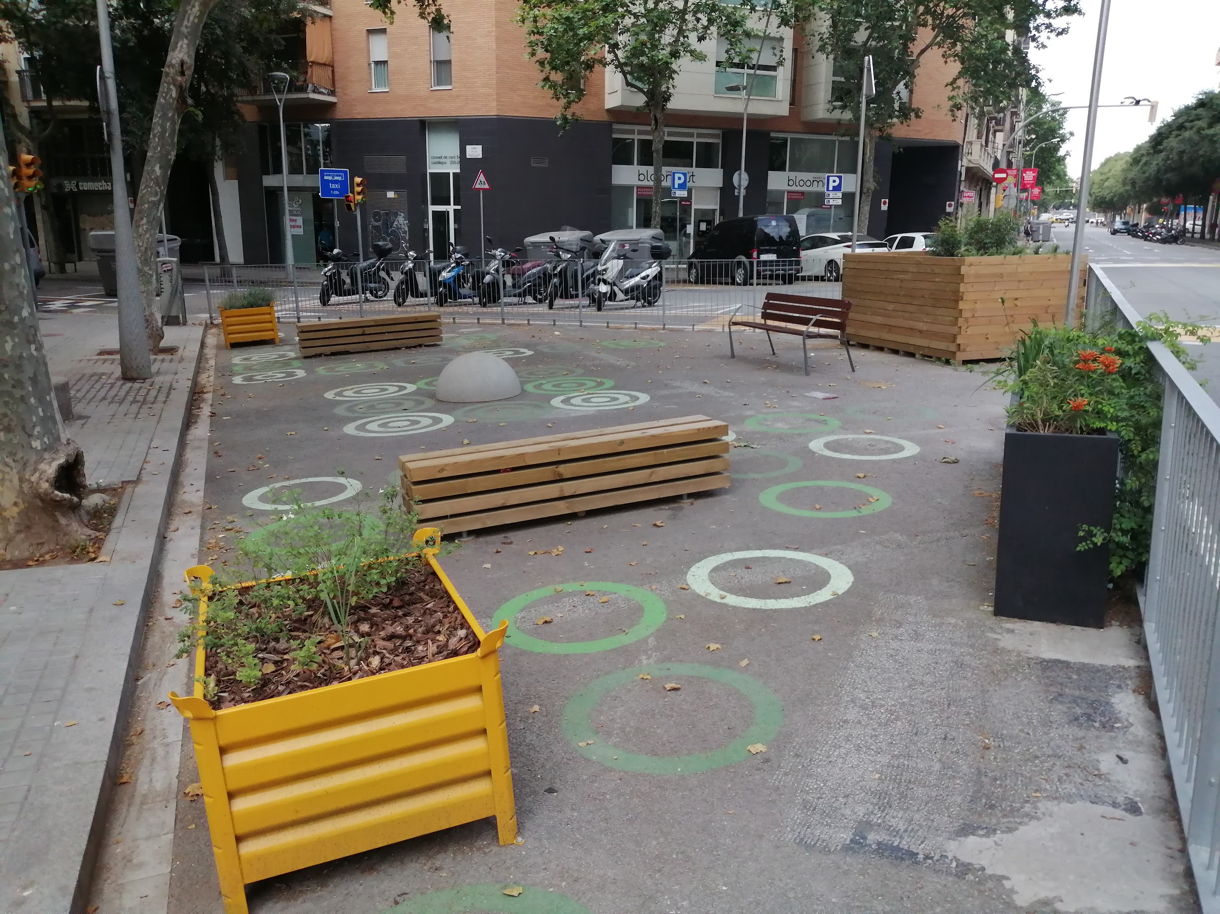
Barcelona has seriously been upgrading public space for pedestrians. This ranges from widening sidewalks so that even when cafés pop up there’s still plenty of space left, to blocking cars from entire streets so commerce can blossom, and narrowing and limiting travel lanes for cars, making them easier to cross, while forcing drivers to slow down. This seems a win-win scenario that would be applicable in so many commercial areas all over Chicago’s neighborhoods, if only to ensure an equitable and inclusive approach that would benefit all, not just the wealthier neighborhoods.
Last, Barcelona is not done, and its current policies have generated a fair share of detractors. The owner of a bike store in my neighborhood criticized the lack of consistency in design and execution of the new manners and remaining too car-friendly. He was mostly disappointed in Barcelona not following examples from cities like Cologne, Münster, Amsterdam, and Copenhagen. Whereas a few tourists I spoke to loved the transformation, some of my Catalan friends, even the ones on the left side, heavily criticize the current mayor, Ada Colau, for what they perceive as traffic chaos. Since I don’t drive, I do not share those sentiments, as I get around just fine.
They also criticize the considerable amounts of money being spent. But like IDOT’s Circle Interchange, isn’t an argument there that this project also creates jobs? All I can say is that I believe Barcelona’s transformation would similarly change and improve Chicago in many instances, and I recommend that all those who are responsible for Chicago’s future transit come see and experience this promising example for themselves.

Streetsblog has migrated to a new comment system. New commenters can register directly in the comments section of any article. Returning commenters: your previous comments and display name have been preserved, but you'll need to reclaim your account by clicking "Forgot your password?" on the sign-in form, entering your email, and following the verification link to set a new password — this is required because passwords could not be carried over during the migration. For questions, contact tips@streetsblog.org.