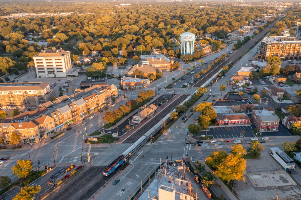
A version of this piece about biking the exact city limits of Chicago (or as closely as possible without spending lots of time on dangerous and/or unpleasant major roads) previously ran in the Chicago Reader. Here's the much-longer "director cut" of the article, with additional details and photographs from the trip that we couldn't fit into the print version.
Along with several other circumference cycling projects, for the better part of a decade I led the annual Chicago Perimeter Ride, which typically drew about 100 people for a leisurely all-day-and-evening cruise around the city, with plenty of stops for sightseeing, snacking, and swimming. That tradition may have earned me a reputation as the Perimeter King of Chicago, but I've suffered from imposter syndrome. While that itinerary was always a blast, it was actually a very streamlined, stylized route that came nowhere close to tracing the actually city limits. We didn't even set wheel in outlying neighborhoods like Mount Greenwood, Clearing, or Edison Park.
So for years I've been meaning to make things right by biking the exact city limits of Chicago, or as close possible without putting myself at undue risk of being flattened by a semi driver. The COVID-19 quarantine, when entertainment options are limited, seemed like an ideal time to do it. Since I planned to spread out the journey over two days, spending a night away from home, I'd basically be taking a vacation solely within the city limits.
I chose a few ground rules for my route. Roads with more than five lanes were generally dealbreakers unless I had no choice but to ride them for a few blocks, so that ruled out pedaling around O'Hare, which would involve riding miles on a nightmarish seven-lane stretch of Touhy Avenue. Since the airport is only connected to the rest of Chicago by a narrow isthmus, that didn't seem like much of a copout.
I also opted not to bother tracing the outlines of Norridge and Harwood Heights, those suburbs that are oddly embedded within Chicago's Northwest Side for long-forgotten political reasons. I'd generally avoid having my route cross the city limits into the inner-ring burbs. And where the border is a busy main street, and there's a parallel chill, leafy residential road nearby, I'd ride that instead. (You can find more of those kind of low-stress routes on the Reader's Mellow Chicago Bike Map.) Steering towards shadier streets paid off, because the late-August weekend I picked for my trek was generally gorgeous, but with torrid temps in the lower nineties.
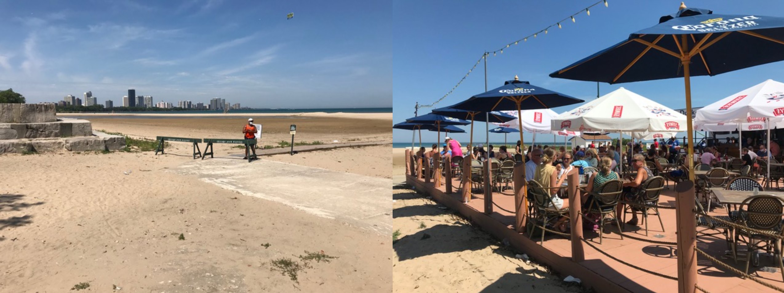
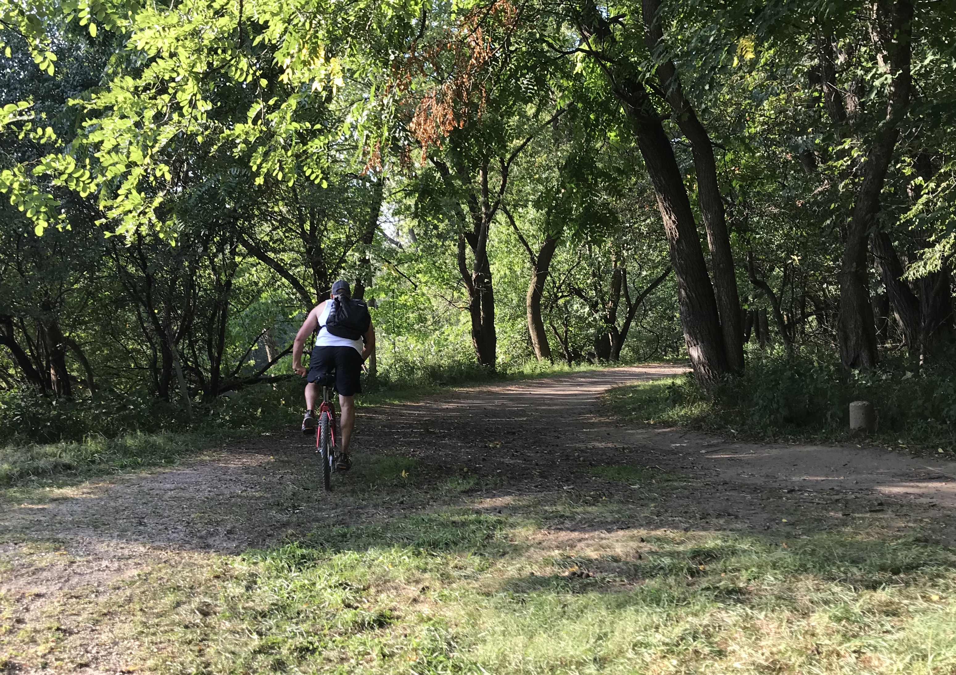
Around noon on a Saturday, my 111-mile trip begins on the Lakefront Trail at Montrose Avenue, near my Uptown home, with a counterclockwise route planned for optimal shoreline views. Pedaling east toward the park path that hugs crescent-shaped Montrose Beach, I'm annoyed to see the Dock at Montrose bar is open and full of people in tank tops sipping Corona, but hopefully not transmitting it. (Sorry.)
Actually, I don't have a problem with taverns and restaurants offering outdoor service, which experts say is relatively safe, during the crisis. And the Dock offers just about the best sunset view of any ground-level Chicago watering hole. But next to the bustling patio is a vast expanse of empty sand, with lifeguards standing ready to shoo away beachgoers in the name of pandemic safety.
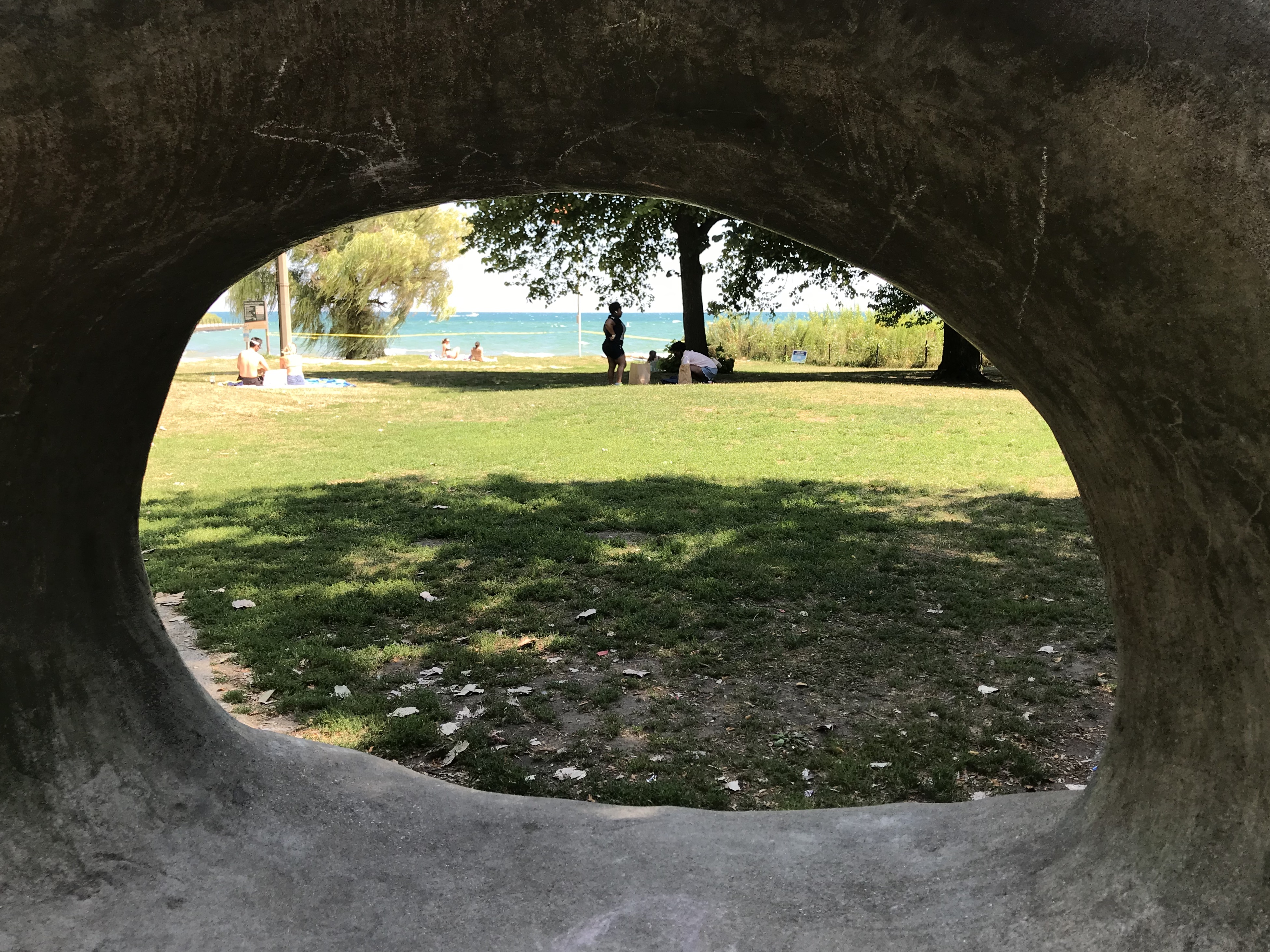
The absurdity of Mayor Lori Lightfoot's coronavirus lakefront policies are further underscored when I roll on to the revetment north of Lawrence, which is fairly crowded with sunbathers and people swimming off the rocks -- riskier than swimming of the sand at Montrose -- with little or no lifeguard supervision. Amusingly, a brawny, heavily tattooed guy is lounging in a giant purple unicorn pool float.
At the end of the trail at Ardmore Avenue, I cut west to Winthrop Avenue to avoid nasty Sheridan Road, roll through the Loyola campus, and then take an alley to Pratt Boulevard, where I head east again to Loyola Beach, picking up the park path that starts by Lynn Takata's serpentine "Waveform" sculpture. After six blocks on Sheridan, I tag the Evanston border by Juneway Beach, where the smooth sand has sadly been replaced by rough boulders in response to climate change-related rising lake levels and erosion.
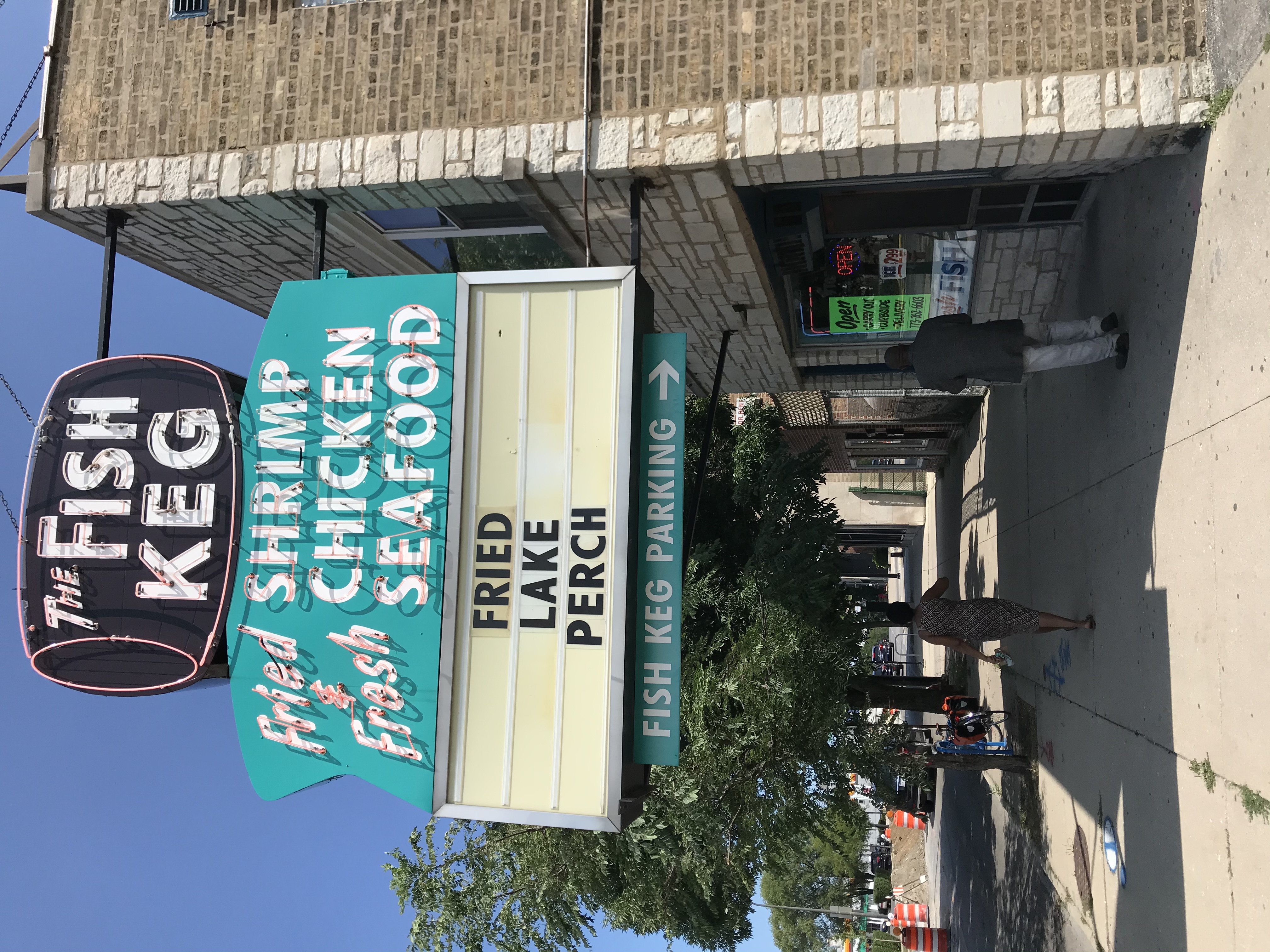
Making my way to Howard, I pedal into the West Ridge community, stopping to pick up a fried clam lunch at the Fish Keg, an old-school takeout joint with the slogan "Seafood for the Soul." Rolling south on Kedzie Avenue, I pass by the home of Chicago's orthodox Jewish community, dense with synagogues and yeshivas. A preteen girl and boy walked down the street, the latter in suit, fedora, and sidelocks.
Heading west on busy Devon Avenue, I check out Novelty Golf & Games on the Lincolnwood side. The put-put course includes a giant rooster, a miniature Hancock Tower, and an ersatz Easter Island moai.
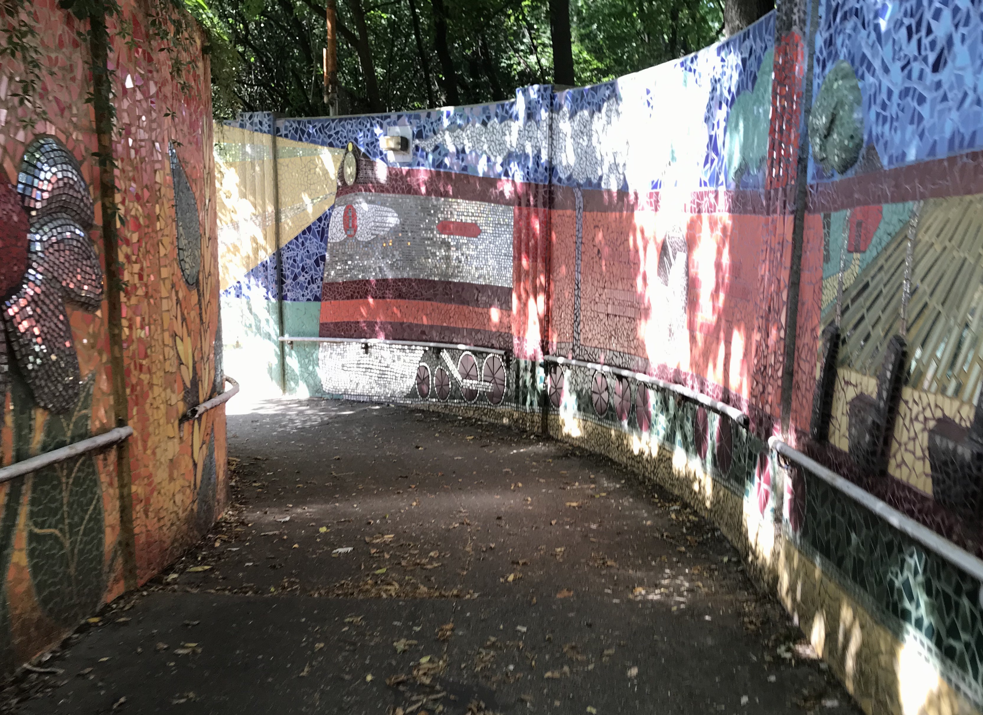
Just west of the Edens Expressway, I follow the borderline northwest on Ionia Avenue into Edgebrook, a pleasantly sedate neighborhood where many of the houses look like mansions. An underpass below Metra tracks by Hiawatha Avenue is lined with a colorful mosaic mural honoring the namesake founder of the Iroquois nation, as well as the eponymous train line to Milwaukee.
As I round a small northerly knob of the city on Algonquin, Lunt, and Dowagiac avenues, the suburb-in-the-city feel is hammered home by the sight of an older gentleman watering the yard of his ranch house while sitting in the driveway on a striped lawn chair that matches the home's American flag. The Monkees' "Pleasant Valley Sunday" runs through my head.

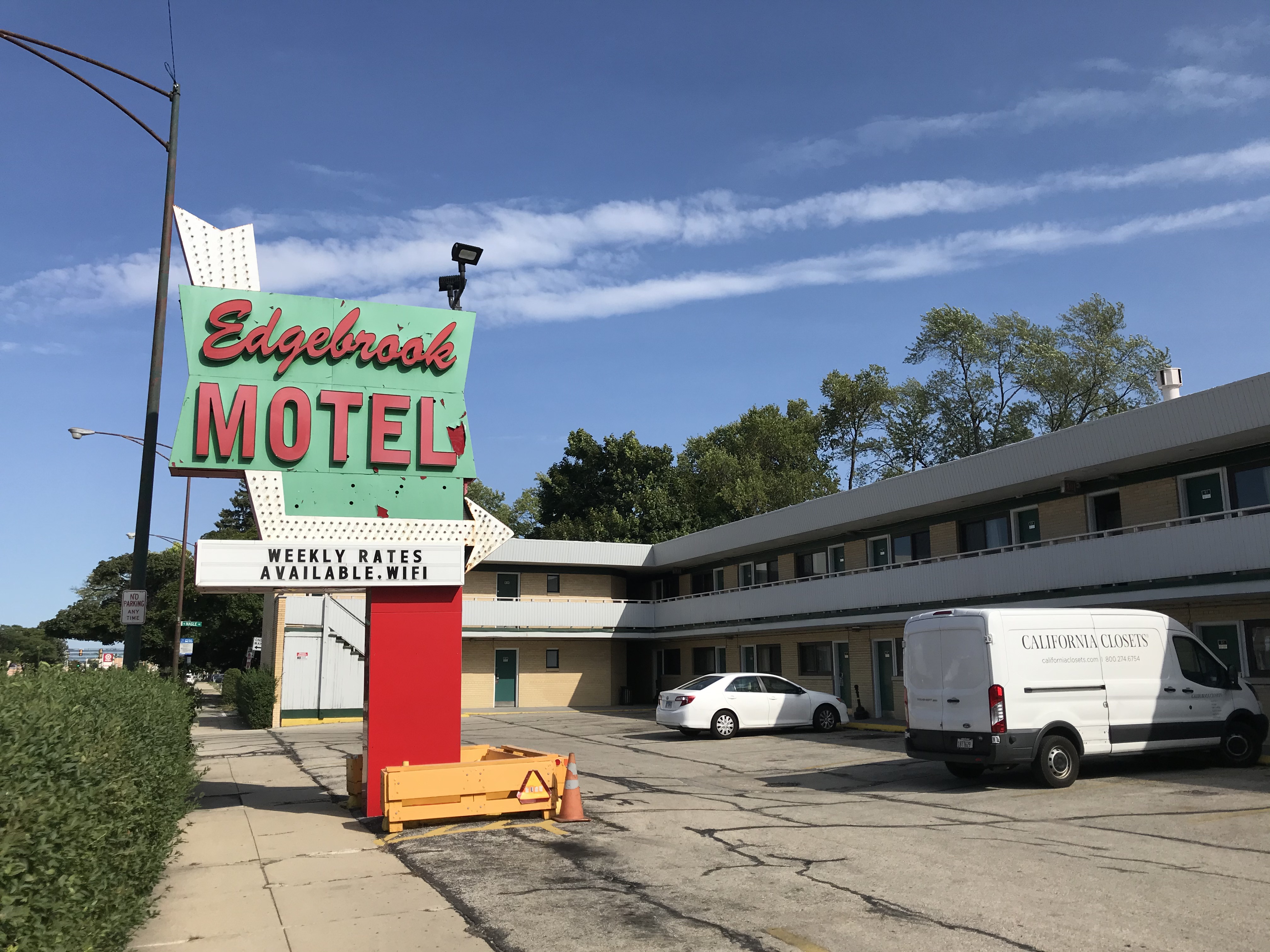
Northwest of there is an even smaller protrusion of Chicago into the 'burbs, a tiny finger of off of Touhy poking into Niles. After riding the street loop inside that, I continue west to the Leaning Tower of Niles, a half-size replica of the Pisa landmark. Across the street is the Edgebrook Motel, with an appealingly garish red-and-seafoam green sign, the first of many examples of retro-futurist "Googie" architecture and signage I'll encounter on this trek.
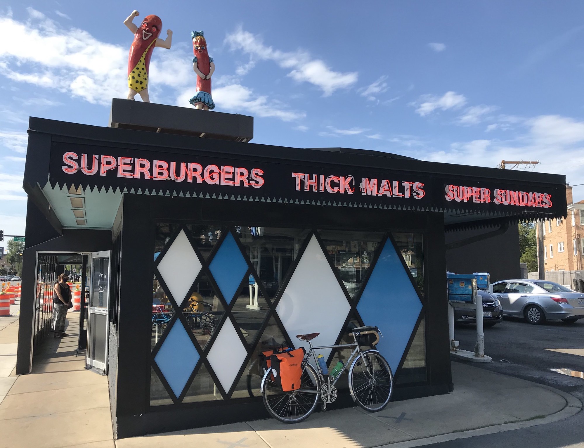
After cutting southwest across Caldwell Woods on the North Branch Trail, I'm at one of Chicagoland's best-known examples of Googie, the beloved Superdawg drive-in. Its nifty design features blue and white diamond panels, red neon, and the famous winking anthropomorphic wieners on the roof.
Soon I'm tracing the outline of Edison Park, Chicago's northwestern-most neighborhood. Eighty-seven percent white, it's popular with Chicago city workers, many of whom might prefer to live in the suburbs, but need to meet the city's residency requirement. Ebinger Elementary displays a "We Support Our First Responders" banner with images of a firefighter and a cop.
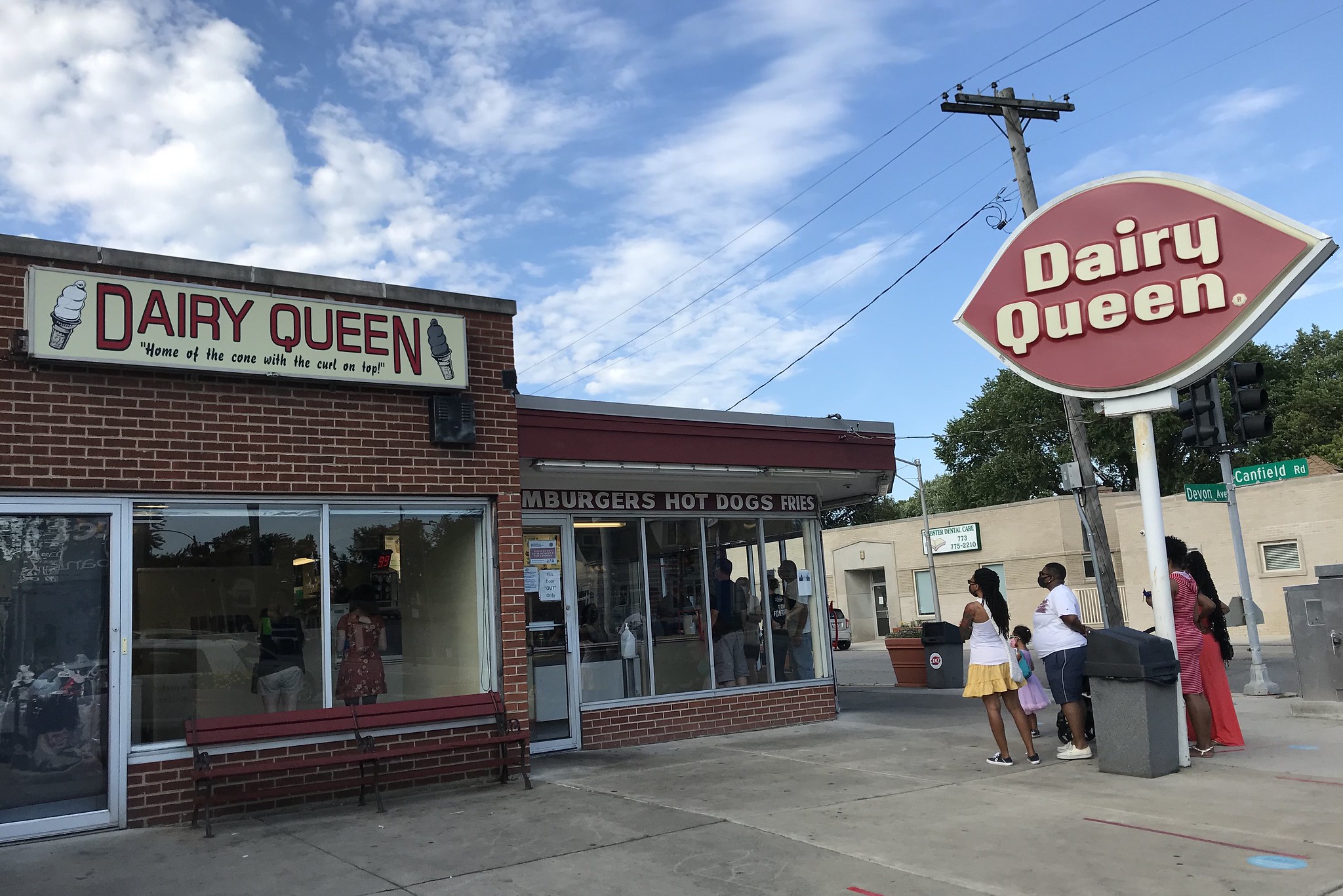
Heading south on Canfield Road, at Devon I pass a trapped-in-Seventies-amber Dairy Queen with the quaint slogan "The cone with the curl on top."
After rolling west towards the sun on an unpleasant stretch of Higgins Road paralleling the Kennedy Expressway, I'm rewarded with several miles of serene off-road riding on the wooded Des Plaines River Trail. I exit the path at Belmont avenue, resisting the temptation to visit nearby Gene and Judes, the River Grove hot dog stand famous for its minimalist "depression dogs" (onion, relish, mustard, and sport peppers only, served with French fries on top, wrapped in paper) and Hala Kahiki, the historic multiroom tiki bar next door.
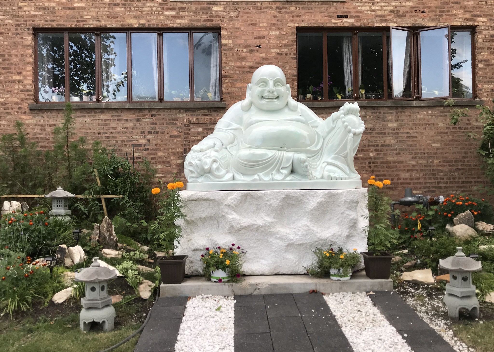
Heading east I'm in the Dunning community. I pass by Truc Lam Temple, a Vietnamese house of worship that recently relocated from Uptown. A large, fat, smiling Buddha sculpture holds court in front of the new building.
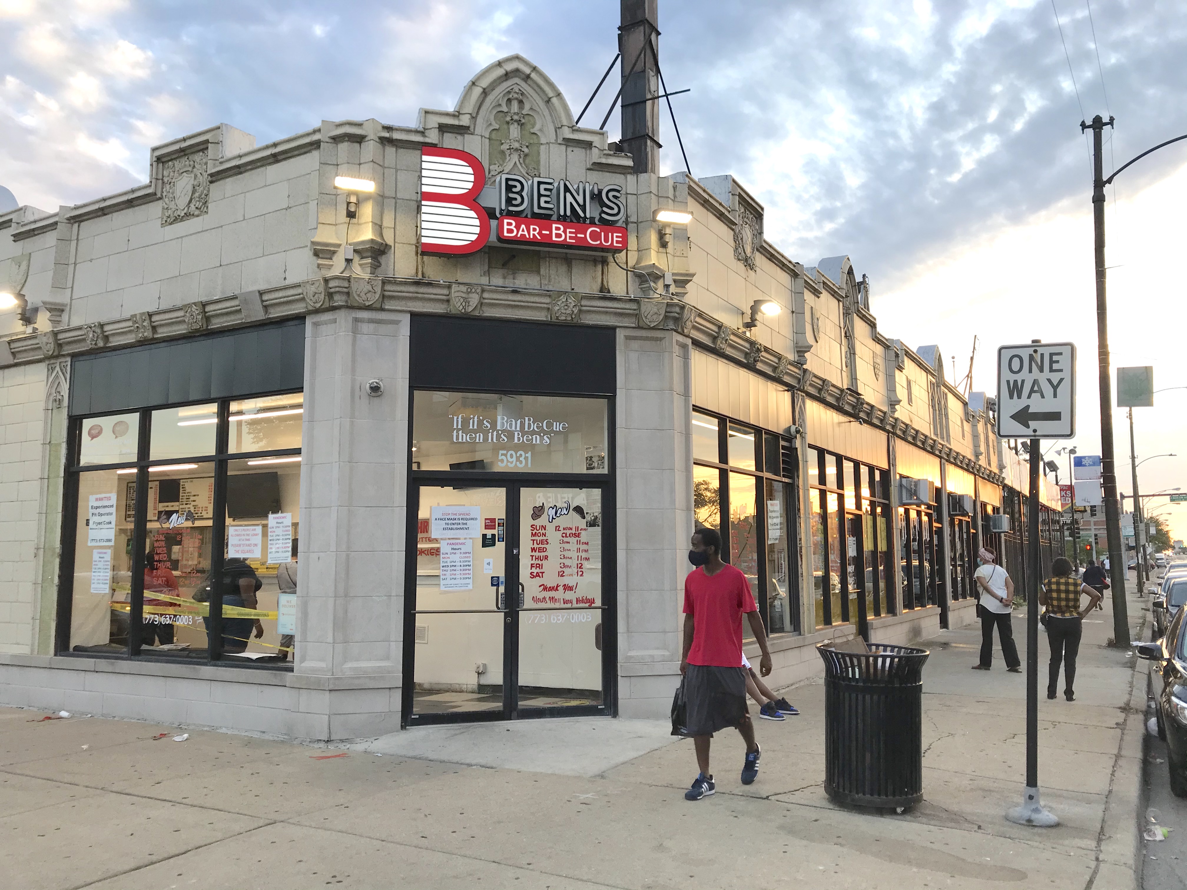
Pedaling south into the majority-Black Austin community, I pass Ben's Bar-Be-Cue, an appealing takeout place in an ornate old terra cotta storefront. However, I don't understand the logic of its slogan: "If it's barbecue then it's Ben's."
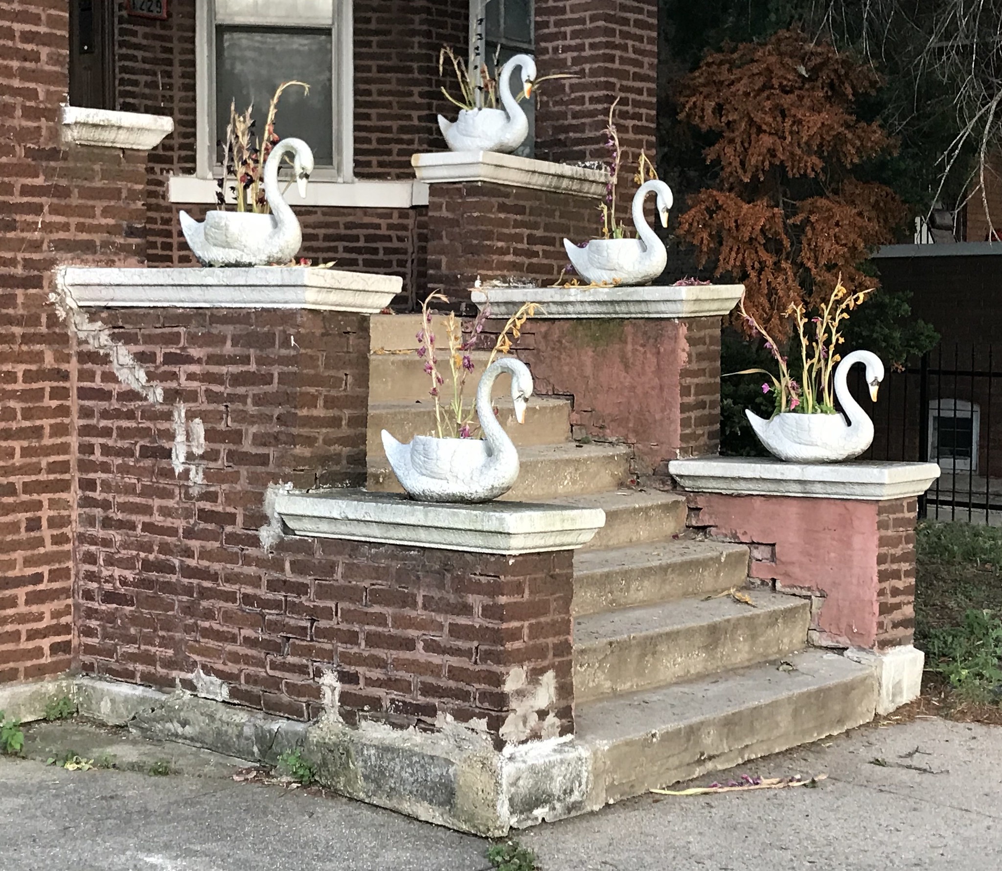
Continuing south on Mason and Mayfield avenue as the sun descends, many "Black Lives Matter" and tricolor Black Liberation flags are on display. Kids are playing on the sidewalk with toy cars and scooters, or jumping on a trampoline next to a community garden. People sell sno-balls with vividly colored syrups from card tables. Five swan-shaped planters stand cheerfully on a brick stoop. As I cross Madison, I look left toward Loop skyscrapers tinted pink by the sunset, about seven miles east, but seemingly a world away.
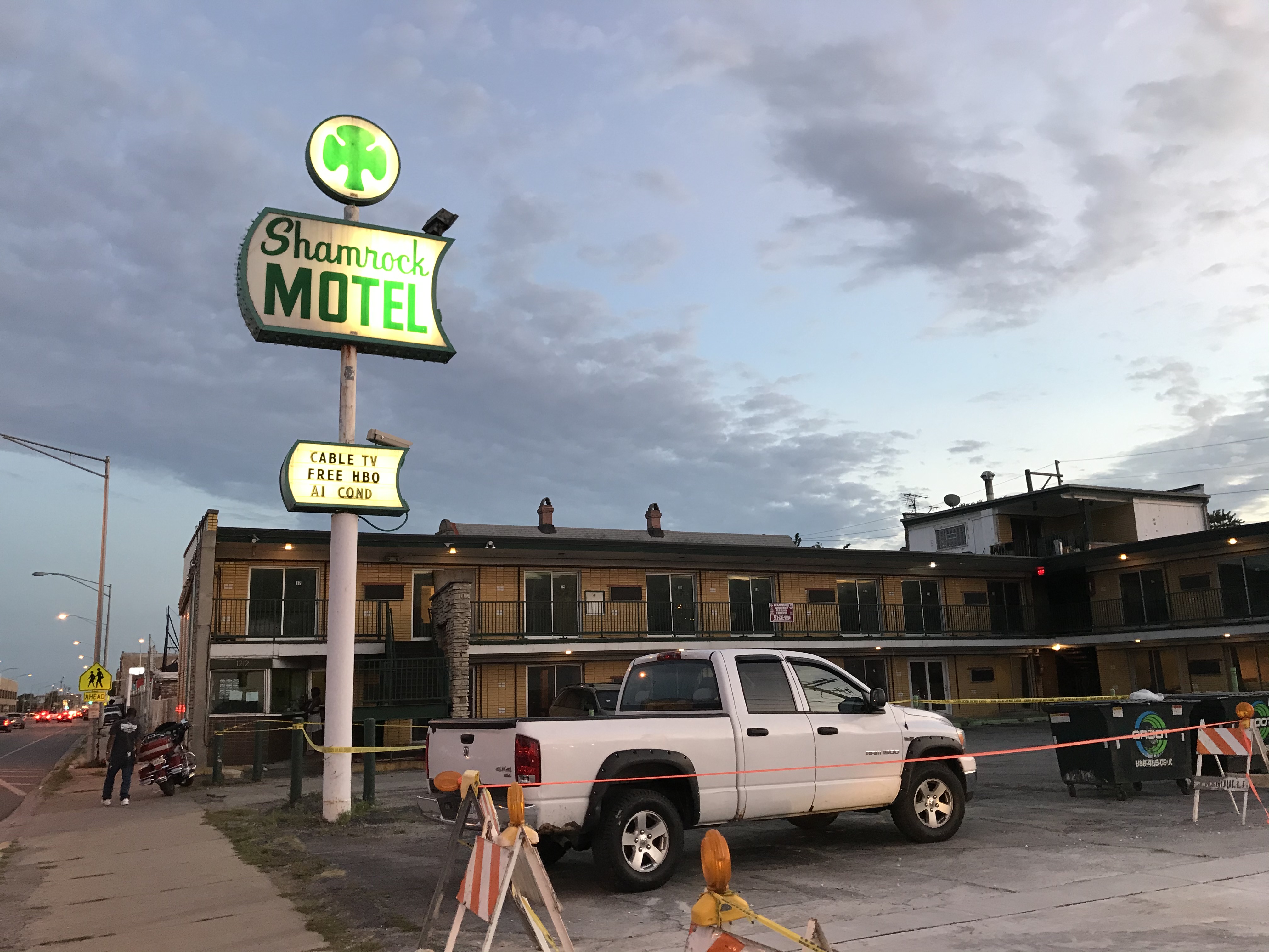
After crossing Columbus park, I roll east along Roosevelt Road into a mostly industrial zone, passing by the Shamrock Motel, another establishment with a cool old-fashioned sign. Just east, a two-story black-and-pink sex shop offers "Toys / Arcade / Lingerie 24/7."
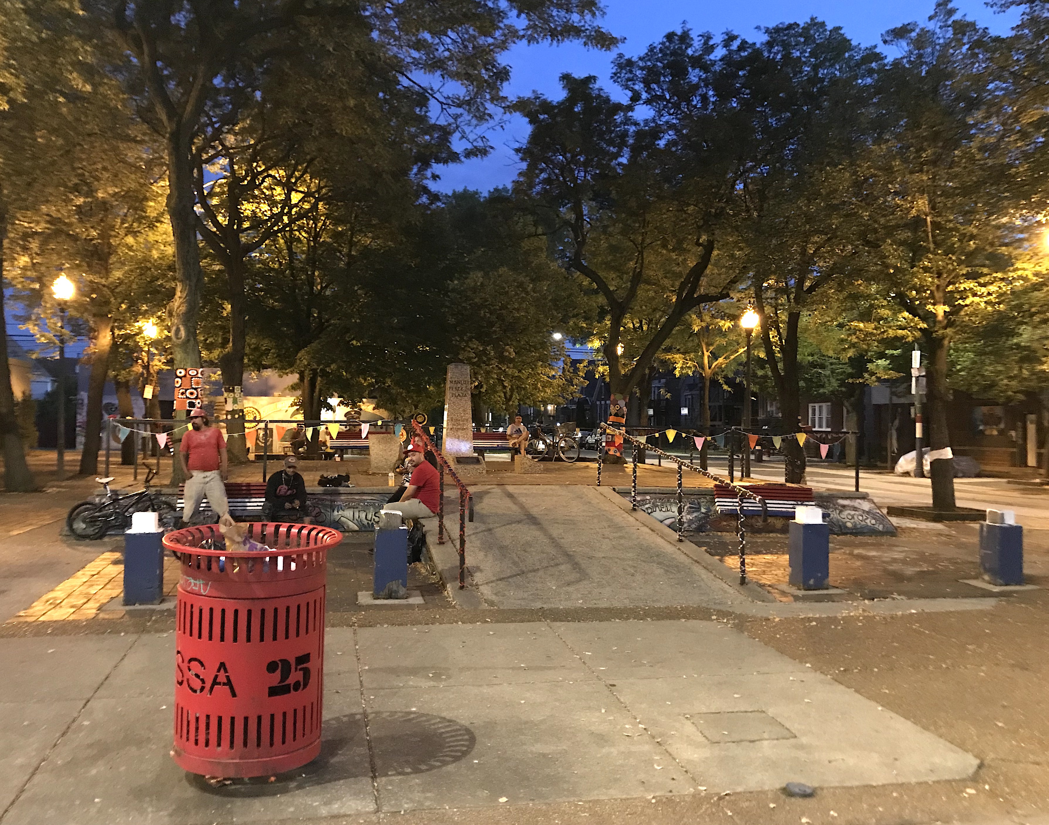
Heading south, it's time for dinner on 26th Street in the Mexican-American Little Village community, Chicago's second-busiest retail strip after the Magnificent Mile. At Taqueria Los Gallos, I pick up a tub of their specialty, carne en su jugo: beef, bacon, and beans in broth, garnished with radishes and avocado. I feast on it at nearby Manuel Perez Jr. Plaza, a memorial to a Chicano World War II hero who was killed by Japanese sniper fire in the Philippines. Across the street, a raucous band featuring tumbling timbale rhythms and a prominent tuba blares from at a backyard party. Nearby someone sets off fireworks so loud the plaza shakes.
Refueled, I continue south on the Pulaski Road bridge over the Chicago Sanitary and Ship Canal and the Stevenson Expressway and into Brighton Park. After passing through a desolate industrial zone with various trucking-related businesses, I take residential streets west through the Garfield Ridge community, part of the Southwest Side bungalow belt. There are many backyard gatherings here, including a full-blown house music dance party in someone's garage.
I've decided to spend the night at the iconic Rainbow Motel, about two miles west of Midway Airport, known for its waterbed-and-Jacuzzi rooms, including ones with Las Vegas, Hawaiian, outer space, and -- wait for it -- sandwich themes. While I feel a bit silly staying at a love hotel solo, I spent a night there with a significant other years ago, so I know it's a reasonably sanitary, non-scary place. It's also the cheapest option in the area, save for the nearby Skylark Motel which, ominously, doesn't offer overnight rentals until midnight.
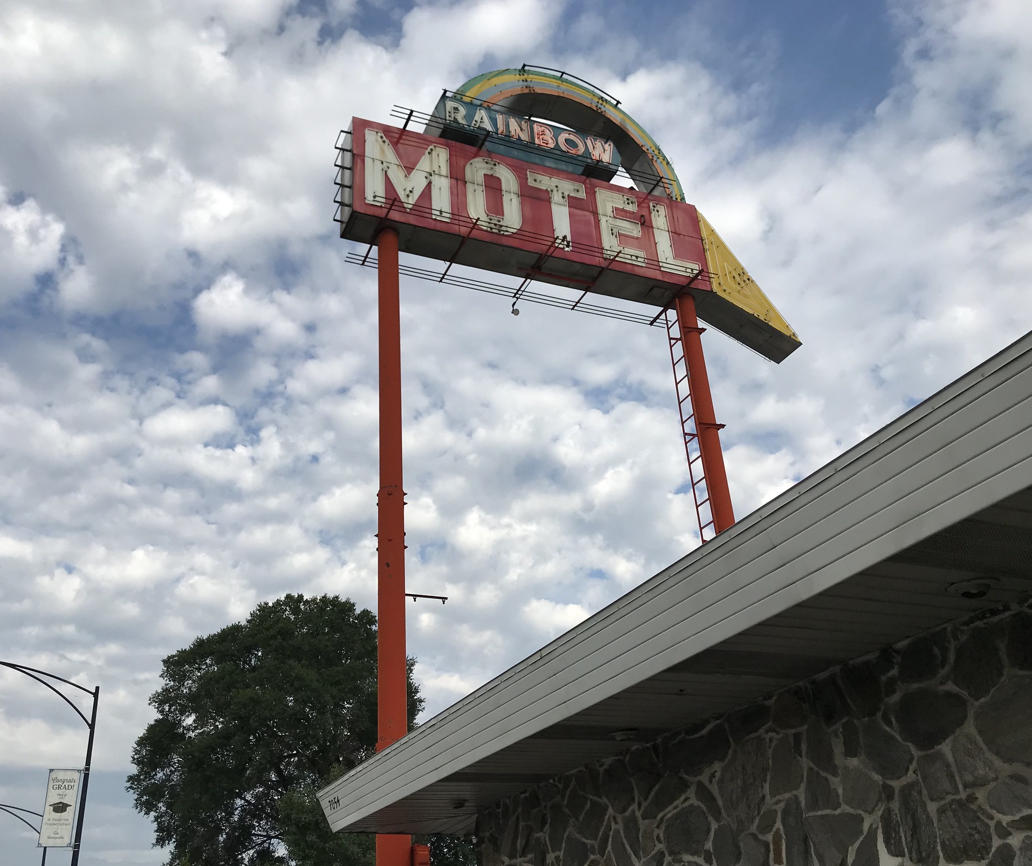
Granted, the bare-bones single room I stay in this time is nothing to write home about, and when I ask if it comes with a complimentary bottle of spumante, like last time, the desk guy laughs at me. But if you ever ride this route with your partner, I'd recommend splurging on one of the honeymoon-style rooms for what the motel's brochure calls a "dream fantasy vacation" experience.
In the morning I grab a Danish and doughnut at Weber's, the busy old-school bakery across the street, and resume my pilgrimage. Pedaling east on 64th Street in the Clearing neighborhood, I'm once again in cop-and-fireman land, as evidenced by the many variations on "Blue Lives Matter" flags flying, including one that also includes a red stripe for firefighters and a green one for border patrol agents.
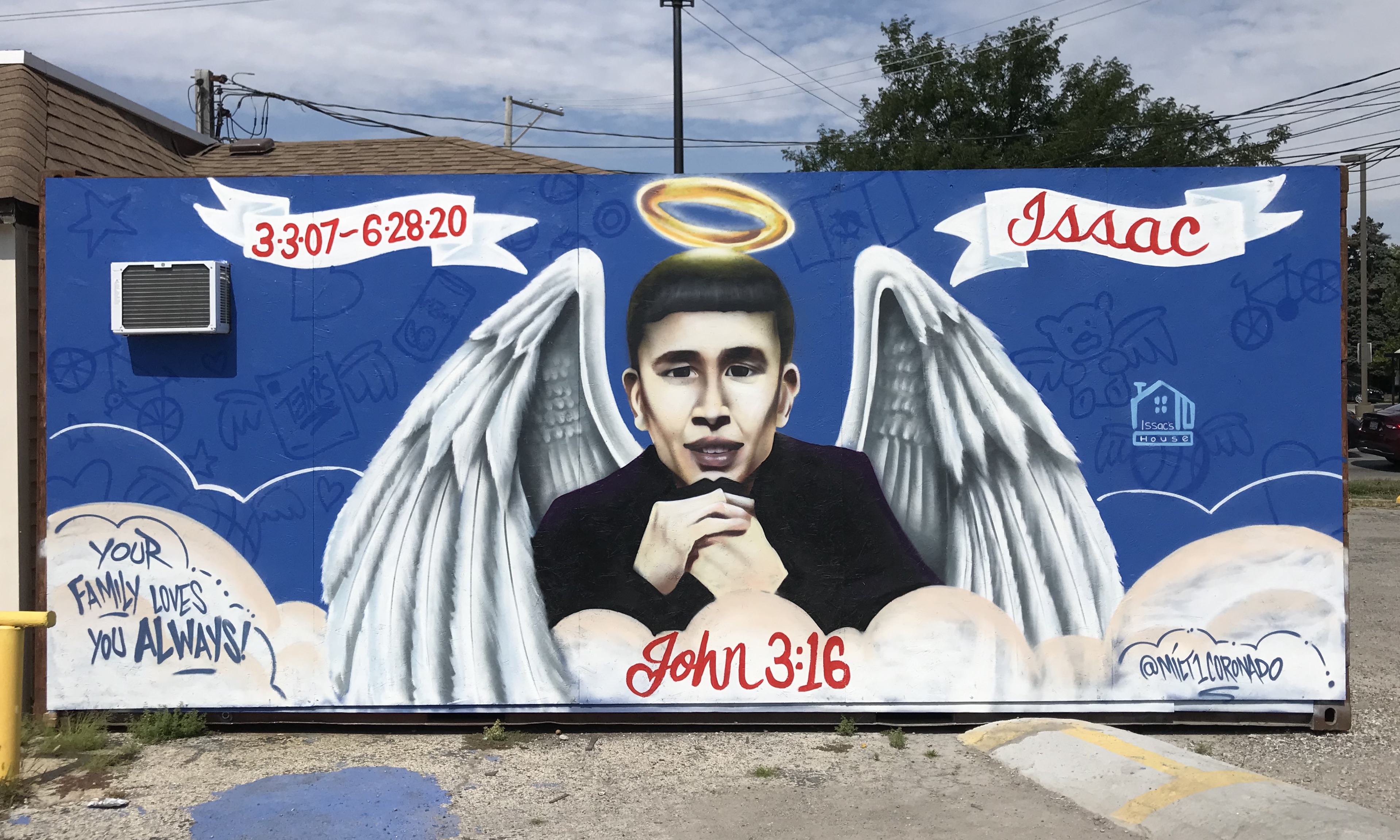
Rolling southeast into Ashburn, I check out Vito & Nick's, a contender for the best thin crust in Chicago, then head to Lawndale and Columbus to visit the shrine and mural honoring Issac Martinez, 13. An allegedly intoxicated hit-and-run driver killed Martinez on his bike last June. A white-painted "ghost bike" was also installed at the crash site with a sign reading "Safe Bike Lanes!"
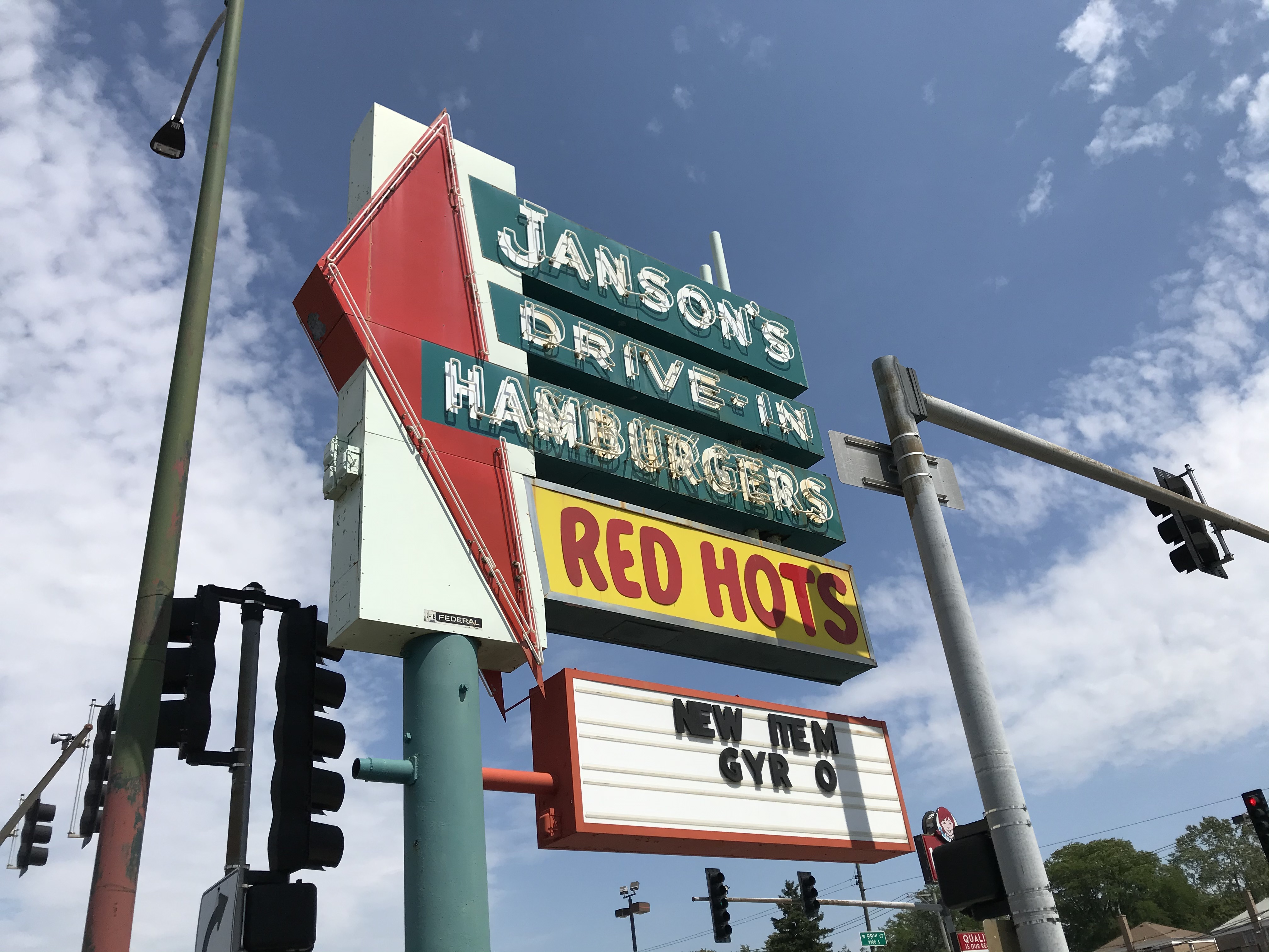
Pedaling east into Beverly, I grab a snack of chili cheese fries at Janson's Drive-In, which has another awesome Googie sign, serenaded by Buddy Holly and Chubby Checker. From there, annoyingly, the city boundaries veer west again, taking me farther from my finish line.
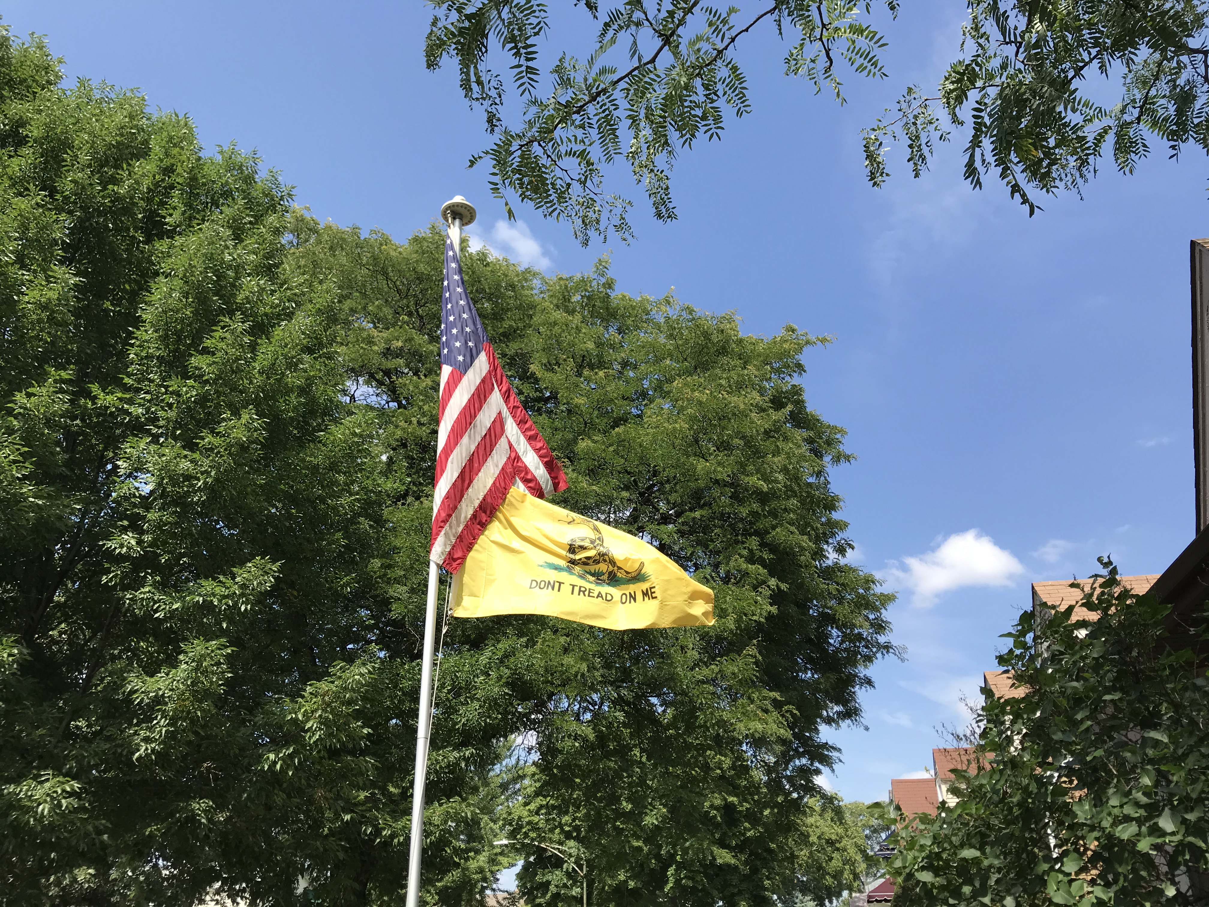
Next, annoyingly, the city boundaries veer west again, taking me farther from my finish line. Crossing Sacramento Avenue, I'm in the Mount Greenwood community, another overwhelmingly white cop-and-fireman neighborhood, with a history of racial tension. After rounding the Saint Xavier University Campus, I come upon a house with a "Don't Tread on Me" rattlesnake flag, a reminder that I'm in the only part of Chicago that voted for Trump.
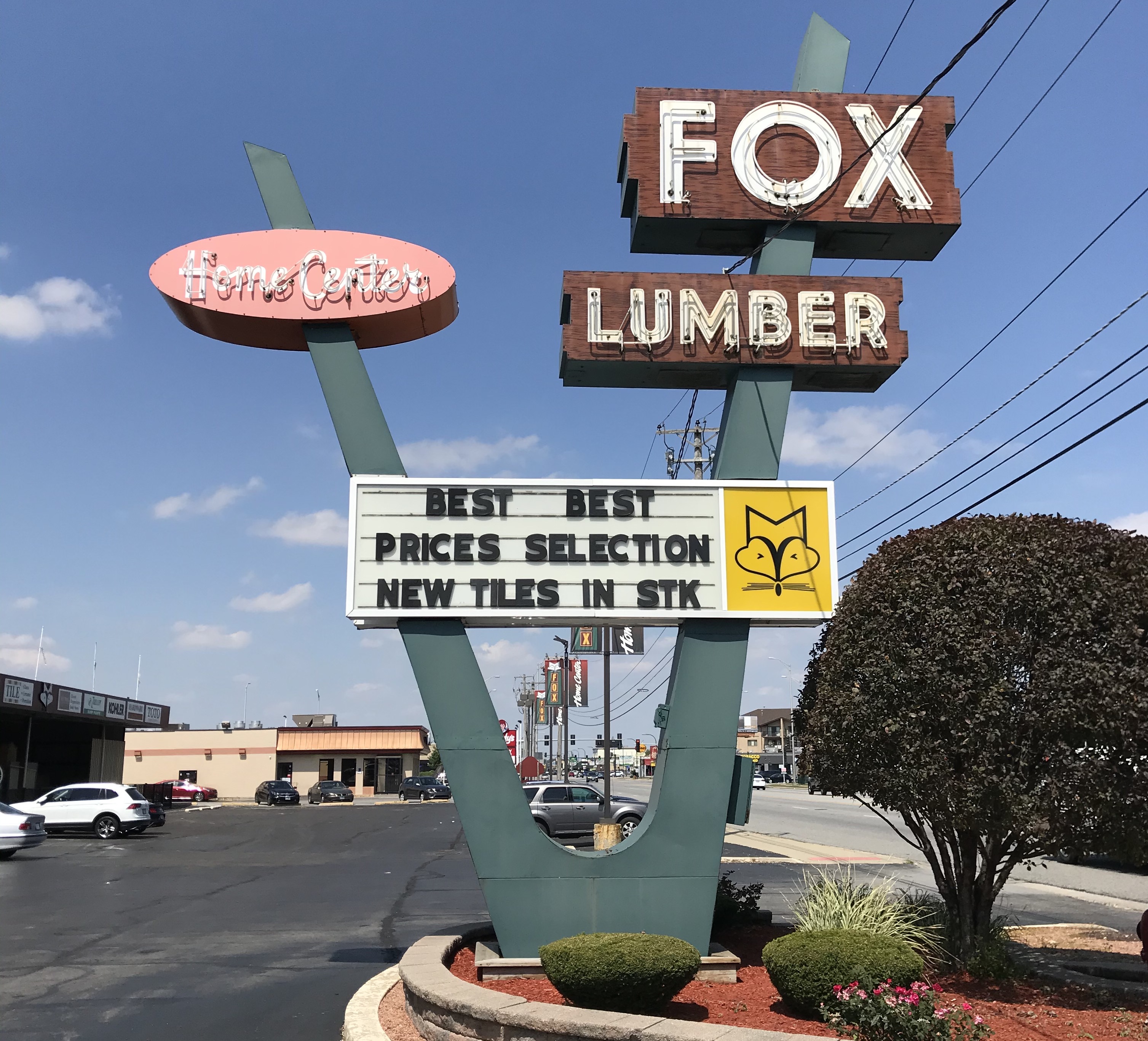
I ride three sides of Saint Casimir Cemetery on hectic multilane roads (one bright spot along the way is still another cool Googie sign, at Fox Home Center in Alsip), and then thankfully start making my final trek east. In the Morgan Park community, Saint Walter Catholic Church has an outdoor display of small sculptures of Jesus walking the stations of the cross, although sadly someone has ripped one of the crucifixes out of His hands.
After that I consider detouring a mile north to Home of the Hoagy, purveyor of the sweet steak, the South Side-only cheesesteak variant that's just about the only indigenous Chicago sandwich I've never tried. But decide I need to stay focused on my task if I'm going to complete this thing.
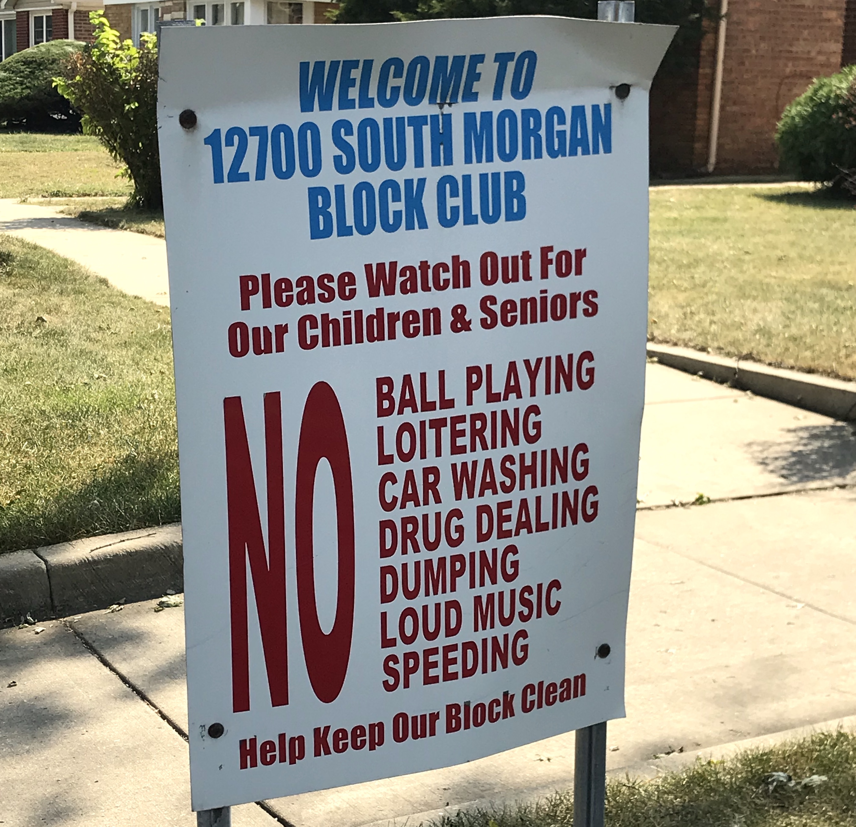
Continuing southeast into the African-American West Pullman community, the 12700 block of South Morgan has a block club sign, common on the South Side, prohibiting activities ranging from ball playing to drug dealing. Accordingly, this corner of the neighborhood seems neat and orderly. Tidy homes on the south side of 129th Street back up to the Calumet River, which forms the city border here.
On the other side of the river in the tiny Riverdale enclave, the only Chicago neighborhood south of the Calumet, it's a different story. Many houses are falling apart, seemingly awaiting demolition. Local community advocate Fatimah Al-Nurridin will later tell me she's not sure why this is the case, but there's interest in improving the area.
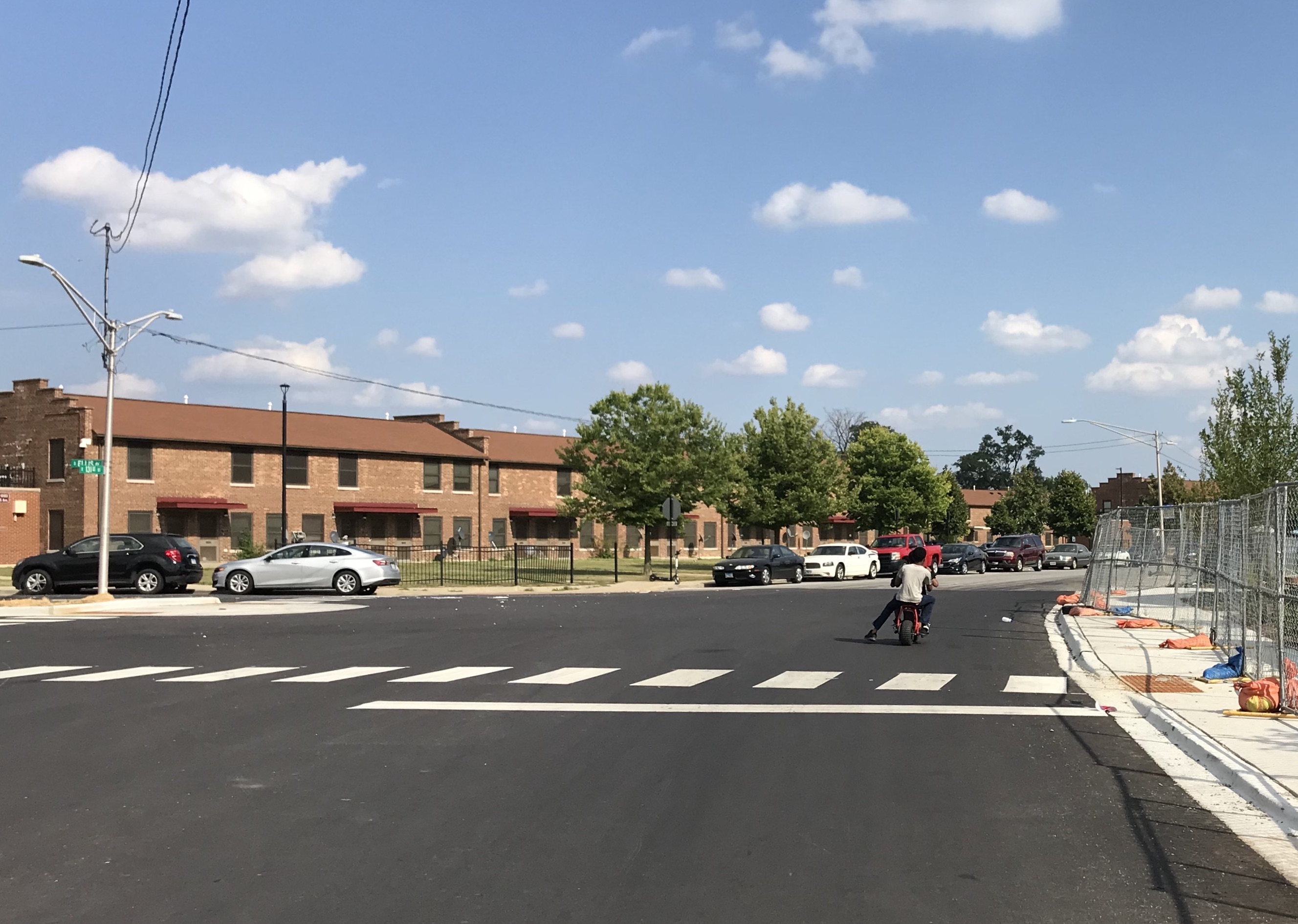
From there I head northeast into the Altgeld Gardens housing project, where two young boys on a gas-powered dirt bike try to talk me into racing them for a $5 bet so they can win and buy Cokes. "Sorry guys, I've got to keep moving," I demur. If I'd been quicker on my feet, I'd have asked them if they know Deloris Lucas, aka the Bike Lady, who runs the We Keep You Rollin' community cycling group out of nearby Golden Gate Park.
After that I make the harrowing but basically unavoidable trip east on high-speed 130th Street to get to Hegewisch, at the southeast corner of the city. Fortunately, once I cross the north-south section of the Calumet, an off-street bike path parallels the highway, providing relief from the traffic onslaught.
While it's still in the city, Hegewisch feels more like a sleepy small town in Indiana, which lies just east of the neighborhood. But Hegewisch got more than its fair share of interesting places to eat and drink. I pick up a tasty chicken-filled masa pocket at the no-frills shack Gorditas Adrian's, then roll east to tag the Hoosier border. On the way I pass Harbor Point Estates, Chicago's only trailer park.
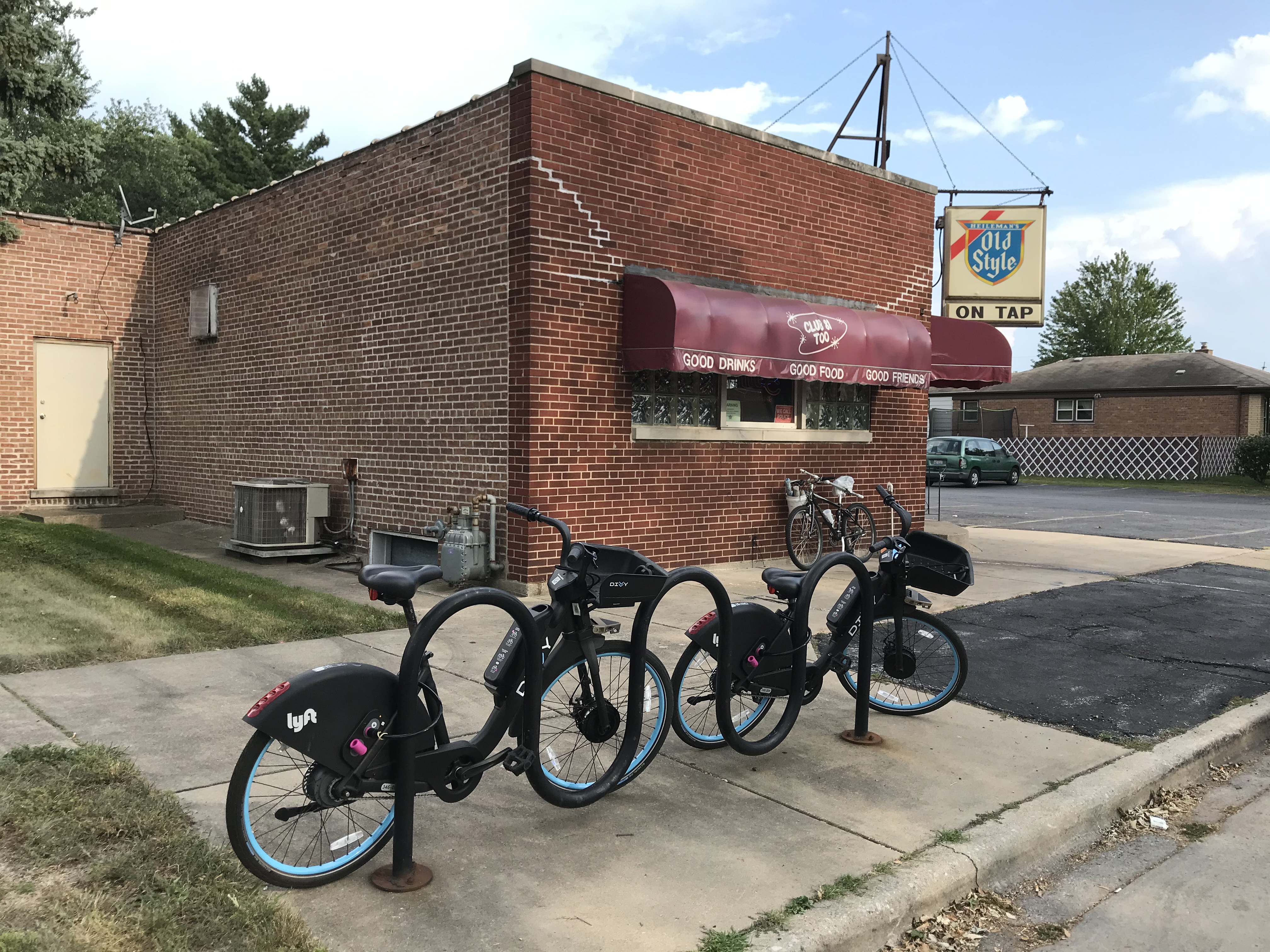
Finally it's time to head north again. After passing by Club 81 Too, a longtime corner bar known for its Friday fish fries, I roll past Wolf Lake, which straddles Illinois and Indiana and was home to an active Nike missile silo during the Cold War. I pick up the Burnham Greenway Trail and ride through lakeside Calumet Park, full of people grilling.
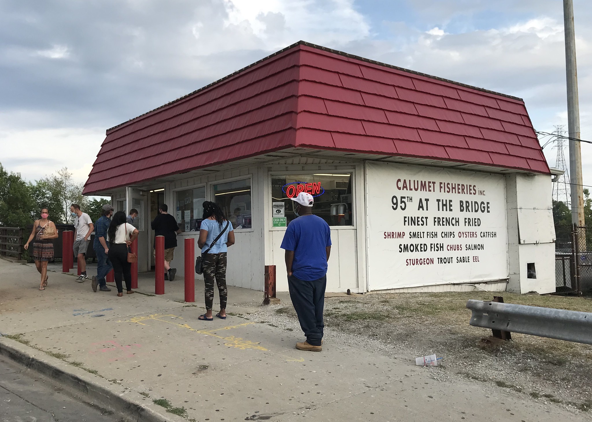
Next I head west on 95th Street to Calumet Fisheries to pick up a big hunk of garlic-pepper smoked salmon that I'll enjoy on bagels for most of the following week. Fun fact: The Calumet River bridge just the seafood shack stands by is the one Jake and Elwood famously jumped in the Bluesmobile.
Soon I'm at the Lakefront Trail again. I've got 16 miles of what should be smooth sailing on familiar turf with a sweet tailwind to complete my circuit.
But suddenly the sky darkens, and the wind does a 180. By the time I reach Promontory Point, I'm fighting a headwind and downpour, rolling into the jaws of a thunderstorm. Weirdly, the setting sun remains visible to my left, and then a rainbow materializes over Lake Michigan.
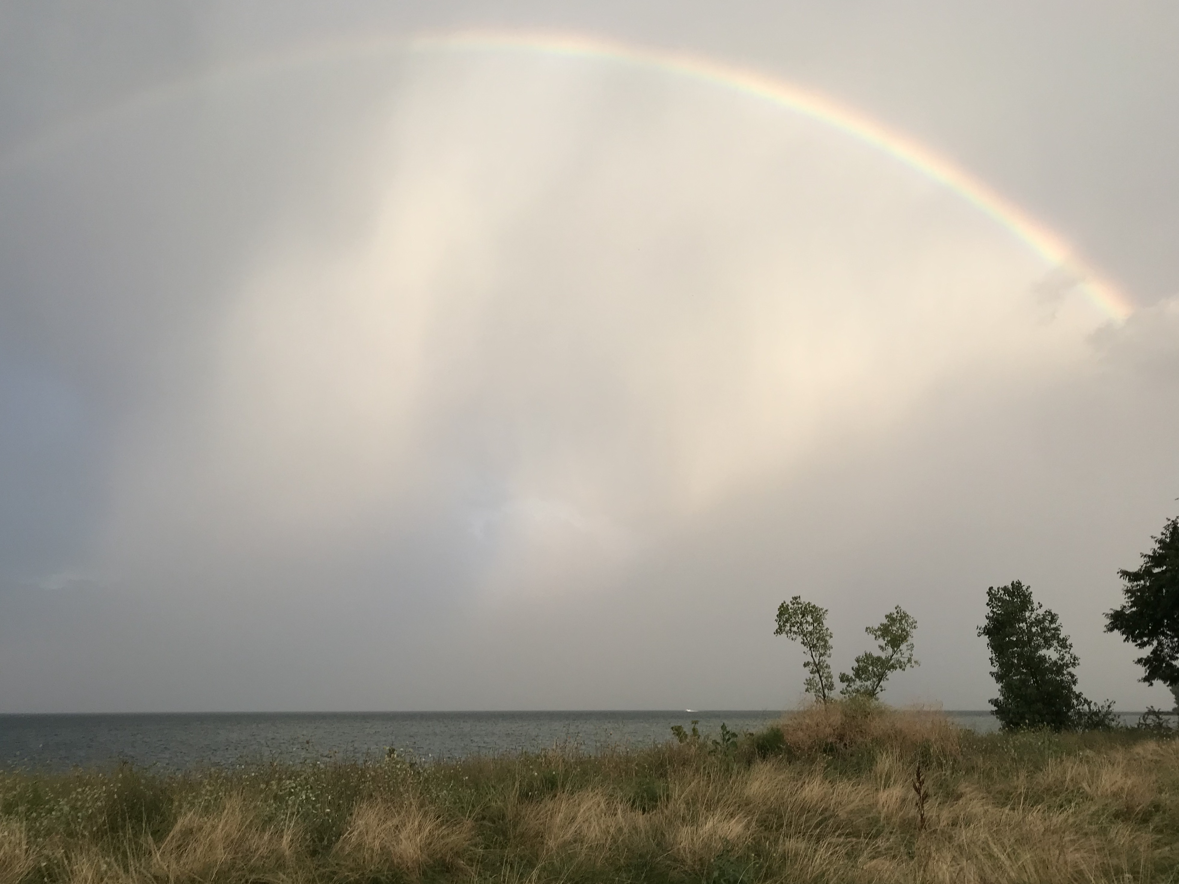
Luckily, the storm soon dissipates, and my spin back to Montrose is uneventful. But I can't imagine a more fitting grand finale to my epic circuit around Chicago than that bizarro sunset-thunder-rainbow.