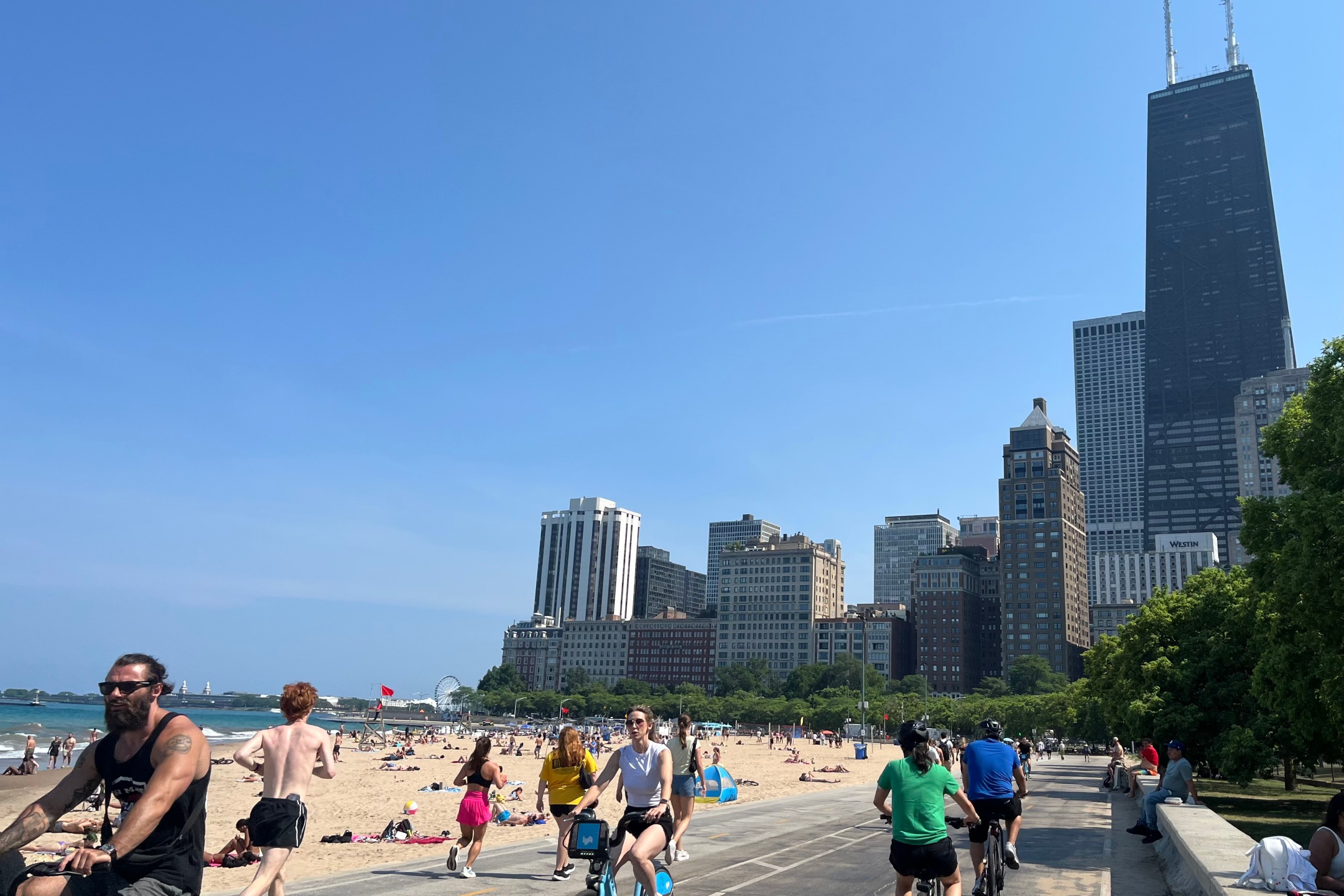
Today the Chicago Department of Transportation provided Streetsblog Chicago with a list of bikeways slated for 2018 installation, and it’s a promising roster, if somewhat North Side-centric.
In 2017 CDOT installed 16 miles of new bikeways and restriped 22 miles of existing bikeways. The 208 facilities included the popular Glenwood neighborhood greenway in Uptown and Edgewater, and dashed bike lanes on Milwaukee in Wicker Park as park of a "complete streets" redesign of the corridor.
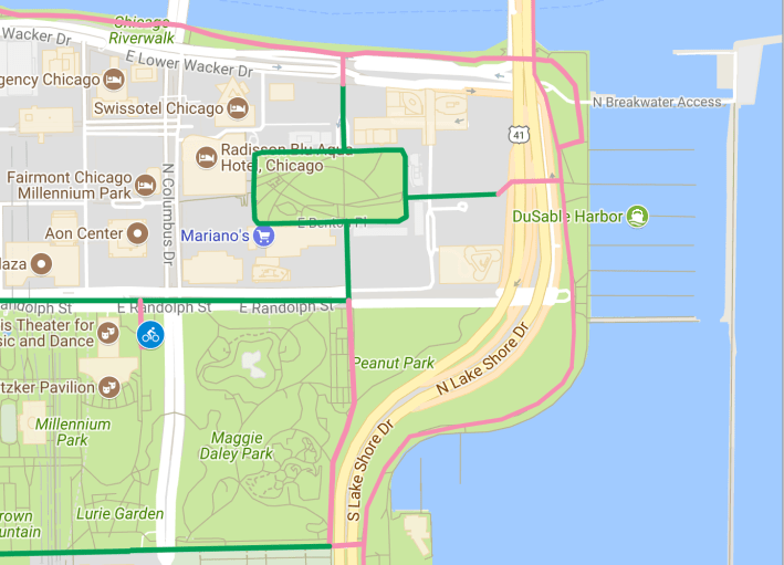
Green lines are planned protected bike lanes, red lines are planned buffered bike lanes, and orange lines are planned neighborhood greenways.
This year 20 miles of new bikeways and 20 miles of restriping are planned, including the following buffered and protected lanes.
- Stony Island Buffered Bike Lanes: Doty to 122nd
- Clinton Protected Bike Lane: extension from Van Buren to Harrison PBL
- Mid-Level Randolph Protected Bike Lane: Michigan to Lakefront Trail
- Washington Buffered Bike Lanes: Desplaines to Canal
- Cermak Buffered Bike Lanes: Marshall to Wood
- Vincennes Buffered Bike Lane: 76th to 69th
- Upgrading protected bike lanes with concrete curb
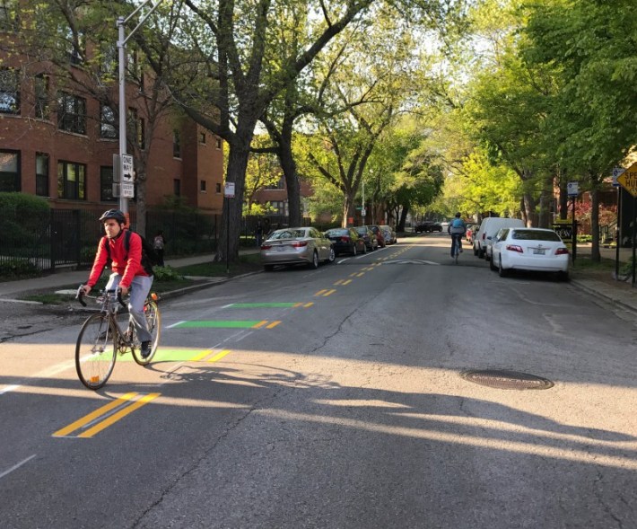
CDOT will also be putting in several miles of "neighborhood greenway" side street routes. These are essentially the same thing as “bike boulevards” in other cities. But so far proposals for concrete traffic diverters on these streets, which prevent drivers – but not cyclists – from using them as cut-through routes, have been shelved due to opposition from residents. The following routes will get 20 mph speed limits, other types of traffic calming, signs, and pavement markings.
- Glenwood (Ridge to Devon)
- Glenwood/Greenview (Devon to Evanston Border)
- Manor (Montrose to Lawrence)
- School/Roscoe (Lincoln to LSD)
- Wood (Milwaukee to Cortland)
- Cortland (Damen to Ashland)
A few thoughts on some of the upcoming bikeways:
The Stony Island lanes will improve bike access to Big Marsh bike park and nature center, something that South Side bike advocates have been requesting for years.
The protected lanes on mid-level Randolph are a good idea. Currently getting from Upper Randolph to the Lakefront Trail requires circuitous, non-intuitive routing, but taking middle Randolph is not for the faint of heart due to fast vehicle traffic and the gloomy environment. In addition to the protected lanes, better lighting would improve this route.
Extending the Washington bike lanes to from the West Loop to the Loop proper is long overdue. Last year a couple blocks of lanes were added from Halsted to Desplaines, so this new stretch will fill in the missing link to the protected lanes along the Washington Loop Link bus rapid transit corridor.
The Cermak buffered lanes will make an important through street a bit safer to bike on – that stretch currently has no marked bikeways -- and they will also help calm traffic and shorten pedestrian crossing distances. On the other hand, I still wouldn’t recommend riding on Cermak unless you’re accessing a destination on that street because it gets plenty of truck traffic, and 21st Street, a block north, offers a safer, more pleasant alternative.
The Vincennes buffered lanes represent a modest upgrade from the existing conventional bike lanes.
The extension of the Glenwood greenway north to Evanston will be handy, since the existing signed route from the Lakefront Trail to Evanston is a bit circuitous. It appears that the section of Glenwood from Ridge to Devon has already been striped.
The Manor greenway, which will connect California Avenue and Horner Park to the North Shore Channel Trail, is a project that was watered down. CDOT piloted traffic diverters on Manor in 2016, but the test was canceled after a backlash from residents who disliked having to adjust their driving routes.
The School / Roscoe greenway will help calm traffic on and publicize what is already an excellent east-west bike route (Roscoe is westbound and School is eastbound.) Even though the western terminus of the greenway routes will be Lincoln, School works as an eastbound route from Oakley (2300 west) to the lake, and you can head take Roscoe west to Roscoe Village (where it already has bike lanes) cross Western Avenue with a stoplight, and take bike lanes on Campbell south to Belmont to cross the river.
The Wood and Cortland greenways will extend the existing Wood greenway north from Milwaukee Avenue and make it a little safer to access the Bloomingdale Trail.
It’s great that almost all of these bikeways will make streets where plenty of people are already riding bikes safer and more pleasant for cycling. And the Stony Island lanes will encourage more people to ride to Big Marsh, an important South Side amenity that is currently a little scary to access on two wheels.
However, it’s unfortunate that just about all of Chicago’s neighborhood greenways – the above list plus the existing facility on Berteau in Ravenswood and Lakeview and a nearly completed greenway on Leland in Uptown – are being installed in relatively affluent, bike-friendly North Side neighborhoods. That’s because so far this type of bikeway has been funded by ward menu funds. That means that either the alderman has to be willing to spend money on the project, or residents have to vote for it in a participatory budgeting election.
In South Side and West Side communities with less biking and other infrastructure priorities, it may be tougher to get support for spending the local ward’s limited funds on bikeways (although neighborhood greenways benefit all road users by discouraging speeding.) But residents in these areas also deserve low-stress, traffic-calmed routes, so the city should figure a way to fund neighborhood greenways in all parts of town.