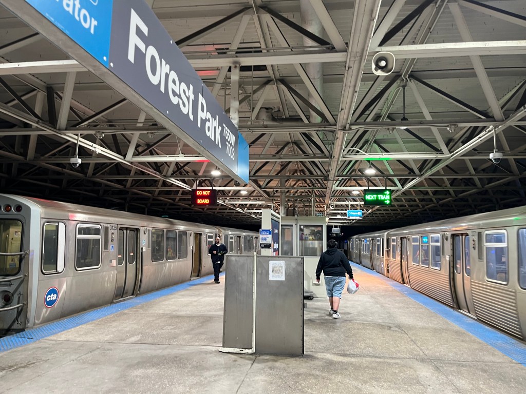
Even With the New Dockless Pilot, Chicago Still Has Vast Bike-Share Deserts
Chicago’s Divvy system has one of the most, perhaps the most, expansive service areas of any U.S. docked bike-share system, covering more than 100 square miles of Chicago’s 227 square miles and serving 63.8 percent of the population, according to the city government. And Tuesday’s launch of dockless bike-share technology on the Far South Side, mostly outside of the Divvy zone, provides access to shared bikes for somewhere on the order of 250,000 more residents. (The pilot area includes just about all of five wards, and parts of several others, and each of Chicago’s 50 wards contains roughy 50,000 people.)
But Active Transportation Alliance director Ron Burke has noted that just because all those people now live within the dockless bike-share (“DoBi”) pilot area, that doesn’t mean mean there will be enough cycles to go around. Companies are limited to releasing 250 bikes each, or only 50 if the cycles don’t have a built-in U-lock or cable lock for securing them to a fixed object. (After July 1, all bikes must be “lock-to” models.)
The current vendors include two operators with “free-locked” bikes (LimeBike and Ofo) and one with lock-to cycles (Zagster/Pace), so that’s at most 350 vehicles to be spread over something like a fifth of the city’s area, compared to about 6,000 Divvy cycles. However, word is that a fourth company, Jump Mobility, may soon deploy up to 250 lock-to bikes, and other vendors may get permits as well.
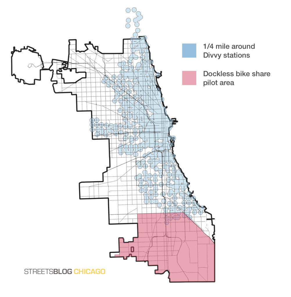
To get a better idea of exactly which parts of town currently have bike-share access, I asked Streetsblog’s Steven Vance to create a map superimposing the Divvy service area with the DoBi zone. Rather than simply drawing a line around the perimeter of all the Divvy stations, he drew a circle around each station with a quarter-mile (two standard Chicago blocks, or about five minutes of walking) radius. We’re guessing that’s about the maximum distance most people are willing to walk to access a bike-share station or get from the docks to their destination, so it more-or-less illustrates the territory that is actually served by the station.
The map shows that the dockless pilot expands the portion of the city with shared bikes by about 50 percent (although it’s worth noting that large portions of the territory, such as the Lake Calumet and Wolf Lake areas, are unpopulated.) But it also shows that huge swaths of the Southwest and Northwest sides don’t have access to Divvy or DoBi. Since federal funding for new bike-share docks will likely be in short supply under the Trump administration, expanding the dockless zone to include the entire city — which would essentially cost taxpayers nothing — would be the obvious solution to address that issue.
On the other hand, the city of Chicago wants to make sure that DoBi won’t cause major problems with street clutters as it has in other cities, or cannibalize traditional bike-share. So far the latter issue doesn’t seem to be a problem in Washington D.C., which is allowing dockless vendors to operate citywide.
And while the dockless pilot area generally includes all parts of the city south of 79th Street, superimposing it on the city boundaries shows that large parts of the Ashburn, South Chicago, and East Chicago community areas south of 79th were excluded from the service areas, which means that most residents in these sections also live in bike-share deserts. It’s not clear why these areas were left out, and the local aldermen have not responded to my inquiries.
Finally, Steven’s map illustrates that while the Divvy zone covers a large portion of the city, the coverage isn’t equitable because the stations are much closer to each other – and thus more convenient – in some parts of town than others. For example, in Lincoln Park, where stations are rarely more than two blocks apart, just about all residents live within a five-minute walk of a station. Meanwhile in Englewood, something like half of the territory within the Divvy zone isn’t within a convenient walking distance from the docks.
Granted, the higher density of people and destinations downtown and in North Lakefront neighborhoods partly justifies the higher density of docks in those parks of town. But it’s no surprise that most stations on the South and West sides have seen relatively little use, because the inconvenient station spacing makes them a lot less useful.

Read More:
Streetsblog has migrated to a new comment system. New commenters can register directly in the comments section of any article. Returning commenters: your previous comments and display name have been preserved, but you'll need to reclaim your account by clicking "Forgot your password?" on the sign-in form, entering your email, and following the verification link to set a new password — this is required because passwords could not be carried over during the migration. For questions, contact tips@streetsblog.org.