We Need Better Obama Center Transit Access, Not Wider Roads
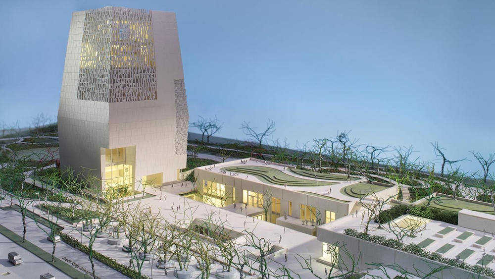
Rendering of the Obama campus. Image: Obama Foundation
[Streetsblog Chicago editor John Greenfield publishes a weekly transportation column in the Chicago Reader. We syndicate the column on Streetsblog Chicago after it comes out online.]
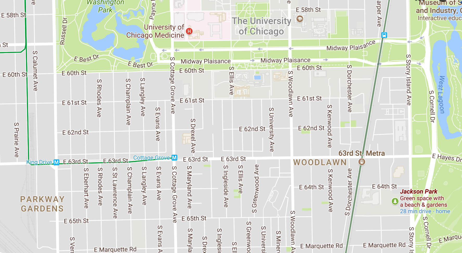
At last May's unveiling of preliminary designs for the Obama Presidential Center in Jackson Park, Barack Obama voiced support for boldly reconfiguring the Frederick Law Olmsted-designed green space to make it more people friendly. The proposal calls for converting most of Cornell Drive, a road through the park that ballooned to six lanes during the urban renewal era, to parkland between 59th and 67th Streets to connect the presidential center site to the rest of the lagoon-filled natural area. A section of Marquette Road would also be removed to unify the two halves of Jackson Park Golf Course.
Some community leaders argued that the road closures would create carmageddon for south-side commuters. But Obama noted that the plans call for building a sledding hill next to Cornell, plus plenty of new open space. He added that it's important not to get so "fixated on traffic that we lose sight of what's possible."
However, when the city of Chicago presented transportation plans for the center in August, the proposal was still fairly traffic obsessed, with relatively little attention paid to improving transit, walking, and bike access to the area as a strategy to reduce driving.

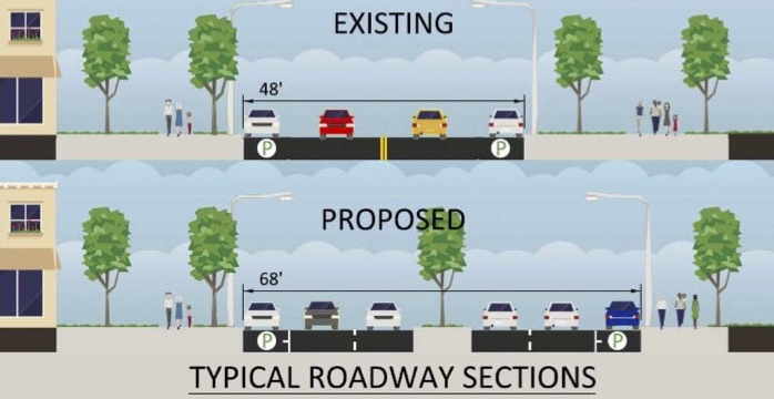
To handle expected rush hour overflow traffic from the Cornell closure (Marquette isn't a major commute route), the proposal calls for widening other nearby roads. Specifically, the city's plan calls for adding a new southbound lane to the five-lane segment of Lake Shore Drive between 57th and Hayes Drive, the southern border of the presidential center site. Parking would be stripped from Hayes to expand it from two travel lanes to four. And parkland would be gobbled up to add two lanes to Stony Island between 59th and 63rd/Hayes and one lane to Stony from 63rd/Hayes to 67th.
All told, there would be a net gain of three to five acres of green space. While the Chicago Department of Transportation hasn't released an official cost estimate for the expansions, Mayor Rahm Emanuel has indicated that the widening of LSD alone would cost upward of $100 million, which he hopes to pay for with state funds.
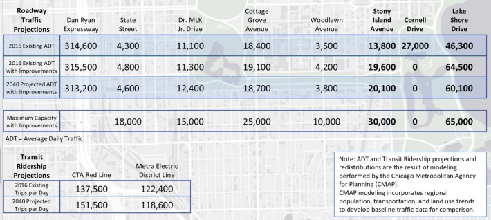
In addition to being expensive, the expansions would actually encourage more driving. Even with the closure of Cornell, the widening of Lake Shore Drive and Stony Island would create enough capacity for 95,000 vehicles per day, 7,900 more than are currently using the three roadways in the area, and a full 14,800 more cars than are projected to use LSD and Stony by 2040, according to CDOT. This is the wrong strategy for a city with the stated goals of reducing car dependency and fighting climate change.
This approach also ignores the phenomenon of "traffic evaporation"—when road capacity is decreased, some drivers respond by avoiding unnecessary trips or switching to other modes. So if we closed Cornell without adding capacity elsewhere, it's likely many of the current trips would disappear, especially if CTA and Metra service were increased.
So far the city has released relatively few details on plans to improve walking, biking, and transit access to the campus. Proposed sidewalk bump-outs and pedestrian islands will make it easier to cross nearby streets, although the widening of Stony Island will generally increase crossing distances, and four new pedestrian-bike underpasses may be added to Jackson Park. CDOT may also stripe some of the bike lanes recommended for local roadways in the city's Streets for Cycling 2020 plan. But that's about it, and the city has said even less about boosting bus and rail access.
Transit advocate Mike Payne, a native of South Shore, voiced his displeasure with the car-centric Obama center plan when he spoke before the CTA board at its January meeting. Since 1996 he's been pushing for the Gray Line, his proposal to convert the Metra Electric District line to rapid transit and integrate its fare system with the CTA as a strategy to improve job access and encourage investments on the south side. In 2016 a consortium of 14 south-side groups formed to advocate for similar goals.
Payne noted that the Gray Line would provide direct CTA train service from downtown's Millennium Station to the MED's 59th Street stop, just north of the Obama center. It could also reduce the number of car commuters on LSD and Stony Island. He added that the city's and the foundation's submitted plans for the campus offer "no type of improvements to public transit in the area—only road modifications."
Independent of the Obama center plans, in September Metra increased service between Millennium Station and Hyde Park so that trains run every 20 minutes or so until 7 PM. The train trip to the presidential center takes about 20 minutes. Metra is also planning to rehab the 59th Street station, including adding elevators and reopening the 60th Street entrance, according to spokesman Michael Gillis.
On the other hand, the CTA hasn't announced any plans to boost bus and rail service to the center—spokeswoman Irene Ferradaz says it's "premature" to do so. As it stands, the #2 Hyde Park Express, #6 Jackson Park Express, #15 Jeffery Local, and #28 Stony Island bus lines run past the site on Stony Island.
The campus location makes the 1997 amputation of the Jackson Park branch of the Green Line particularly regrettable. At the time, community leaders led by Bishop Arthur Brazier argued that the elevated tracks were a blight that discouraged development. But if they hadn't been torn down east of Cottage Grove Avenue, the old Stony Island station would have been kitty-corner from the new attraction.
Last month there was a small victory for making the presidential center less auto-centric when the foundation bowed to pressure from various community groups who opposed plans for an aboveground parking garage on the east end of the nearby Midway Plaisance. Instead the facility will be built below the campus, although it will still hold a whopping 400 to 450 cars.
When I asked Obama Foundation spokesman Sam Michel whether the foundation has looked into beefing up noncar access to the center as an alternative to costly road expansion, he referred me back to Metra and the CTA.
Since the foundation and transportation officials expressed little interest in the idea of increasing sustainable transportation access to the center as a way to avoid road widening, I ran it by local transit gurus Steve Schlickman, a former Regional Transit Authority chief, and DePaul transportation professor Joe Schwieterman. Schlickman was skeptical that even $100 million would be enough to pull off Payne's Gray Line proposal, arguing that the MED would need costly switching improvements and electrical system upgrades in order to accommodate el-train-style frequency.
But both experts argued that offering nonstop CTA bus service from the Loop to the Obama center and the nearby Museum of Science and Industry would be a relatively inexpensive way to encourage visitors to take transit to these attractions instead of private cars, taxis, or ride hailing. (The #6 bus covers this route but makes many stops in Kenwood and Hyde Park on the way to Jackson Park.) While the MED is also a quick, direct route to the park, Schwieterman noted that Metra is more intimidating for tourists because "it requires doing some homework by studying scheduling and local stops."
Unfortunately, decision makers seem dead set on widening roads to facilitate driving to and past the Obama center, even though the numbers show that the current plan is overkill. All the same, residents should continue to push for excellent CTA and Metra service to the campus, so that those supersize streets don't simply clog up with cars again.
Stay in touch
Sign up for our free newsletter
More from Streetsblog Chicago

State legislators pushing for merging CTA, Pace, and Metra into one agency spoke at Transit Town Hall
State Sen. Ram Villivalam, (D-8th) and state Rep. Eva-Dina Delgado (D-3rd), as well as Graciela Guzmán, a Democratic senate nominee, addressed the crowd of transit advocates.

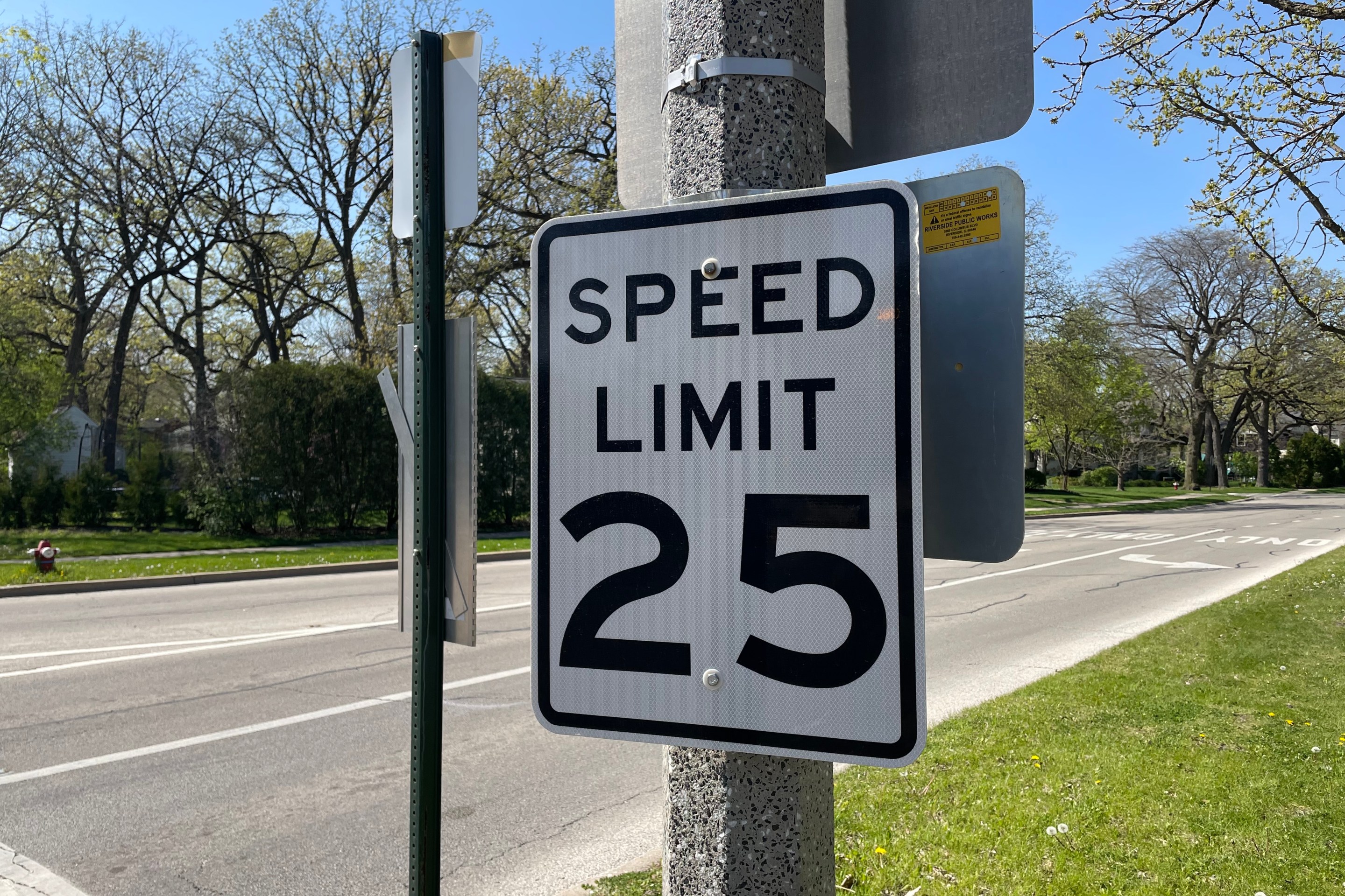
Equiticity and ATA: Passing a 25 mph speed limit should be combined with street redesigns that calm traffic
Equiticity, a mobility justice nonprofit, says the new speed limit shouldn't involve increased enforcement, which it says would disproportionately impact drivers of color