How Houston’s Sprawl Makes It Harder to Cope With Storms Like Harvey
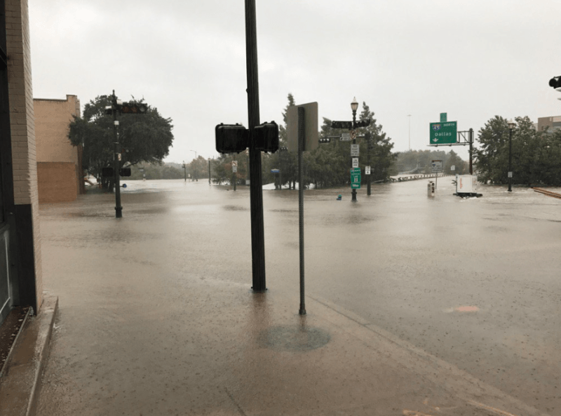
Hurricane Harvey has dropped more than 20 inches of rain on Houston, and the scenes from the city are devastating. Emergency crews carrying children through waist-deep water out of flooded homes. Nursing home residents waiting in a murky indoor lake to be rescued.
As the rescue effort unfolds (if you want to contribute, Slate has an overview of local charities helping victims of the storm), we should also be asking how to prevent or mitigate future storms. On a global scale, Harvey is another sign of the urgency of climate action to prevent superstorms from becoming ever more frequent and destructive.
Locally, while any city would be overwhelmed by so much rain in so little time, land use in the Houston region has made a difficult situation worse. Woods and prairies that used to provide a measure of resilience against stormwater are now covered in impervious surfaces, and development has sprawled into low-lying floodprone areas, increasing the public’s exposure. Last year, ProPublica reported that the region “has paved over over 166,000 acres of mostly former coastal prairie since 2001, land that held highly absorbent grasses.”
Jeff Wood, who grew up in the Houston region, has been thinking about how the city’s development patterns contributed to the current crisis. At the Overhead Wire, Wood writes that the problem is not Houston’s “lack of zoning” so much as a transportation and development paradigm that’s completely heedless of considerations like stormwater absorption and steering clear of the floodplain.
Wood flags a Texas development tool called the Municipal Utility District as one vehicle for runaway sprawl in the Houston region:
I’m sure MUDs exist in other places but they don’t seem to be as prolific as they are around the suburbs of Houston. The basic idea of a MUD is that it’s a way for developers to buy land and set up shop to build new development. Once they own the land they can request the creation of a MUD that allows them to sell tax exempt bonds for infrastructure…
So if a developer can just plop down anywhere in the county and build a massive development of single family homes, it stands to reason that regional drainage and water networks are not a top planning priority.
All this development gobbling up natural lands was enabled by the region’s expensive freeway habit:
But Houston as a region is currently working on its 3rd ring road and has made it a point of developing these roads to open up areas to development. The most recent example being the Grand Parkway, which organizations such as Houston Tomorrow have fought vociferously. The Grand Parkway now looks like an even worse decision considering it’s now opening up the Katy prairie land to more development, area that should really be left to its natural state.
More recommended reading today: Dezeen looks at how cities could use trees instead of bollards to prevent vehicular terrorism. And Buffalo Rising reports on a new design concept for the removal of the Scajaquada Expressway that involves making a historic bridge in the Olmsted-designed Delaware Park car-free.

Read More:
Streetsblog has migrated to a new comment system. New commenters can register directly in the comments section of any article. Returning commenters: your previous comments and display name have been preserved, but you'll need to reclaim your account by clicking "Forgot your password?" on the sign-in form, entering your email, and following the verification link to set a new password — this is required because passwords could not be carried over during the migration. For questions, contact tips@streetsblog.org.