A proposal in the update to the business improvement district's master plan would improve the walkability and economic viability of a short block of Milwaukee Avenue at a busy intersection. Across from the Polish Triangle, the little public square inside the intersections of Ashland/Milwaukee/Division, is a short block on the northeast side that has trouble retaining storefront businesses, and has no landscaping or pedestrian amenities.
The Wicker Park-Bucktown Special Service Area is a city-designated area that levies a low tax on property owners within the district to market the businesses and help fund aesthetic and infrastructural changes. The SSA board adopted the update to its award-winning master plan in December. It maintains and extends the same sustainability goals to continue improving access to the Wicker Park and Bucktown neighborhoods for people coming on bikes, on sidewalks, or via transit.
The proposal would widen the sidewalk to create space for sidewalk cafés, trees, and benches. The problem, the plan says, is the "the area’s popularity has stressed the sidewalks that are trying to serve sidewalk cafes, bike parking, newsstands, sign and lightpoles, etc. All components contribute to a vibrant area, but can make it hard to get around."
Currently, two storefronts are vacant. Sweet Cakes Bakery moved here from their location a mile away on Damen Ave. near Chicago Ave., but it didn't last long. The storefront designs themselves aren't particularly inviting to walk-up patrons. That leaves the block without any businesses to support the "linger longer" type of activity business districts like WPB are aiming for, ones where you can get a coffee or snack to go and then find a spot outside to relax.
A wider sidewalk also means shorter crossing distances to the Polish Triangle, where there's a 24-hour Blue Line entrance, along Ashland and Division.
The WPB SSA has been mildly successful in some of its efforts to create a "vibrant" Polish Triangle, but they currently rely heavily on programming and mostly occur in the summer. There's often more pigeons than people here.
The plan also proposes a bike lane in both directions of Milwaukee on this short block. Milwaukee Ave. is the busiest street for biking in the city and the change would dedicate space for cycling where there currently isn't any. This would mean that the handful of car parking spaces on the northbound side of the street would go away.
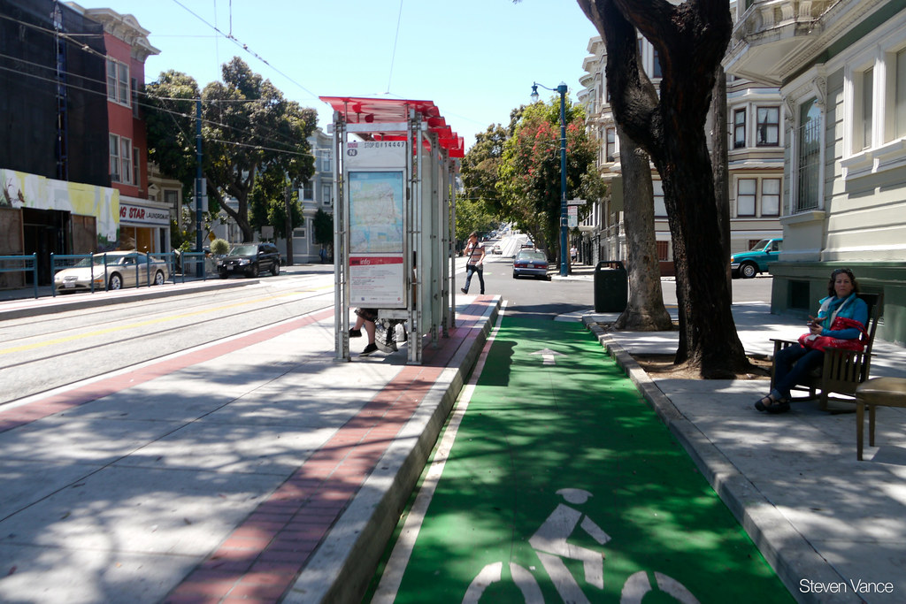
I believe the proposal should go a step further and create the city's first raised bike lane and combination "floating" bus stop for the northbound 56-Milwaukee bus at its existing stop on the east side of Ashland.
Here's how it would work: Cycling northbound, you're on the raised bike lane between the sidewalk and the road, but as you approach the bus stop at Ashland you'll curve towards the right a little so an island can be carved out for waiting bus riders. In this configuration the bus never has to leave the flow of traffic and wait to re-enter it.

These are essential to eliminate the inherent conflict of a bus and a bicyclist trying to share the same space. They're ideal for several existing bike lanes in Chicago, including on Clark Street where there is a lot of bus traffic, and on 55th where there's a protected bike lane – except at bus stops.
Another option is to move the bus stop on the far side of Ashland, which can decrease delays on the route.


