Maps
Top Categories
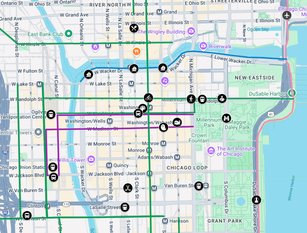
Feeling out of the Loop? Try our interactive map of walk/bike/transit landmarks in downtown Chicago
Recently, Streetsblog Chicago heard from Phil D'Anieri, Teaching Professor at the University of Michigan's Department of Urban and Regional Planning. This week, he's leading a class on a transportation-themed trip to the Windy City. These students are in a new degree program called Urban Technology, and they'll be spending their time in Chicago looking at issues and opportunities related to sustainable transportation.
June 10, 2025
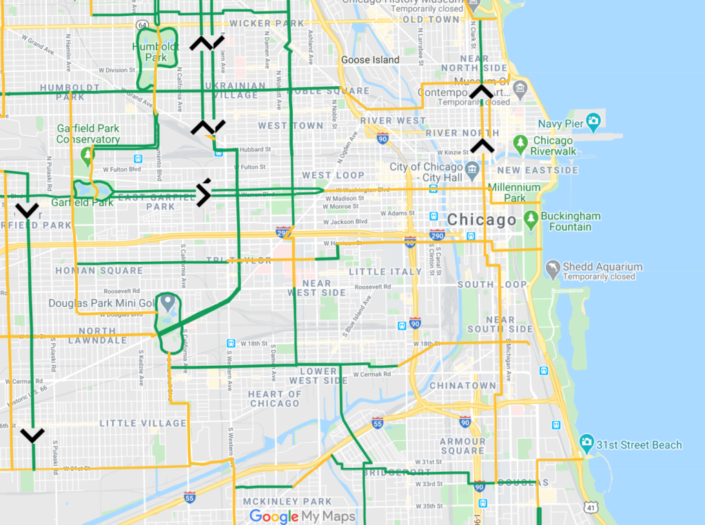
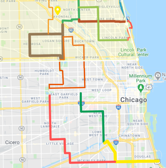
Mapped: Here’s how to bike around the Kinzie to Chicago Ave. closure of the Milwaukee Avenue “Hipster Highway”
Milwaukee Avenue, the diagonal street that runs about 11 miles northwest-southeast between downtown and Superdawg Drive-In in the Norwood Park neighborhood, is Chicago's most important cycling street. It's got the highest ridership of any roadway in our city, and since it's the most direct route from the Loop to Wicker Park, Logan Square, and Avondale, some call it the "Hipster Highway."
April 4, 2025

After inaccurate claims by alders that speed cams are concentrated on South, West sides, these areas aren’t getting many of the 16 new ones
While there have been racial disparities in who is getting tickets for speeding, existing camera locations aren't to blame, but income-based fines are needed.
March 31, 2025
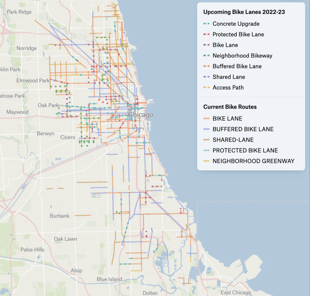
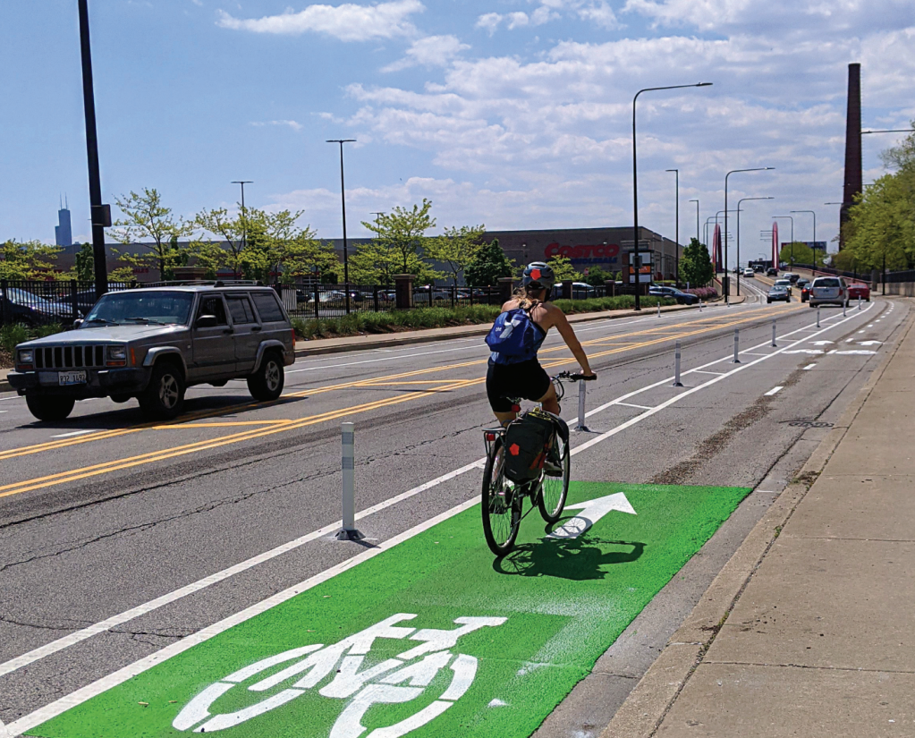
Check out the colorful Chicago Current and Upcoming Bike Lanes map
Chi Hack Night volunteer Sean MacMullan geocoded Chicago Department of Transportation bike network data and created the nifty map
July 11, 2023
Here’s the colorful story of how CTA ‘L’ lines got their hues
While it seems like the CTA's lines have been designated with colors forever, it's actually only been that way for a few decades.
March 2, 2023

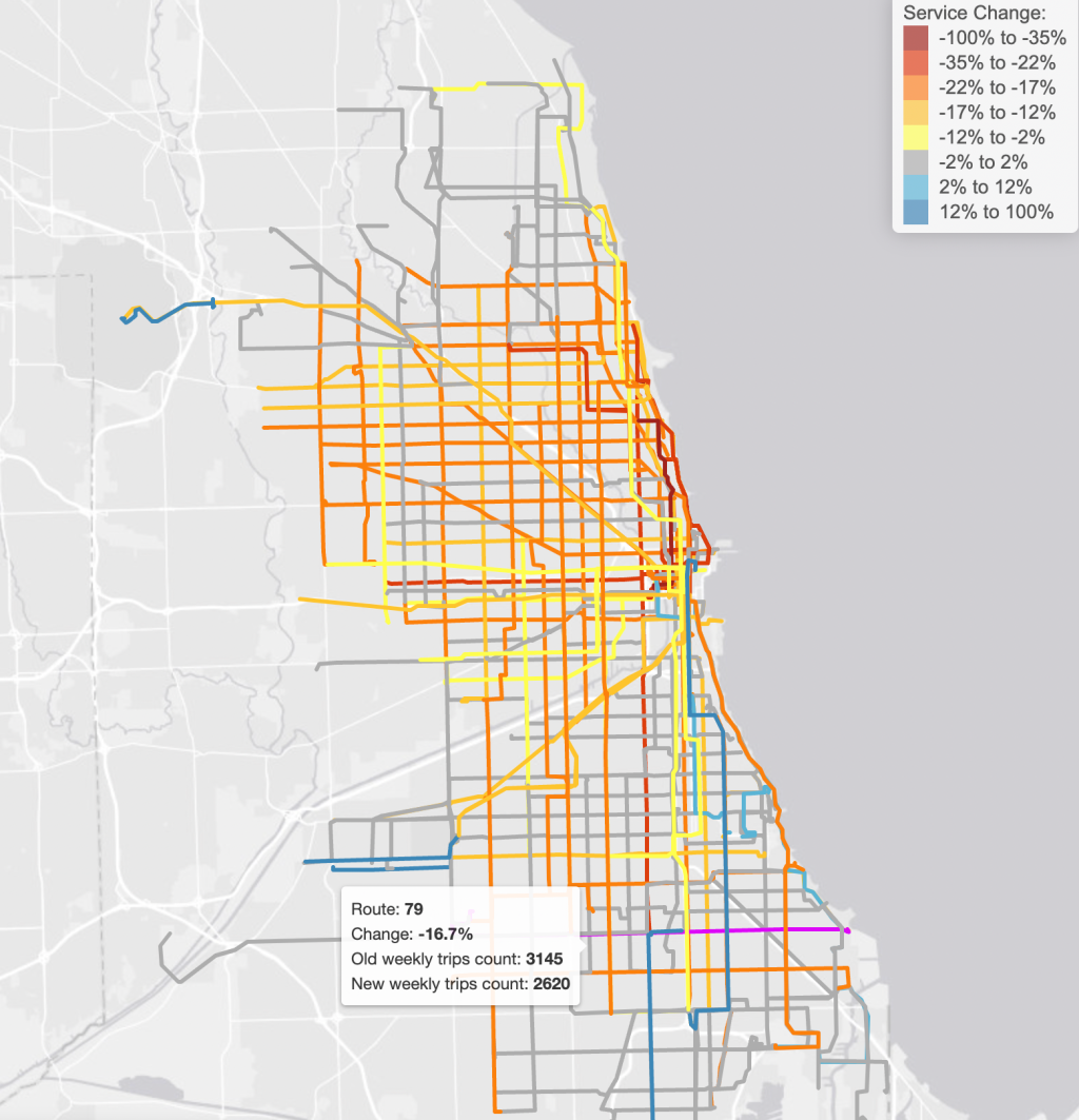
Commuters Take Action maps just how deep cuts in scheduled CTA service have been
Commuters Take Action recently published an analysis and map of the new schedules showing the change in the total number of scheduled trains or buses run for each route.
February 7, 2023
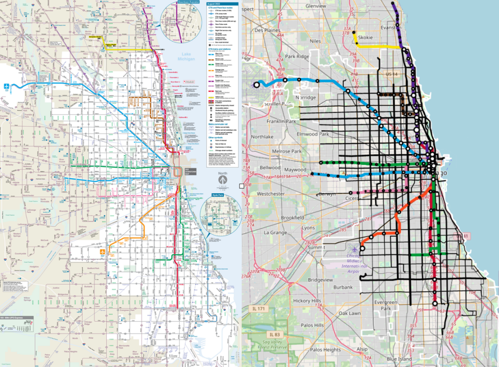
Mapped: Explore our interactive CTA ridership map
Analytics professional Daniel Cruz combined the CTA network map with ridership data to visually highlight how ridership is spread throughout the CTA system.
December 21, 2022
Map: Here’s where CDOT has installed, or is currently building, bikeways this year.
The Active Transportation Alliance has called out the lack of connectivity and the dearth of protected bike lanes in the city's plan.
September 23, 2021
Could a network of Slow Streets circuits speed pandemic recovery?
Streetsblog reader Nate Hutcheson brainstormed a system of Slow Streets designed as a community and economic development strategy.
January 27, 2021
Map: What could a Slow Streets network look like in Chicago?
This map some potential Slow Streets routes in the central city, including side streets and park roads where through traffic could be prohibited during Stay at Home.
May 13, 2020