With the passing of Dennis McClendon, 67, Chicago has lost a great historian and cartographer
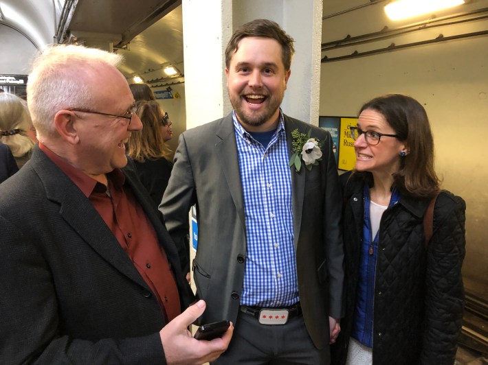
In the early morning of Thursday, August 8, Chicago cartographer, historian, and tour guide Dennis McClendon, nicknamed “Mr. Downtown,” passed away at age 67 from complications related to pancreatic cancer. If you’re reading this local transportation news website, you already know his work.
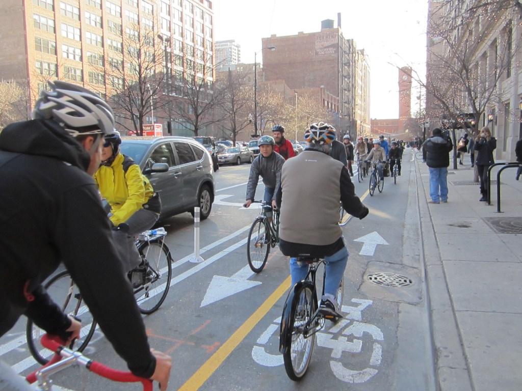
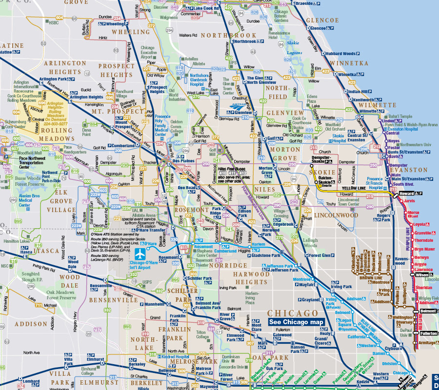
Dennis designed the CTA map for many years, starting in 1993. He also helped create the Chicagoland transit system map that the Regional Transportation Authority currently publishes. He also worked on the Chicago Department of Transportation’s bike map for many years. And he designed countless maps, for tourists, real estate developers, and for fun.
As one of the city’s foremost contemporary historians, Dennis was also a contributor to the Encyclopedia of Chicago, a project of the Chicago History Museum, published in 2004.
Dennis was diagnosed with cancer last spring and moved to Texas in the summer to get treatment closer to his family. He was born in Texarkana on July 23, 1957. Dennis was also openly gay and mentored a whole generation of urbanists who were gay (as well as urbanists of all orientations). He was also a font of knowledge on how Chicago’s gay community migrated from the Old Town neighborhood to the Boystown community over time, which paralleled a time when the number of out gay people was increasing.
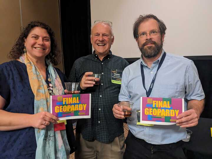
Dennis was involved in many hobbies and knowledge sharing groups. He attended North American Cartographic Information Society meetings, an association of cartographers, since 1985. Dennis served multiple roles there: board member, conference program planner, and later president. Dennis was the creator of “Geodweeb Geopardy”, the final event of the NACIS annual conference.
“[Dennis] must have been a big fan, as he ‘channeled’ Art Fleming [a former Jeopardy host] and was just masterful at it,” said Susan Peschel, a business manager for NACIS and former visual resources librarian at University of Wisconsin-Milwaukee, who met Dennis in 1985. “He tailored each game annually to the city we met in. All of the questions were very challenging but people loved it. It had to have taken quite a long time to put it together, but it was clearly a labor of love for him and an absolute hit at our annual conferences. I can’t imagine anyone coming close to filling those shoes.”
This obituary incorporates perspectives of two authors, Steven Vance and Jake Peters.
Steven
I don’t remember exactly the first time I met Dennis. It may have been in 2010, or a couple of years earlier, at a Central Electric Railfans’ Association meeting in a University Center meeting room. Or it could have been a year or two later, at a Grid Chicago happy hour, an Ashland bus rapid transit walk, or a Chicago Map Society presentation at the Newberry Library.
When I moved to the South Loop, closer to where Dennis lived, we met several times to play trivia at Half Sour and Roots (I believe our team won every time, largely in part to his knowledge of history and places), and once I played on a team for South Loop-themed trivia and he was the quizmaster. If Dennis was on your team you were pretty much guaranteed to win, as his three teammates at the Young Professionals in Transportation trivia event this year could attest.
Dennis lived in a condo in one of the two high-rises in Dearborn Park I. Visiting him involved sharing coffee and pie he made, and looking over new maps he was drawing, older maps he picked up on a recent trip, and walking home with a book or two from his collection that he needed to periodically cull. The books typically were either about Chicago or trains.
The last book I got from him was about the North Shore interurban. That route ran from the Chicago Loop to the city of Milwaukee over some of the same tracks that the Purple Line uses today, as well as parts of Metra’s Union Pacific North line.
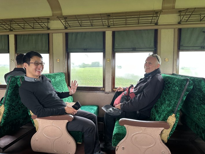
Dennis traveled frequently. He visited Japan and Thailand multiple times, and last year went on a complex itinerary across several adjoining countries in Eastern Europe, including Romania and Montenegro. Dennis offered very good travel tips, including these notes about traveling in Japan that he said I could share with anyone. He recommended places to get takeout food if price or time was a consideration, and a coastline circle trip from Tokyo to Enoshima and back, which I did.
In Dennis’s home office were cabinets and boxes full of notes, maps, copies of conference proceedings, and more maps. In the center was his computer desk upon which his Mac Mini sat. Dennis made maps using Adobe Illustrator (and Macromedia Freehand before that) rather than a GIS application. Although GIS was still a part of the process, he typically didn’t use it to automate map rendering.
“His design sense was precise and particular,” said Nat Case, a fellow member of NACIS. “He much preferred manually rendering street lines to get a better expression of street relationships than you could get by simply dumping line data.”
Amongst other map makers, Dennis was well known for his proprietary base map, which he shared with other cartography companies. You can see maps he made on his company’s website, Chicago CartoGraphics.
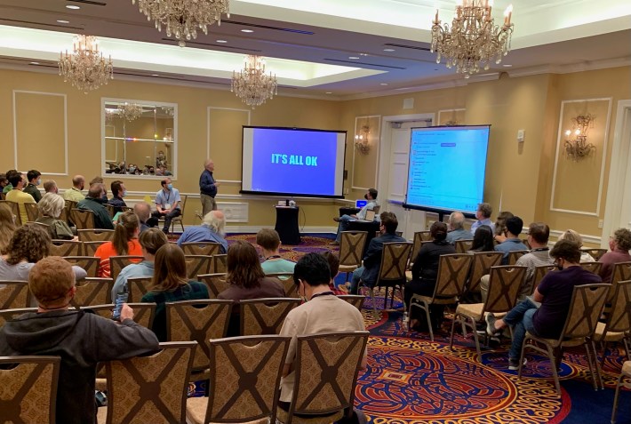
Dennis had a lot of opinions about urban planning in Chicago, past and present. Earlier this year he even started an urbanism salon to discuss the city planning news du jour. He was only able to hold two salons, but there was a robust discussion of whether the City should allow or fund a new Bears stadium. Dennis and I quite often did not see eye to eye. He was much less in favor of eliminating parking mandates than I am. But I don’t actually remember why he said he felt that way. Sadly, I’ll never be able to resume that conversation.
Jake
Dennis knew me ever since I was born. He had met my father, Jim Peters, when they both worked for the American Planning Association magazine in the early 1980s. Dennis moved to Chicago in 1982 in order to work for the accounting firm Arthur Andersen as a young lawyer. But he veered off that trajectory and back into the area of his undergraduate degree, urban studies. He quickly became part of the social and professional network that my parents were involved with, a cohort of young planners, historians, and urbanists who worked for the City government in the late 1980s and 1990s.
My first memory of Dennis is from 1996 or 1997 at the old Landmarks Division of the City’s Department of Planning and Development offices in the Reid, Murdoch & Co. Building. His company, Chicago CartoGraphics, had been hired by the City to make maps and brochures for an effort to designate a large group of “pending” landmarks. To help distract my young, map-obsessed self, Dennis showed me various historic maps. I recall that meanwhile in a nearby room, the late 42nd Ward Alderman Burt Natarus was vociferously opposing the designation of many of these pending landmarks.
Later, when I was in high school working on a history fair project, Dennis helped me learn where to find various historic map and image resources, including scans from his personal collection. We pored over documents in his downtown office, and his Dearborn Park home, which overlooked some of the former railroad sites I was researching. Dennis knew where to look for documentation of the many proposed rail consolidations that were proposed before and after Union Station was completed.
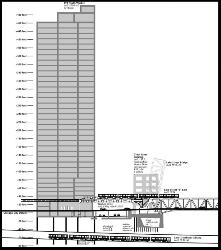
When I was a high school senior, Dennis hired me to install some new kitchen cabinets after he had broken his arm. Then, over the summer, he hired me as an intern to sort through files to find reference maps and confirm his field notes. He also showed me how to use aerial photography and tools for field measuring as we collected data for a 3D map of downtown Chicago. He relished helping people learn by “doing,” usually by verifying a claim or rumor, rather than simply taking what had been written as a fact. He was often skeptical—perhaps, sometimes, too much—but it came with his desire for meticulous research to find the truth and build an opinion, or a map, from it.
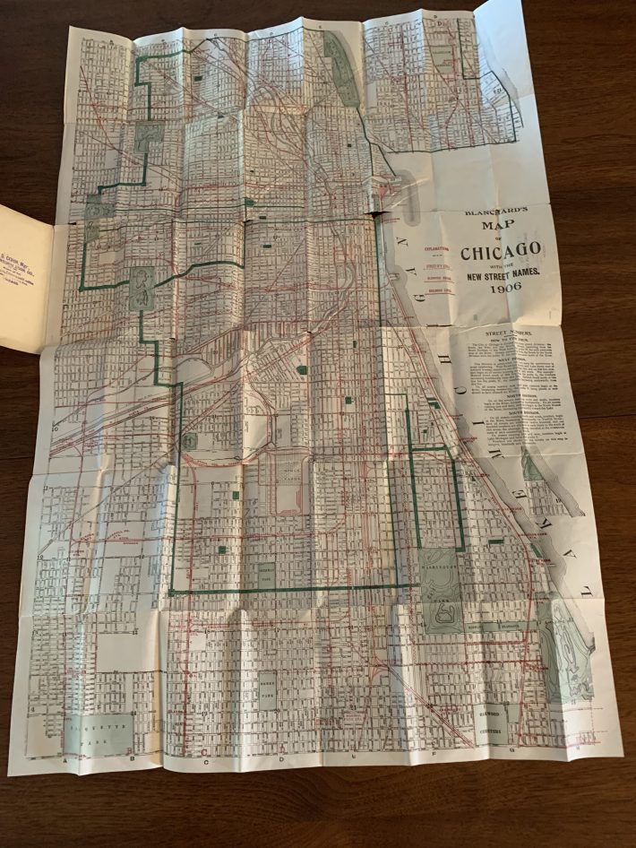
He also was generous with not only his time, but also the artifacts he had found. He’d freely pass them on to a worthy caretaker once he had digitized them. And often when you visited him, you left having eaten something (although never vegetables), along with a memento of the visit – usually a map. For a housewarming gift during the COVID-19 pandemic, Dennis gave my wife and me an original historic map, which we had framed behind conservation glass so it could be fully appreciated without being degraded from constant folding and unfolding. I have another map from the late-1970s (on an unusual black background) that is safely stored for future framing. It was a favorite of Dennis’s because of how it showed off the craft (and errors) of the printing process. Needless to say, as a cartographer, he was in exactly the right profession.
One feeling that a lot of people who knew Dennis are having is that, because he knew virtually everything about Chicago history and transportation, his passing means that a major resource we all relied on is no longer around. Dennis, you will truly be missed.

Did you appreciate this post? Please consider making a tax-deductible donation, to help keep Streetsblog Chicago’s sustainable transportation news and advocacy articles paywall-free.

Read More:
Streetsblog has migrated to a new comment system. New commenters can register directly in the comments section of any article. Returning commenters: your previous comments and display name have been preserved, but you'll need to reclaim your account by clicking "Forgot your password?" on the sign-in form, entering your email, and following the verification link to set a new password — this is required because passwords could not be carried over during the migration. For questions, contact tips@streetsblog.org.