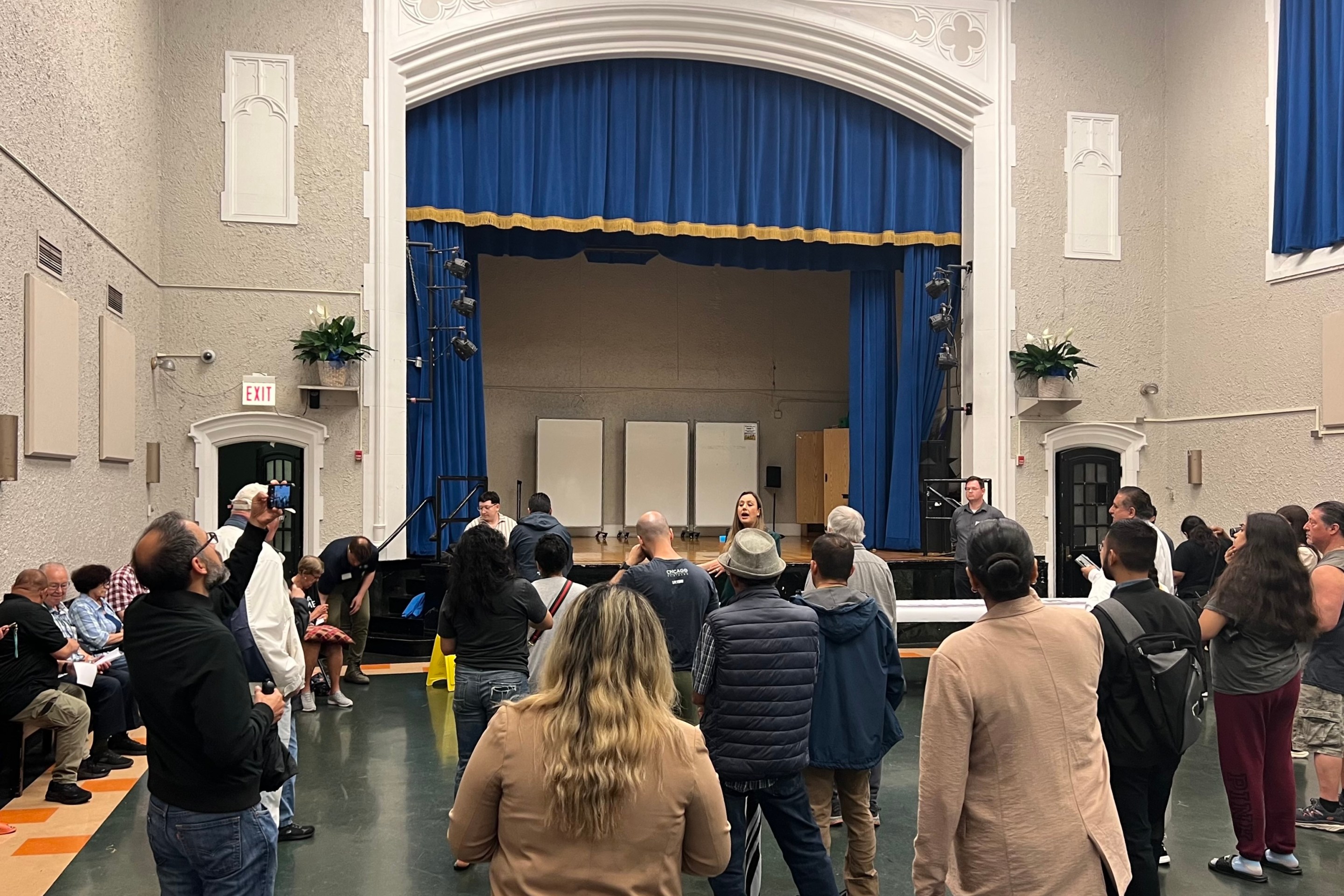
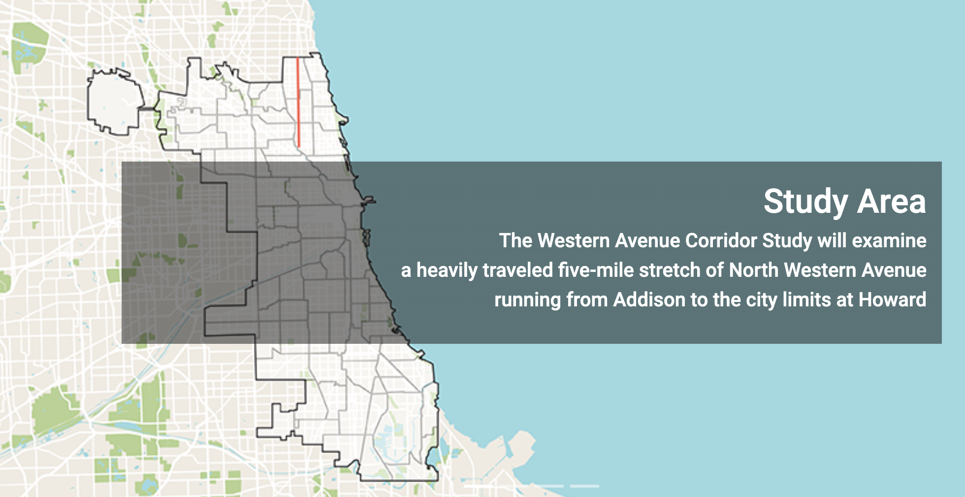
Over a year ago, the city of Chicago began a community engagement process around reimagining Western Avenue (2400 W.) between Addison Street (3600 N.) and Howard Street (7600 N.) Neighbors along the corridor provided their vision of development, transportation, and public realm improvements along Western. The Chicago Department of Planning and Development recently released a summary report of its findings. Over the course of the community engagement process, 15,000 postcards were mailed to residents who live on or near Western; 400 ads about the study were displayed in buses that serve the corridor; 1,500 people filled out the study’s online survey; 40 business owners were interviewed; 370 people participated in three public virtual events; and 700 people viewed replays of the virtual events.
Let's take a look at what the report says about each area of study.
Transportation
Western Avenue is Chicago’s longest street at 24 miles. Between Addison and Peterson Avenue (6000 N.), Western is classified as a principal arterial, serving major activity centers, high traffic volumes, and long trip demands. This segment of Western is also defined as a strategic regional arterial corridor, which serves as a network of arterials throughout the region to complement the expressway system. North of Peterson Avenue (6000 N.), Western, is classified as a minor arterial, typically serving shorter trips and providing more access points to property than principal arterials.
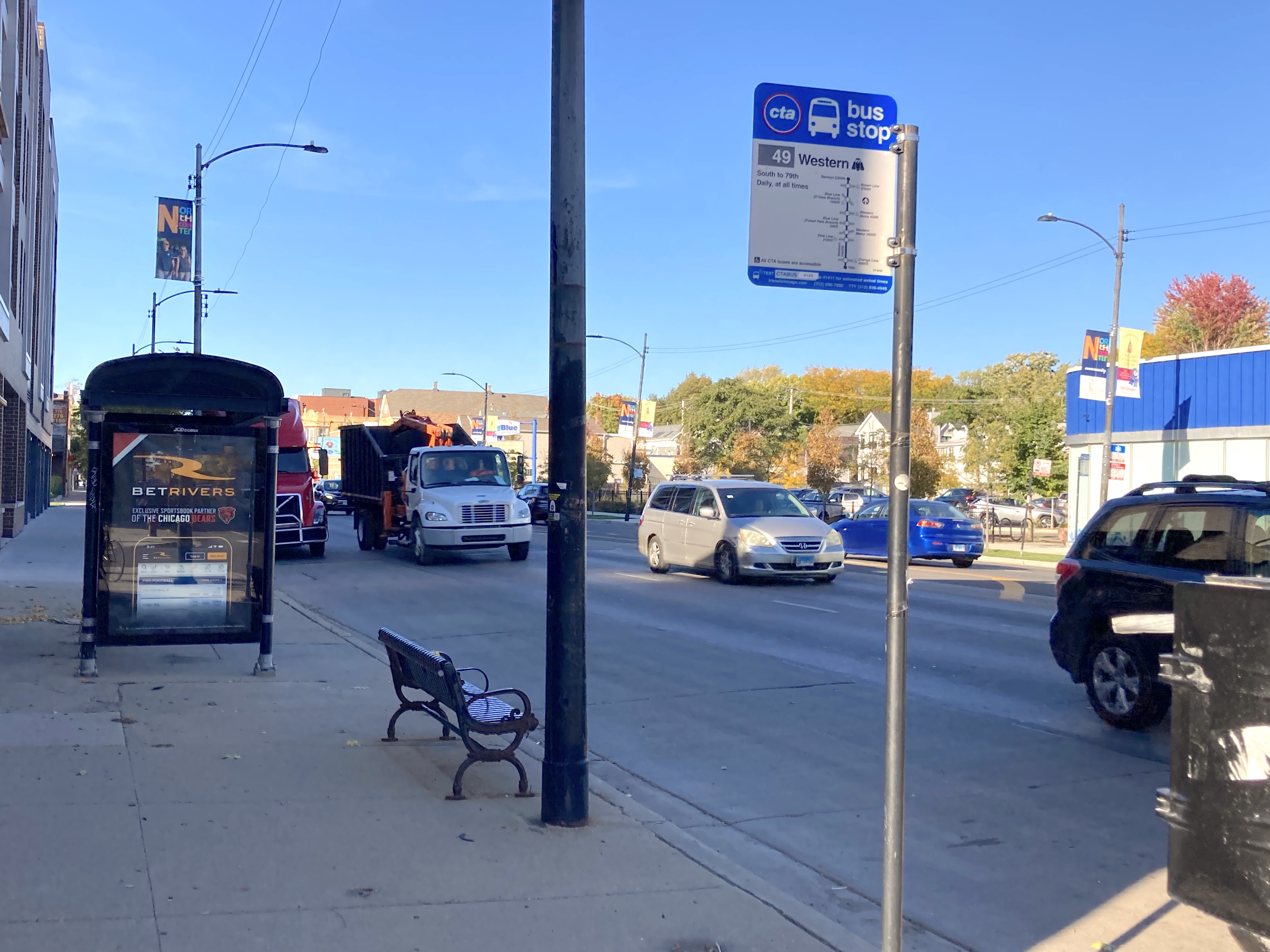
Along with serving lots of drivers, Western Avenue is a crucial route for bus riders. The 49 Western and X49 Western Express buses sees some of the highest ridership in the city, making the avenue typically rank among the top five Chicago corridors for ridership. Transfer points and high-use bus stops along the corridor are key nodes of activity along the corridor. High ridership zones along Western include Addison; Lawrence (4800 N.) and Leland (4700 N.) avenues near the Western Brown Line station; Foster Avenue (5200 N.); and Devon Avenue (6400 N.) Western is identified as a focus corridor for the CTA and CDOT’s Bus Priority Zone program.
The planning department found that across the corridor, parking and curbside regulations are somewhat fragmented. This inconsistency poses challenges for visitors or customers trying to navigate or locate parking. The study recommends a comprehensive approach to curbside management for the corridor, which DPD says could improve curbside demand predictability, increase economic growth, and reduce transportation mode conflicts.
Most of the curbside space along Western features no restrictions or parking meters and functions as free car parking. Employees and residents primarily use free parking adjacent to businesses, which limits short-term parking opportunities. Approximately 30 percent of the curb space is metered parking. About 3 percent of the curb space is designated as loading zones for commercial deliveries or standing zones for drop-offs and pickups.
I was surprised by these stats. It's particularly frustrating that so much of the curb space functions as free parking, especially along a bus route that could benefit from converting parking lanes into dedicated curbside bus lanes. (Another option would be converting two of the four travel lanes.) Many businesses along Western have their own parking lots that potential customers could use in the event free street parking is removed. However, the plan does recommend making improvements to the Western bus riding experience through bus prioritization.
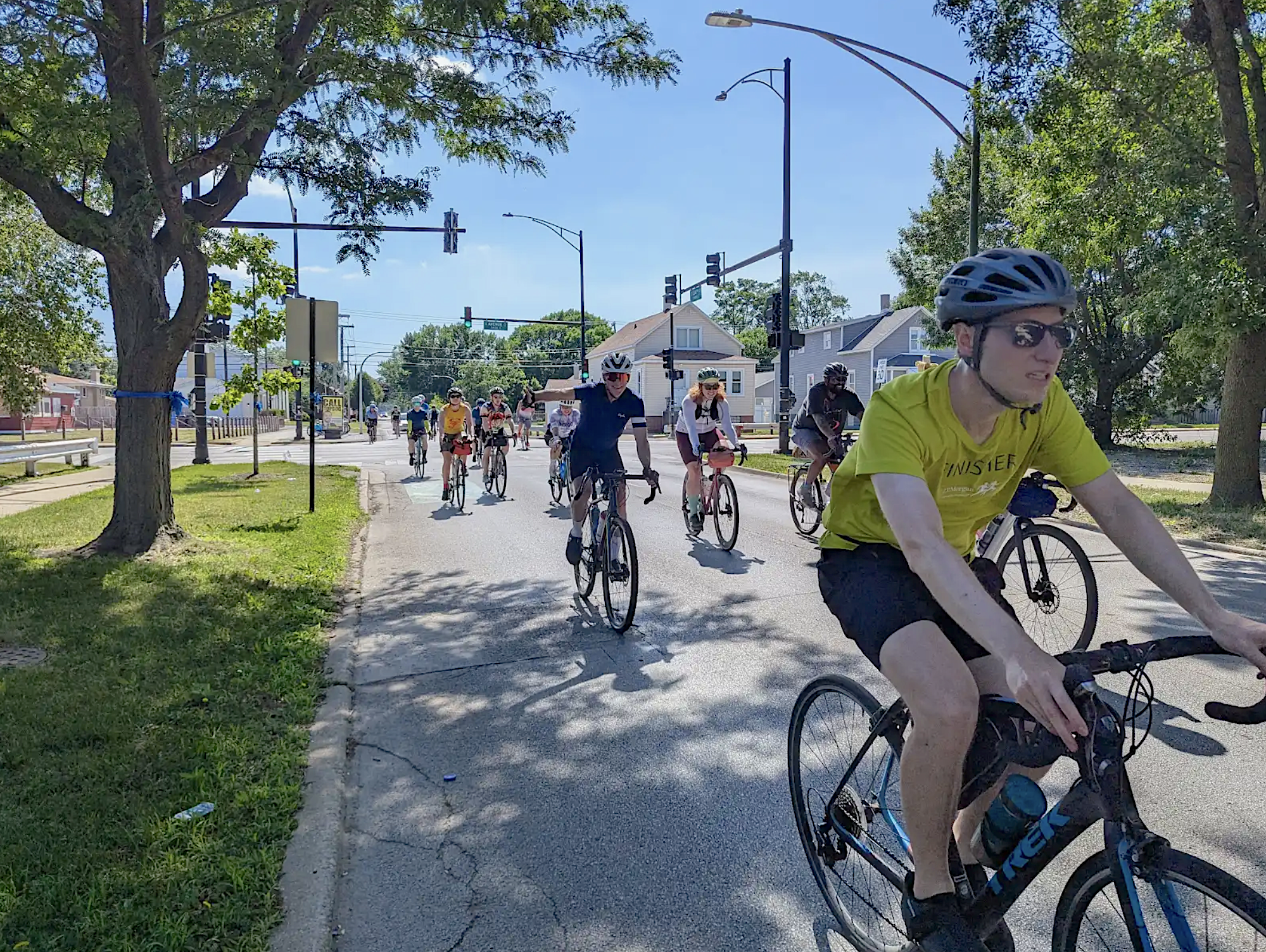
Given high traffic speeds and large truck volumes, biking along Western Avenue is an uncomfortable and risky experience. Between 2014 and 2018, there were 897 crashes involving pedestrians and 717 crashes involving people biking. Most crashes have occurred at major intersections, notably at Howard, Touhy Avenue (7200 N.), Granville Avenue (6200 N.), Foster, Lawrence, and Montrose Avenue (4400 N.)
In a public meeting summarizing the report to the public, Chicago Department of Transportation mentioned making side streets near Western more bike friendly and acknowledged the need to created a bike network. One idea I'd like to see implemented are bicycle boulevards, east-west routes and north-south routes. Looking at where many crashes involving people biking, notably arterial roads where travel is more direct than side streets can be by bike, there is a need to provide convenient and comfortable streets for biking. Traffic diverters and consistent and universal traffic calming along side streets, and signage along arterials directing people on bikes and scooters to side streets would be a step in the right direction.
Long distances between stoplight intersections was identified as a factor in pedestrian and bike crashes on the corridor. North of Berwyn (5300 W.) there are generally signalized intersections every quarter mile, or about two full blocks. South of Berwyn stoplight intersections are typically spaced every eighth of a mile, or about one full block. Non-signalized intersections can be hazardous to cross without the presence of a pedestrian refuge island. There are currently pedestrian refuge islands at Morse (6930 N.) in the northern segment of the study area and at Eastwood (4630 N.), Cullom, (4300 N.) and Belle Plaine (4200 N.) in the southern section of the study area. The study calls for improving safety at more intersections with pedestrian islands and other interventions.
Housing
Regarding housing, a key finding was that due to population growth (there’s been a 6 percent population increase along the corridor) and relocation patterns, there is increasing demand for a range of housing types – including apartments, condominiums, and single-family homes – and a need for various affordability levels. Three community areas within the study – West Ridge, Lincoln Square, and North Center – have been designated by the Chicago Department of Housing as inclusionary housing areas. These districts are defined as currently high-cost or low-affordability communities experiencing displacement of existing low- and moderate-income residents, where high housing costs prevent low- and moderate-income residents from moving to the area.
Feedback from residents indicated they want to see more housing along Western. One recommendation from the plan is to encourage new housing opportunities across a range of income levels and protect existing affordable housing stock.
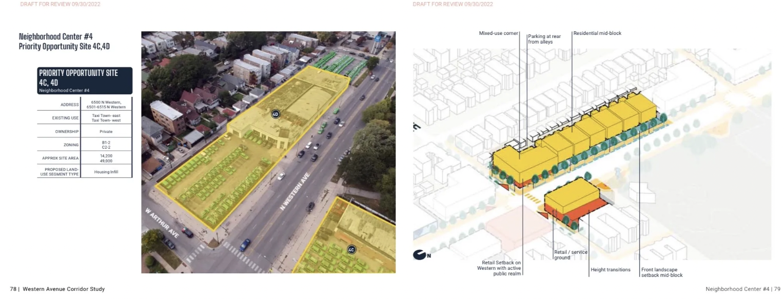
I was pleased to see some proposals for community hubs / neighborhood centers along Western Avenue. These hubs would have increased density, mixed-use development, and pedestrian- and transit-oriented development. The goal for these hubs is to create “15 minute neighborhoods," communities where residents can fulfill most of their daily needs within a 15 minute walk.
There are a few locations identified as potential sites for development. For example, 6500 North Western, currently home to a taxi business, was highlighted as a possible location for infill housing development. In a public meeting last night sharing some of the findings of the report, attendees were told that the planning department would not require these potential developments be built, and that the report is more of a guide and reference for developers to consider when working along the corridor.
Public Realm Improvements
According to the report, Western Avenue’s public realm is varied across the five-mile corridor. Typically, areas with newer development feature sidewalks up to 20 feet wide with landscape buffers, planters, bus shelters, bike racks, and on-street parking, promoting a more pedestrian-friendly, walkable environment. In central and southern portions of the corridor, sidewalks can be as narrow as four feet wide and are frequently interrupted by driveways. Interestingly, locations with high pedestrian activity, such as areas next to parks or high-ridership bus stops, tend to have narrower sidewalks.
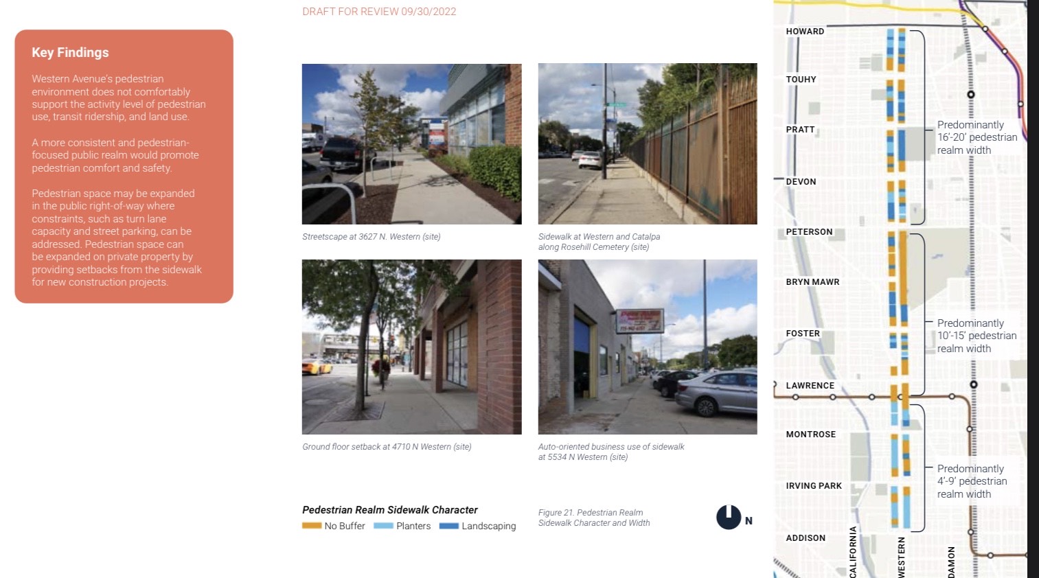
The lack of a landscape buffer between the sidewalk and fast-moving and loud car traffic along Western creates an uncomfortable pedestrian experience. There’s also a need for benches, trash receptacles, and bike racks along much of the corridor. The plan recommends expanding the public right-of-way where constraints such as turn lanes and street parking can be addressed. Encouraging new developments to have setbacks from the sidewalk can also allow for more pedestrian space. Plans to provide placemaking in the form of sidewalk activations, public art, community programming, and new public spaces will also provide a more welcoming pedestrian environment.
In looking at the report, I’m somewhat hopeful about the future of Western Avenue from Addison to Howard to become a home for increased housing density, speedier bus service, and a more welcoming environment for people on foot. You can check out the full report here and fill out a survey about the plan’s themes and goals. The online survey closes October 31st. If you'd like to watch a replay of the virtual meeting regarding the report held on Oct. 6th, you can watch it on YouTube. Lastly,the official city website for the project can be accessed here