Obama Center construction makes it difficult to access 63rd Street beach on foot, bus
The current construction project for the Obama Presidential Center in Jackson Park includes pedestrianizing a portion of Cornell Drive through the green space between the Midway Plaisance and 63rd Street, as well as between 65th and 67th streets. Marquette Drive will also be pedestrianized between Stony Island Avenue and Richards Drive, joining the two halves of the Jackson Park Golf Course. Unfortunately, to appease motorists, the work also includes widening stretches of DuSable Lake Shore Drive, Hayes Drive (which is the equivalent of 63rd through the park), and Stony Island Avenue. The intersection of Stony Island and Midway Plaisance between 59th and 60th Streets will also be reconfigured.
The Chicago Department of Transportation, which is doing the road work, is renovating the bike-pedestrian underpass at 63rd below DLSD, and building new ones near 63rd/Cornell, 67th Street/Jeffery Boulevard, and 67th/South Shore Drive. New traffic signals will replace stop signs at the triangular intersection of Hayes and Richards Drive surrounding the Statue of the Republic, nicknamed “The Golden Lady.” There will also be upgrades to multiuse paths within the park, but there are no plans for improvements to the nearby Lakefront Trail. There has also been no mention of reopening the long-closed Clarence Darrow pedestrian bridge over the Colombia Basin, between the Museum of Science and Industry and Wooded Island.
Stony Island near the OPC will balloon from the current two travel lanes to four. CDOT will install new stoplights at 62nd and 64th streets. The 62nd Street signal will help Hyde Park High School students access Jackson Park after school, including for sports practices at athletic fields. The 64th Street crossing will be helpful for accessing the park’s field house.
🚧 Roadway work for the Jackson Park Transportation Improvements project to support the Obama Presidential Center is starting April 14th on DuSable Lake Shore Drive, Hayes Drive, and Stony Island Avenue.
🚧See below for details on traffic impacts.#DriveSafe #YourCDOT pic.twitter.com/fPu1kugBXf
— CDOT (@ChicagoDOT) April 12, 2022
One frustrating byproduct of all this work is that it has hindered access to 63rd Street Beach, located on the other side of DLSD from the rest of Jackson Park, in multiple ways. Hayes Drive currently has lane closures between Stony Island and the access road to the Jackson Park Golf Course parking lot. (The access road is visible in the map below as the next north-west roadway north of Hayes and west of DSLD.) Hayes east of the access road is completely completely closed to on-street traffic.
As I experienced on a recent walk through the park, the sidewalk on the north side of Hayes between Richards Drive and the parking lot access road is closed over the Inner Harbor Bridge. In addition, the sidewalk on the south side of Hayes that curves off Richards Drive has had overgrown trees blocking it along the bridge.
Crossing Hayes or Richards here on foot is not too bad right now due to construction limiting vehicular traffic in this area, but you do have to go through the Statue of the Republic intersection. That junction is closed off but there is no marked crosswalk, so you must be careful.
Also, biking through this area is not easy because of rough terrain due to construction tearing up the road surface. The pedestrian underpass at Hayes/DLSD is also closed due to construction, and a posted detour has pedestrians and cyclists crossing the highway on foot with a marked pedestrian crosswalk at a stoplight. That’s much more dangerous than using the viaduct, considering how many drivers do not obey pedestrian signals even when they have a red light.
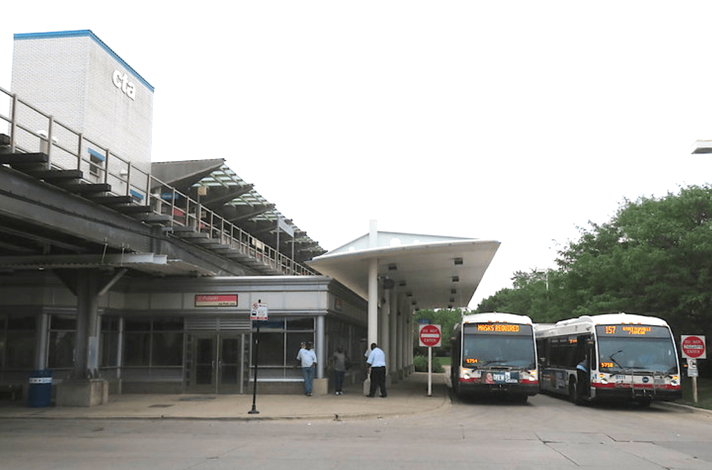
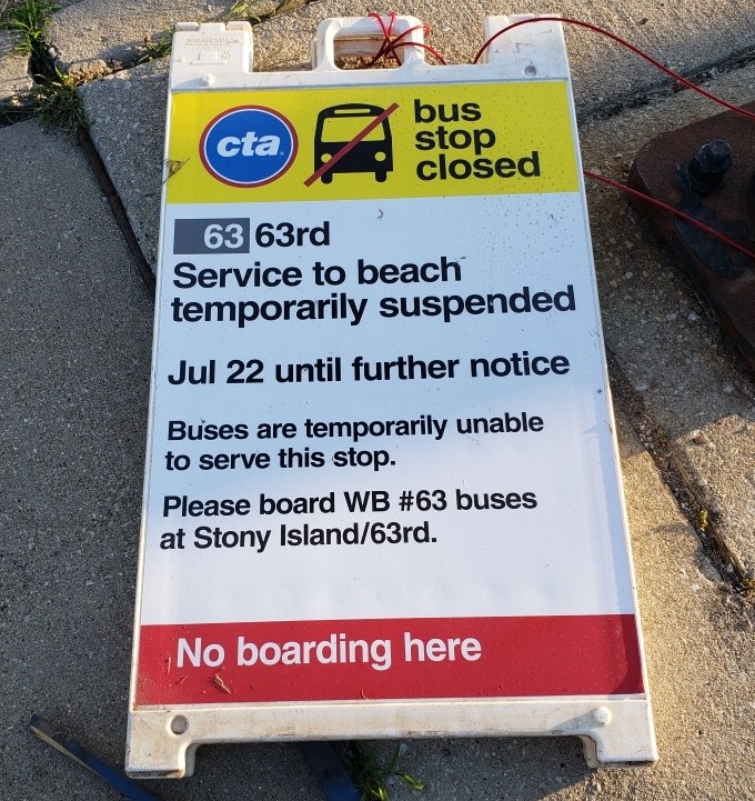
CTA buses stop at 63rd Street Beach between Memorial Day and Labor Day, when Chicago beaches are open for swimming. The #63 63rd Street bus normally provides daily service between Midway Airport Orange Line station and the beach during the summer. Due to the OPC construction, the route initially made a detour around Hayes to get to the shore. But since late July, when the road work intensified, the #63 has simply stopped going east of Stony Island, as it does during non-summer months. I ride that bus to work at the University of Chicago and, confusingly, the LED displays on the front of the buses I’ve ridden have continued to incorrectly state that the route terminates at 63rd Street Beach.
Moreover, for some time after #63 buses stopped going all the way to the beach at the end of July, the CTA’s webpage for the route failed to include an update about the service suspension. You can see that on this archived image of what the page looked like on August 3. CTA customers trying to ride the bus all the way to the lake would have had no clue about the mile-long walk awaiting them from Stony Island to the beach, even after looking at the website. This confusing lack of information has made getting to 63rd Street Beach difficult for those who don’t have a car or bike or who can’t walk the mile between Stony Island and DLSD, particularly with all the obstacles created by the current construction on Hayes.
Another way to get to 63rd Street Beach by bus is to take the #67 67th/69th/71st bus to 67th/Jeffery/DLSD and then walk north on the east sidewalk of the drive until you meet up with the Lakefront Trail at Marquette. That’s also about a mile, but at least you don’t have to deal with the construction.
The construction on the Obama Presidential Center has impacted many different groups in many different ways, but pedestrians, bike riders, and transit riders have borne the brunt based on lack of access to certain areas of the park, especially the beach. Hopefully these setbacks will be offset and remedied in the future when the next phase of construction begins and even more when the project is complete and people can enjoy the new car-free parkland.

Streetsblog has migrated to a new comment system. New commenters can register directly in the comments section of any article. Returning commenters: your previous comments and display name have been preserved, but you'll need to reclaim your account by clicking "Forgot your password?" on the sign-in form, entering your email, and following the verification link to set a new password — this is required because passwords could not be carried over during the migration. For questions, contact tips@streetsblog.org.