Chicago needs to ramp up the number of bus stop boarding islands
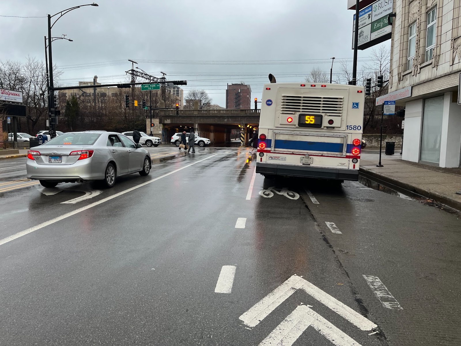
Chicago has a problem when it comes to bus stops and bike lanes. Too often when a bus needs to access the curb, it enters the bike lane, cutting off cyclists and also providing a gap in physical bike lane protection that is then abused by drivers who block the bike lane with their cars and trucks, as well as the bus stop, for an extended period of time.
Here’s a run-down on various design arrangements in use right now in Chicago, with custom names I’ve assigned them for easier discussion, and some suggestions on where we should go from here.
The Interruption
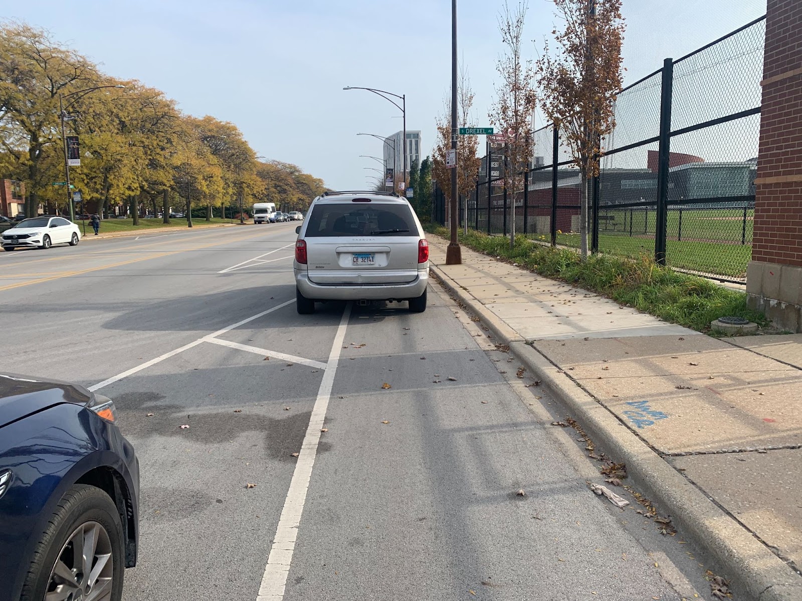
In this arrangement, the bus stop simply interrupts the bike lane. Buses merge into the bike lane and then back into traffic.
The 55th Street PBL was one of Chicago’s first, installed in 2012 as part of a road diet project that reduced the number of vehicle lanes on most of 55th between Cottage Grove Ave. and Lake Park Ave. Concrete end-caps on the parking lanes, and some pedestrian islands, were added in 2019, but the overall design of the bike lane (and bus stops) has not changed in the 10 years since it was first rolled out.
This bus stop configuration is bad design.
First, there is a danger of collision between bike and bus with the merge.
Second, a cyclist stuck behind a stopped bus must wait, or try to merge with car traffic, or ride on the narrow buffer, all of which are inconvenient or dangerous.
And third, drivers will use this gap in physical protection (nominally provided by parked cars, but if there are no cars then there is no protection) to double park in the bike lane. The portion of the bike lane pictured is often blocked by drivers picking up or dropping off patients at the nearby Friend Family Health Center.
This design usually occurs mid-block or just after an intersection.
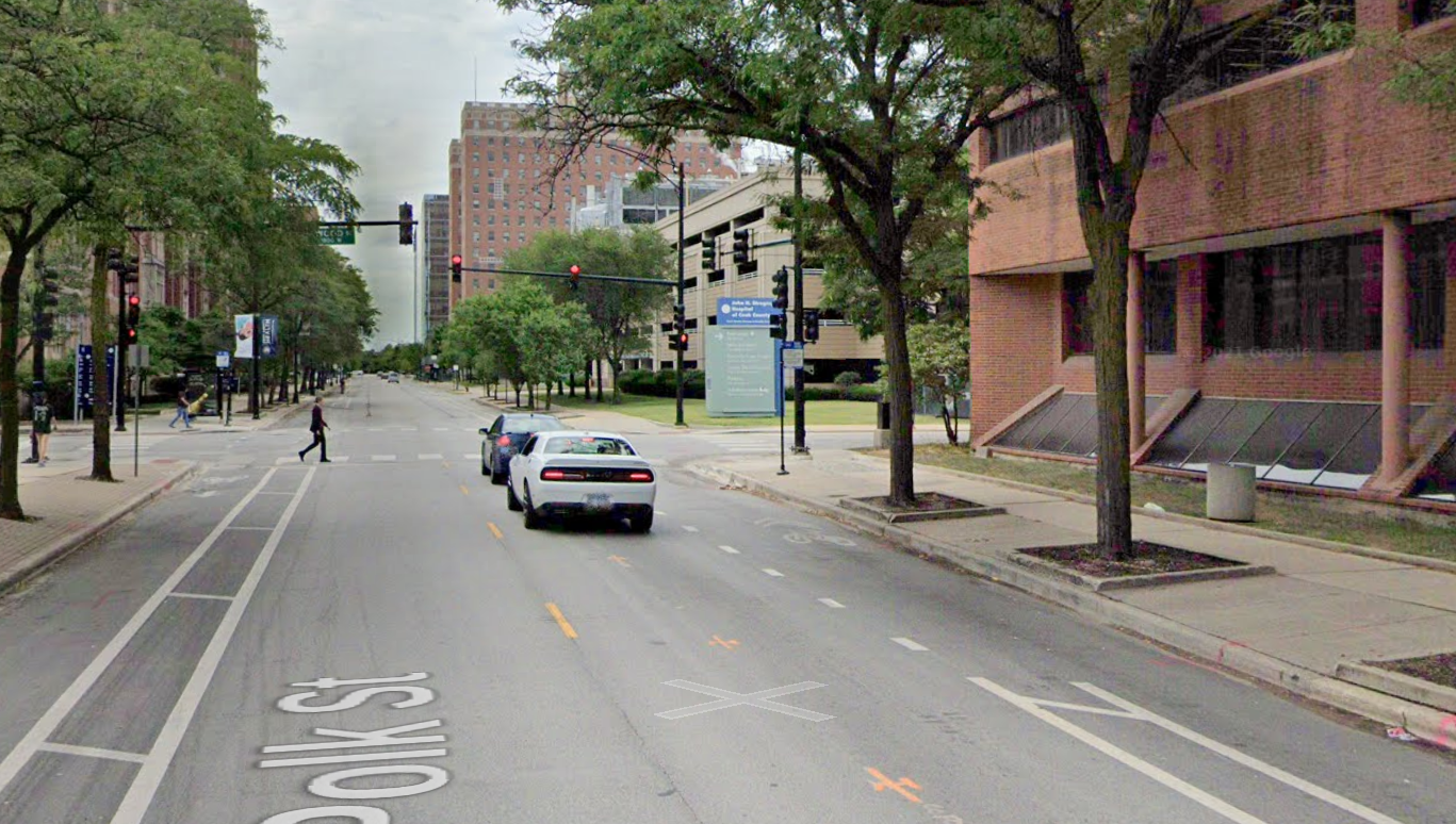
The Right Turn Merge
With this design, which occurs just before an intersection, cyclists are merging with both buses and right-turning cars. In addition to the merging danger, this arrangement tempts drivers to illegally turn right in front of the stopped bus, rather than waiting—which is dangerous for pedestrians, bus riders, and for the drivers themselves.
This danger isn’t specific to roads with bike lanes, and while drivers should wait patiently, a better road design would remove this temptation—most simply by just siting the bus stop on the far side of the intersection instead of the near side.
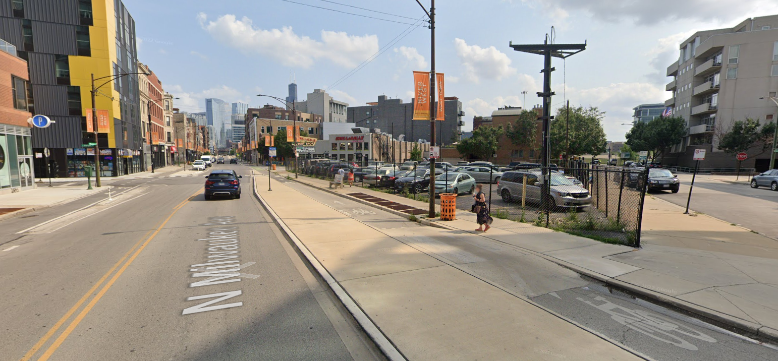
The Interruption and The Right Turn Merge are the default bus-bike interaction seen in Chicago, and are widely deployed on roads that have both a bus route and a bike lane (whether protected or not), such as much of Milwaukee Ave. and Lawrence Ave.
The Criss Cross
This arrangement is more common with unprotected bike lanes where cyclists ride between parked cars and moving cars. Rather than merge into one lane to pick up passengers or turn, buses and other drivers cross the bike lane entirely to the curbside lane. The bike lane then has motor vehicles passing by on both sides.
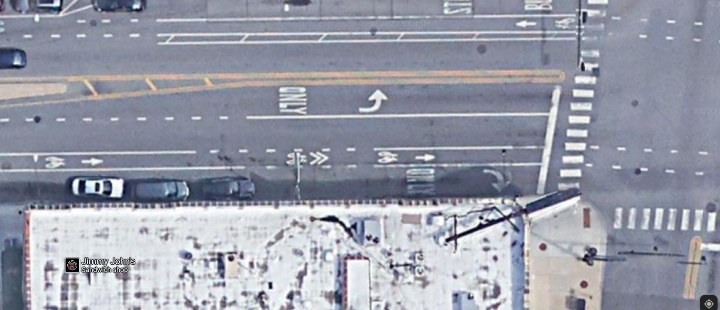
At least that’s how it works on paper. In reality, buses and right turning cars rarely get fully in their new lane—their tail end almost invariably blocks the bike lane.
Also, while right-turners only have one conflict as they cross the bike lane, buses need to merge back with through traffic after picking up passengers, so they have to cross the bike lane again, this time in the middle of the intersection, which can cause conflict and reduce the sense of safety for the person riding in the bike lane.
The Criss Cross is usually seen on slightly wider roads, where there is room for a full right-turn lane to the right of the bike lane, such as Roosevelt Road.
How can these bike lane design problems be solved?
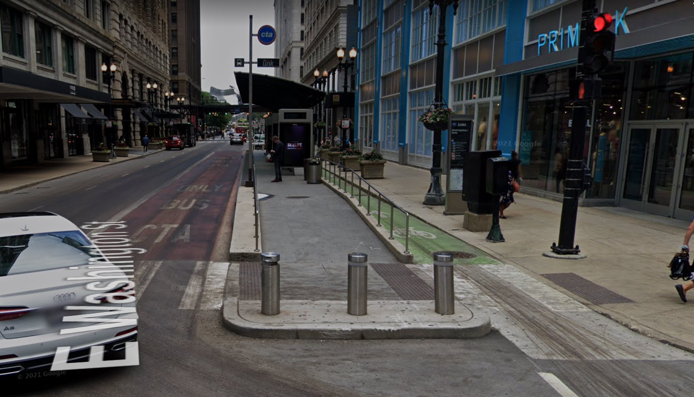
The Opposite Side
The easiest method is just to put bus stops and bike lanes on opposite sides of the road.
Buses stop on the right and bikes ride on the left, so there are no conflicts.
This only works on one-way streets, and is used extensively in downtown Chicago (on Clinton, Dearborn, and Washington, but not on Franklin, Desplaines, or Harrison) and a few other places around the city, such as Jackson Boulevard on the West Side, from Oakley Avenue to Halsted Street.
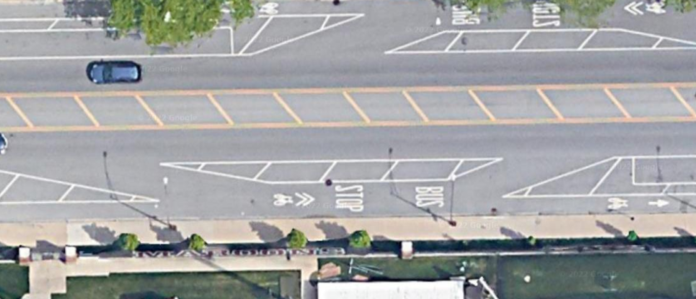
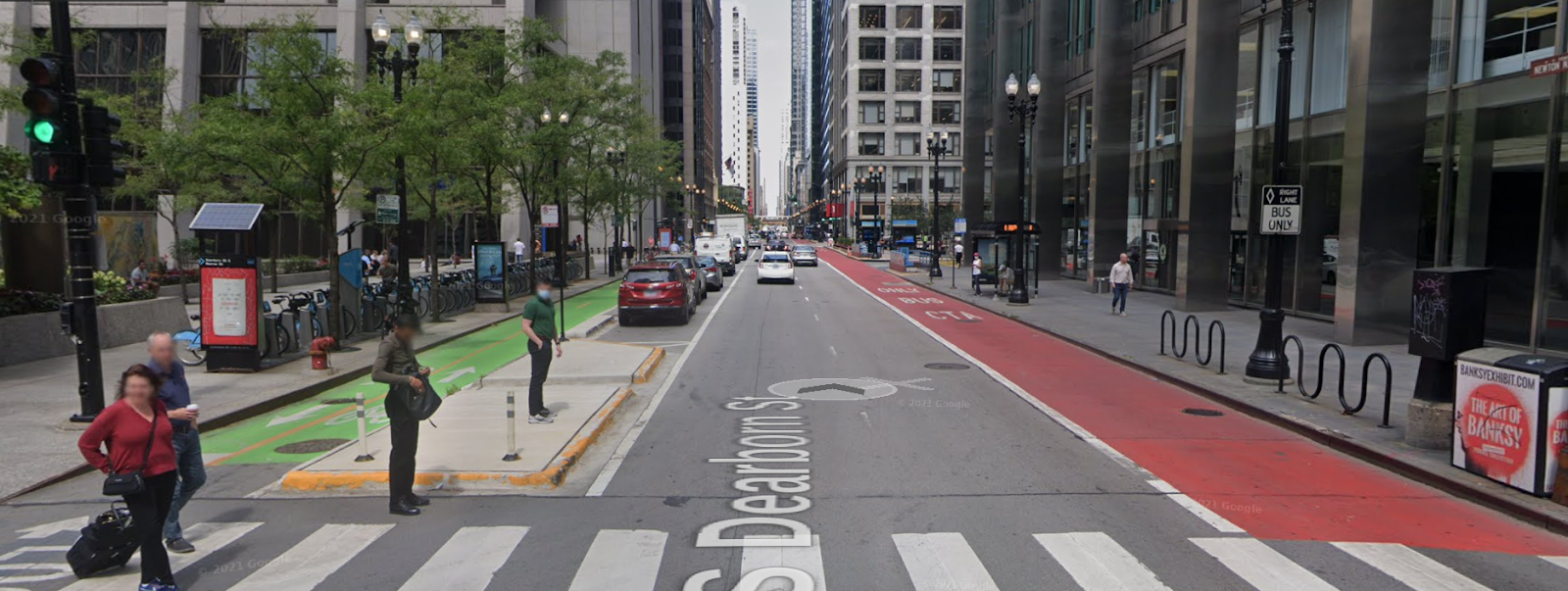
The Simple Island
“The Simple Island” is a more general solution – it’s a “floating bus stop” or “bus boarding island”, which provides an island for people to board and alight from the bus. To get to or from the bus stop, they cross the bike lane at a crosswalk.
These are rare in Chicago, but are common in places with good bike infrastructure – check out this street design in Somerville, Mass. I would love to see more built. There are a few on Jackson between Austin and Central, installed as part of a Complete Streets project in Columbus Park this past fall.
And there is one at Milwaukee and Carpenter, installed in 2018.
Here’s the before (The Interruption):
And the after (The Simple Island):
The crosswalk between the sidewalk and the bus stop island can be raised (as pictured above), which slows down cyclists a bit, or the island can have curb cuts and wheelchair ramps like a normal crosswalk.
At a busy stop along a heavily-used bike route, you might have railings keeping passengers from crossing anywhere and forcing them to cross at the designated crosswalk. At a more lightly-used stop, or where bikes are few and far between, it’s ok to take a more casual approach and let people cross wherever they want, as long as a wheelchair ramp is provided for those who need it.
Two upgrades I would like to see added to future installations are a greater degree of visual distinction of the bike lane (green paint) and mountable or forgiving curbs, angled so you can ride your bike over them if needed. Forgiving curbs are a great safety feature whenever the bike lane is narrow and pedestrian conflicts are likely, so a cyclist can swerve onto the sidewalk to escape a potential collision if needed. (These are used widely in the Netherlands, Germany, and Denmark.)
The Fancy Island
The Loop Link corridor along Washington St., which opened in 2015, includes very fancy boarding platforms. While the main motivation for this project was to speed up buses (which it has largely failed to do), it also created a mostly-protected bike lane with good bus-bike interaction.
This is a good but expensive design, most appropriate for the Loop and maybe some busy “L” stations. It has high platforms for level boarding, extensive rain shelter, digital information signs, and platforms long enough for multiple buses. There are also bollards to protect waiting bus passengers against runaway drivers, and a railing to funnel passengers to one of two crosswalks which have ADA-compliant wheelchair ramps.
Along Washington Street, the bike lane is painted green, but it is still narrow – at worst it’s impossible and at least it’s uncomfortable to pass another cyclist. And in the Loop, pedestrians stepping into the bike lane are very common. I would like to see the bike lane be two feet wider and have a mountable curb on the sidewalk side.
The Way Forward
I think the way forward for Chicago is way more Simple Islands. They are cheap and easy to build, simple to maintain, and flexible in terms of where they are placed and how much infrastructure is needed (shelter, railings, etc.).
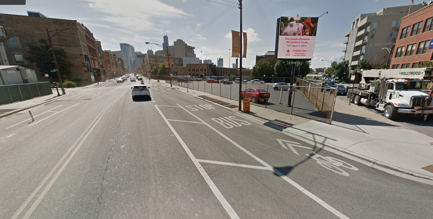
What would this look like? First we’ll look at a mid-block stop, since those are simplest to visualize. Let’s return to where we started at 55th and Drexel.
Here’s the current situation again:
And here’s how it would look with Simple Island floating bus stops:
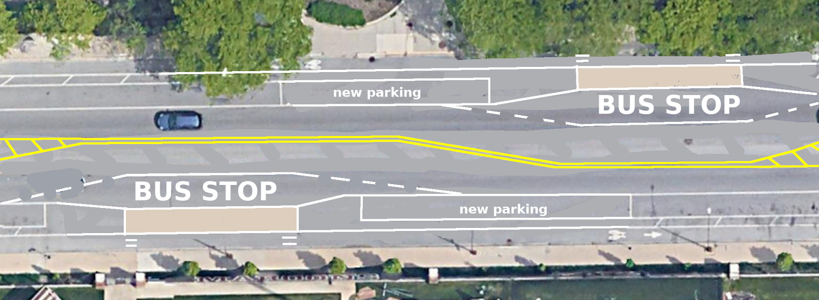
This design completely eliminates bus-bike conflicts, preserves all existing traffic lanes, eliminates the danger of double parked cars blocking the bike lane, and actually adds about five additional parking spots (since the bus merge space uses the median space rather than parking lane space).
The costs would be pouring two 7’ x 40’ concrete islands (or up to 60’ long on routes with the longer articulated buses), adding four ADA wheelchair ramps or two raised crosswalks across the bike path, and some paint. Streetsblog asked CDOT for cost estimates of recent and future islands, but they were not available by press time. In Seattle in 2011, a group of 10 bus stop islands cost $253,603.
This is not a heavily-used bus stop or sidewalk, so you would not need to invest in railings, mountable curbs, or a bus shelter—which might be appropriate at a busier location.
This is how it would work mid-block; at intersections there are additional considerations which depend on a lot of details including the width of the road and the number of desired vehicle turn lanes.
The best and easiest option is to place the bus stop just after the intersection (instead of just before) to avoid conflict between stopped buses and right-turning cars. On a 80-foot right of way like 55th St. there is insufficient room for two turn lanes and a bus stop. So we combine right turns and through traffic into one lane, and basically trade the westbound right turn lane for the eastbound bus stop and vice versa. (The Corner Refuge Island does provide space for one right-turning car to wait for cyclists and pedestrians without blocking through traffic, a practice recommended by NACTO, of which Chicago is a founding member.)
Here’s how that would look, layered on top of the protected intersection design from a previous Streetsblog article (here the new sidewalks and bus stop boarding areas are in black):
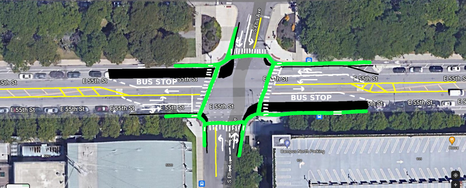
Once you’ve built a protected intersection, you have already built most of the infrastructure needed for a floating bus stop: what was a 10-foot end cap to the parking lane now becomes a 40-foot (or 60-foot) bus stop island. For stops with multiple bus routes you might make it 80’ or 120’ to accommodate two buses at once. Passengers can use the same crosswalk and wheelchair ramps that already exist across the bike lane at the intersection to access the bus stop, or a second crosswalk across the bike lane can be added towards the front of the bus stop if desired.
Here’s a cross-section view of the same intersection with the proposed changes:
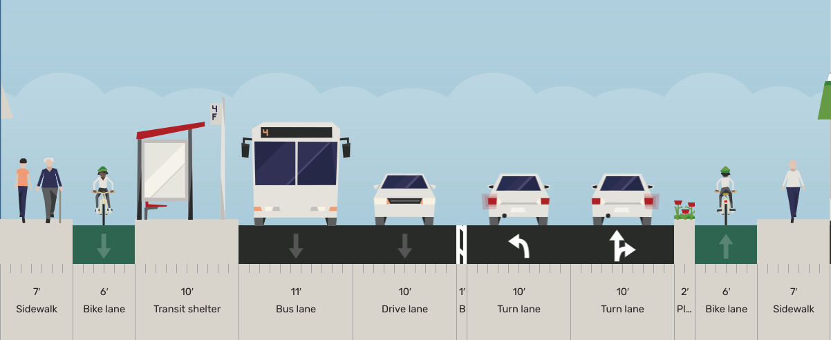
Chicago has many 66’, 75’-80’, and 100’ arterials, and the exact design will look different depending on the desired number of turn lanes, whether the cross-street is one way, whether there is a grassy parkway between street and sidewalk, and whether any diagonal streets are involved.
Across most Chicago intersections, a variation on this basic layout will work. In many cases you will have to make compromise: give up a dedicated right-turn lane, have buses stop in the through lane (or one of the multiple through lanes on the 100’ arterials), or move your bus stop 100 or 150 feet from the intersection—which may make be just fine when the cross street doesn’t have a bus line to transfer to.
I reached out to the CTA to ask about their operational experience with the few bus boarding islands that already exist in Chicago: “So far, CTA’s experience with the bus boarding islands has been positive,” a CTA spokesperson said. “Since the Chicago Department of Transportation (CDOT) has jurisdiction over streets and sidewalks and builds public way infrastructure, CTA works closely with them…CTA will continue to work with CDOT to identify other locations where this treatment may be feasible and beneficial.”
A CDOT spokesperson, Susan Hofer, added: “Floating bus stops improve transit operations, provide more space for transit customers, can shorten the crossing distance for pedestrians, and enhance the level of comfort for people biking.
“Additional floating bus stops…are currently being designed for designated stops along the Milwaukee Avenue and Clark Street protected bike lanes [in Edgewater] with the goal of beginning implementation in 2022.”
That’s great news, but Chicago has a lot of catching up to do! These should be rolled out everywhere as quickly as possible.
Here are some recent examples from around North America:
Gratuitous floating bus stop and bike lane photo! 🚌🚍🚲 pic.twitter.com/EtPcef3zFq
— Somerville Infrastructure (@SomervilleInfr1) March 16, 2022
Love a good floating bus stop and bike lane! pic.twitter.com/4TjeUTBjnH
— Jerome Alexander Horne (@jahorne) October 16, 2021
https://twitter.com/fchi/status/1114209472908382213

Streetsblog has migrated to a new comment system. New commenters can register directly in the comments section of any article. Returning commenters: your previous comments and display name have been preserved, but you'll need to reclaim your account by clicking "Forgot your password?" on the sign-in form, entering your email, and following the verification link to set a new password — this is required because passwords could not be carried over during the migration. For questions, contact tips@streetsblog.org.