Here’s what we should do to actually make the Illinois Prairie Path safer in Hillside
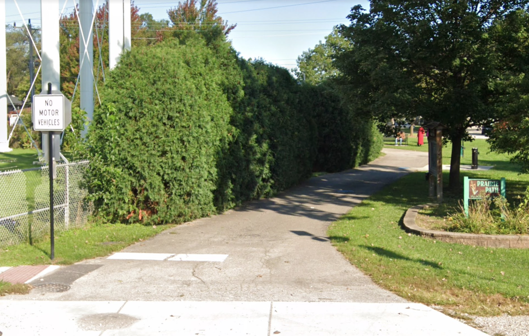
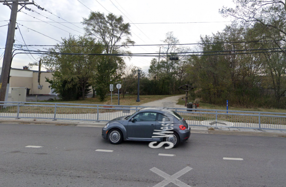
The Prairie Path north of Butterfield Road, looking north. Image: Google Maps
Earlier this week Streetsblog's covered the controversy over the Illinois Department of Transportation's plans to relocate a section of the Illinois Prairie Path in west-suburban Hillside as a safety strategy. From reading the piece, which I edited, you might have gotten the impression that former Ashland Avenue bus rapid transit opponent Roger Romanelli, who's using the bike trail project as a campaign issue in his run for village trustee, is the only party in the wrong here. Romanelli is pushing an alternative to the trail relocation that wouldn't fully address existing path safety issues.
But IDOT's plan is also far from ideal. So if we really care about improving safety and convenience for pedestrians and cyclists, the real solution is a third option, which I'll discuss in a bit.
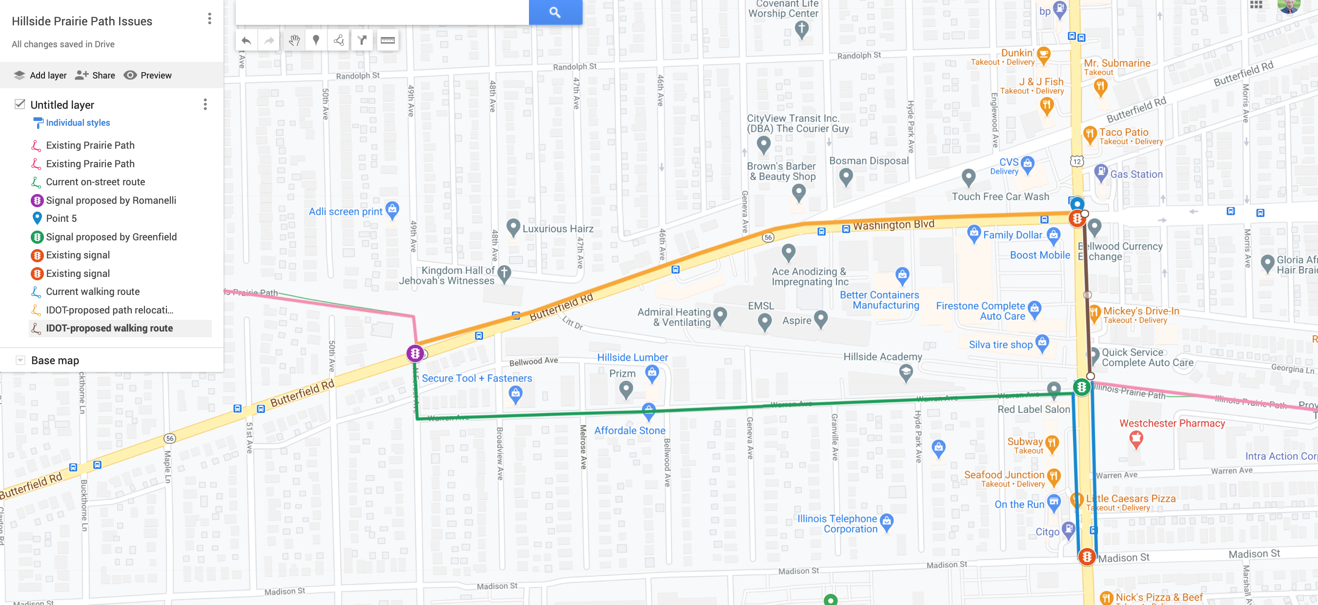
The current layout
As it stands, pedestrians and cyclists traveling on the path in Hillside are directed to take an on-street route between Butterfield Road (Illinois Route 56) and Mannheim Road (U.S. Route 12), consisting of Forest Avenue and Warren Avenue, shown in green on the above map. Currently they need to make unsignalized crossings at Butterfield, a two-lane street, and Mannheim, a busy four-lane highway.
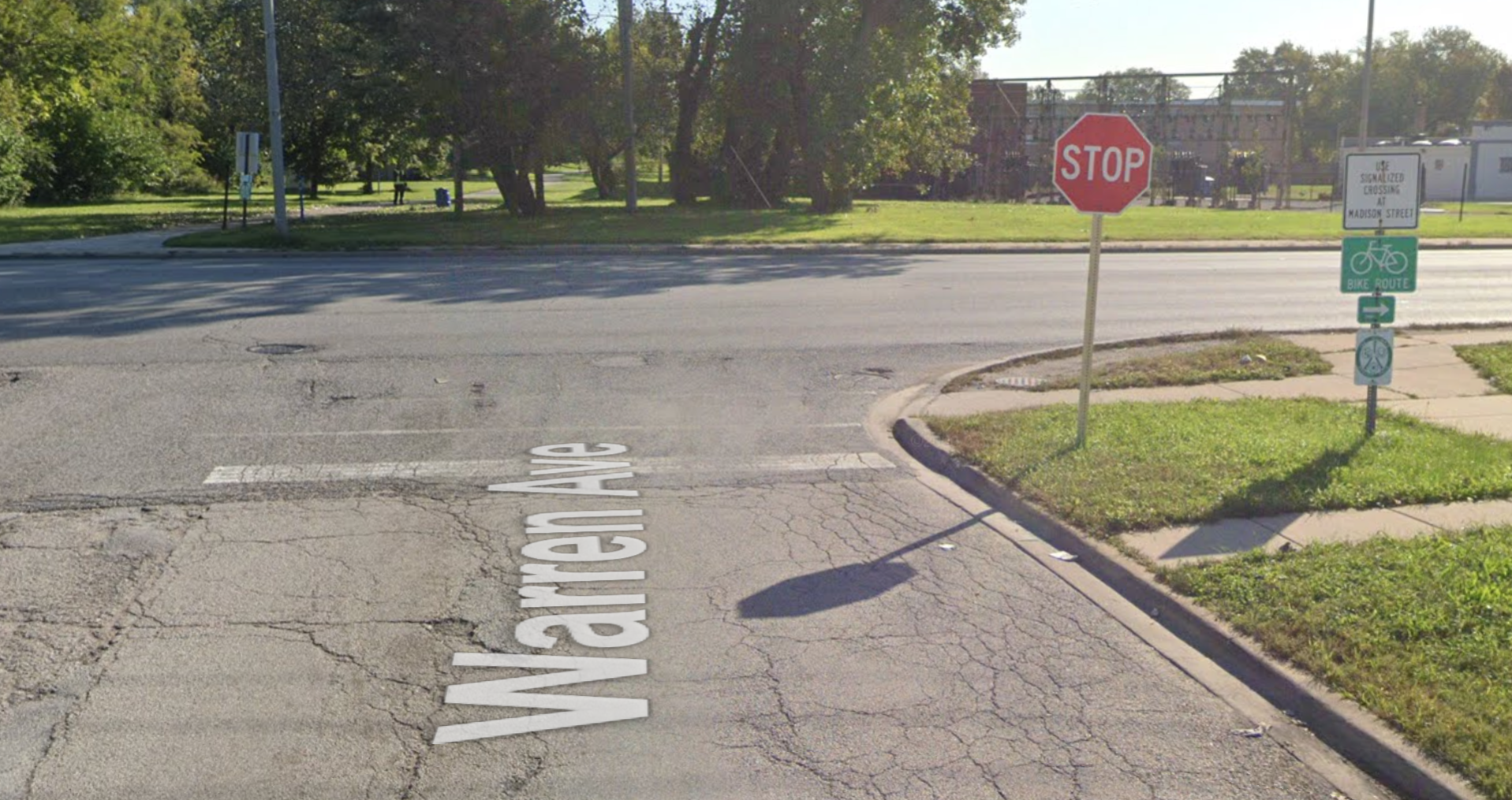
At Warren/Mannheim, trail users are supposed to detour south on foot for a block on the sidewalk to Madison Street, where there's a stoplight (red on the above map), and then walk north again to the trail, a pedestrian route shown in blue on the map. However, many instead choose to avoid that annoying detour by making a riskier direct crossing across the highway, Frogger-style.
IDOT's plan
IDOT wants to discourage path users from crossing at Warren/Manheim, as well as preventing people from having to cross Butterfield without a signal. Their proposed solution is to build a new half-mile path on the north side of Butterfield and Washington Boulevard (orange on the above map) to take trail users between Forest and Mannheim.
IDOT spokesperson Maria Castaneda said the department doesn't have detailed information on the specific layout of the proposed new bike/ped route. "The preliminary engineering study was completed in 2015 and the layout presented at that time will be revisited once construction funding is fully in place. The right-of-way acquisition process will impact both the schedule and design of the project."
The project is budgeted at $7 million, including road repaving and (ugh) widening, plus adding the new path, Castaneda said. But this excludes right-of-way acquisition or engineering, which aren't funded yet. "Once the village secures construction funding, coordination will begin between the department and Hillside."
The problem with IDOT's proposal is that is that, while it would theoretically eliminate crossings at unsignalized intersections, it would create a longer, less direct route that requires walking your bike on the sidewalk for a block from Washington/Mannheim to the east leg of the trail, a walking route shown in brown on the above map.
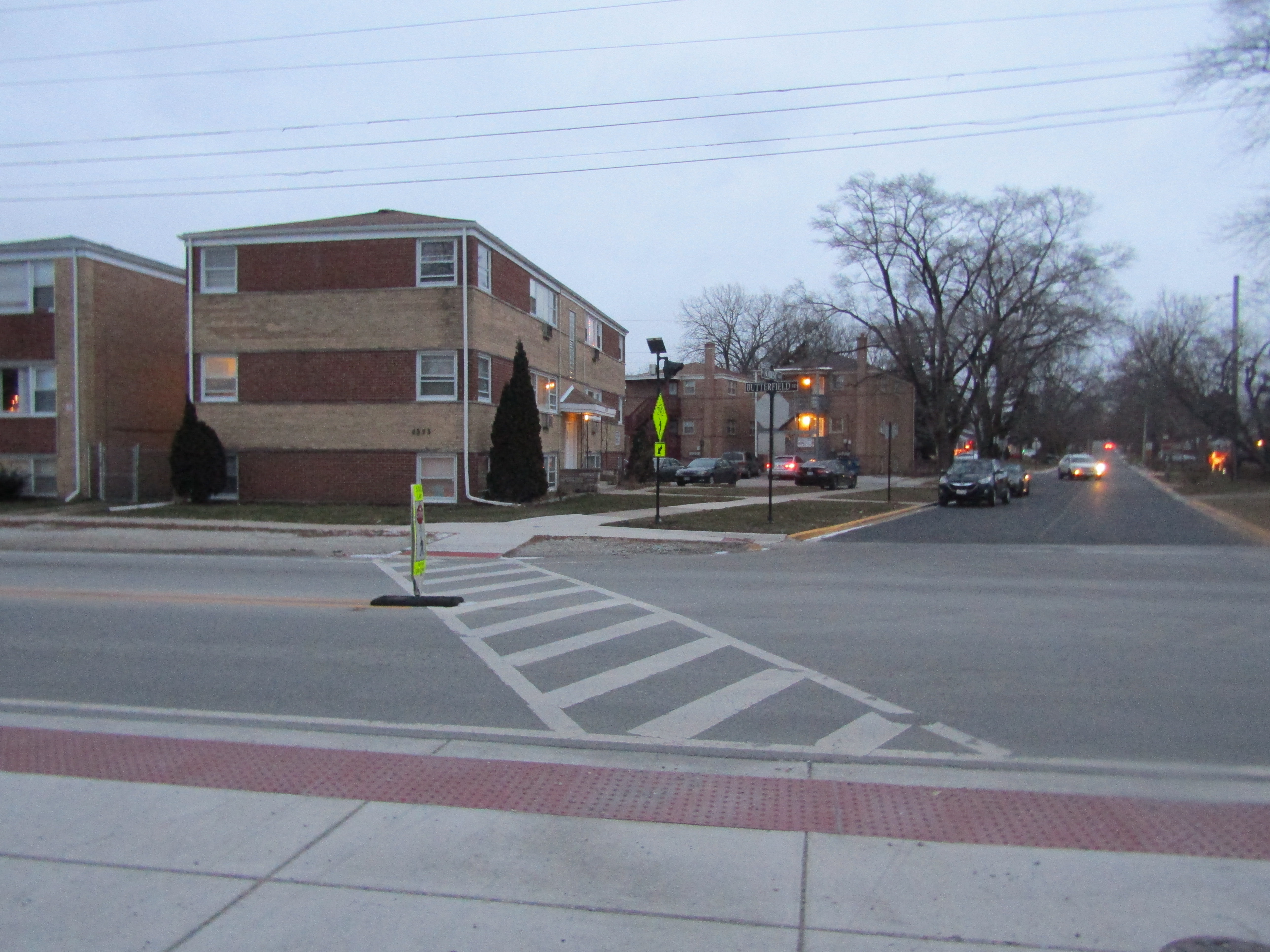
It's likely many path users would simply avoid that hassle by continuing to make the less safe crossing at Mannheim/Warren and taking the on-street route to Butterfield. I suppose IDOT could try to discourage that by installing fencing by the curb on the east side of the street, similar to the setup below. (I'm not suggesting that fencing would be a good approach, but it's one that decision-makers often use when they want to discourage people from making the most direct, logical crossing.)
Romanelli's counter-proposal
Romanelli and his running-mates for position in the Hillside village government are arguing that IDOT's plan would bea waste of taxpayer money. He says that instead instead of rerouting the trail to Butterfield and Washington, the existing on-street route on Forest and Warren should be retained (Romanelli lives just south of the Forest/Warren intersection), and a new stoplight should be installed at Butterfield/Forest (Purple on the above map.) Then, he argues, the savings could be used to hire new social workers to assist police officers in the field.
There are a couple problems with this plan. First, the crossing at Butterfield, a two-lane street, is less dangerous that the situation a few blocks east where the trail intersects with Mannheim. Secondly, it's not clear that a new signal at Butterfield would be significantly cheaper than creating the new half-mile bike/ped facility. Third, it's probably not even possible to move most, if any, of the money for the trail relocation from infrastructure to payroll for social workers.
The real solution
To prevent crashes and give path users a non-circuitous route that doesn't require walking bikes, the best approach would actually be to build on what Romanelli is proposing by adding push-button-activated stoplights for trail users at both Butterfield/Forest and Warren/Mannheim, along with a curb cut and marked crosswalk.
IDOT's Castaneda didn't respond to request for a cost estimate for installing stoplights, but the Washington State Department of Transportation estimates the cost of purchasing and installing a traffic signal at $250,000 to $500,000. Perhaps a bigger obstacle than cost would be the fact that IDOT has traditionally been resistant to make any changes for pedestrian and bike safety that could result in minor delays for drivers on roads it controls.
So that's what would be done here if IDOT planners and Hillside community leaders were being sensible. How this conflict will ultimately play out, especially in light of COVID-19 related revenue shortfalls, is anybody's guess.
Stay in touch
Sign up for our free newsletter
More from Streetsblog Chicago

State legislators pushing for merging CTA, Pace, and Metra into one agency spoke at Transit Town Hall
State Sen. Ram Villivalam, (D-8th) and state Rep. Eva-Dina Delgado (D-3rd), as well as Graciela Guzmán, a Democratic senate nominee, addressed the crowd of transit advocates.

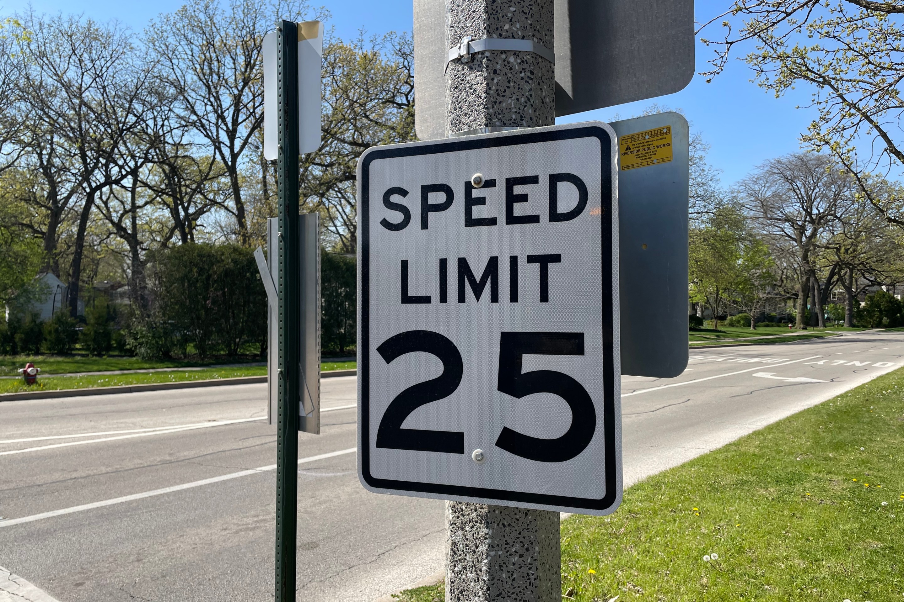
Equiticity and ATA: Passing a 25 mph speed limit should be combined with street redesigns that calm traffic
Equiticity, a mobility justice nonprofit, says the new speed limit shouldn't involve increased enforcement, which it says would disproportionately impact drivers of color