New City Bike Map Includes Upcoming Greenways, Safety Tips for Motorists
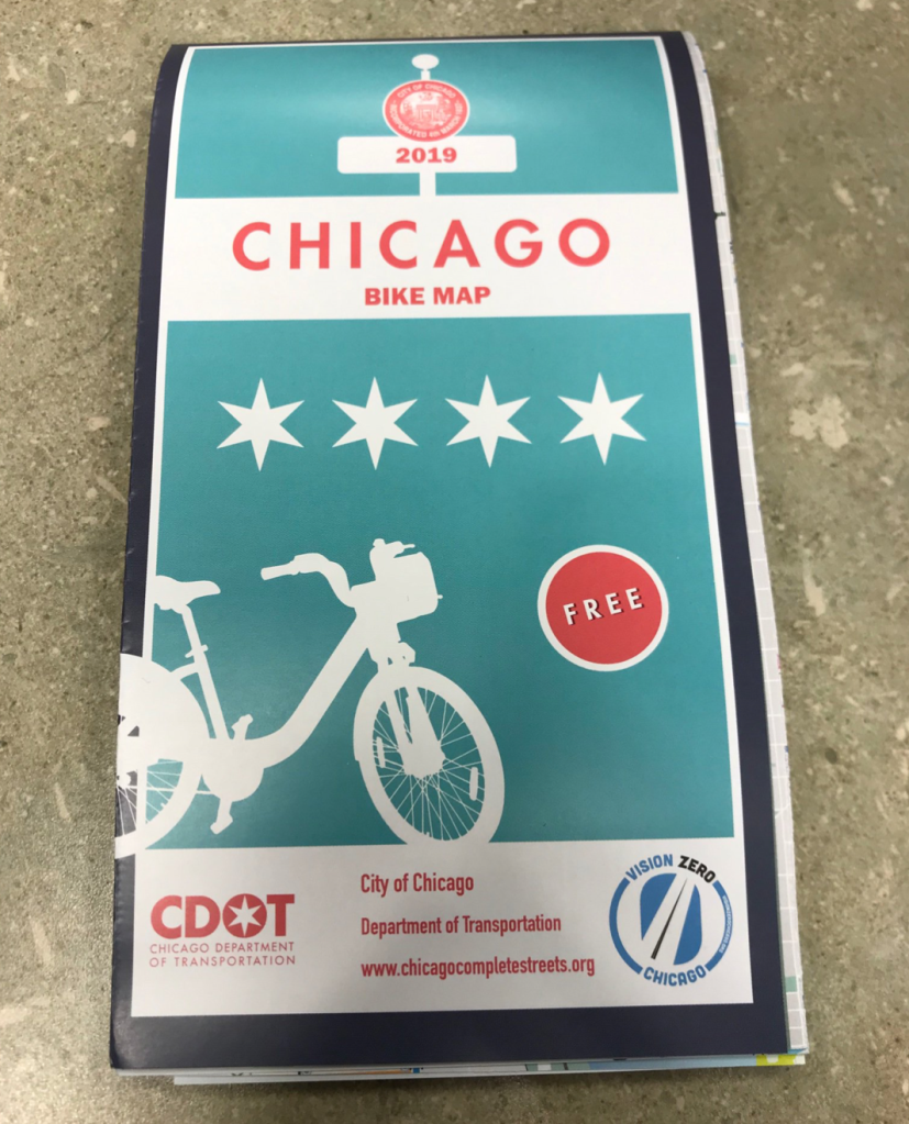
For a bike planning geek like myself, this is an exciting time of year, when the Chicago Department of Transportation’s bikeway construction season is in full swing, and the city’s Chicago Bike Map is released. (Check out the Mellow Chicago Bike Map that I created last year for the Reader for an alternative take that emphasizes backstreet routes. I’ll be expanding the map citywide this summer.)
I really like this latest edition of the city’s map, and it’s not just because the map accurately depicts the Chicago Riverwalk as bike/ped trail. That’s despite the efforts of downtown alderman Brendan Reilly to ban cycling on the path, and erroneous signs at the riverwalk entrances that threaten cyclists with prosecution.
I also like the map because it includes a wealth of useful — and potentially lifesaving — information for residents, whether they’re on a bike or in a car or truck. Last year the state of Illinois passed legislation requiring the “Dutch Reach” anti-dooring technique to be included in the state driver curriculum. CDOT followed suit by illustrating the technique on the new map.
Chicago has seen several cases in recent years in which right-turning truck drivers fatally struck bicyclists and pedestrians. For example, in August 2018 a turning dump truck driver struck and killed fitness instructor Allison Park, 39, on her bike in Greektown. Last March, a semi driver fatally struck high school student Anthony Macedo, 14, as he stood on a corner in Gage Park.
In response to these tragedies like these, Chicago passed an ordinance requiring side guards on some large trucks doing business with the city, and is installing the safety gear on the municipal fleet. The new map warns people driving large trucks to check their blind spots carefully before turning, as well as alerting cyclists to the locations of trucker’s blind spots, and suggesting that pedestrians take a step back from the curb when trucks are turning. “We tried not to make the language victim-blaming,” CDOT deputy commissioner Sean Wiedel told me.
On a lighter note, on the eve of the citywide Divvy bike-share expansion, which includes electric-assist bikes, and this summer’s dockless scooter pilot, the map includes a chart that illustrates which types of vehicles are allowed to use bike lanes, pass stopped cars on the right, and park on the sidewalk.
It doesn’t quite jibe with my understanding of the recently passed e-bike ordinance — my impression from the version of the ordinance that was released in mid-March was that Class 2 electric bikes, which go no faster than 20 mph but are “throttle-assist” and don’t require pedaling, aren’t legal on bikeways. Local bike/ped attorney Brendan Kevenides (a Streetsblog Chicago sponsor) had the same interpretation of the law, so I’ll seek some clarification from CDOT in the near future. Update: CDOT says “The version that was approved by City Council in April does allow Class 1 and Class 2 e-bikes in bike lanes.”
The bike map has always offered suggestions on how to safely use off-street trails. But this year it includes an image of the new separated bike and pedestrian paths on the Lakefront Trail, with the no-brainer advice that you shouldn’t bike on the walking paths, and vice versa.
The traffic-calmed side-street bike routes CDOT calls neighborhood greenways have become increasingly common in recent years — the department says there are 15 miles of them completed or under construction. The new map shows some greenways that were completed last year or earlier this year, including ones on Roscoe and School/Aldine in Lakeview, Manor Avenue in Ravenswood Manor, and a route connecting the existing Glenwood Greenway in Uptown and Edgewater to Evanston.
The map also shows some greenways that are still works in progress. In Pilsen, a route connecting recently striped buffered bike lanes on Cermak to Loomis via Wood and 21st is getting speed humps and dashed “advisory bike lanes” (the same kind that are striped on Milwaukee in Wicker Park.) This will provide a safer route for student biking to and from Benito Juarez high school, allowing them to avoid the tricky five-way intersection at Cermak/Ashland/Blue Island. The stretch of Blue Island south of 18th, which is a one-way southwest-bound diagonal, getting a bike lane in the near future as part of a streetscaping project
Another under-construction greenway is the extension of the existing Wood Street bikeway in West Town north into Bucktown, where it will meet up with Cortland, which is also getting new traffic calming features. One nifty item is a cutaway in the parkway on the north side of the Cortland/Marshfield intersection, which will make it easy for westbound cyclists on Cortland to turn their bike 90 degrees to make a box-style left turn onto Marshfield, if they prefer doing that to a vehicular-style left turn. From there they can head a block south to the eastern trailhead for The 606. Similarly, CDOT is putting in a painted left-turn box at Cortland/Damen for southbound cyclists.
The new bike map will be available at this year’s Bike to Work Rally on Friday, June 21, from 7 to 9 a.m. in Daley Plaza, 50 West Washington. You’ll also pick it up at local bike shops in the near future, or you can request copies via this CDOT webpage.

Read More:
Streetsblog has migrated to a new comment system. New commenters can register directly in the comments section of any article. Returning commenters: your previous comments and display name have been preserved, but you'll need to reclaim your account by clicking "Forgot your password?" on the sign-in form, entering your email, and following the verification link to set a new password — this is required because passwords could not be carried over during the migration. For questions, contact tips@streetsblog.org.