Perhaps it was fitting that the Chicago Department of Transportation used Thursday’s meeting of Mayor's Bicycle Advisory Council, the last one before Mayor Rahm Emanuel leaves office, to announce a major change in the way the council works.
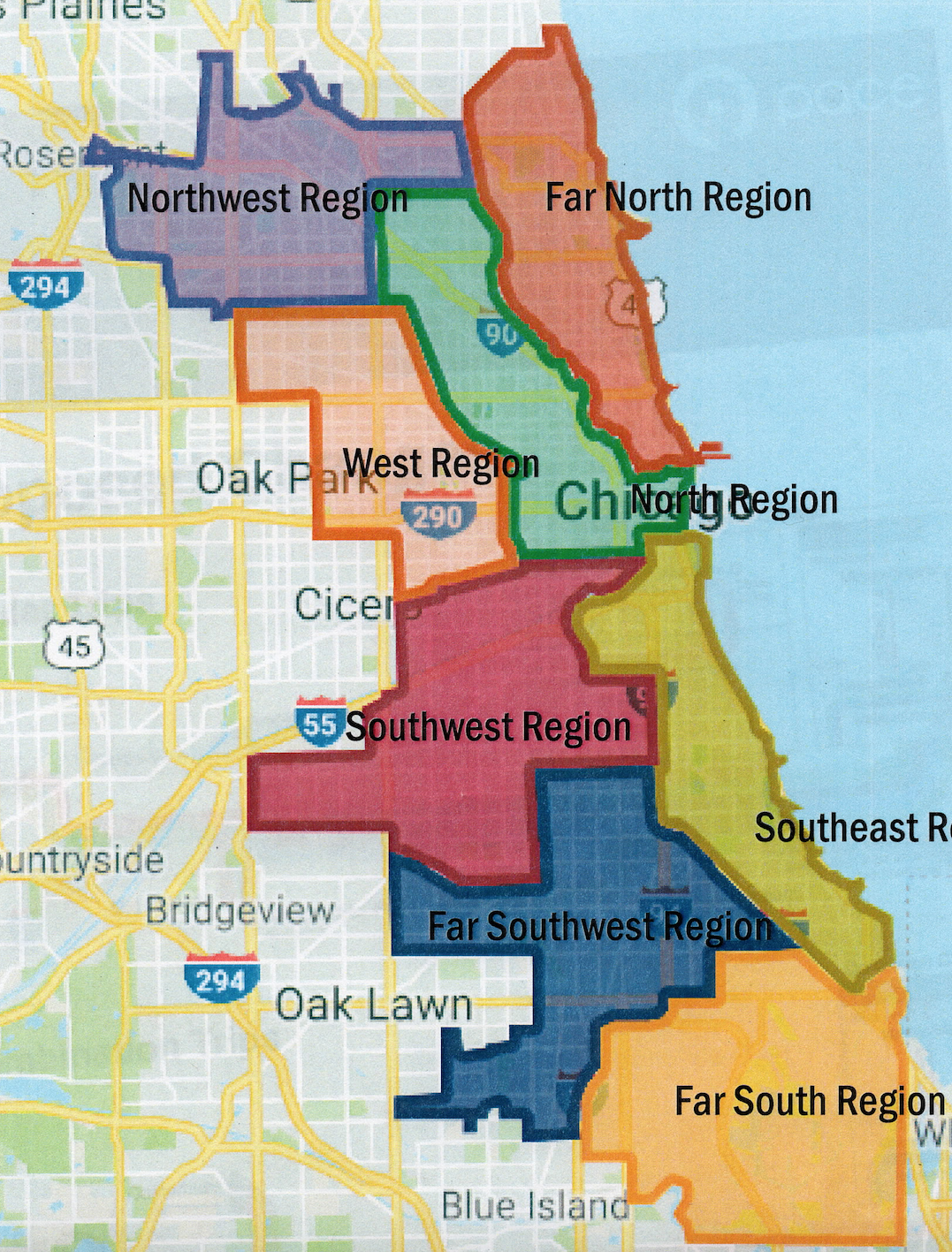
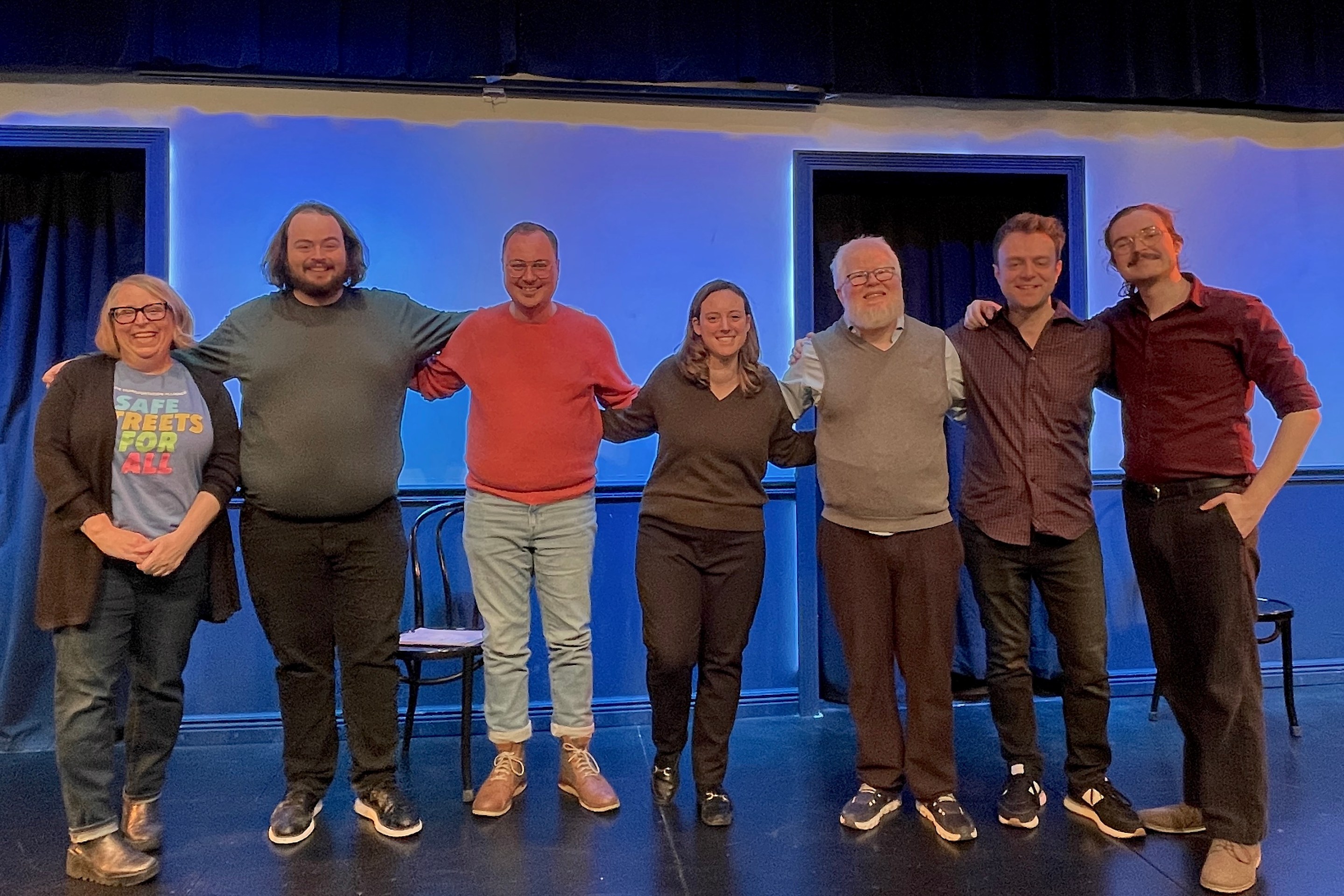
Under this restructuring, the department has divided the city into eight “regions,” each one with its own community representative. CDOT bicycle and pedestrian programs planner David Smith explained that the city wanted each zone to have a point person who would be able to tackle issues specific to their area and give residents someone they can go to with their concerns and suggestions. So far, seven of the positions have been filled -- the city is still looking for someone to represent the Far Southwest region.
Smith said that the new system has three goals – to give the council a better understanding of what's happening in the entire city, to build a closer relationship between CDOT and MBAC, and to give people “no matter what part of the city they’re in, [a person] they can talk to and share ideas.” In addition to regular meetings, CDOT staffers will be doing field visits with the reps to highlight local projects and initiatives.
The names of the regions aren't entirely indicative of their locations. The Far North Region, which is represented by former Bike Uptown member Melanie Eckner, covers all of the neighborhoods bounded by the main and north branches of the Chicago River and the North Shore Channel.
The North Region, which is represented by architect and occasional Streetsblog writer Jacob Peters, includes the Near West Side community area, the Loop and most of the Northwest Side community areas between the north branch of the Chicago River, Metra’s Milwaukee District North line tracks, and the north end of Albany Park.
The Southeast Region, which is represented by Go Bronzeville’s Ronnie Harris, includes Bridgeport and all of the South Side community areas bounded by the Dan Ryan Expressway, Roosevelt Road, the Chicago Skyway, the Calumet River and Lake Michigan.
The Far South Region, which is represented by Deloris Lucas from the bike group We Keep You Rollin’, includes the Riverdale Community area (which contains Altgeld Gardens, Golden Gate, and other enclaves), East Side, Hegewisch, South Deering, Pullman, West Pullman, Roseland, Washington Heights, Calumet Heights and Burnside.
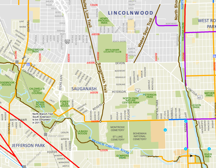
The Northwest Region, which is represented by Joe Sislow, who has served as a North Side representative for MBAC, includes most of what is usually grouped into Far Northwest Side: the Jefferson Park, Dunning, Portage Park, Norwood Park, Edison Park, Edgebrook and O'Hare community areas, as well as North Park.
The West Region, which is represented by Austin Coming Together community organizer Jose Abonce, includes North Lawndale, West Garfield Park, East Garfield Park, Austin, Montclare, Belmont-Cragin, and Hermosa.
The Southwest Region, which is represented by Streetsblog reporter and community activist Lynda Lopez, includes Brighton Park, McKinley Park, Archer Heights, Marquette Park, Gage Park, West Lawn, West Elsdon, Clearing, and Garfield Ridge, Back of the Yards, Pilsen, and Little Village.
Finally, the Far Southwest Region, the one area that doesn't currently have a representative, includes Englewood, West Englewood, Auburn-Gresham, Beverly, Morgan Park, Mt. Greenwood, Ashburn, Avalon Park, Chatham, and Greater Grand Crossing.
During the meeting, Sislow and Peters gave presentations about their respective regions, talking about the neighborhoods they include, their demographics, what kind of challenges they face, and how they hope to make things better.
Sislow said the Kennedy Expressway cuts through the Northwest Region “like a scar,” disrupting Chicago street grid. The rail line embankments have a similarly disruptive effect, he said. Many neighborhoods south of the expressway, he said, barely have any cycling infrastructure, and the few bike lanes that exist don't necessarily connect to any major destinations. And while he described Milwaukee Avenue and its bike lanes as a “lifeline” to the Loop, he said Google bike directions tend to avoid routing cyclists there. “Milwaukee is there for expert cyclists, but I don’t think it’s there for the rest,” Sislow said.

At the same time, he singled out some assets. The Sauganash/Valley Line trail, which was built on a former freight train line embankment, provides a smooth connections to many destinations, as does the North Branch trail by the river. Building the Weber Spur trail – another path slated for an abandoned freight train line – would improve connections further.
Sislow said that one major obstacle to filling the infrastructure gaps are – and he emphasized that he was trying to be diplomatic – certain aldermen “who don't necessarily have the desire to work with that.” Another challenge, he said, is a driving-centric culture. “Rush-hour parking is a bane of my existence,” Sislow said. “Curb cutouts, we see more and more of it as we see Starbucks drive-throughs show up like a plague of locusts.”
He said that his major priorities would be to work with local residents, as well as Divvy, to identify routes casual cyclists would be comfortable using and putting in signage and docking stations. “Divvy is big for us,” Sislow said. “The more we can connect local, point-to-point, [to] things like train stations - [residents] will start seeing more cycling and see what’s useful.”
Sislow noted that 45th and 39th wards are getting new aldermen. “We can [get in] contact with them to work with them and see [how] we can work in their wards.”
Next Peters noted that one of the major challenges to safety on the Near West Side are “high-crash corridors” such as Milwaukee, Ashland, Western, and Damen avenues. “I never bike on Western because I had way to many close calls in other cities on streets like Western,” he reflected. Western is generally a wide five-lane stree, a layout that facilitates speeding by drivers.
Another issue, Peters said, is that there is less cycling infrastructure on the Near West Side north of Diversey Avenue. The fact that Milwaukee crosses countless streets at a 45-degree angle is another major issue, he said.
As far the assets, Peters said that his region has many active bike advocacy organizations that have good ideas about how to make biking safer and more convenient.
He said that his major priority would be to advocate for filling infrastructure gaps further north.
“If we’re not solving these problems up in Albany park and Irving Park and Avondale, than it doesn’t matter if we are solving problems closer to downtown,” Peters said.
Peters said he plans to meet with at least one alderman within his region every month. He plans to push for a holistic regional bike plan, similar to what has already been implemented in Edgewater.
“[We need] to find an alder that would replicate this project,” he said.
In the ensuing discussion, several council members and people in the audience singled out rush-hour parking restrictions, which ban parking along main streets during peak hours and theoretically create additional travel lanes for drivers, as a major barrier to creating dedicated for sustainable transportation.
“We also working with CTA to convert some of rush hour parking restriction lanes into bus lanes,” said CDOT deputy commissioner Luann Hamilton. “We’re working on Chicago Avenue right now.”


